
Apr 3 - Sea to Sky Snow Conditions
Overall theme:
Spring has arrived. We haven’t fully transitioned out of a winter snowpack yet but we’re well on our way. Convective activity creates visibility issues but also brings good refreshes. Afternoons are hot!
Where we’ve been skiing:
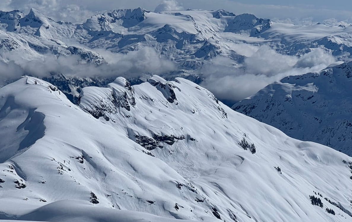
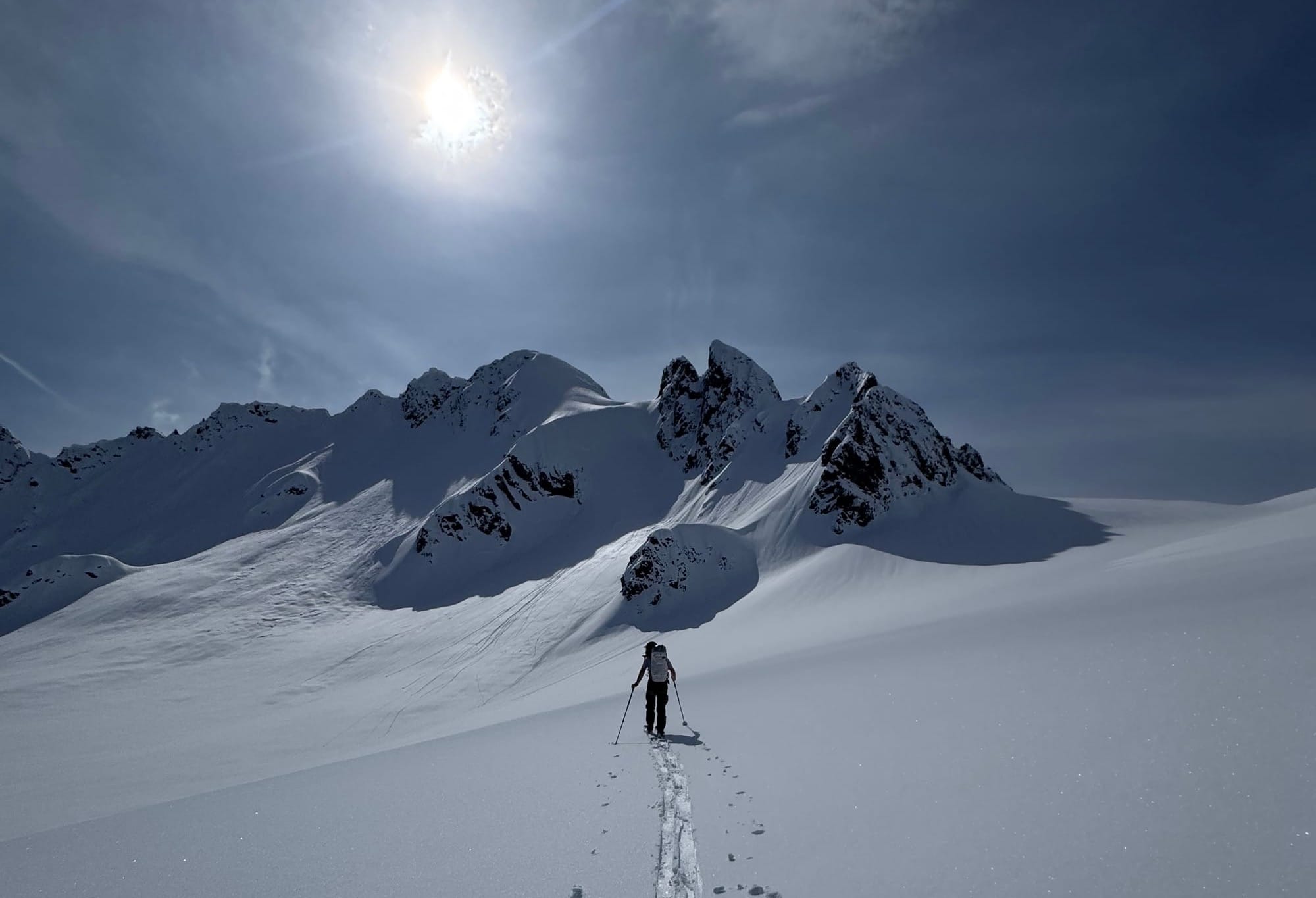
We’ve had a mix. A low storm on Friday got us out in Squamish but with every bit of high pressure we’ve gotten as high into the alpine as possible - Tantalus Range, Blackcomb Backcountry, Nch’Kay. Low elevation trailheads are still hanging in there. Sea to Sky Gondola and Red Heather roads are still in good shape. Parking on Brohm is around 900m.
What’s happened since the last update (weather & general snowpack structure):
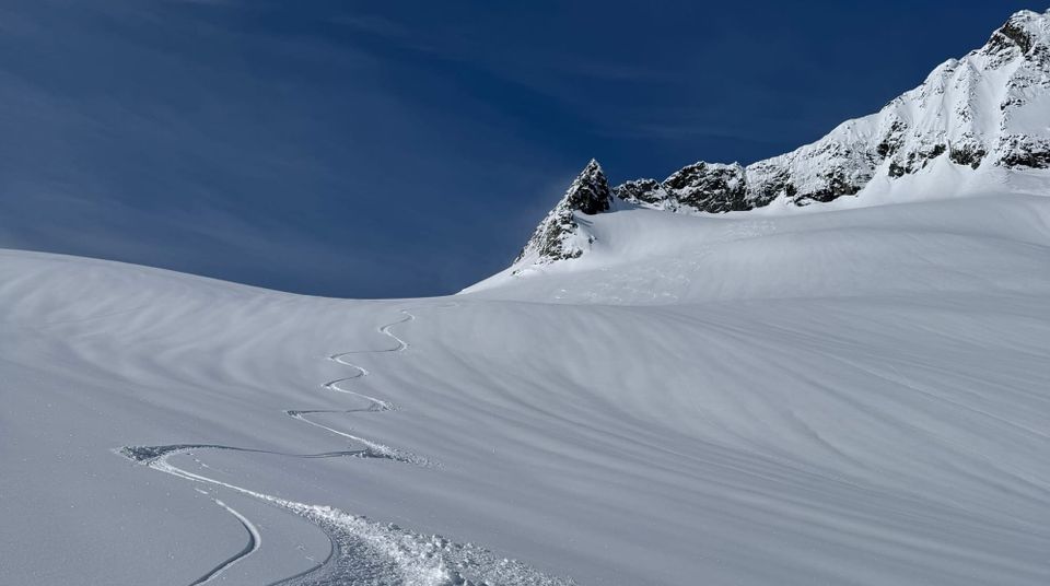
Overall the snowpack has been settling and healing from the pounding rain it absorbed last week. A major avalanche cycle flushed out many of our lines. For a little bit, avoiding debris was one of our major concerns. Now, that’s all being slowly covered back up and the high mountains look a little more normal. The snowpack is generally nice progressive density powder on north facing protected terrain. There’s a temperature crust forming on solar slopes at all elevations and this will continue to become more pronounced (and hopefully make travel a bit easier). We’re not quite to good corn skiing in the big peaks but it’s probably just about there at TL elevations and will be here soon!
What’s the weather and avalanche forecast?
A ridge of high pressure will strengthen over the province on Friday and this Saturday, bringing sunshine with a dramatic rise in freezing levels.The ridge will weaken and move east on Sunday, allowing a weak front to move through later Sunday evening with showers. An Upper trough will bring showers and cooler temperatures early next week.
Overview:
- Friday: Light Southwesterly wind with freezing levels 1500 rising to 2200m and nil precipitation.
- Saturday: Moderate SW wind with FLs 2200m and nil precip.
- Sunday: Moderate to Strong SW wind with FL lowering to 2000m and 5-7mm precip.
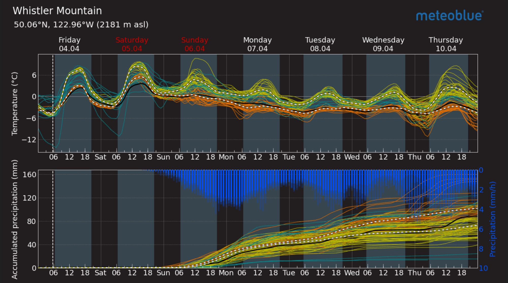
For the moment, much of the region is moderate or low avalanche hazard. The primary problem is wet loose with the rising temperatures. We’ll also see cornice hazard here as we transition from winter to spring and the juicy cornice tabs break off. Finally, there’s always some lingering windslab in the high mountains on lee slopes as we found on Thursday around Squamish.
What are my questions for the weekend?
Right now there’s pretty high confidence in the forecast. I’m mainly wondering if we’ve seen the majority of the loose wet action happen or if that will spike along with rising freezing levels. Further out, I’m wondering if we’ll see the precip totals that the long range forecast has for us next week…
What will I watch out for or avoid completely?
- Giving cornices a wide berth. They’ve been growing until this week and now they are breaking. Bad time to be booting under a cornice!
- Areas where wet loose could cause me problems - especially above exposure.
- And don’t forget the warm temps are going to start to make ‘shrunds and crevasses sag. It’s early, but start paying attention!
Closing Thoughts:
While the persistent slab problem is still being talked about by professionals, it sure seems like the soaking we got should have been enough to trigger that layer almost everywhere. That being said, it’s still at the back of my mind. If I’m not 100% sure a slope already cleaned out: what if I’m wrong? What are the consequences here?
For more information, check out Zenith Mountain Guides and our local avalanche forecast. Weather forecasts are custom from meteorologist Jason Ross. These updates are supported by SkiUphill Squamish - the best stop for ski touring equipment in the Coast Mountains and made possible by the Sea to Sky Gondola! Use this information at your own risk. Conditions change rapidly from when this report was written!
Member discussion