
April 18 - Sea to Sky Snow Conditions
Overall theme:
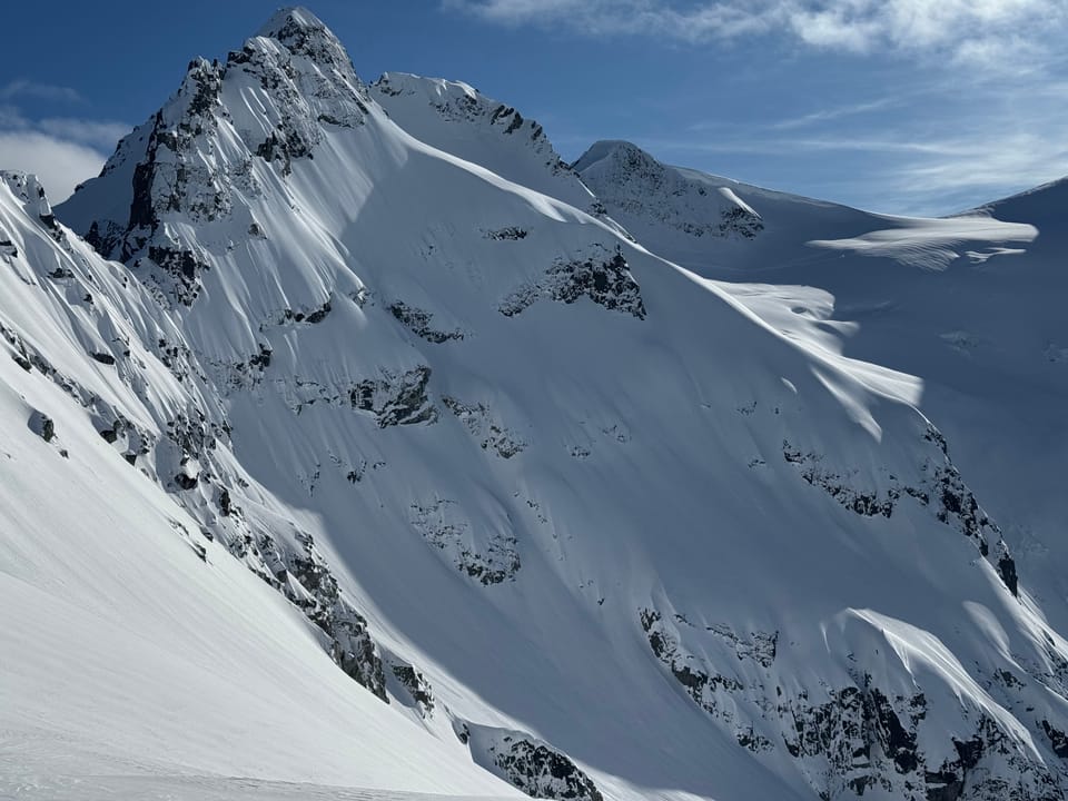
Big greenhouse effect early in the week really cooked a lot of the snowpack. If you can get above 2100/2200m on true north, there’s some powder remaining. Other than that, corn’o’clock is the key hour.
Where we’ve been skiing:
We’ve been up in the Spearhead Range, Brohm, and on the Duffey. We’ve also talked with lots of folks skiing the Neve. Conditions are quite thin down low - the S2SG road is melting quickly. Elfin road is skiable to the car but just barely (and won’t last much longer). Duffey trailheads are thin and VERY icy (microspikes are key). Get high and protected for soft snow or otherwise plan your timing for corn! Traverse season is happening.
What’s happened since the last update (weather & general snowpack structure):
We are properly into spring diurnal. This past week has been warm daytime temps with clear/cold nights. There are no layers of concern in the snowpack. Any new snow may present surface instabilities. Wind slab can always accumulate as spring winds shift and convective storms drop snow but the primary avalanche concern is wet loose.
What’s the weather and avalanche forecast?
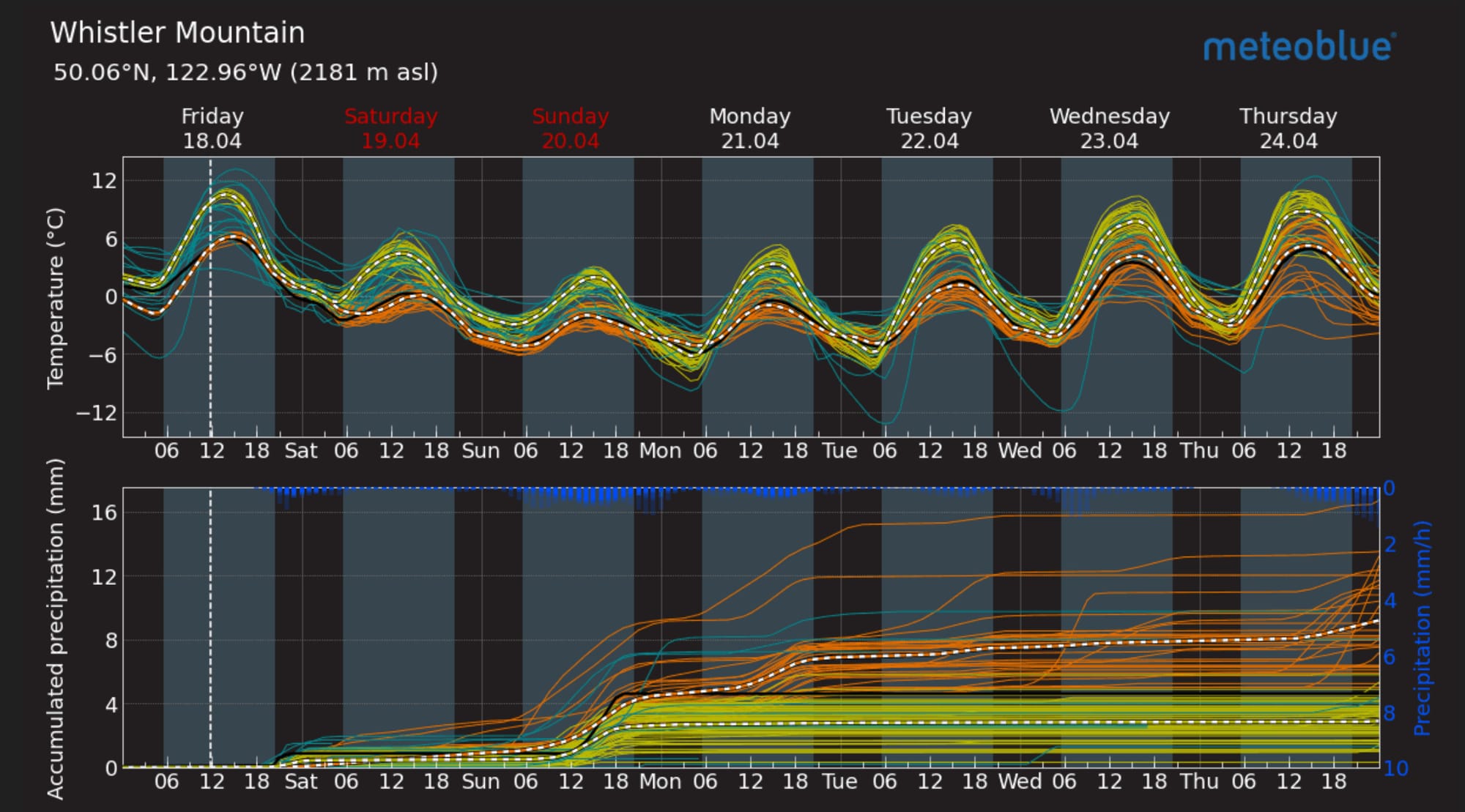
A ridge of high pressure will weaken and shift east on Friday, allowing a weak frontal system to move southeast across the area Friday evening into early Saturday morning, ushering in a cooler air mass with a chance of showers or flurries and strong ridgetop winds. An upper trough is expected to develop across the south coast from Sunday into Monday, bringing with it unsettled conditions and the possibility of showers or flurries. A weak ridge of high pressure will build towards the midweek of next week, resulting in drier conditions and warmer temperatures.

Synopsis:
- Friday: Moderate Southwesterly wind with 3300m FLs and nil precip.
- Saturday: Moderate NW wind with 1500-1800m FLs and trace precip.
- Sunday: Light NW wind with 1000-1500m FLs and 2-4cm.
What are my questions for the weekend?
- Will we see much new snow on Sunday? Looks like not much of a reset but it could produce a bit more.
- Will there be much of a refreeze over the weekend? Clouds will impact the spring diurnal.
What will I watch out for or avoid completely?
- We will mostly be watching for overhead. Wet loose and cornice are top of mind for sure. The cornice on Decker is looking FAT!
Closing Thoughts:
Spring is here! There’s still good snow to be found but you gotta work for it. Traverse season is full on and we’re looking down the barrel of volcano season!
For more information, check out Zenith Mountain Guides and our local avalanche forecast. Weather forecasts are custom from meteorologist Jason Ross. These updates are supported by SkiUphill Squamish - the best stop for ski touring equipment in the Coast Mountains and made possible by the Sea to Sky Gondola! Use this information at your own risk. Conditions change rapidly from when this report was written!
Member discussion