
April 26 - Sea to Sky Snow Conditions
Overall theme:
Spring is happening fast! The snow line is receding, access is pulling back, and folks are switching to their bikes… but there’s still skiing to be had - if you can make it into the alpine, you're going to have a good time!
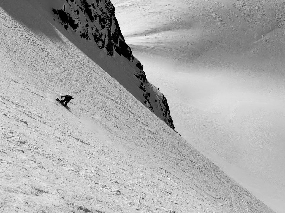
Where we’ve been skiing:
Evan spent a few days in the Whistler Backcountry and Duffey and we checked in with a few folks on similar programs (Eric has been in the Rockies). For the most part, it’s about getting up into the alpine as quick as possible and looking for sheltered and supported north facing terrain for pow or solar aspects with good timing for corn. Trailheads are starting to thin out - Joffre Lakes and Cerise Creek both require a bit of walking now. S2SG and Red Heather are also both melting back.
What’s happened since the last update (weather & general snowpack structure):
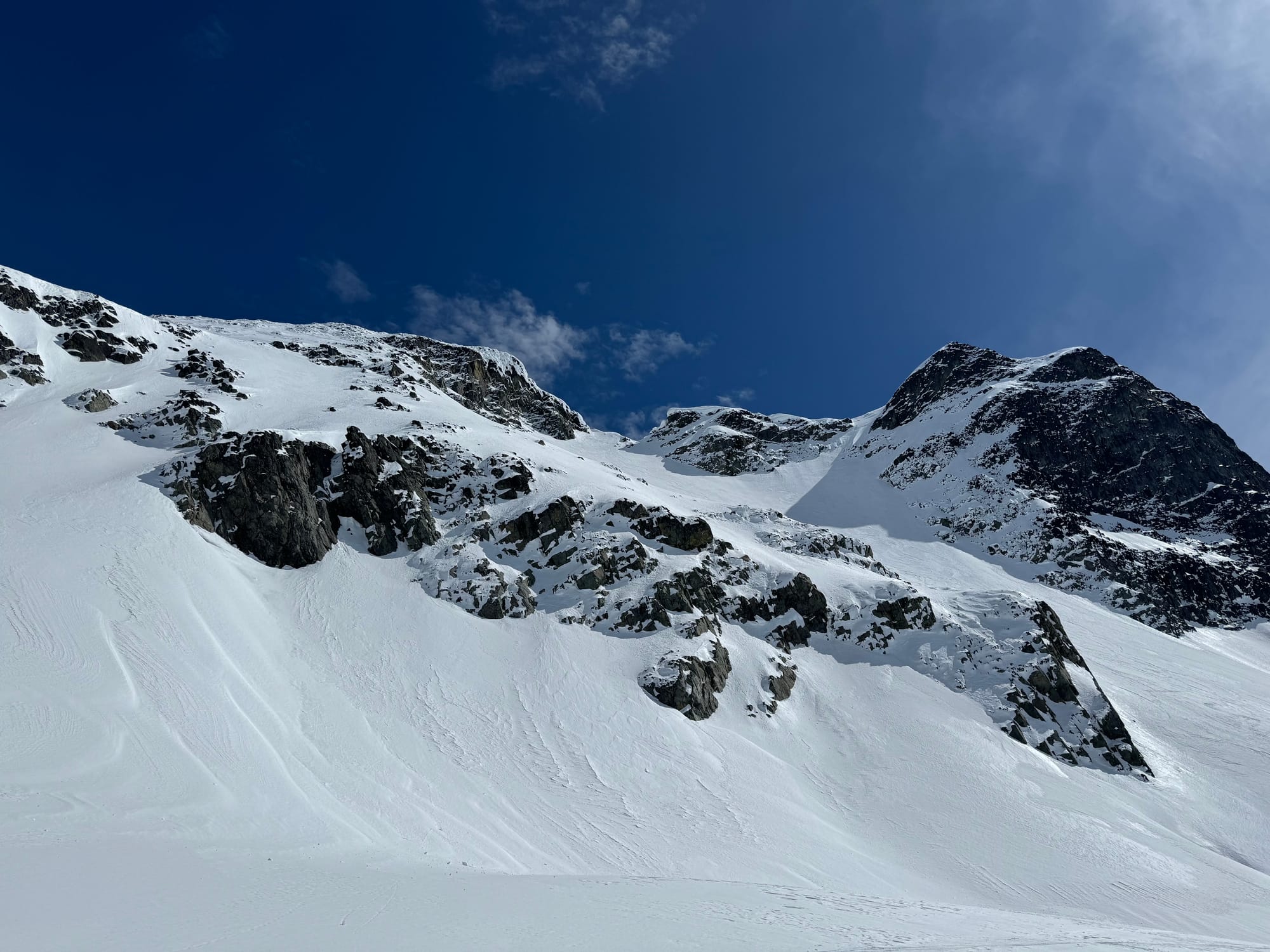
Early in the week we had generally quite nice weather with strong solar affect in the alpine. Folks got up to skiing some big lines throughout the corridor. The mid and lower snowpack are generally well settled but new snow and wind are creating surface windslab instabilities that have caught a few folks off guard. Thanks to those that sent us notes about a few of these!
What’s the weather and avalanche forecast?
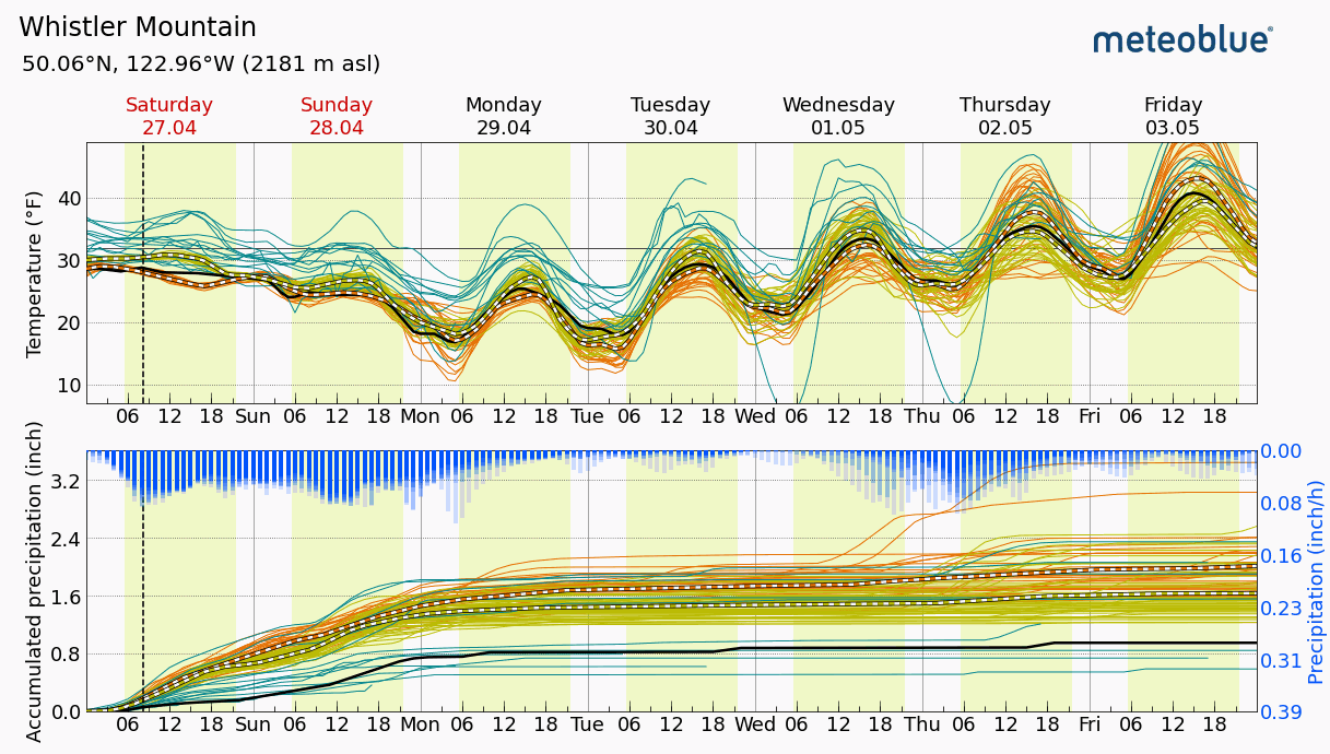
We have decidedly unsettled weather through today and the weekend. Snow totals are unclear but the freezing levels look low enough that we’ll see it mostly falling as snow above TL. This is coming with some wind so definitely expecting that to translate to more windslab in the alpine! Next week still looks dirty but the trend is towards higher pressure and a stronger diurnal cycle so I wouldn’t be surprised to see the precip amounts drop and clearer sky overall next week!
Avalanche Canada posted their final forecast of the season yesterday with a primary focus on windslab - this is the time of year for surface instabilities! Keep in mind that AvCan does produce their mountain weather forecast year round and this is an awesome resource! If you’re skiing, you should be giving that a look!
https://avalanche.ca/weather/forecast
What are my questions for the weekend?
- How much precip are we expecting and where will we see the snow line?
- When will we see the big warmup? The last few seasons, we’ve had big May warmups that ushered in summer time with freezing levels far above mountain top. This generally means the end of cold pow skiing even on north faces. It’s not in the forecast yet but I’ll be watching for it!
What will I watch out for or avoid completely?
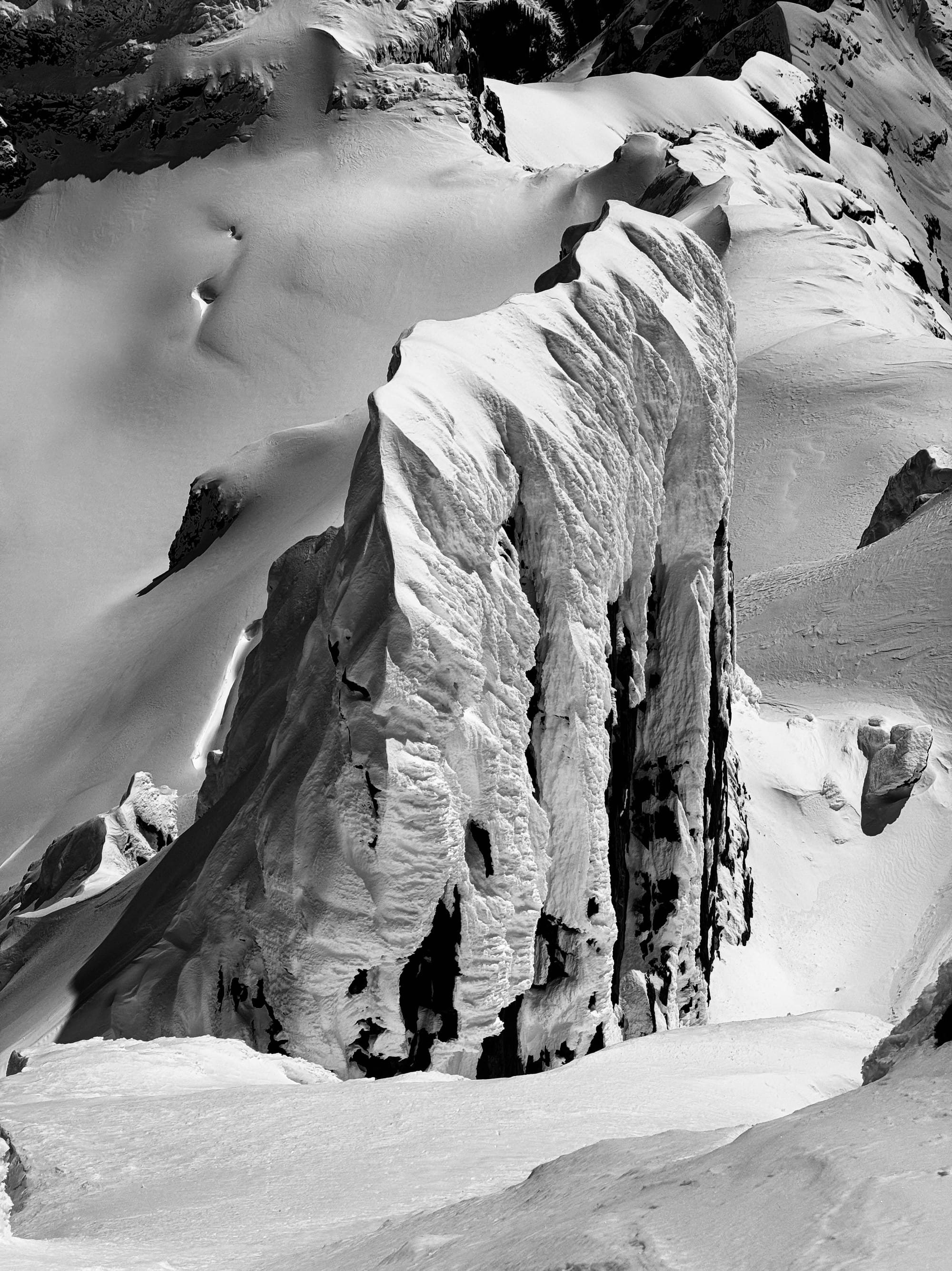
Still avoiding the steepest couloirs or anything with much of a cornice but the bigger supported alpine features are going to be the most promising.
Closing Thoughts:
This will be our last newsletter of the season! It’s been a good run. We’ll still be getting out here and there but it’s definitely winding down. A reminder that Whistler Mountain closes this weekend as well!
For our supporters this season, thank you! We'll be cancelling all the paid subscriptions so you won't see charges over the summer. Your subscriptions make this newsletter possible!
Eric Carter and Evan Stevens contributed to this report. For more information, check out Zenith Mountain Guides and our local avalanche forecast. These updates are supported by SkiUphill Squamish - the best stop for ski touring equipment in the Coast Mountains and made possible by the Sea to Sky Gondola! Use this information at your own risk! We are not responsible for your actions in the backcountry and conditions change rapidly from when this report was written!
Member discussion