Dec 13 - Sea to Sky Snow Conditions
Overall theme:
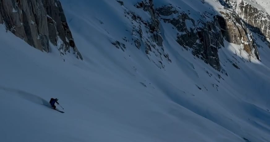
Another week, another inversion but now we’re back to storms! We’ve had a good week of high pressure and the storm snow over the weekend helped with ski quality, even if the rain that preceded it stripped away quite a bit of snowpack. We had a few warm days in the alpine however wet loose avalanches weren’t as big a problem as expected, in part because of how weak solar radiation is for us in December!
With a major weather pattern change coming, it’s time to shift how we’re thinking about playing in the mountains this weekend.
Where we’ve been skiing:
We’ve been in Squamish, around Whistler-Blackcomb, Birkenhead and up on the Duffey! The most notable thing is how much snow was lost on Friday/Saturday with the rainfall. Our existing low elevation skiing got hammered and areas like the Sky Pilot road, the first few hundred meters of the Red Heather trail, and the ski out to Whistler Village all started sprouting rocks and dirt. Hopefully the incoming storm helps a bit with access! As it stands now, the more coastal you are, the harder hit things were. Any low elevations really took a hit; for example the snow stake for Sky Pilot area at 1050m went from 115 to 40! All the creeks opened up to 1500m and any trees below that elevation are almost back to unskiable snowpack depths. The good news is the snowpack is rock solid and homogenous.
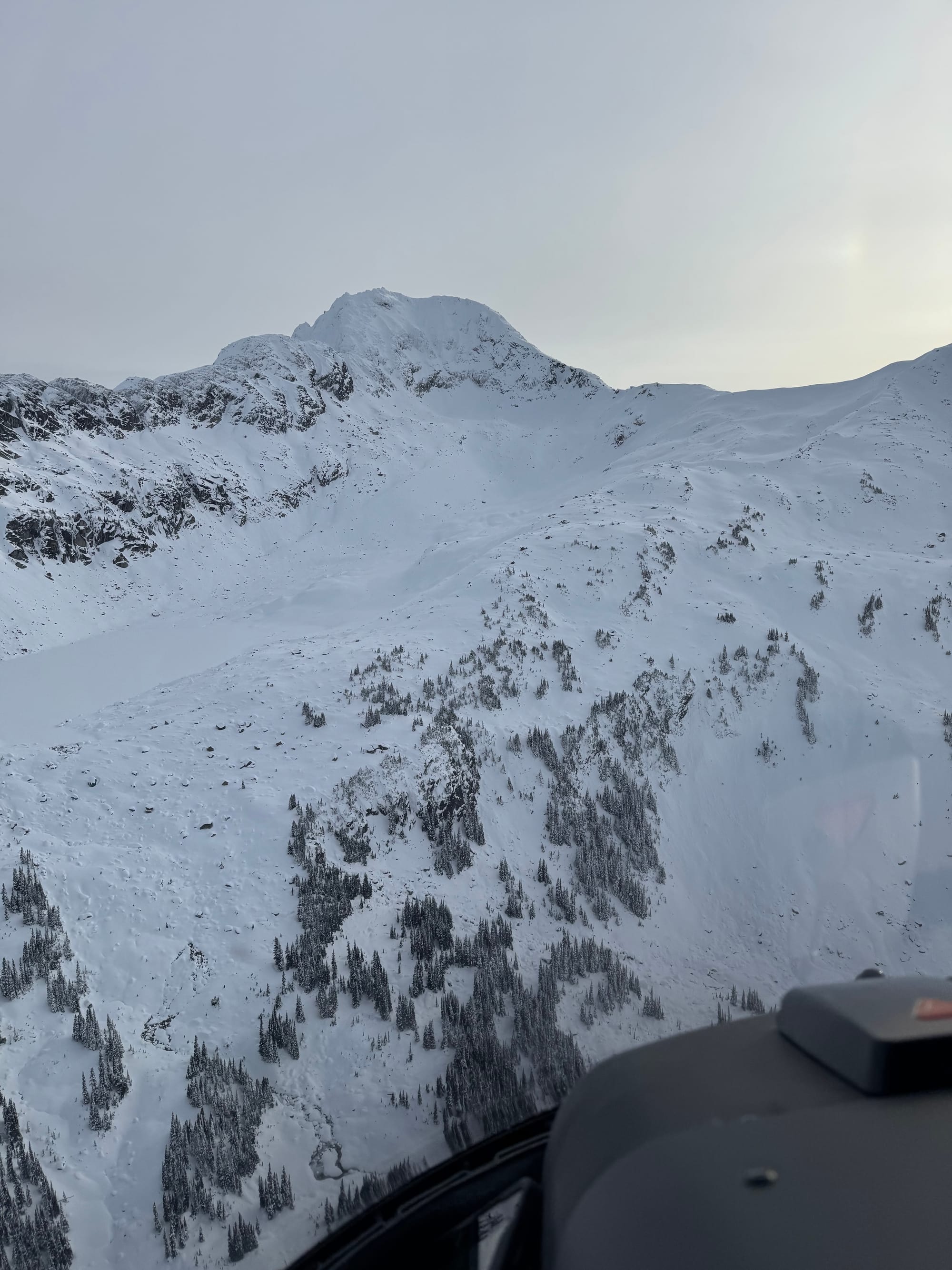
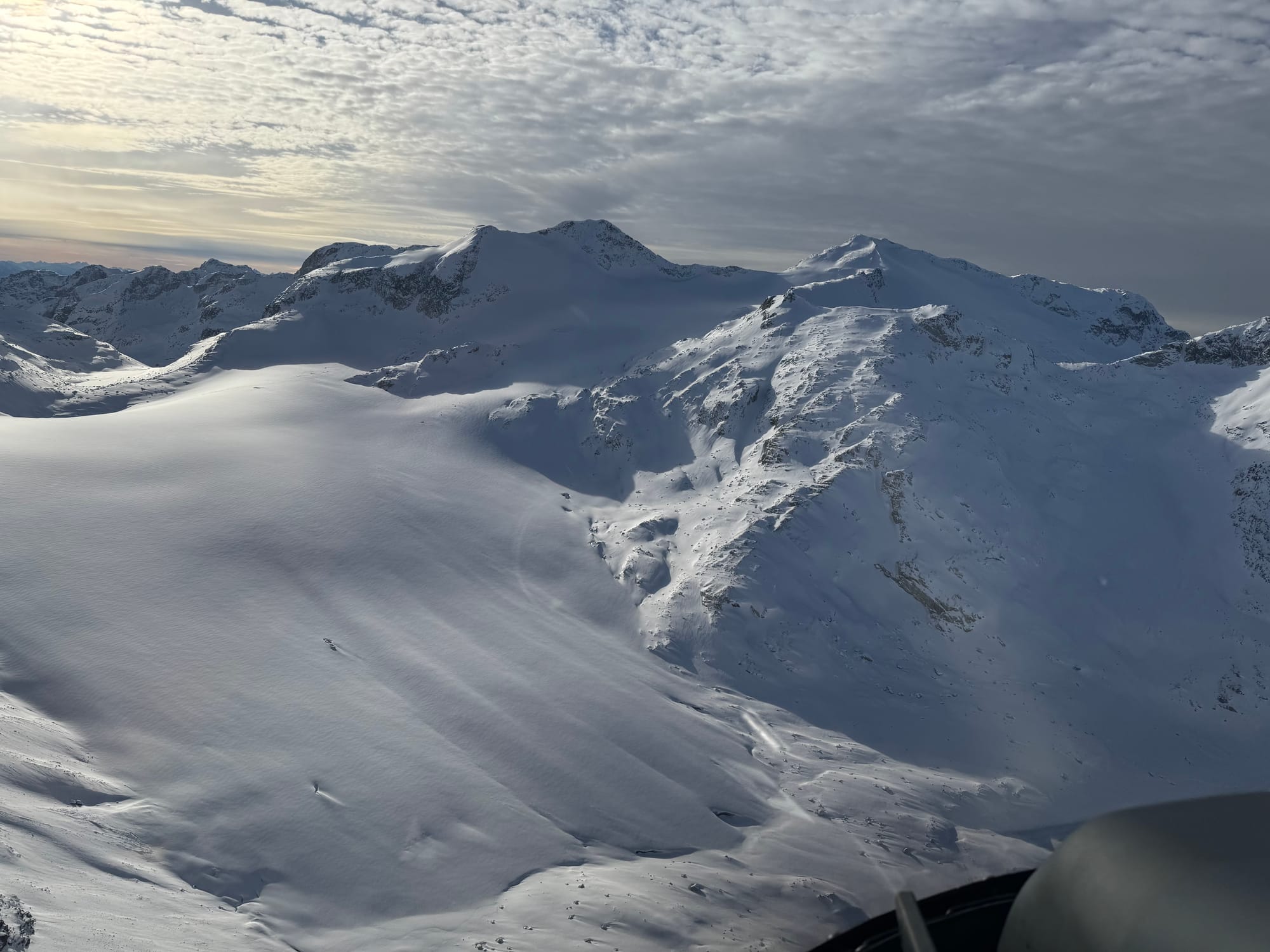
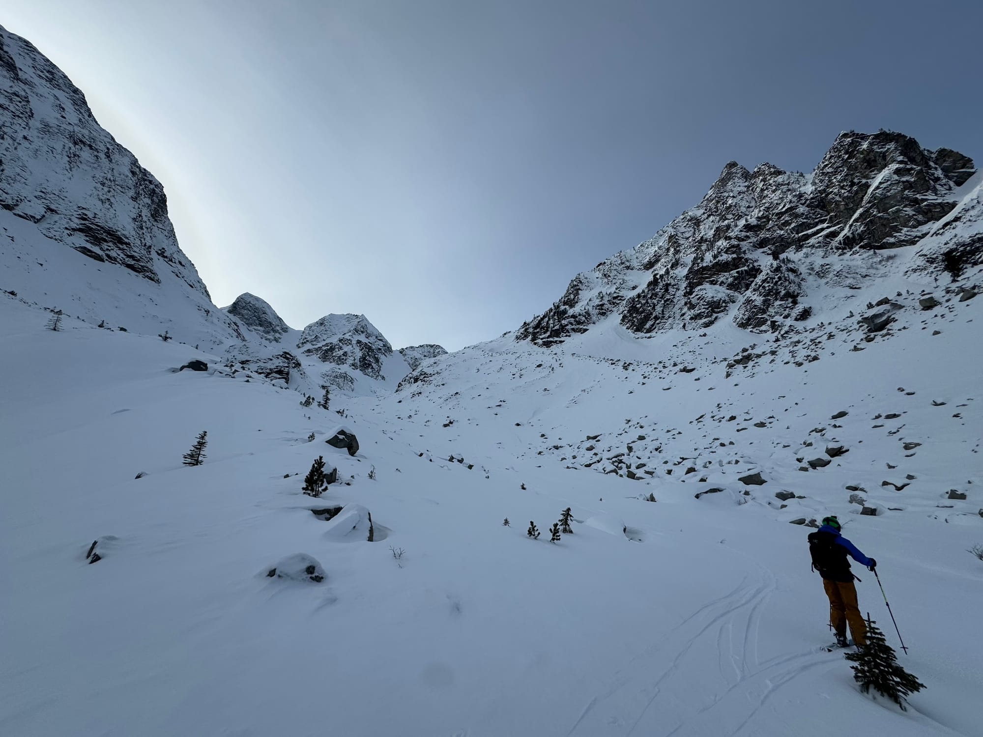
Centre is the Place Glacier showing good alpine coverage and not as much for wind ripples as we'd expect! L and R show the bottom of the Birkenhead Glacier and treeline in the area - low coverage on the talus and open creeks. Representative of treeline terrain in lots of places now!
What’s happened since the last update (weather & general snowpack structure):
Our existing snowpack is relatively simple. The storm snow from over the weekend is settling out and fairly well bonded to the crust below which formed during the high pressure earlier in the week. In Whistler, we saw rain quite high, up to ~2300m. The warmth and rain playedout differently the deeper you get into the interior. Above 1800m on the Duffey got little to no rain but below 1800m, the new snow sits on a very supportive crust.
Interestingly, this crust isn’t particularly well bonded to the snowpack below, however it does seem to be fairly stiff and a reasonable “bridge”. We’ll see if this continues to be a failure later for snowpack tests after the new snow load arrives.
Below the crust (10-20cm down) the mid and lower snowpack are fairly well bonded and continue to settle.
This past few days of relatively good weather has mostly had an effect on the surface conditions and it’s how the new snow will interact with the surface that we’re most interested in. Due south (solar) aspects heated up with the nice weather and the surface is a new melt-freeze crust. On most other aspects, the surface is faceting out with reports of surface hoar in sheltered areas.
What’s all this mean for the weekend?
First, the question is around load. If it’s a big dump, we’ll see a big avalanche cycle - that’s probably best case scenario. If it’s less than the critical load, we may be set up with a storm slab problem that’s not running naturally but is skier triggerable.
Second is how the storm comes in. Usually we have a wet wallop followed by cooling temps. This produces good bonds to the existing snow surface. At the moment the incoming storm seems like it starts cold. This may not bond as well with the facets and surface hoar at the top of our snowpack. As of this writing, most mountain locations are decently below freezing, meaning the new snow will fall on colder surfaces. At least with cloudy skies we shouldn’t get too much more additional facets or surface hoar on Thursday Night.
What’s the weather and avalanche forecast?
An intense low-pressure system will approach the south coast today through Saturday, bringing significant alpine snow and strong alpine winds. A transient high-pressure ridge will move over the area on Sunday, bringing drier conditions before another system moves into the coast Sunday night through Monday.
On Friday we’re expecting the storm to pick up with moderate winds and freezing levels rising from 600m to 1000m and only 5-10mm of precip. Saturday things pick up with extreme winds and 1200m freezing levels. Precip amounts are highly variable here from 25 - 40mm! Sunday, we see the storm taper off and freezing levels dropping to 600m with another 6mm of precip falling with light wind.
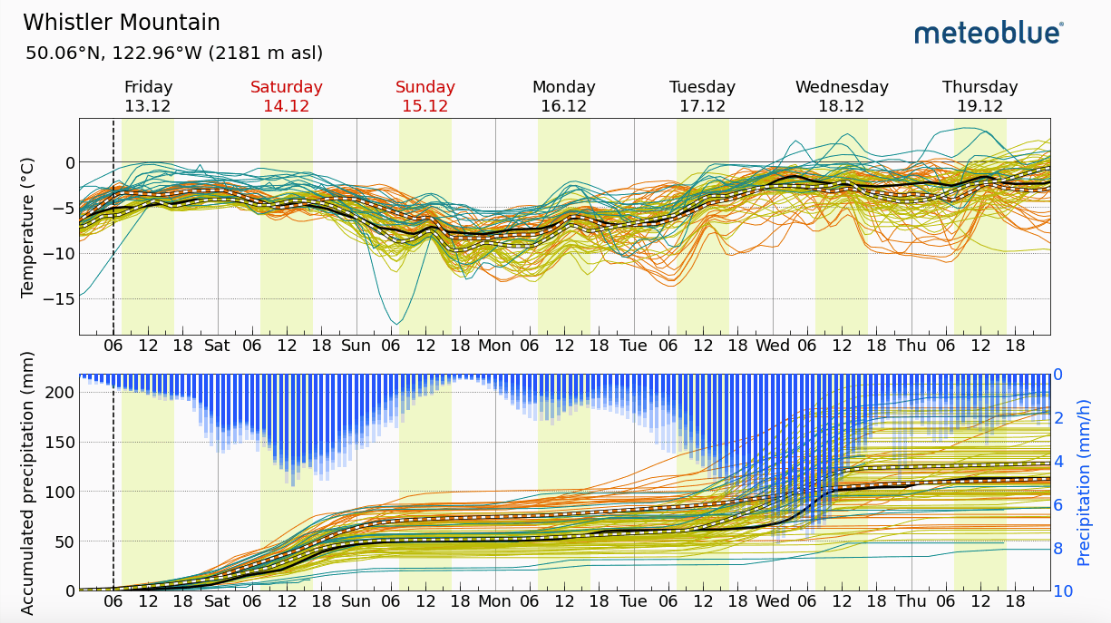
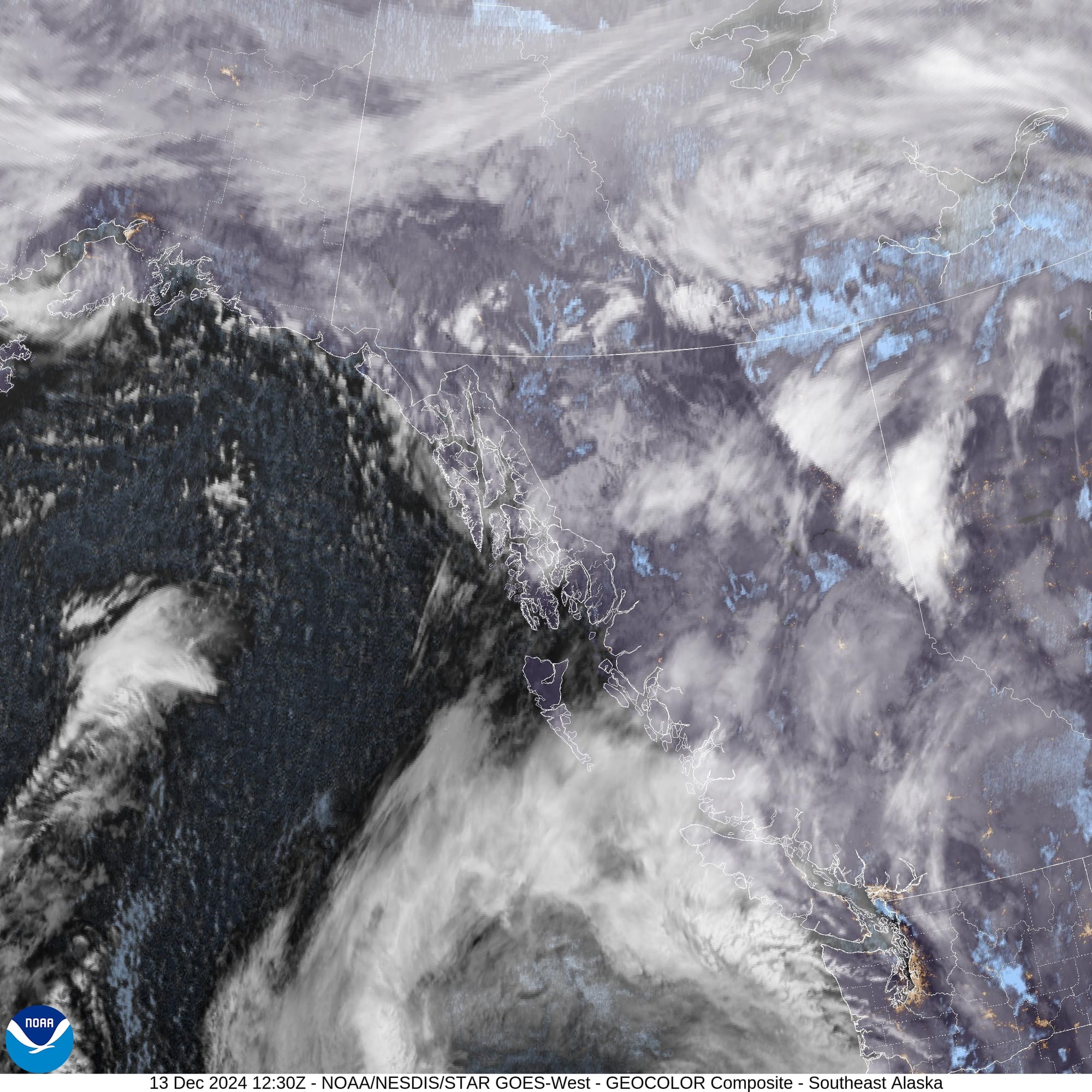
Meteoblue Ensemble for Whistler Mountain :) and the Friday morning Satellite image of the coast from NOAA looking like lots going on!
As the storm progresses throughout the weekend, we’ll see elevated avalanche risk throughout the Sea to Sky. AvCan currently has the South Coast on a considerable rating for the weekend and High on the North Shore.
If we get snow totals higher than forecast, that makes us think we’ll see an avalanche cycle over the weekend and that skiing during the storm will need to stay fairly conservative. If snow totals are lower, we’ll have better opportunities to ski during the storm but maybe bigger problems early in the week when the storm tapers off.
What are our questions for the weekend?
We covered these questions above but here they are again:
- How much of a load will the storm bring? Will there be a natural avalanche cycle in the storm?
- What’s the spatial variability of surface hoar being buried by this storm? In other words, will we see pockets of instabilities protected and prepped for triggering? This will be the most difficult to forecast and will be more of a problem the further inland you go.
- Where can we find good safe skiing and riding this weekend? We need visibility at treeline, as many below treeline locations are not quite filled in yet. The more interior you go, the lower snowpack means accessing treeline runs will be challenging and the big boulder/talus fields that make clearings at/below treeline are not quite skiable. As well, on the Coast, the low elevation trees took a hit and are tough to move through and low tide. It’s a narrow window, but hopefully this storm changes things for the better.
What will we watch out for or avoid completely?
- We’ll be keeping it to storm skiing terrain over the weekend. How much we step out after the storm remains to be seen.
- Below treeline needs more snow before we’re going to be travelling there much!
Closing Thoughts:
If you think back to Brian’s article about strategic mindset from a few weeks ago, this weekend we will be taking a big step back. We’re seeing a major weather shift and elevated hazard. It will be easy enough to investigate the problem as all of the action will be at the new snow/old snow interface or a direct result from winds/temperature changes during the storm. The current snow surface is our new base for a bit, with no real concerns deeper down.
In other news: we came across a detailed article from the infamous Matt Ruta on FATMAP alternatives.
For more information, check out Zenith Mountain Guides and our local avalanche forecast. These updates are supported by SkiUphill Squamish - the best stop for ski touring equipment in the Coast Mountains and made possible by the Sea to Sky Gondola! Use this information at your own risk. Conditions change rapidly from when this report was written!

Member discussion