
Dec 19 - Sea to Sky Snow Conditions
Overall theme:
Winter has returned! Our options have expanded! It’s likely to be a busy weekend in most of the areas with easily accessible snow but keep your guard up. The storms keep coming so save some in the tank for closer to the holidays too!
Where we’ve been skiing:
Exploratory missions from the Hurley to Blowdown/Caspar, Currie, Paul Ridge, and lots of Whistler-Blackcomb!
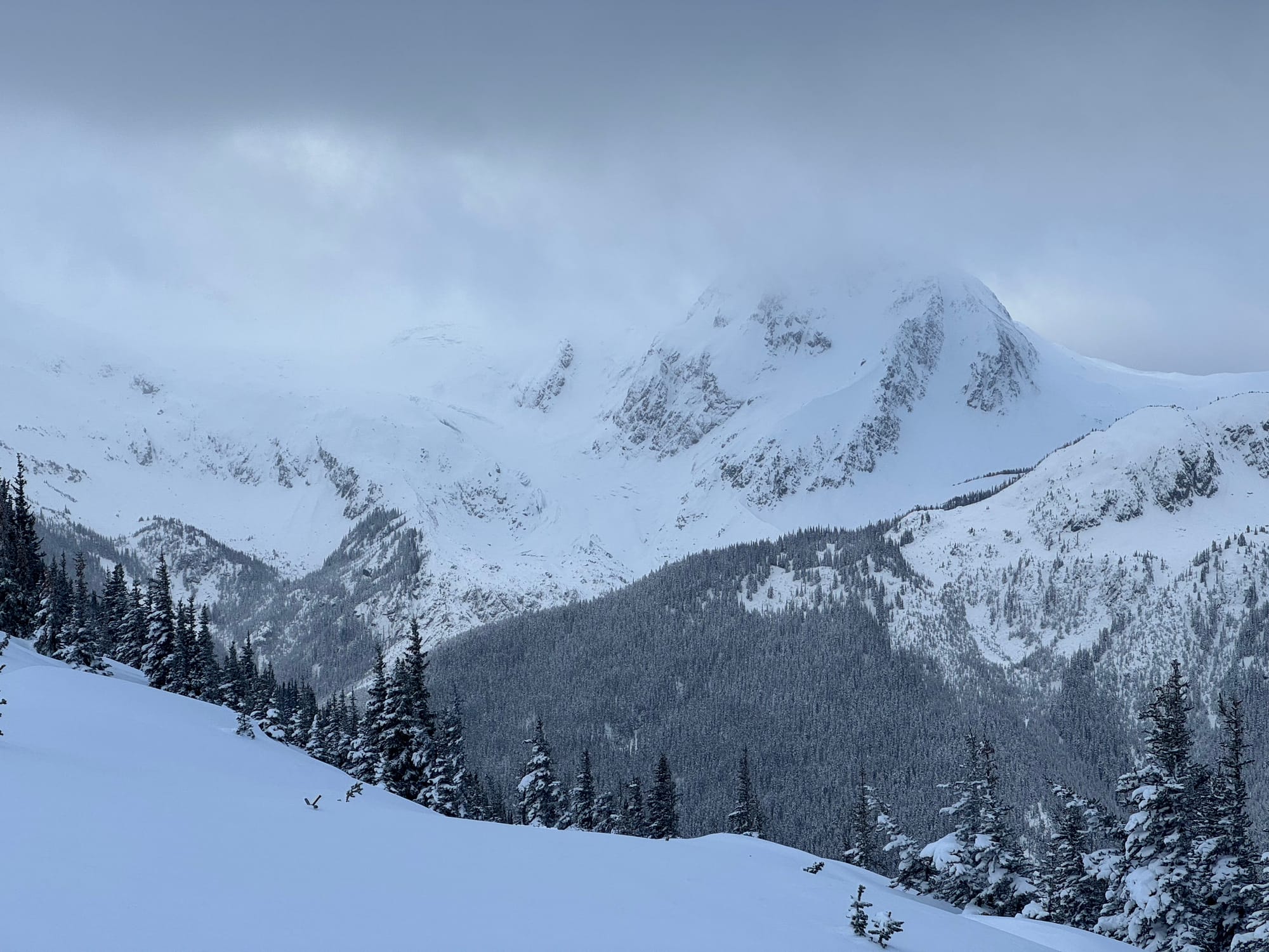
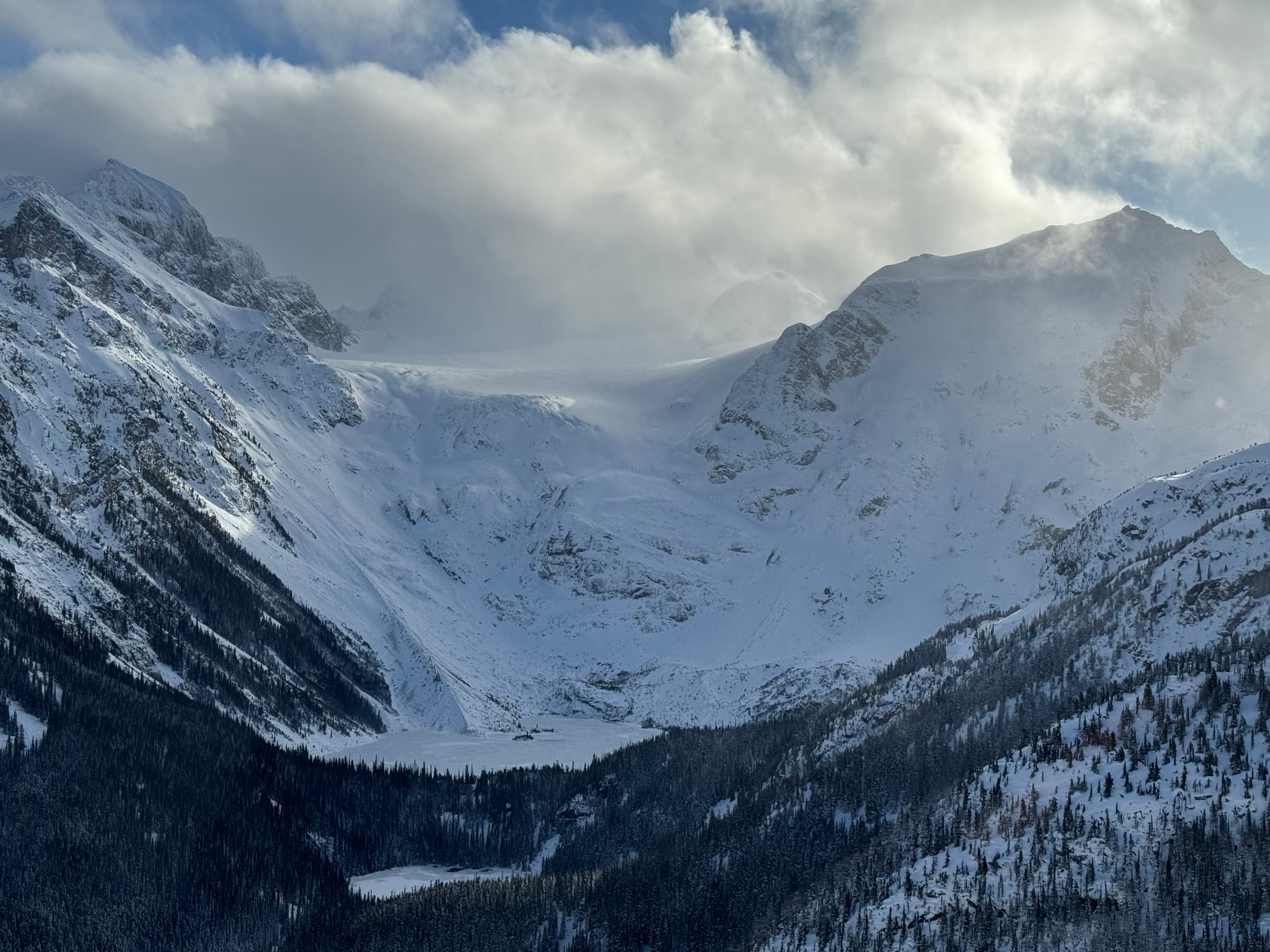
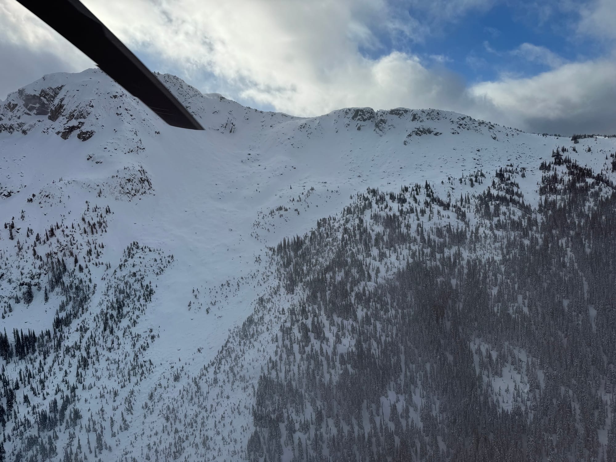
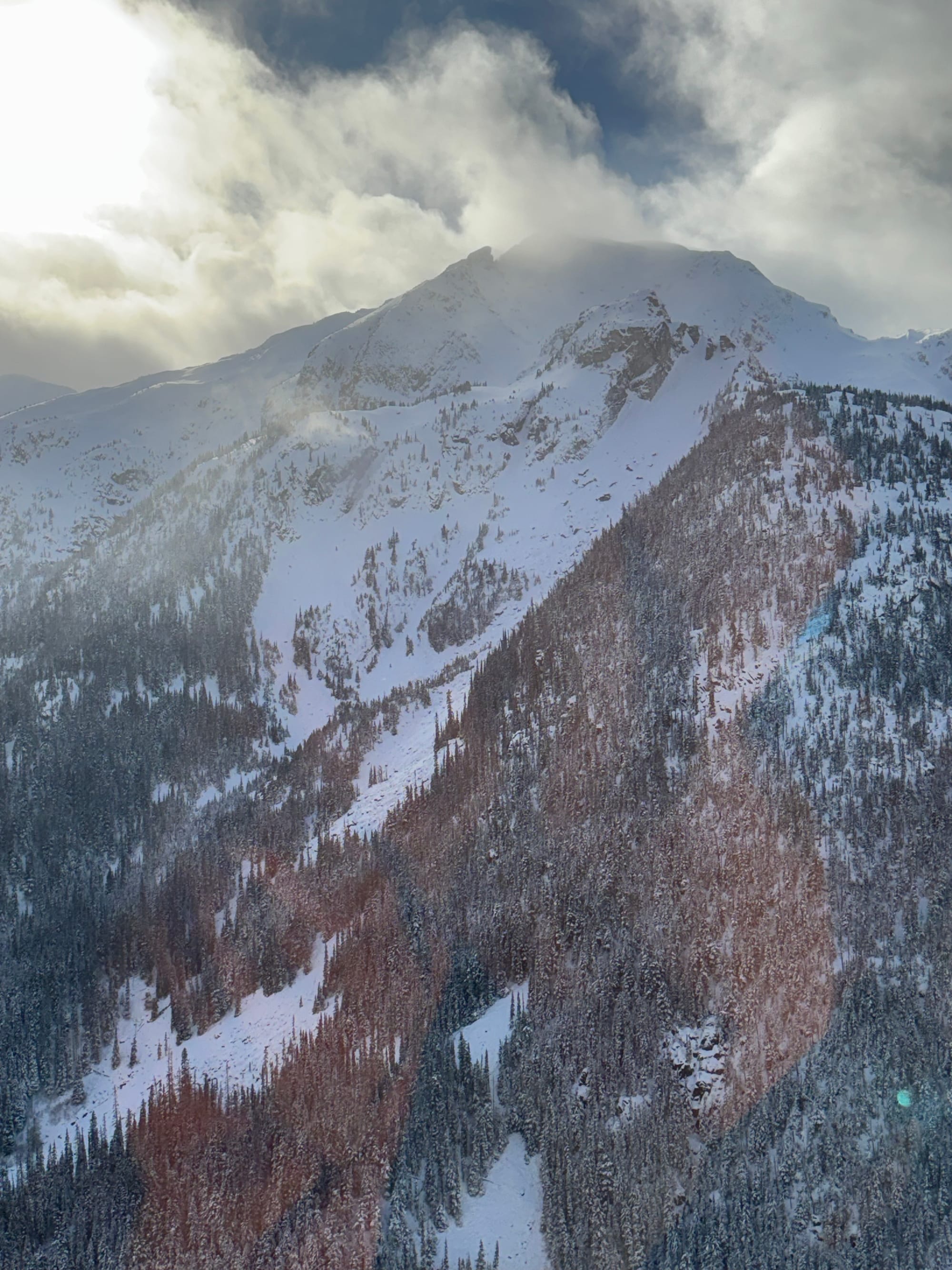
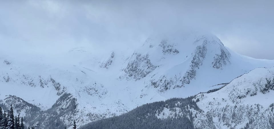
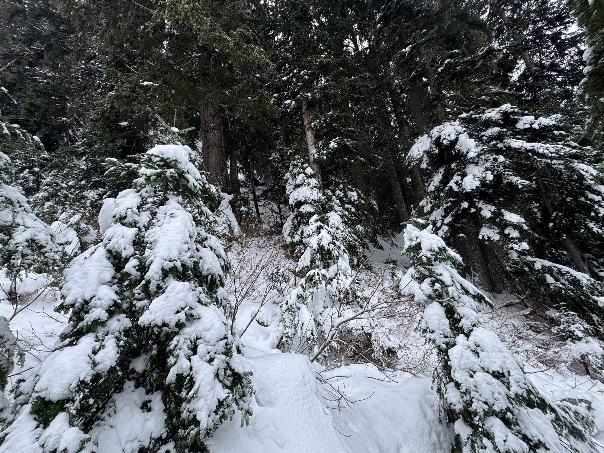
Overlord Glacier, Matier Icefall, Rohr Ridge, Chief Pascal and Heart Strings coverage photos!
Squamish Update:
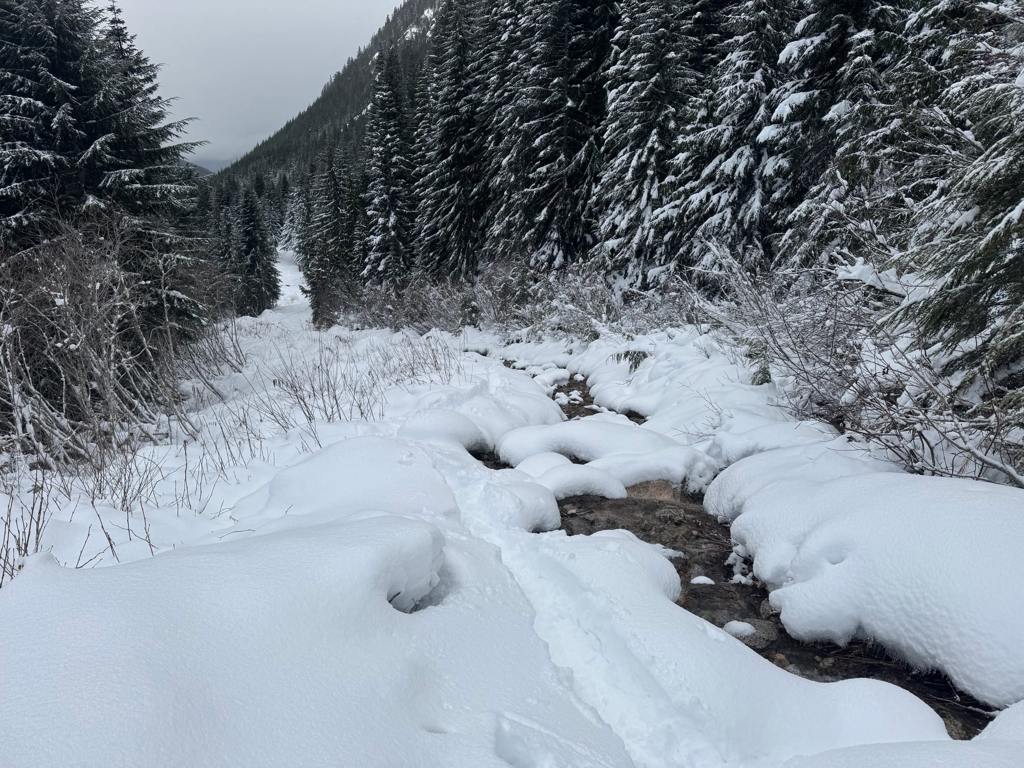
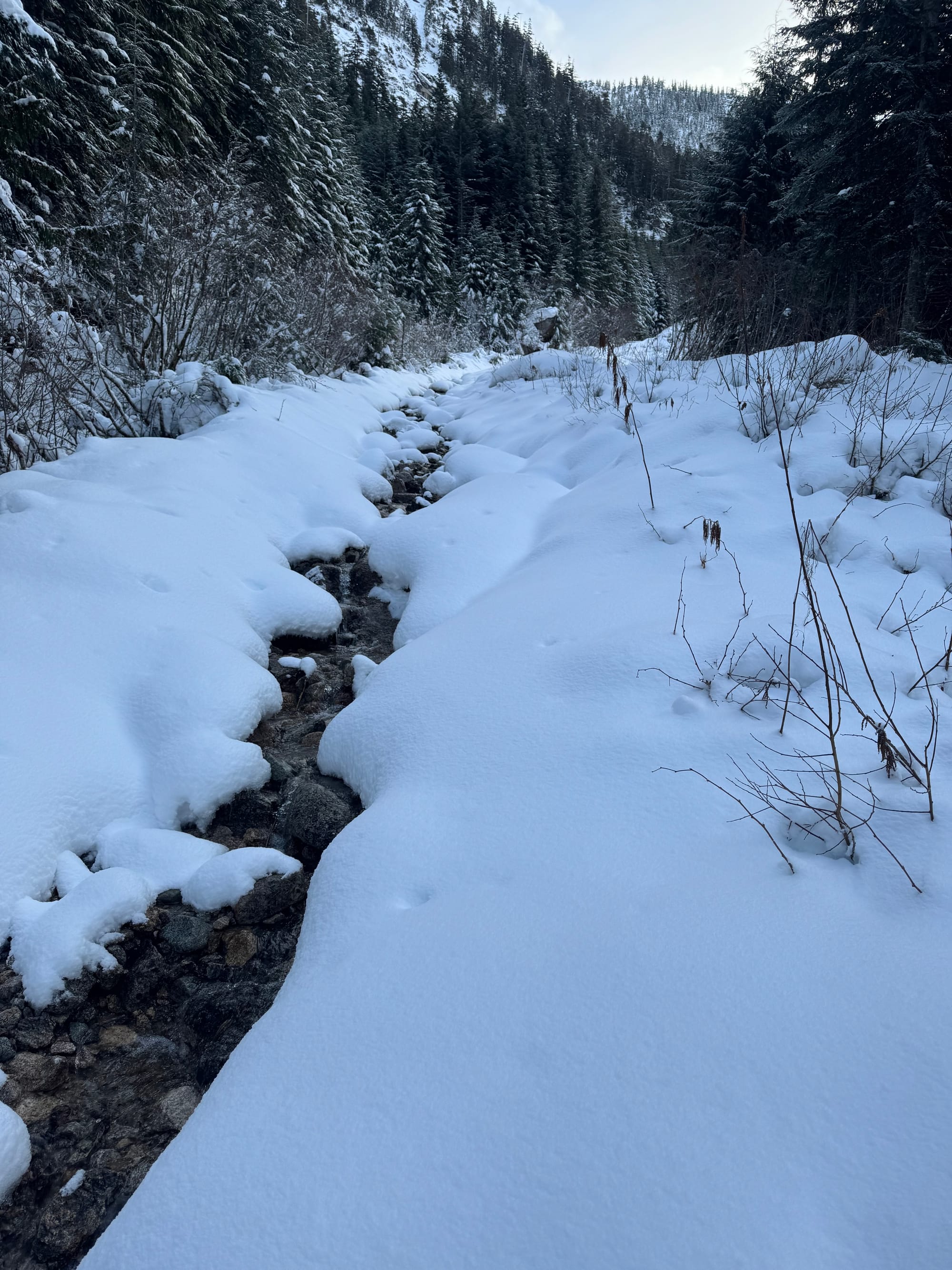
50cm of new snow down to 800m really changed things up. The road to Red Heather is back to being chains mandatory! It’s possible to ski/skin from the parking lot and decent skiing at treeline. Up at the gondola, our man Rob has groomed the road to the snow study plot at the Habrich turnoff. It’s incredible how smooth it is after a bunch of summer maintenance by their crew! Unfortunately, beyond the road, snow doesn’t stack up like you might expect. A gnarly breakable crust thanks to the brief rain storm on Thursday evening caps the 50cm of fluffy pow with no base. This makes skiing unpleasant. Several large creeks and plenty of thinly covered alder. Eric tried to get up high but didn’t make it past the Home Run path due to thin coverage in the trees. This being said, we expect that by early next week, things should really be coming into shape!
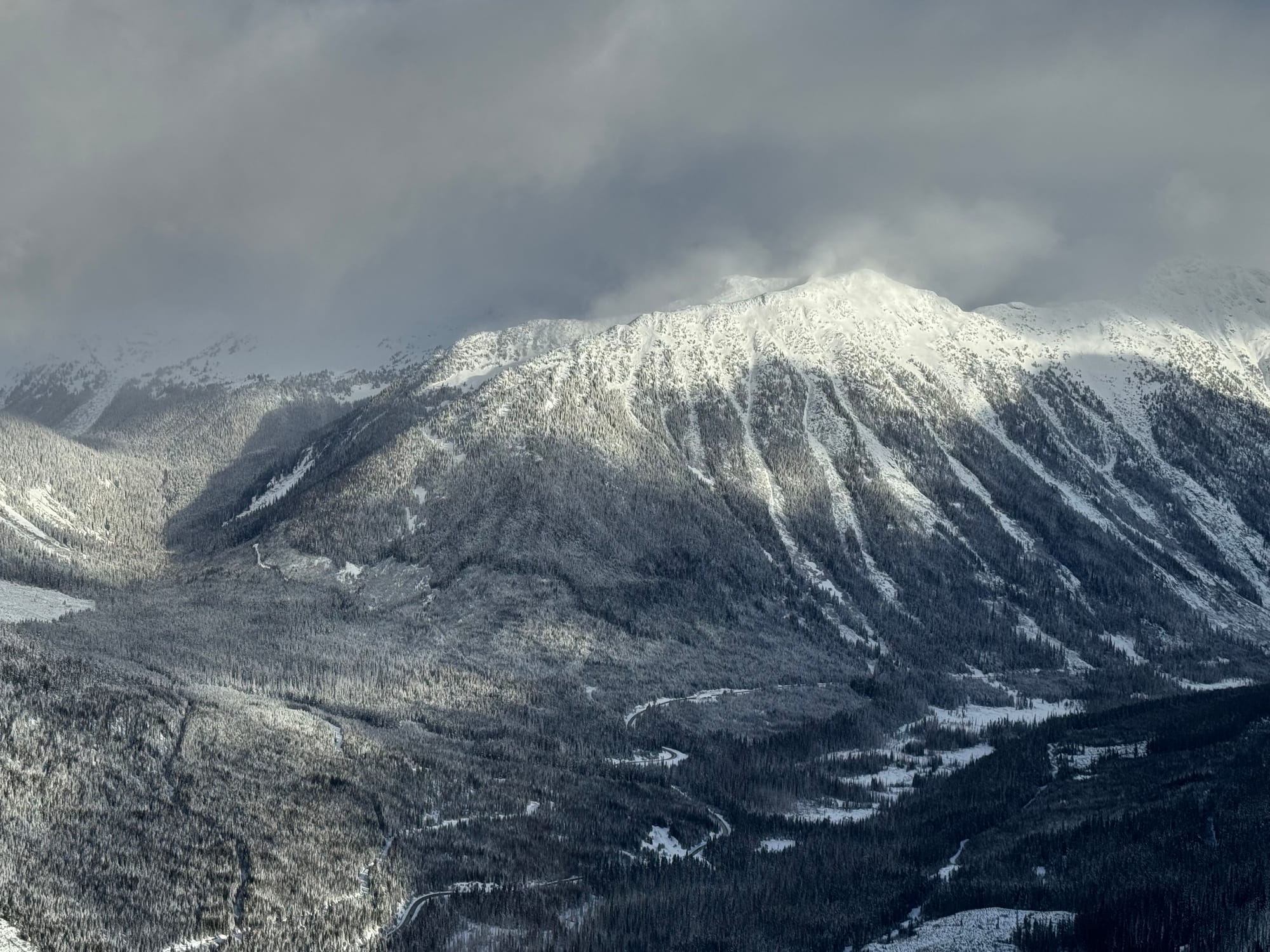
Upper Road looking down at the groomer below, home run avi path, and entrance to the tree triangle uptrack.
What’s happened since the last update (weather & general snowpack structure):
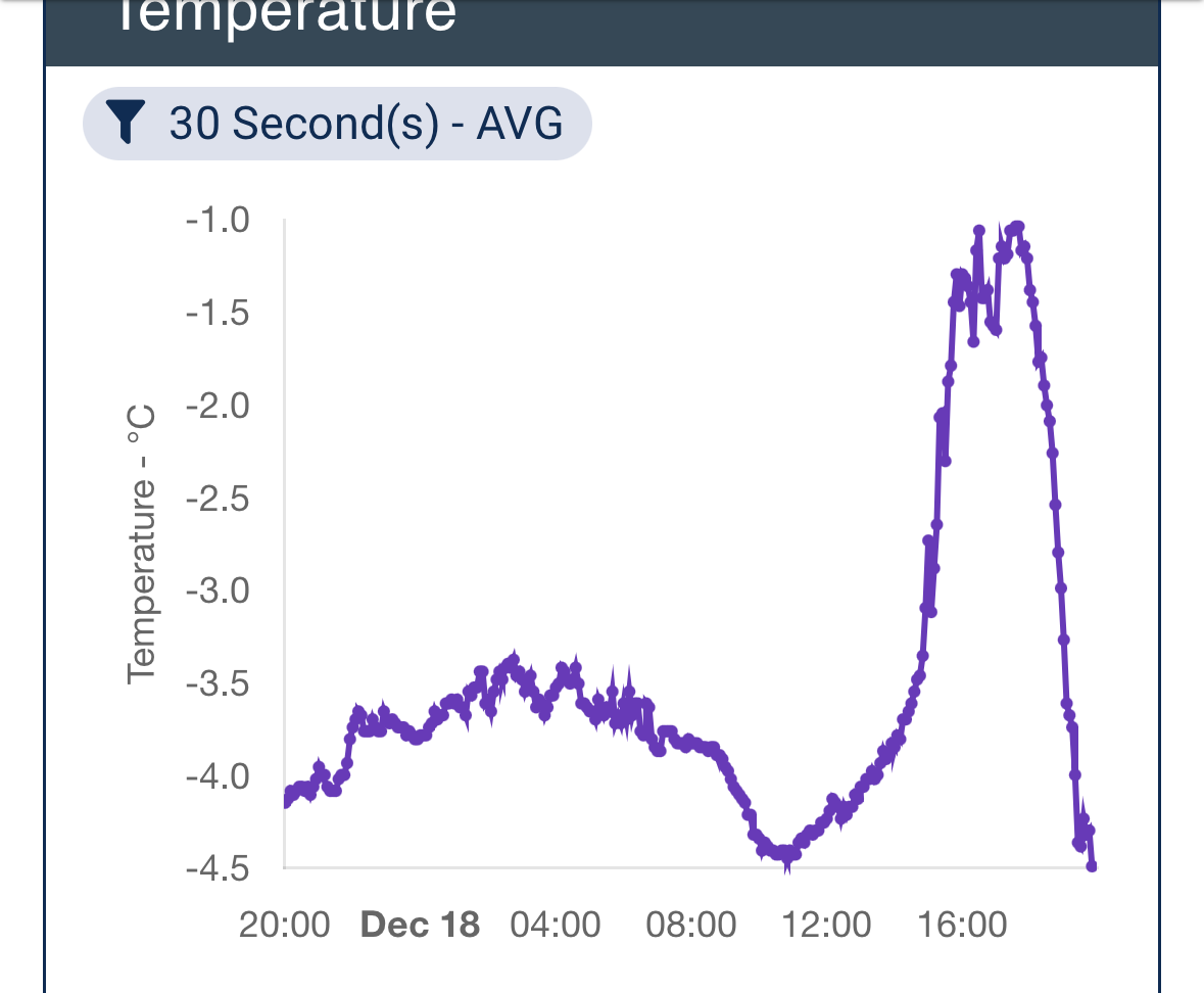
As hoped (and maybe even prayed) for, the atmospheric rivers have started to shift just a touch south with a strong cold front pushing through on Tuesday. After copious amounts of rain associated pre-front, the freezing level finally plummeted and produced 20-40cms of post-frontal snow as low as 1200-1400m. We stayed in the storm path and another 20-40cms fell to the north of the corridor, with 50-60+ falling at 800m and above in Squamish and at the Sea to Sky Gondola (finally!). With the first frontal passage earlier in the week, a fairly widespread avalanche cycle occurred. As we noted, there was a bit of facet/crust combo lingering in the snowpack down 50-100cms when the storms started rolling, that was giving us some clean shears in snowpack tests. But alas, the wallop of moisture provided for us in many ways, and one of the most helpful was a significant clean out event. Avalanches up to size 3-3.5 were observed on all aspects and elevations holding decent snowpack, so even though all evidence is now covered up, heli flights on Wednesday confirmed this. Wednesday PM then produced some shallower wind slabs as a result of some aggressive 100-200kmh winds associated with the frontal passage. Yes, probably 200kmh+! WB’s wind vanes max at 180, and they hit that number a few times! At least now we can likely concentrate on newer snow instabilities closer to the surface…
What’s the weather and avalanche forecast?
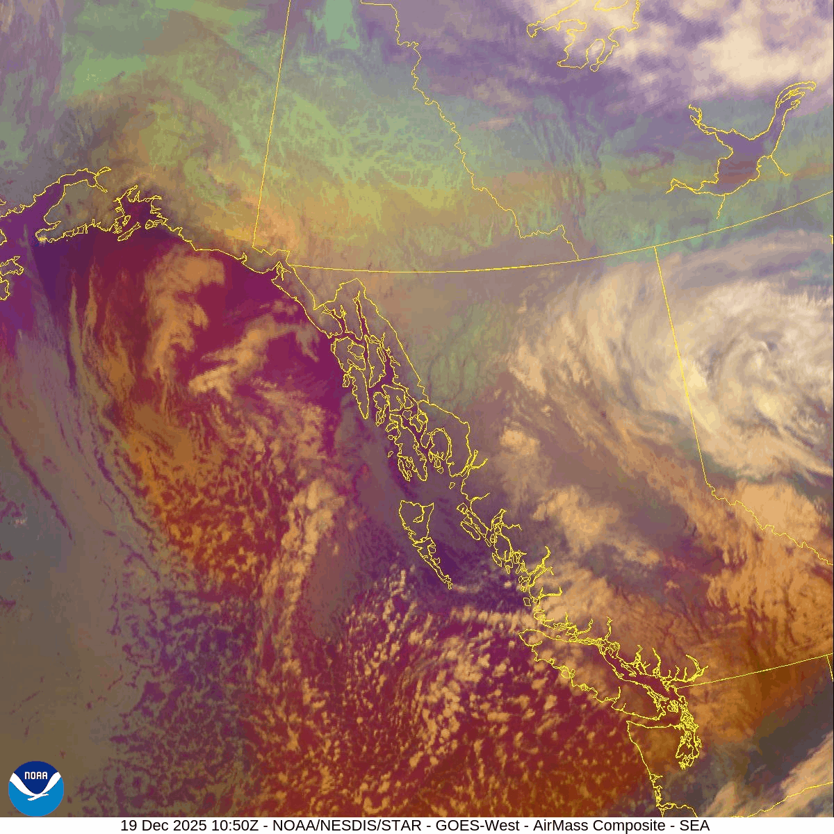
Active period for alpine snow enthusiasts! Notably, those who attended the early season snowpack discussion may recall my mention of a cold arctic air mass colliding with a warm Pacific air mass to produce epic snowfalls, which is the exact setup I previously described. A westerly flow accompanied with an upper trough will steer a series of disturbances across the BC Coast this weekend into early next week, resulting in rounds of alpine snow and rain for the Coast.
Wind Speeds:
- Friday: Light to moderate Southwesterly 30 gusting 50 km/h.
- Saturday: Moderate to Strong Southwesterly gusting to 40km/h gusting 80 km/h
- Sunday: Moderate to Strong 40 gusting 80 km/h
Freezing Levels:
- Friday: 500m rising to near 700m
- Saturday: 400m rising to near 800m
- Sunday: Near 500m rising to near 1000m
Precipitation:
- Snowfall totals for the high alpine 60-80cm by Sunday evening.
- Friday: 4-7cm by 4PM
- Saturday: 15-20cm by 4AM
- Sunday: 30-40cm by 4AM
Welcome to winter!
At the moment, avalanche hazard is considerable throughout the corridor. If we see snow totals increase, we expect that hazard to increase as well. Our primary concern is surface instabilities. Soft slabs are forming quickly with strong winds and are easy to trigger. Eric kicked off a soft slab at ridge crest on Disease Ridge on Thursday.
What are my questions for the weekend?
- How well is the new storm snow bonded to the surface below? Storm/wind slabs will be widespread with strong winds and impressive new snow amounts. Think mid-winter avalanche game but hopefully limited to new snow instabilities as many of our troublesome interfaces have been blown out. However, a new melt freeze crust did form on Dec 16 that all of this new snow is sitting on so search for that and how well it's bonded!
- How well is BTL and TL covered? BTL terrain is still a bit thin in many locations, and we will still be using terrain open to the sky or above 1500m to ride more relaxed, with less fears of hitting buried objects. There’s not a ton of coverage at the lower elevations and its not as supportable/consolidated as the mid and upper elevations.
- Will our persistent slab problem be dropped from the forecast? The Nov 17 crust got well saturated and caused a widespread avalanche cycle earlier in the week. Did this take Nov 17 off our radar? Certainly at TL in most of the places we visited this week but we just don’t have enough alpine data to know for sure. We’ll be looking for that crust facet interface in the alpine and if it shows any signs of reactivity. It might be possible to get high enough that the rain didn’t saturated (on Nch’kay for example) but that may have been high enough that the crust/facet combo wasn’t as much of a problem! We just don’t have enough info.
What will I watch out for or avoid completely?
With storms continuing to roll through, it’s going to be tricky to get into the open alpine. The game will be finding BTL and TL features that are open enough to play. These can hold smaller but still consequential avalanche terrain features.
Closing Thoughts:
It's now really winter and full on avalanche season. Play sharp, watch new storm totals and expect to be on your game as new snow amounts keep piling up. Conditions will still force you into that open terrain, so make sure it's safe before you’re fully exposed to a hazard! Keep the snow dances going. It would be great if this weather pattern could go on until March!
For more information, check out Zenith Mountain Guides and our local avalanche forecast. Weather forecasts are custom from meteorologist Jason Ross. These updates are supported by SkiUphill Squamish - the best stop for ski touring equipment in the Coast Mountains and made possible by the Sea to Sky Gondola! Use this information at your own risk. Conditions change rapidly from when this report was written!
Member discussion