
Dec 24 - Sea to Sky Snow Conditions
Overall theme:
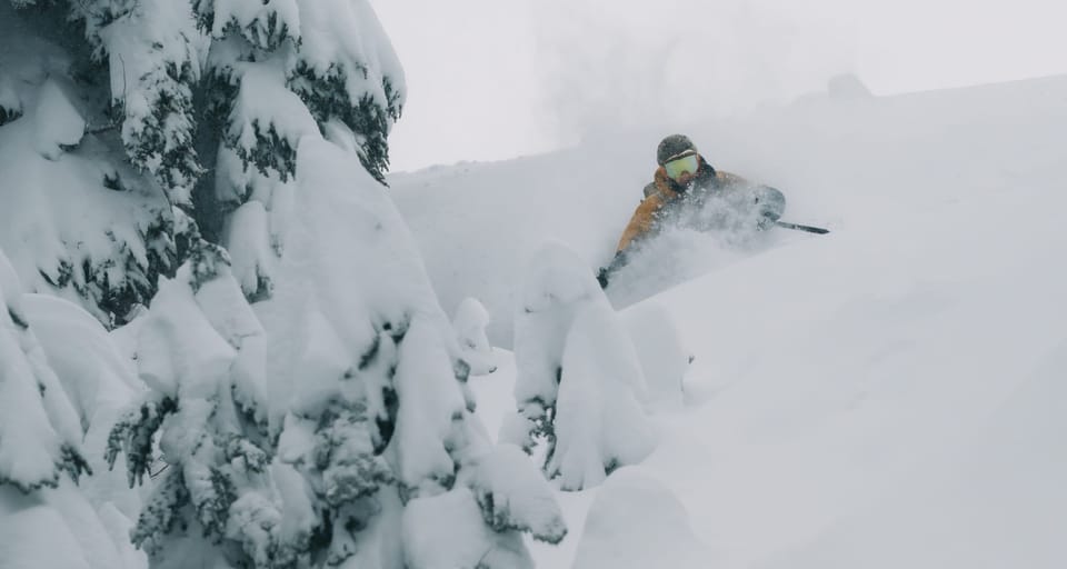
Whatever your brand of mythical gift deliverer, they came through for us this week! 100cm of new snow blanketing the region, down to that critical 900m, will cure seasonal depression in no time. Storm slabs are a thing so step out gently when it goes blue but so far, things are looking promising.
Did your special someone miss the mark on gift giving this season? Or perhaps you forgot to get them something? We have two spots left on our Jan 3/4 ski mountaineering course and it would be a PERFECT make-up gift!
Where we’ve been skiing:
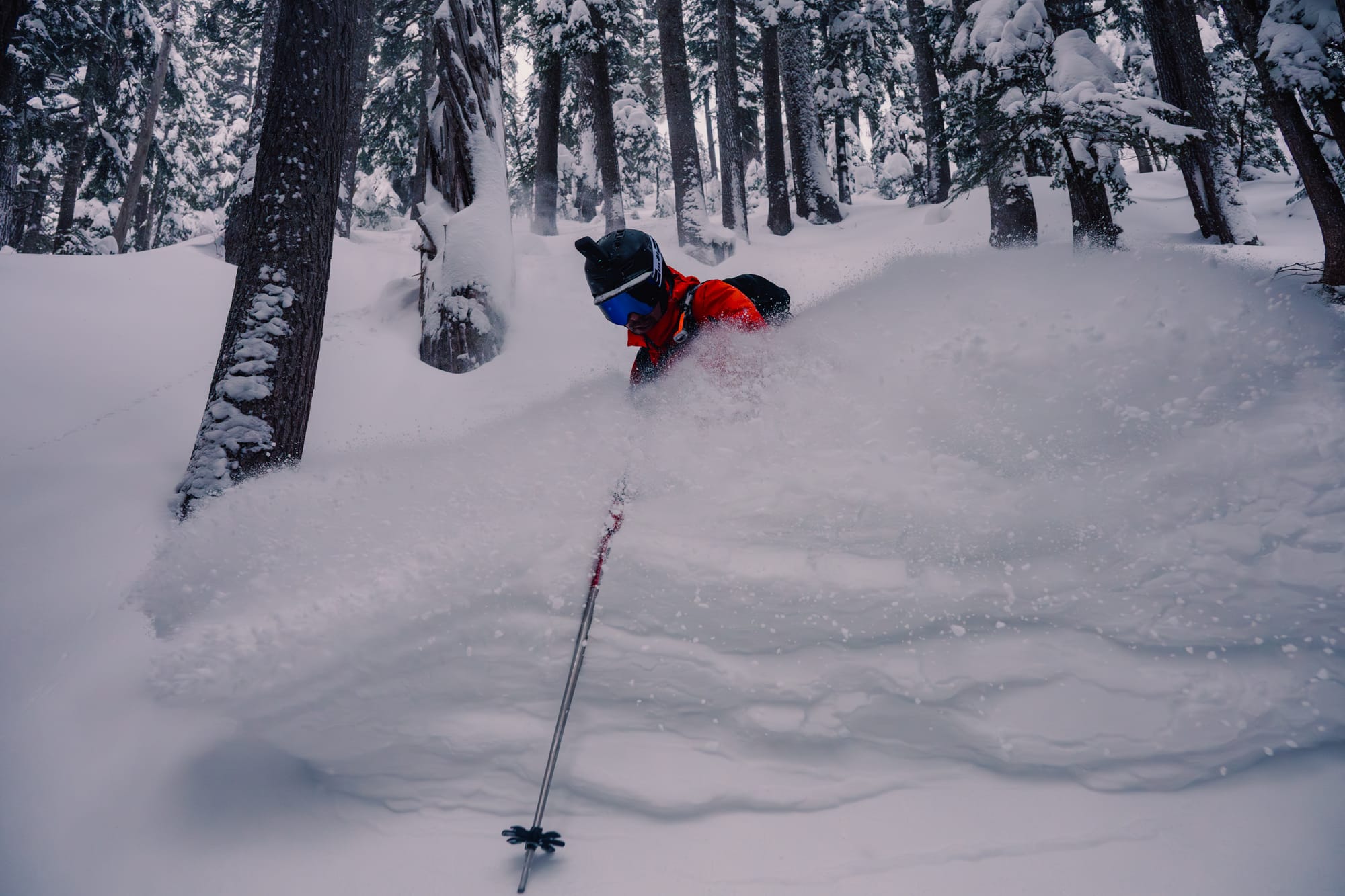
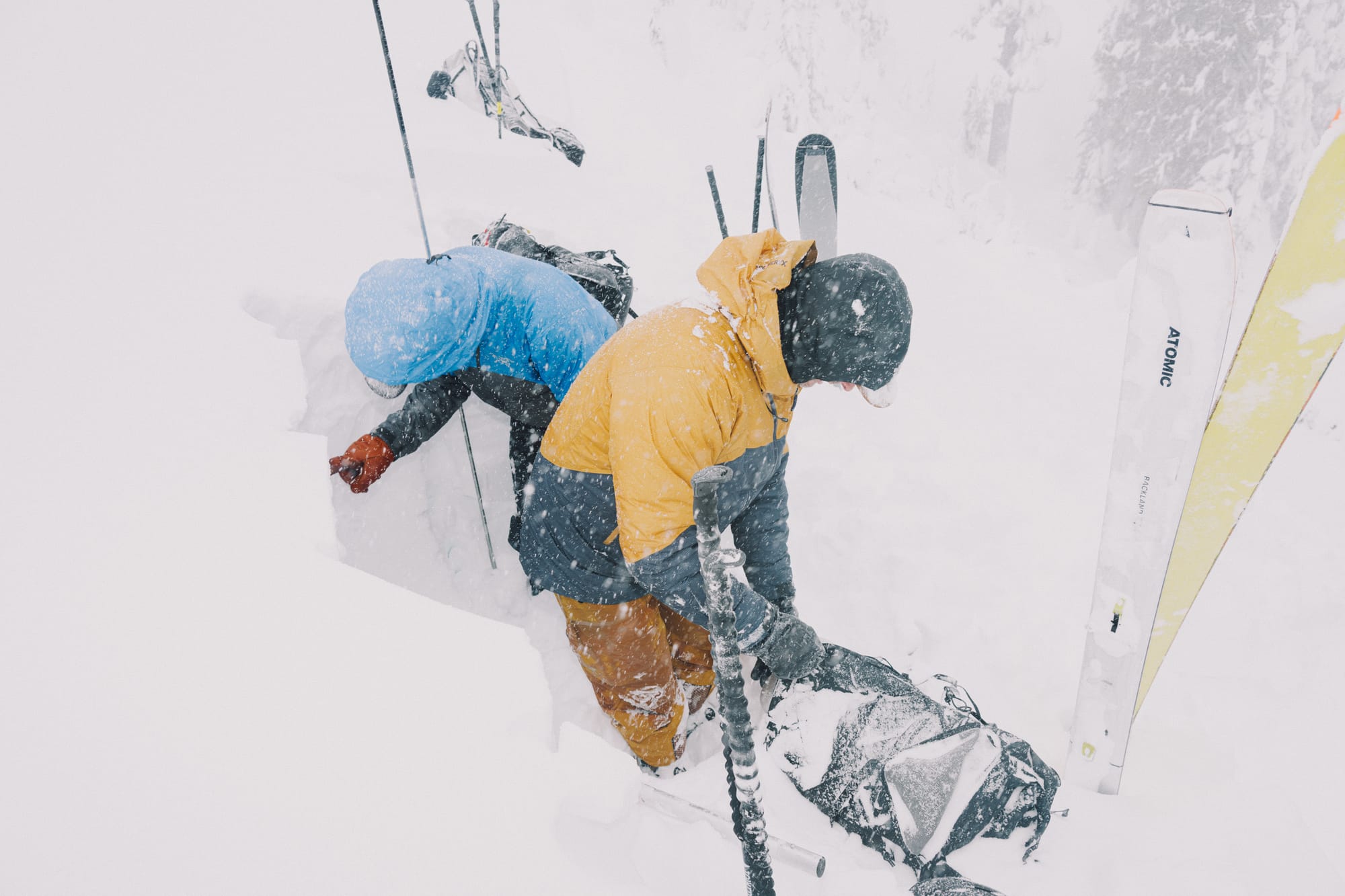
Hard to leave home when it’s good but we’ve been around Squamish, Whistler, and gotten reports from up on the Duffey and universally, it’s looking good. All the classic trailheads are now skiable from the S2S Gondola, Red Heather, ski out to Whistler Village, and everything along the Duffey! Skiable snow is pushing down to 800m in open areas however you gotta get a little higher if you want to be in the trees. It’s also worth noting that all the roads used by the snowmobile clubs are fully into grooming. While it’s fine to drive up Brohm or Brandywine in the early season before grooming starts, those are now big no-no’s unless you’re on a snowmobile. Don’t drive your car past parked groomers or over snow berms. If it looks like a bunch of trucks have parked somewhere and unloaded snowmobiles, you should stop there too! If you absolutely insist on getting up to Metal Dome or whatever, bring a case of beers and a tow rope and you’ll get a lift up the road in no time!
What’s happened since the last update (weather & general snowpack structure):
It’s probably hard to have missed but it’s been snowing. Like a lot! Basically non-stop since our last newsletter. There have been a few density changes in the snowpack as the FL fluctuates a bit but overall it’s been progressively resistant (soft on top and stiffer further down) and settling nicely. Wind has been building slabs and cornices and plenty of controlled and accidental avalanches have been triggered throughout the corridor. These have generally been in the sz 1-2 range however not many people have been in true alpine terrain so it’s hard to say what’s been sliding that we haven’t seen. The big mountains have been absolutely pounded!
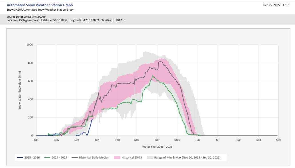
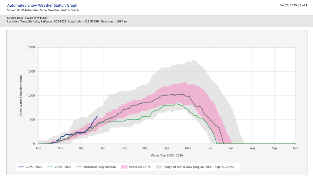
Callaghan and Tenquille snow pillows. Big spike in snow everywhere! You can see low elevations (1000m) just getting to historical min while mid elevations (1600m) is now doing great, above historical 75%!
The snowpack is now back to being roughly two major halves. The top ½ is 100-150cm of new dry snow sitting on the Dec 16 crust. Then you have the Dec 16 and Nov 17 crust/facet complexes separated by about 10cm of snow. That covers our base melt-freeze crust that’s still well saturated and very consolidated. One of our questions from last week was about the new snow bond to the Dec 16 crust. That does not appear to be an issue. All our recent snowpack test results and avalanches have been storm slabs occurring in the new snow, with wind input.
What’s the weather and avalanche forecast?
An upper trough will bring another round of light to moderate precipitation later on Christmas Day evening into Boxing Day. A ridge of high pressure over the BC interior will strengthen over the weekend into early next week, bringing cooler and drier conditions to the Sea to Sky corridor with outflow winds developing over the alpine and in Howe Sound.
Winds speeds:
- Thursday: Southwesterly 15 gusting 30 km/h
- Friday: Southwesterly 29 gusting to 60km/h
- Saturday: Northerly 40 gusting 60 km/h
- Sunday: Northerly 40 gusting 60 km/h
Freezing Level:
- Thursday: 300m rising to near 600m
- Friday: Steady near 300-400m
- Saturday: Near valley bottom
- Sunday: Rising to 500m
Precipitation:
- Thursday: Trace to 1 cm
- Friday: 10-15cm by 4 AM. 10-15 cm by 4 PM
- Saturday: Trace
- Sunday: Nil
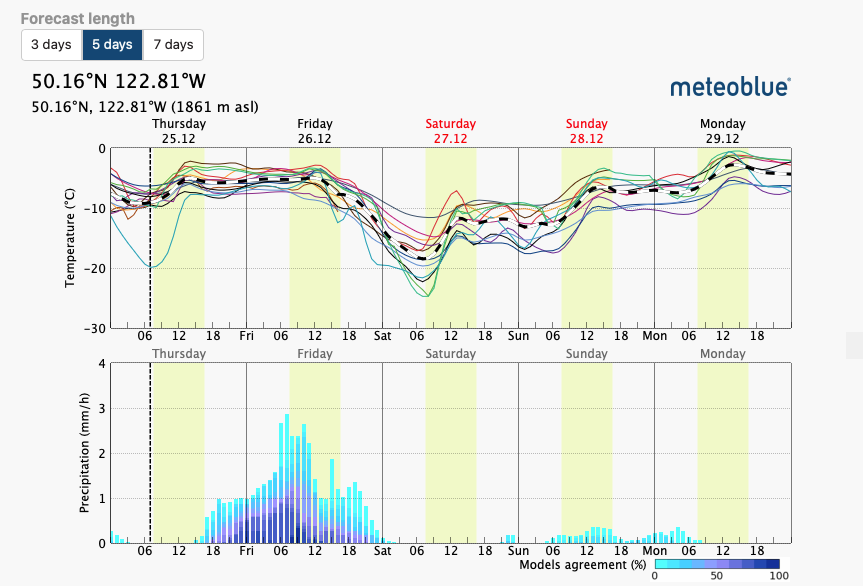
Avalanche hazard stays considerable with our primary problem being storm slab. That will settle quickly as the storms wrap up this week but wind slab will be a concern if it stays windy.
What are my questions for the weekend?
Will we see a warmup? A few forecasts have increasing freezing levels in the not too distant future…
What happened in the alpine? It was surely windy. And it surely snowed a lot. It will be interesting to see if there was an extensive avalanche cycle. It will also be interesting to see the result of that wind loading and its reactivity.
Is the mid-november persistent weak layer still lurking? The crust is still there but it's got a pretty big load above it. It's been a little while since there have been big avalanches on it but we also haven't had a ton of obs. This week could be telling.
What will I watch out for or avoid completely?
Big wind loaded start zones! At any elevation really.
Closing Thoughts:
I’m going to treat alpine, wind loaded terrain with a wide berth to start. I want to be able to start poking into the big mountains and seeing what’s happened as soon as possible but I’d be willing to bet that the best ski quality will still be at TL in alpine features. Then once the high alpine consolidates a bit and gets a few cm fresh on top, big terrain will ski a lot better.
Remember that considerable hazard is still serious. Let the storm slabs settle and be wary of new snow and increased winds through the week.
Happy Holidays!
For more information, check out Zenith Mountain Guides and our local avalanche forecast. Weather forecasts are custom from meteorologist Jason Ross. These updates are supported by SkiUphill Squamish - the best stop for ski touring equipment in the Coast Mountains and made possible by the Sea to Sky Gondola! Use this information at your own risk. Conditions change rapidly from when this report was written!
Member discussion