
Dec 4th - Sea to Sky Snow Conditions
Overall theme:
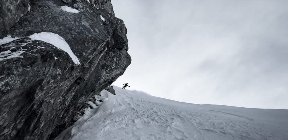
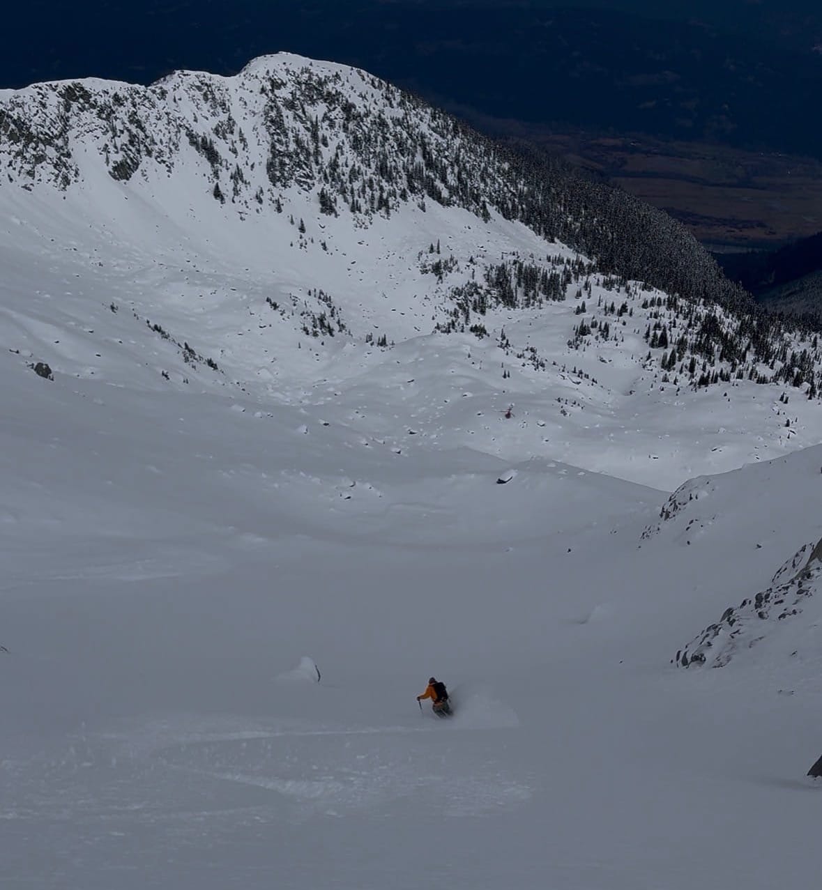
It’s been low tide…but good! With the high pressure, it’s been nice to get into the alpine and take advantage of the better snowpack up there. Some fairly big lines have been skied considering it’s still the first week of December by folks who were willing to do a bit of walking.
Make sure to check that your Sea to Sky Gondola pass is current. Now is the time to renew with their annual pass sale!
We also want to thank everyone who came to the season opener snowpack talk on Sunday. With your help, we raised $3500 for Squamish SAR that evening! If you missed out on tickets and want to be sure you don’t miss future snowpack talks, here’s your guaranteed way in.
Ok onto the important stuff…
Where we’ve been skiing:
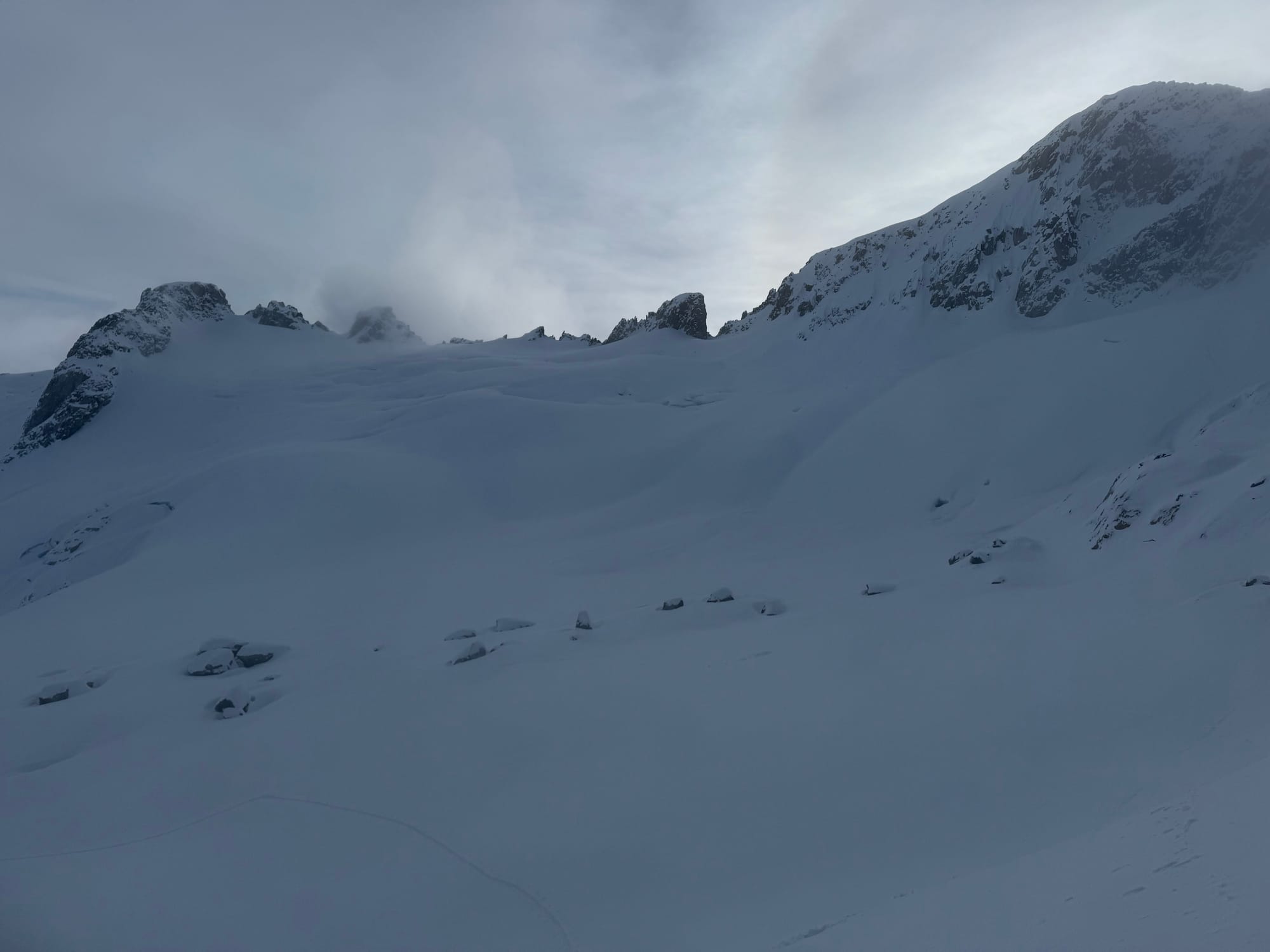
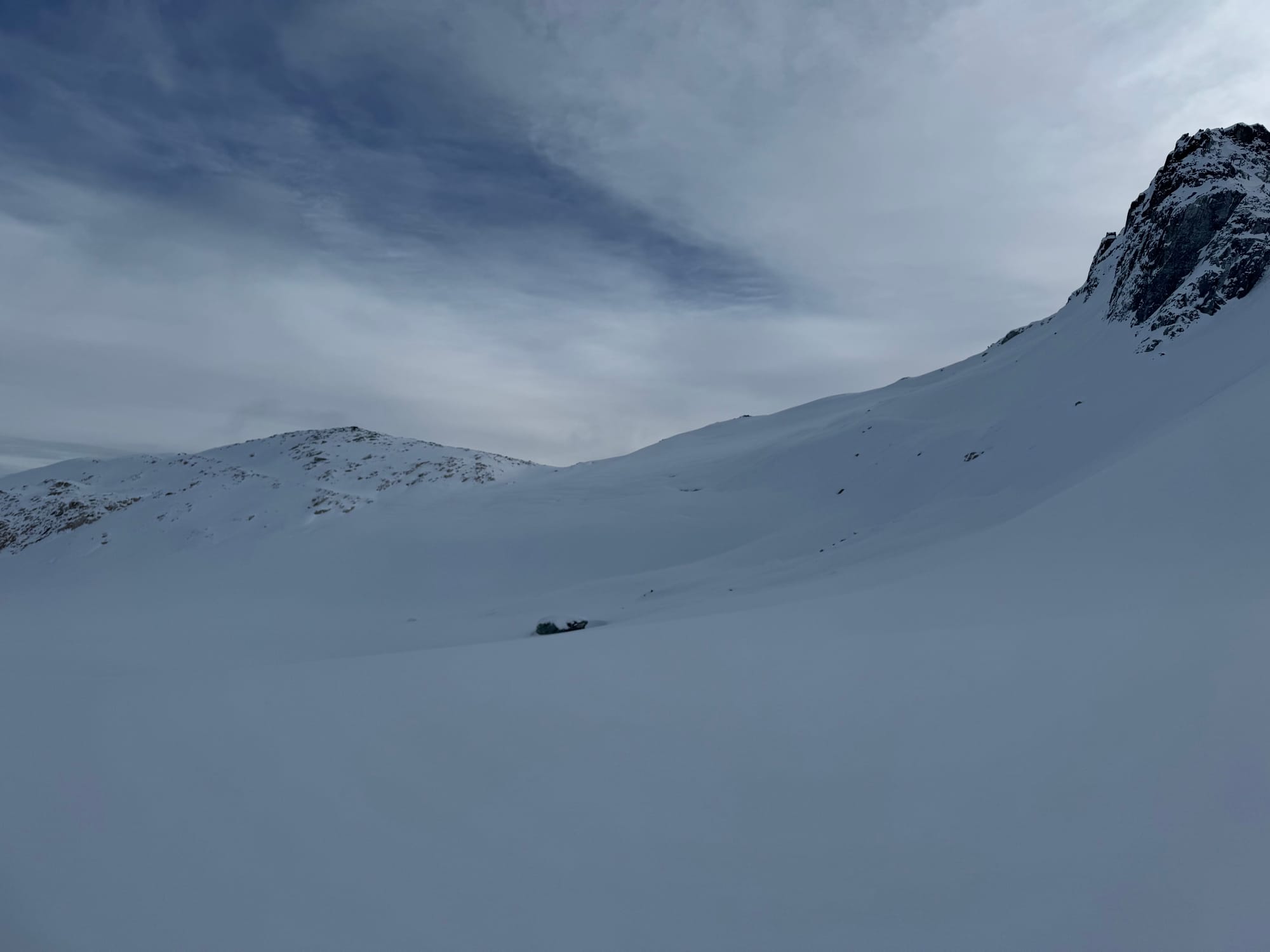
Squamish Valley, Whistler Blackcomb, with reports from Red Heather and Duffey. Skiing has been best where you can drive high (oh hey Metal Dome), get on north facing glaciers, and stay in sheltered terrain. Sheltered steep lines and full-sun lines have been in good shape however the in between lines have had some unpleasant sun affect. There was also a bit of wind effected snow in exposed alpine locations.
Skiable snow line didn’t change much from last newsletter, however a small pulse of precip down to 800m made roads slipperier! Generally the snow line was about 1500m in Squamish and a little higher on the Duffey. Folks were walking into Keith’s hut before skinning.
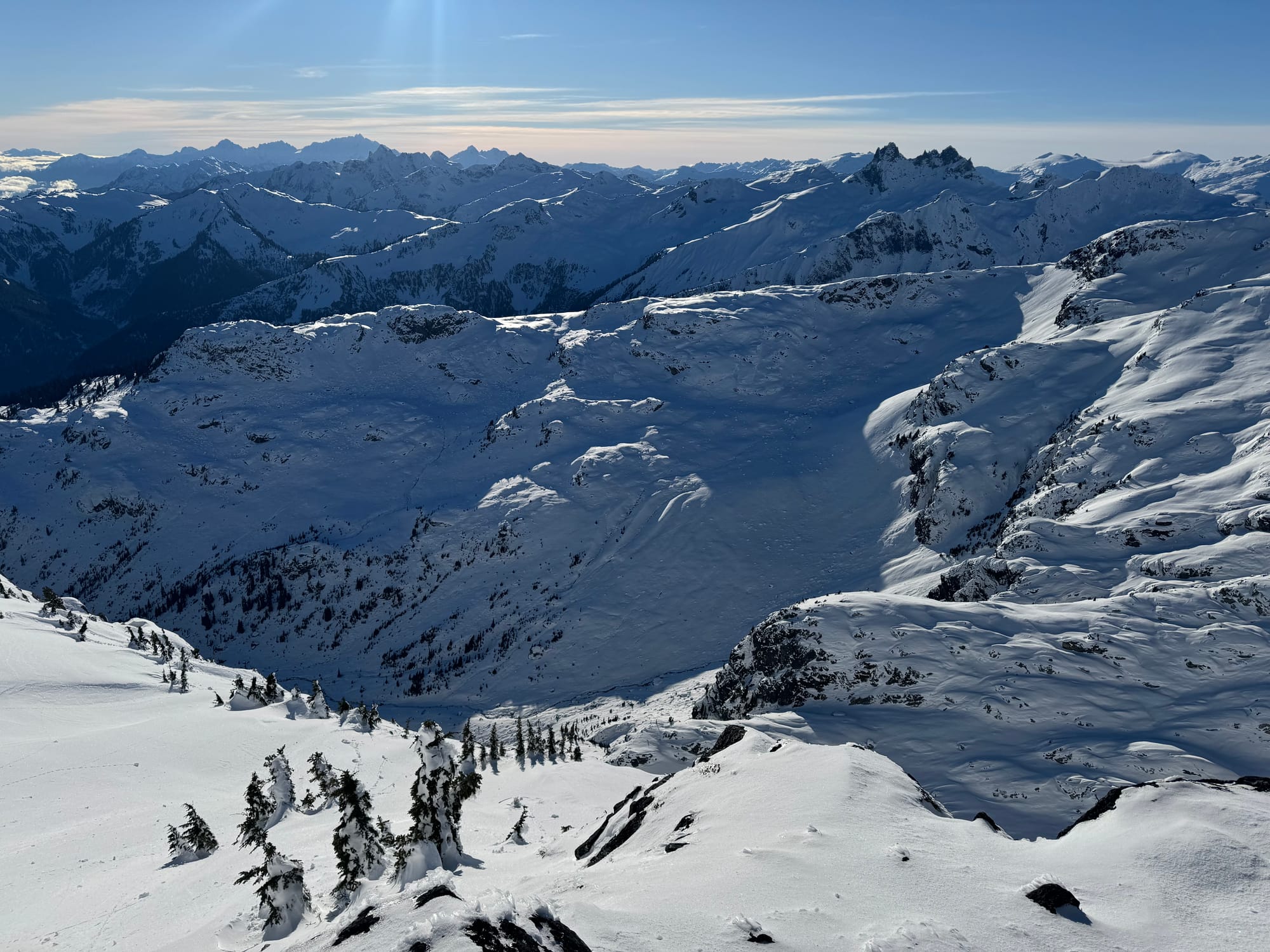
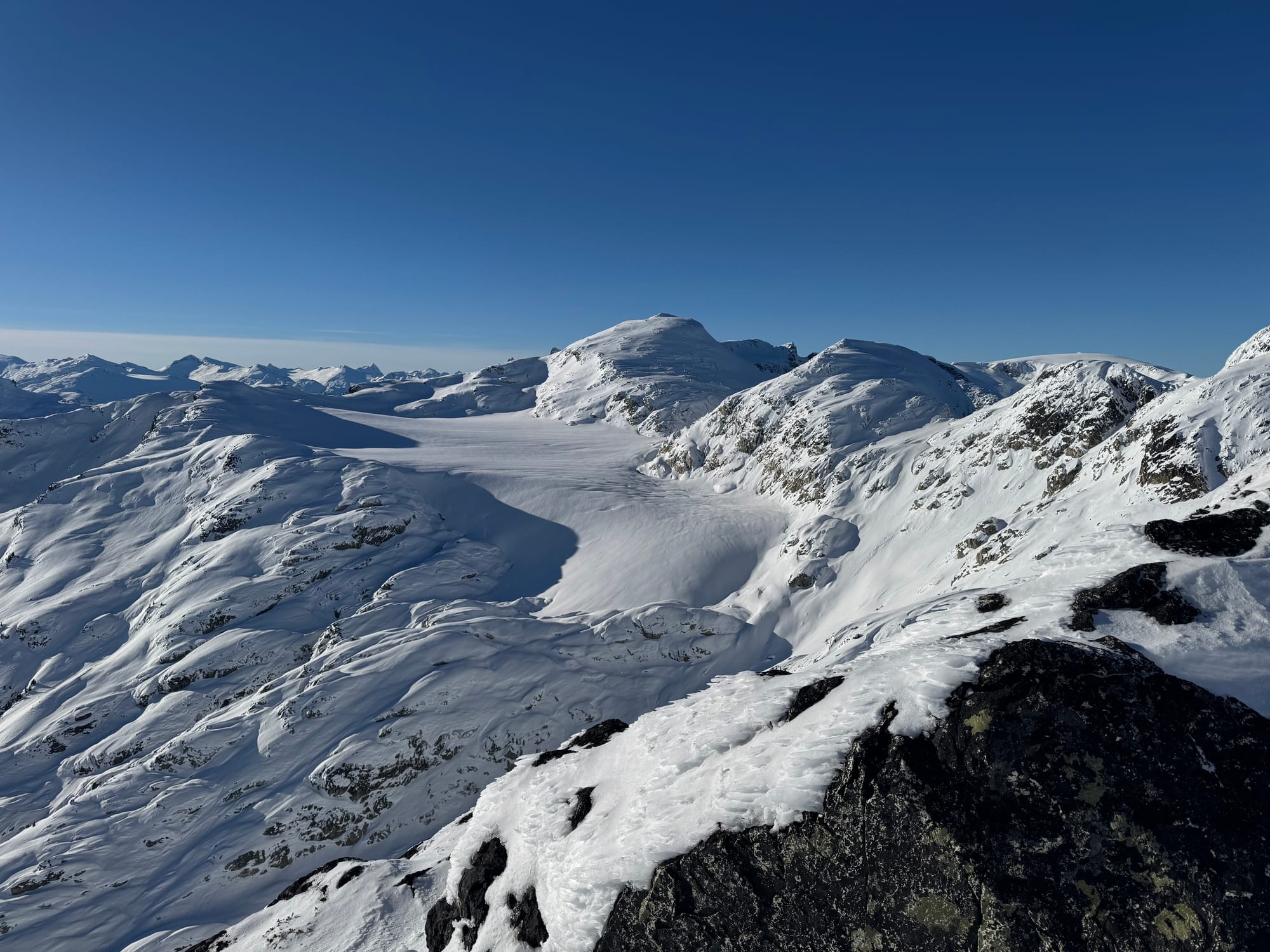
Top left: Brandywine Meadows. Top right: Brandywine Glacier. Bottom left: looker’s right of Spearhead Glacier - Cham and guide notch areas (lots of crevasses at glacier centre). Bottom Right: lookers left Spearhead Glacier (less crevasses than last year!).
Note about Whistler Blackcomb: it’s been great being able to tour from Rendezvous/Jersey Cream but with incoming weather this weekend, expect avalanche control and for the groomed road up to Horstman Hut to be closed. Likely the backcountry access over the weekend will be the traditional exit from the bottom of 7th Heaven out towards Disease Ridge. For the return, make your way towards Last Resort to access Catskinner in order to download. We don’t expect to see 7th Heaven opening up before Dec 12th. Expect the same on the Whistler side. The low road of Moose Meadow, staying out of avalanche control areas in the controlled resort boundaries being your best bet. It sounds like Harmony will potentially open after AC is completed! Consult the WB terrain status map to see what access is open in real time.
What’s happened since the last update:
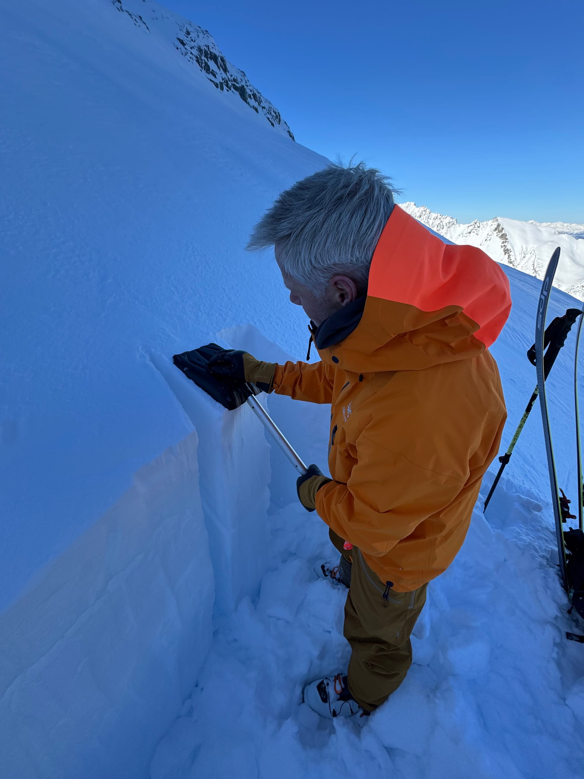
There’s been minimal avalanche activity in the corridor. Small windslabs settled quickly with the warm daytime temps. The stable weather has meant the snowpack structure is mostly unchanged. Most areas have some amount of wind affected snow near the surface. This sits on the mid-november melt-freeze crust. The bond to the lower crust has generally been good but the new load of incoming snow will test it.
What’s the weather and avalanche forecast?
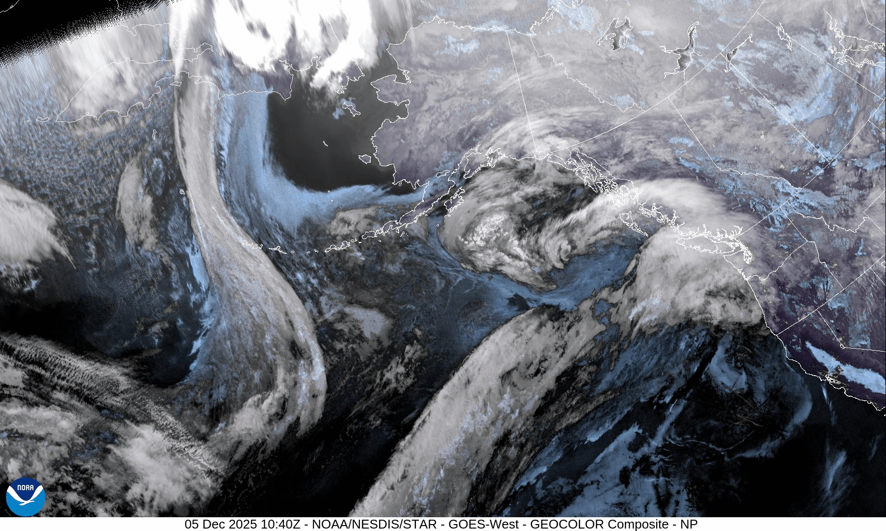
An active weather pattern is expected to impact southwestern BC and the Sea to Sky region this weekend and into next week, as a series of systems move into the area. The first moist frontal system will bring heavy snowfall to alpine regions and strong winds Friday into Saturday. A second system will arrive on Sunday, resulting in heavy snowfall over the alpine regions, accompanied by very strong winds. A third system is expected to arrive on Monday, likely bringing a strong atmospheric river to southwestern BC, with freezing levels possibly rising to near 2000m.Some notes from the forecaster, the incoming systems this weekend will likely produce 30-50 cm by Sunday evening. The models are consistently showing a strong atmospheric river setting up on Monday into Tuesday, the primary question with this system being how high the freezing level will be?
Alpine Wind:
- Friday: Southwest winds 40 gusting 80km/h
- Saturday: Southwest winds 40 gusting 70km/h
- Sunday: Very Strong Southwest 50 gusting 100 km/h
Freezing Levels:
- Friday: 800m rising to near 1300m
- Saturday: 1000m rising to 1400m
- Sunday: Near 1000m rising to near 1700m Sunday afternoon.
Precipitation: Snowfall totals of 30-50cm for the alpine
- Friday: 5-10 by 4 PM
- Saturday: 5-15 cm by 4 AM
- Sunday: 10-20 cm by 4 AM
Avalanche Canada has rated the hazard for the weekend at High on the South Coast and Moderate for the Duffey indicating a big difference in snowfall totals expected. This is highly dependent on timing of the storm so there’s lots that could change. If you see 30+ cm of new snow where you are, anticipate a storm slab problem and elevated hazard!
What are my questions for the weekend?
- What will we end up with for freezing levels? Temps will be flirting around the 1000m mark until at least mid-week. This could make or break our access situation!
- How will the new snow bond to the existing crust? There didn’t seem to be huge surface hoar growth but there was some surface faceting in the colder temps. We’ll see the extent!
What will I watch out for or avoid completely?
- We’re going to be pretty tentative in the alpine over the next couple days. It looks like we’re gonna be slurped by this atmospheric river but just want to be sure it comes with some cold temps!
- Early season conditions still persist. Still gotta watch for logs, stumps, rocks and all that!
Closing Thoughts:
Storms coming! If we’re lucky, everything changes. Give the new snow a chance to settle out and see what the carnage looks like. Skiing over the weekend - especially Saturday - will be tricky because the high stuff may be inaccessible while the typical storm ski zones might still be below threshold. Once it stacks up a bit, it’ll be game on!
For more information, check out Zenith Mountain Guides and our local avalanche forecast. Weather forecasts are custom from meteorologist Jason Ross. These updates are supported by SkiUphill Squamish - the best stop for ski touring equipment in the Coast Mountains and made possible by the Sea to Sky Gondola! Use this information at your own risk. Conditions change rapidly from when this report was written!
Member discussion