
Feb 13 - Sea to Sky Snow Conditions
Overall theme:
Overall it was a quiet week on the Coast! Folks have been cautiously stepping out and finding bigger terrain to be reasonable. While lots of lines still just don’t have the coverage (looking at you Fitzsimmins NF), there’s plenty that are IN! Travel has steadily gotten easier and when you can avoid the wind effect, it’s possible to find plenty of reward!
Before we continue on - a quick advertisement: As we get into prime season, Zenith Guides is booking up fast. If you’ve got a big adventure in mind or just want a day in the backcountry getting the best goods possible, we can make that happen. Right now we’re eyeing up some green brick heli-assisted big line hunting. We might be back to sled accessed tree skiing by the end of the week. Reach out to see what we’re getting up to!
Where we’ve been skiing:
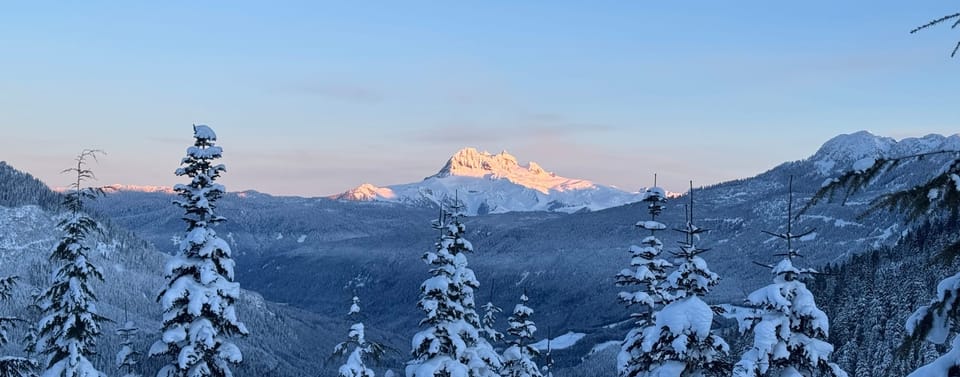
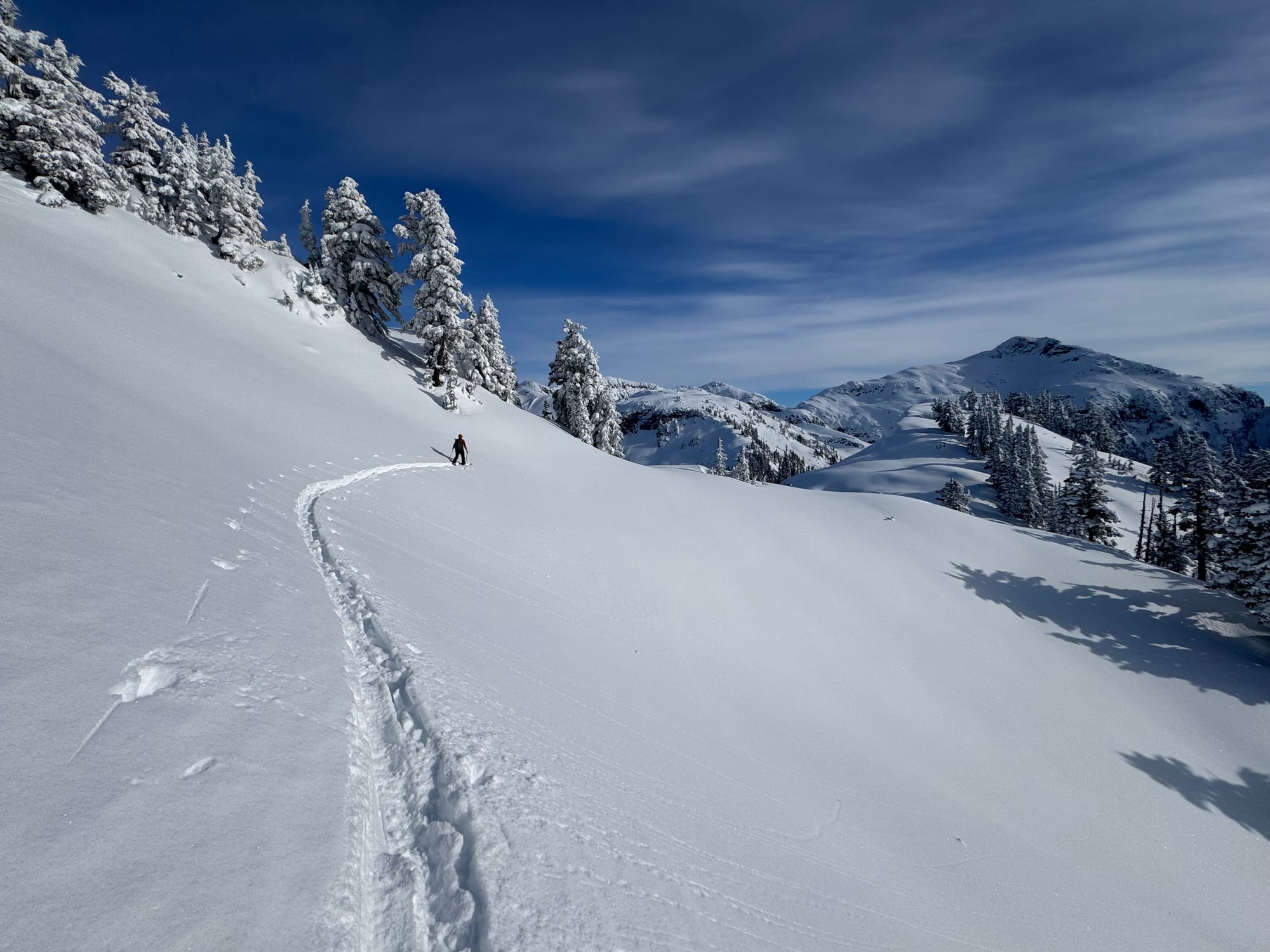
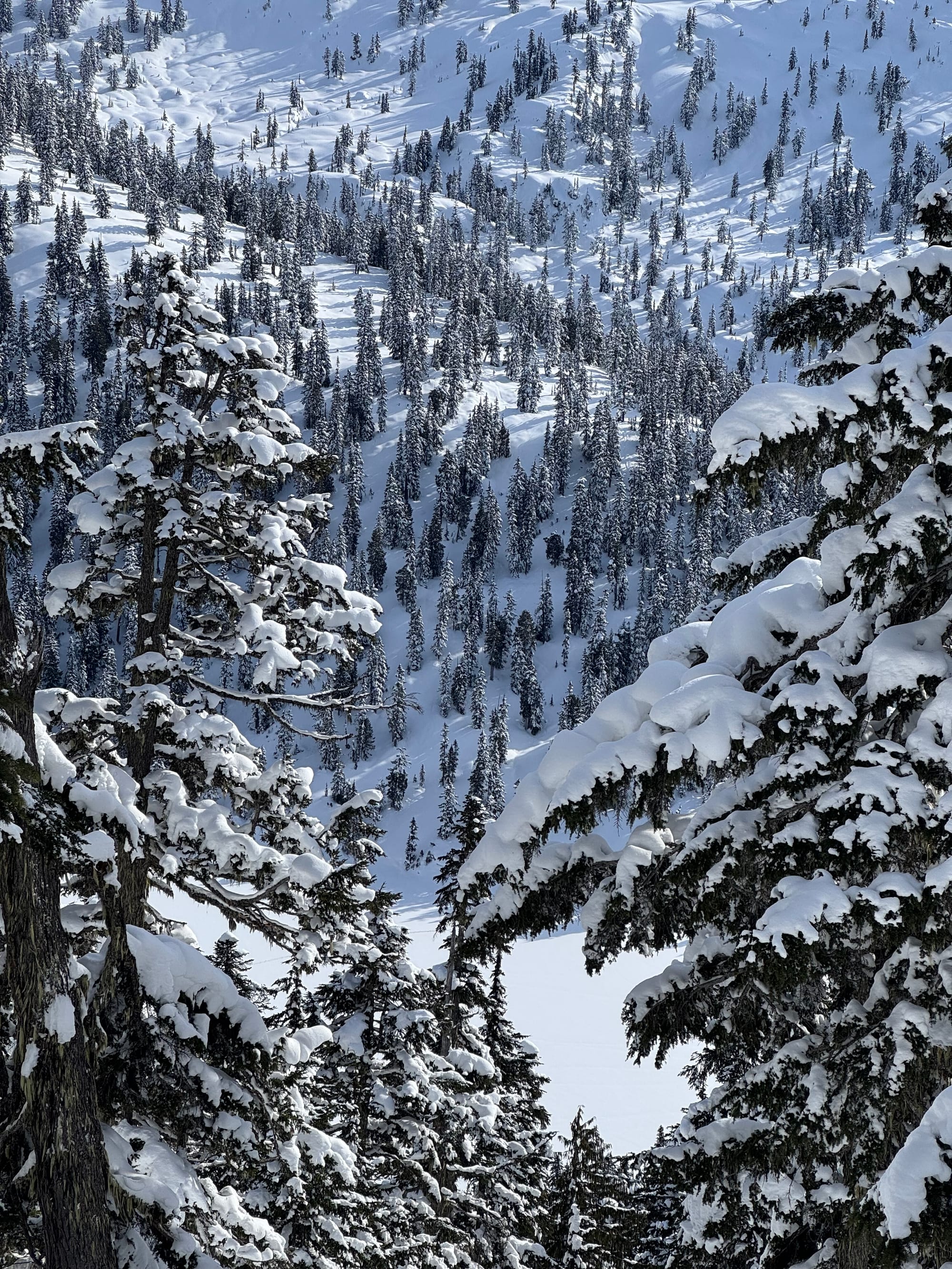
Squamish backcountry, Blackcomb backcountry, and Cayoosh/North Joffre Creek. Tree skiing was the play over the weekend but now it seems we’ve found ourselves back to lurking at treeline and just above, looking for the most protected snow we can find. The highest peaks have been wind stripped but mid-elevations and lower summits are hanging in there! Access has slowly improved with each pulse of snow but extended high pressure starts breaking that back down. All the local trailheads are at least skiable!
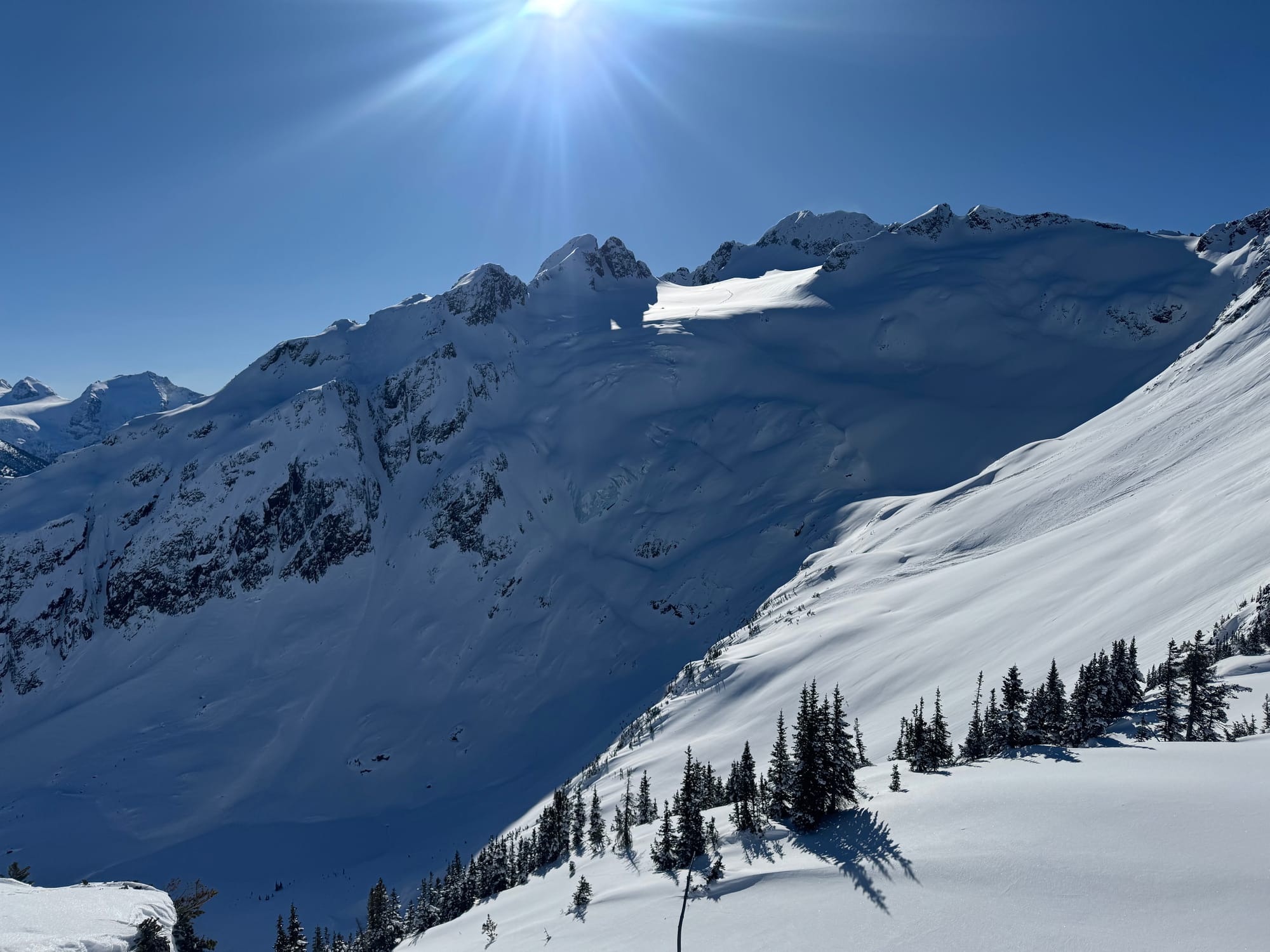
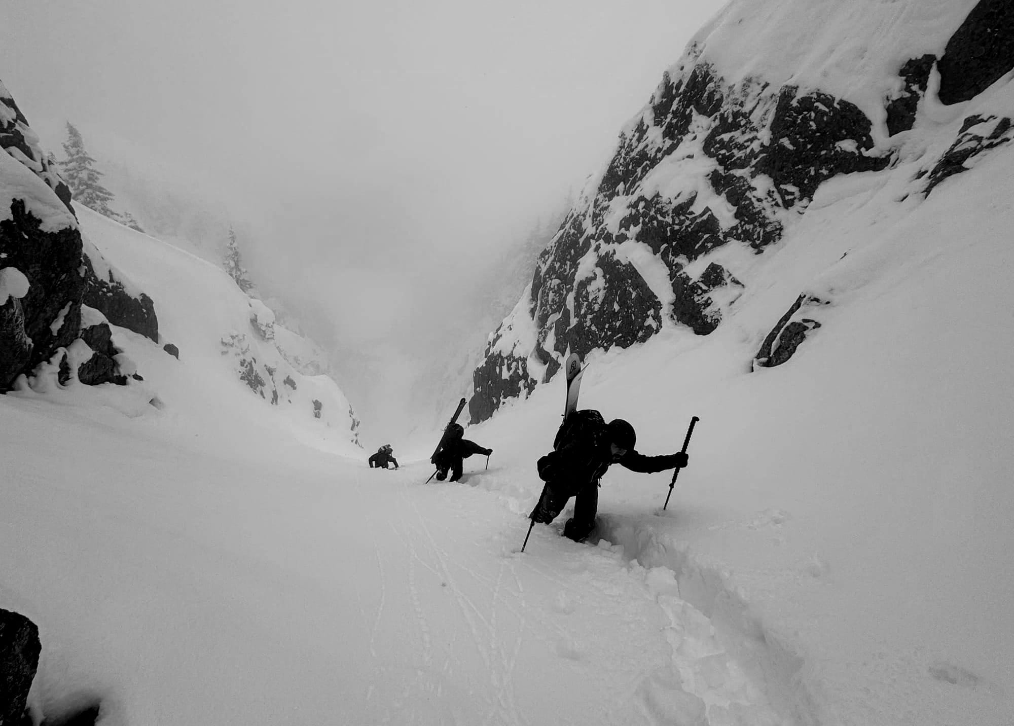
It was tree skiing time early in the week but that gave way to big alpine. Cayoosh N Glacier and Million $ Couloir got some action (R)!
What’s happened since the last update (weather & general snowpack structure):
Last weekend the name of the game was powder skiing. Temps were cold though slightly inverted but the wind held off. As the week wore on, temps stayed low, faceting out the top of the snowpack. The wind did pick up early to mid-week and the cold snow was easily transported. North aspects and ridge crests were stripped, some down to the Jan 30th crust, and wind slabs built up on lee slopes. Closer to Howe Sound seemed to get the majority of the wind affect. It tapered off further north and wind slabs seemed less reactive. The majority of reports of activity were near Squamish with a few decent sized ones reported via MIN in the S2SG area. On thursday, the pattern changed and with temps rising and winds moving back to the southerly direction. Overall the avalanche hazard has been relatively low with minimal natural or human triggered activity.
What’s the weather and avalanche forecast?
The Arctic ridge that has maintained dry and mainly clear conditions for the past several days has slowly weakened; this will allow a low-pressure system to approach the BC coast on Saturday evening into Sunday morning. The next system will bring a slow warming trend with light alpine snowfall amounts of 5-10 cm over the Whistler area and 10-15 cm for the coast from Sky Pilot above the S2S gondola towards the North Shore Mountains. A weak ridge of high pressure will bring some breaks on Monday & Tuesday. West to Southwest flow will bring additional systems to the area Wednesday into next weekend.
Weather synopsis:
- Friday: Light to Moderate wind from the NW, Freezing level at 500m with no precip.
- Saturday: Light to Mod wind from the NW switching to SW. FL 300-500m with 1-3cm expected.
- Sunday: Light to Mod wind from the SW. FL 1000m with 5-10cm expected.
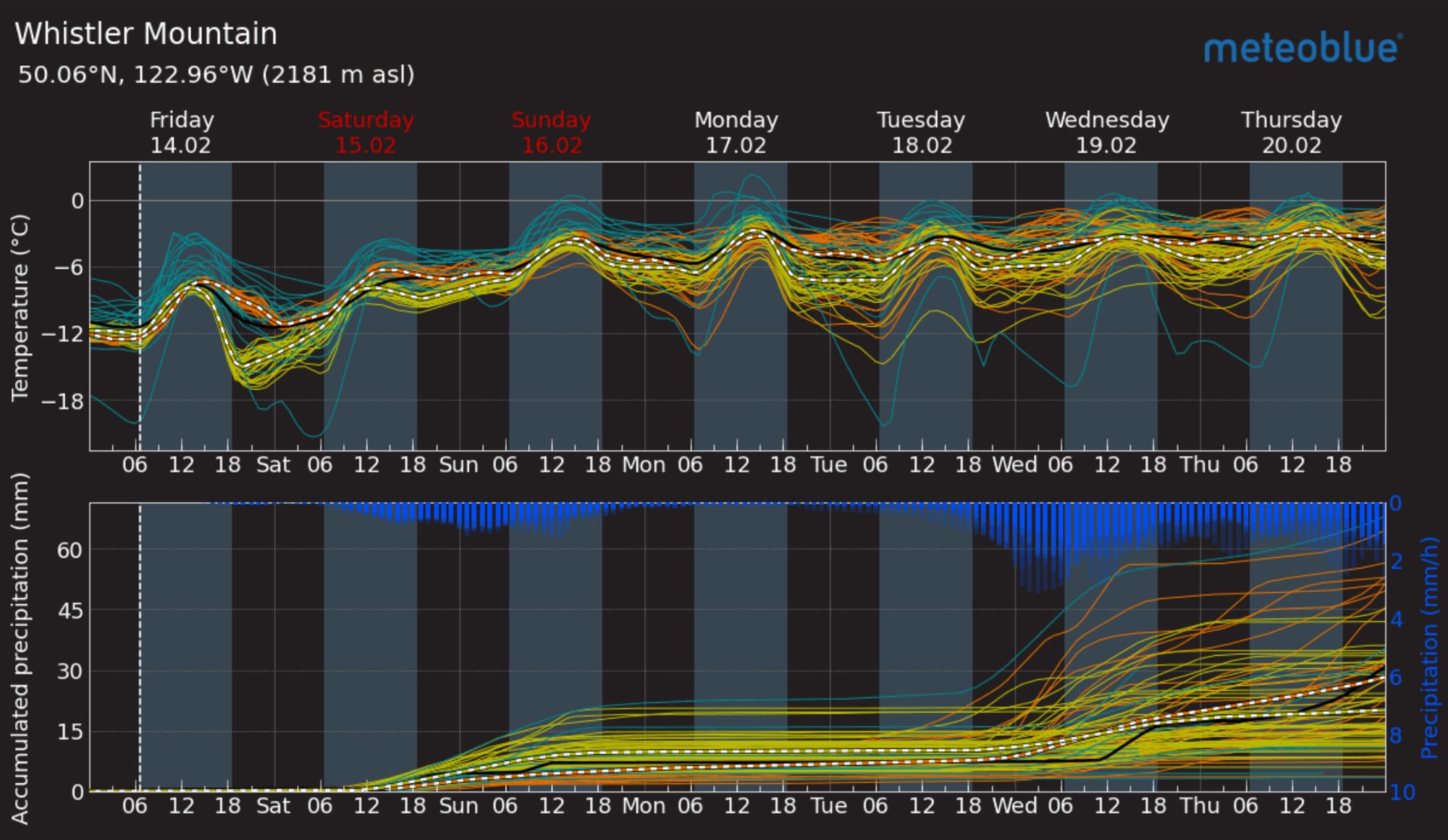
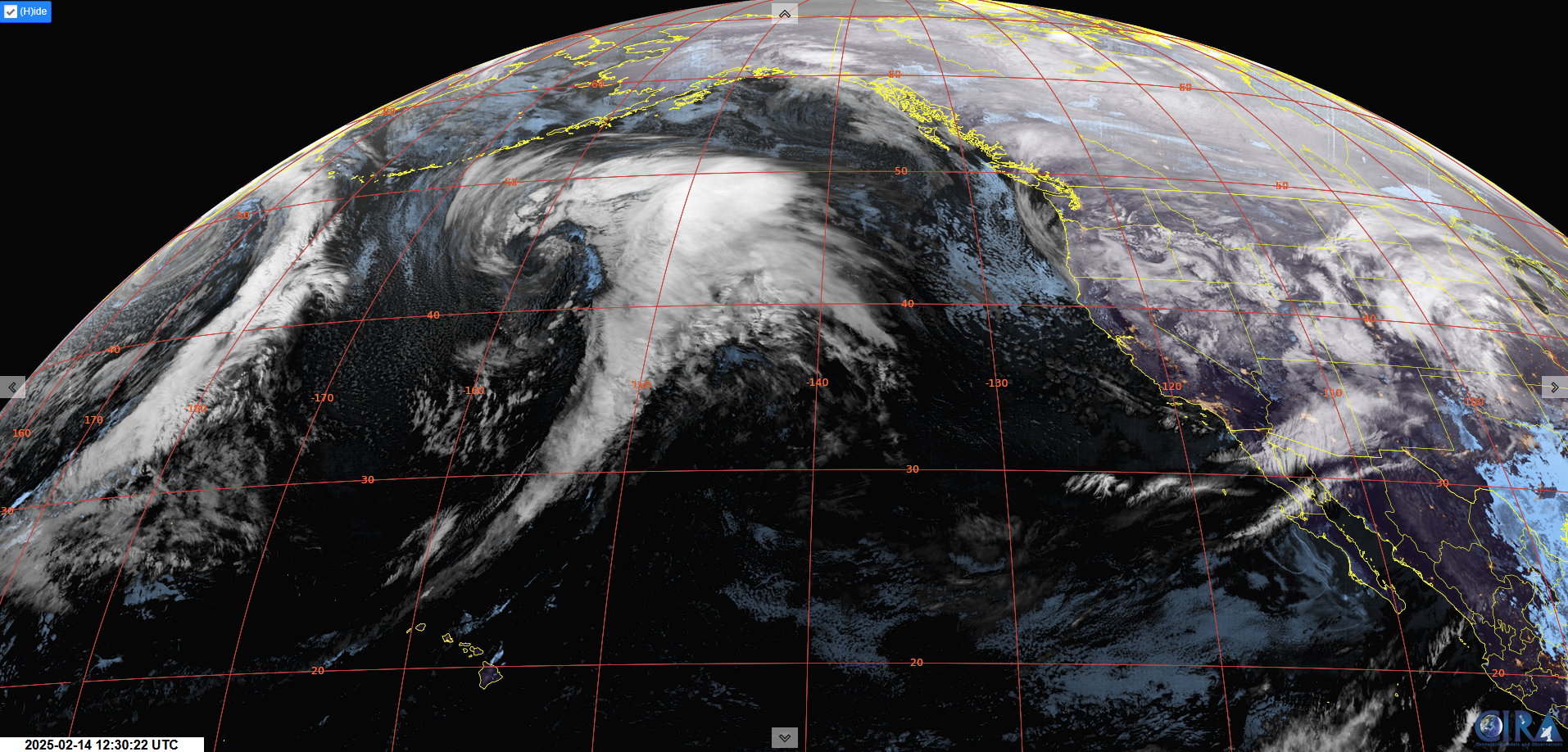
Meteoblue Multimodel forecast for Whistler (L). GeoColor imagery shows the next system on deck (R).
Avalanche hazard is currently Low (1-1-1) with a slight increase to Moderate as we receive a pulse of precipitation over the weekend. We’re expecting sluffing as the new snow bonds poorly to our faceted surface snow as well as wind slab formation on lee slopes.
What are my questions for the weekend?
- How much new snow? It doens’t look like we’re getting a huge load but the storm could still overdeliver, especially near the Coast. I’ll be looking to ski Coastal areas if it does (tree/storm skiing), but if we just get a trickle, going interior should give better vis and lower hazard.
What will I watch out for or avoid completely?
- Wind affected terrain from last week. Primarily for ski quality! Avoid the sastrugi.
- New snow contributing to wind or storm slabs.
Closing Thoughts:
It sure feels like a good time to get after it. Wind slabs are definitely a concern and we need to monitor this new snow before committing to anything huge. It's a pattern shift and our uncertainty is going back up a little bit through the weekend. Reach out if you want to make something happen! Join us on Feb 19th for our monthly snowpack discussion at SkiUphill Coast!
For more information, check out Zenith Mountain Guides and our local avalanche forecast. Weather forecasts are custom from meteorologist Jason Ross. These updates are supported by SkiUphill Squamish - the best stop for ski touring equipment in the Coast Mountains and made possible by the Sea to Sky Gondola! Use this information at your own risk. Conditions change rapidly from when this report was written!
Member discussion