
Feb 26 - Sea to Sky Snow Conditions
Overall theme:
The skiing has been amazing but it’s come at a cost. Our snowpack has set up with some dangerous conditions and now we need to hope that the Coast does its thing and the snowpack heals quickly so the persistent weak layer gets squashed out! We’ve got a PWL problem now and trying to outsmart it has the ultimate consequences. So don’t try and outthink it - just don’t even play its game and use terrain to your advantage until we can all gain some more confidence. The weather pattern is changing but be cautious of clear skies!
Also - Spearhead Traverse season is coming in hot. We’ve had a bunch of inquiries about doing Spearhead in a day and we’re psyched to get going guiding folks on that adventure! We’ve been working on a prep ski day to help folks get ready for what’s in store doing it in a day. If you’re interested in coming out for a training day, shoot us a message!
Where we’ve been skiing:
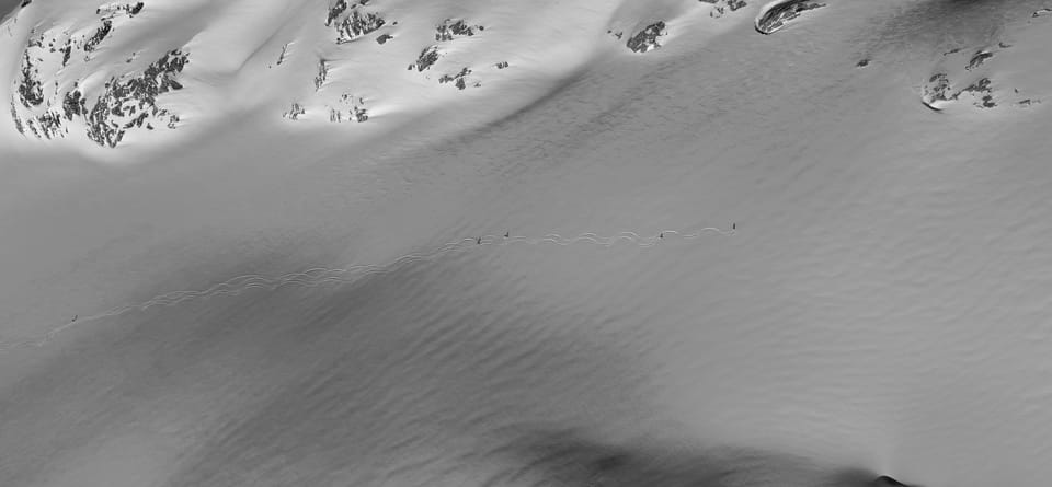
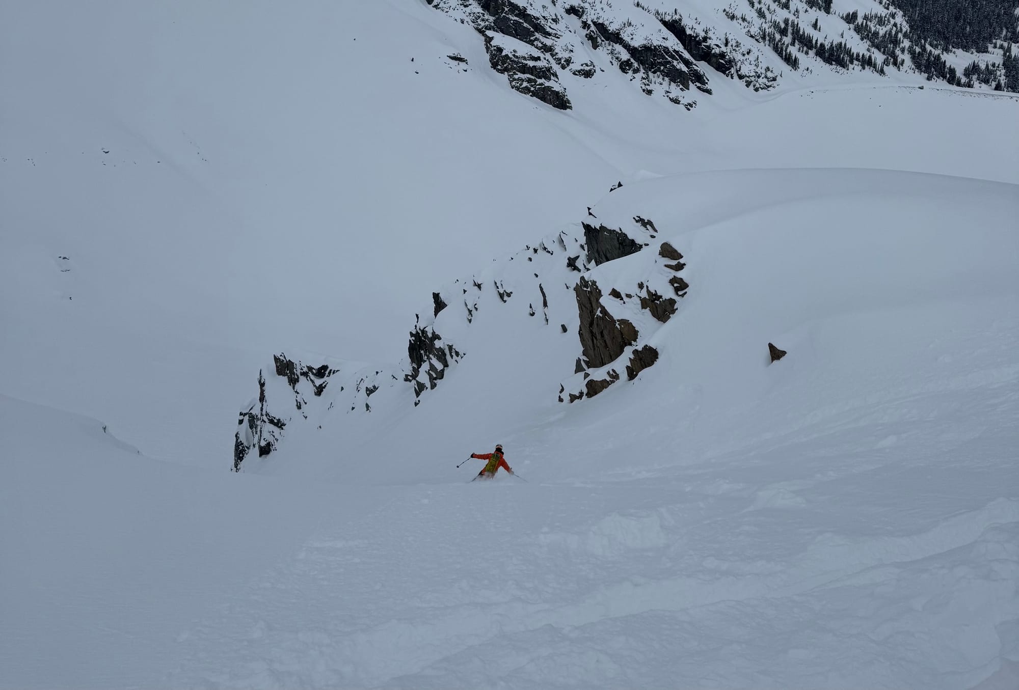
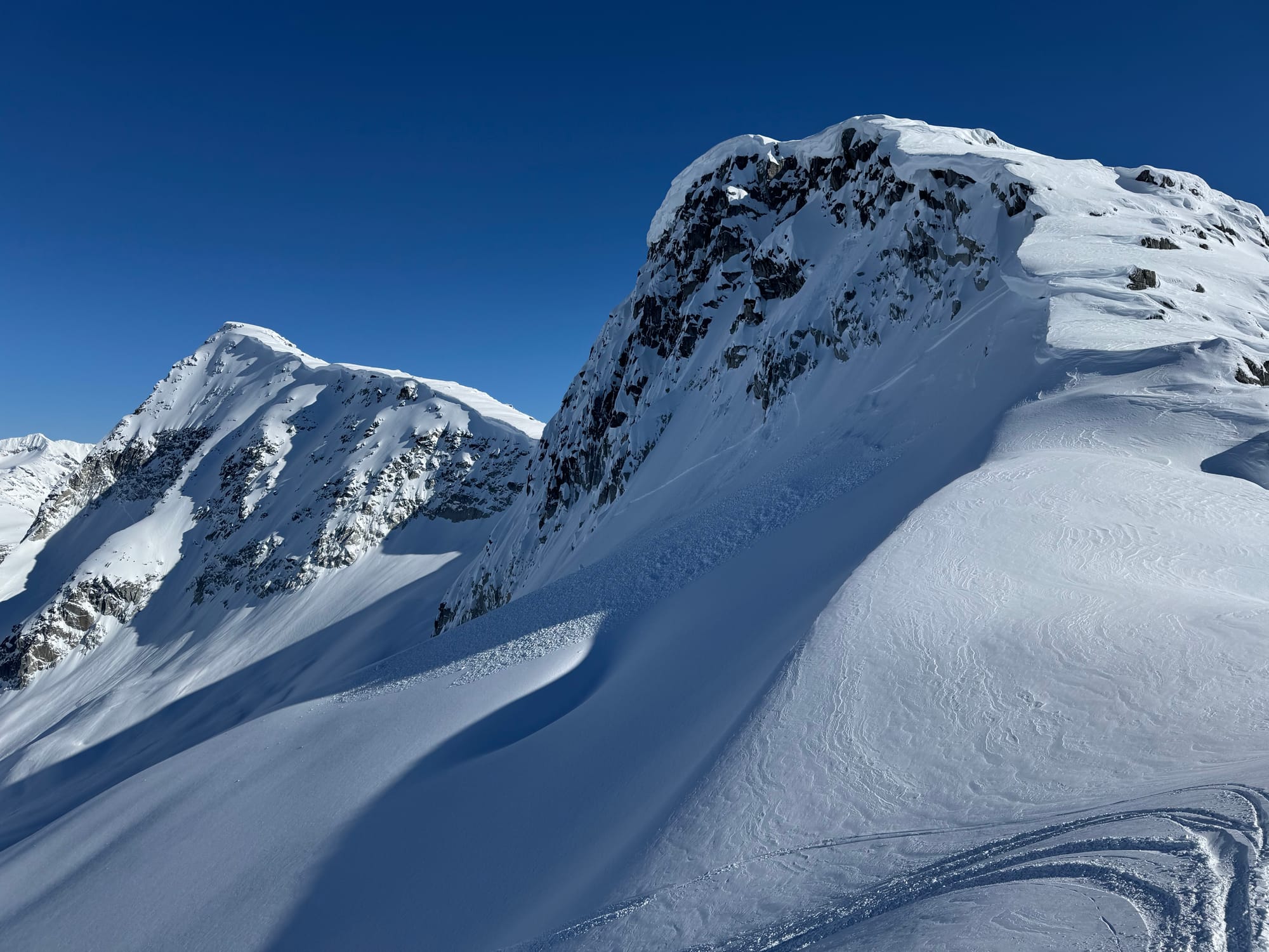
Brohm, Elfin, Sea to Sky Gondola, Whistler, Currie, Place Glacier, Cayoosh, Cassiope. Snow has generally been on the high good side. Not quite as good last week when it was proper fist density snow with excellent skiing but still really good 4-finger pow skiing. Old debris is getting covered up and trailheads are gaining snowpack. S2SG is back to grooming! Red Heather is skiable from the parking lot (and the road is gnarly - chains definitely mandatory).
The wind is rapidly stripping southerly slopes and wrecking ski quality there. We had an interesting day today in the Sky Pilot area digging for the Feb 22 layer that we discuss below.
What’s happened since the last update (weather & general snowpack structure):
Avalanche activity in the corridor?
It’s been tough watching avalanches all around us in Europe, the US, and elsewhere in Canada but we weren’t immune from it and there was a fatal avalanche on the Anniversary Glacier on Tuesday. We don’t know all the details but it’s a general reminder that the mountains are big and dangerous and that our snowpack is not currently as simple as it can be. More discussion around the snowpack itself below.
Snowpack Structure:
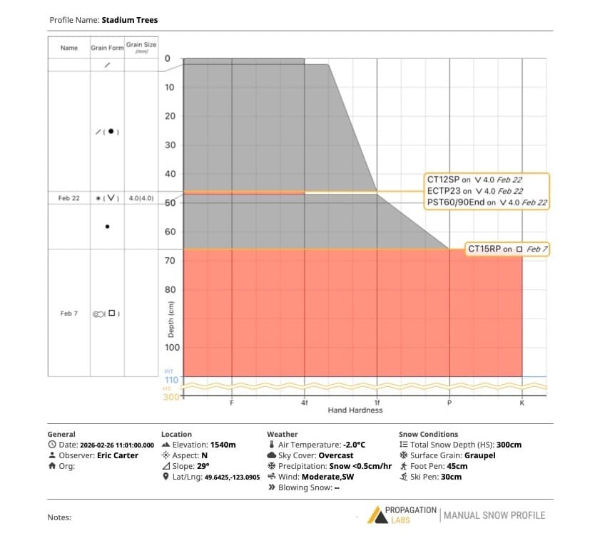
First we had the sad times: January’s high pressure, where the only good skiing was on-piste. A burly surface crust formed (partially made of Eric’s frozen tears). In places closer to the Coast, it’s very thick. Further north, east, and up high, it’s thinner and breaking down a bit but has some associated sugary facets near it. This crust is being called Feb 7 by avalanche pros.
That second week of February brought new snow and a return to the happy times. They weren’t big storms but good enough. The old debris started getting covered up and critically, the snow was sticking pretty well to that Feb 7 crust as the first storm came in warm and windy. We got continued dribs and drabs, and the skiing improved but the period finished with quite good weather: a few days of cold, high pressure, and clear skies. The snow on the surface was generally quite light but settling nicely. This surface snow was faceting out but had some brief snow showers drop preserved stellars (big new snowflakes) on top, as well as building some surface hoar from the cold temps and clear skies. Wind was light and these weak layers were well preserved when the weather returned. This new layer is being called Feb 22. On Sky Pilot today, we were able to observe this surface hoar and preserved stellar layer and got reactive test results (CT, ECT, and PST!).
The pattern shifted over the past weekend when 30-50cm of storm snow fell in two pulses on the Feb 22 layer. Initially, it started off as pretty light, low-density snow. Then it changed to heavier coastal pow. This density change makes the storm snow look like two distinct layers but is already settling out.
Now, all of this is waking up. We had a fairly large avalanche cycle on Sunday/Monday. This was generally stormslab instabilities flushing out mid-storm. Triggering the Feb 22 weak layer under the storm snow can result in small to moderate sized avalanches (like the one we saw below triggered by a cornice near Saxifrage) but can also be much larger (sz. 3) like we saw on the Hibatchi glacier in the Currie zone, especially if it steps down to the Feb 7 layer..
We didn’t see much activity on this Feb 7 layer previously, perhaps because the initial loading on it mid-month wasn’t actually that significant and it was very light snow - it didn’t form much of a slab except isolated wind slab. It wasn’t until we got the weekend’s additional storm snow that the weak layer became overloaded. Because of the upside down density, this new snow also formed a storm slab. On Wednesday and Thursday, the wind picked up significantly and will continue to build wind slab. Feb 22 is relatively close to the surface (40-60) and these wind slabs might be stubborn in some places but reactive and easy to trigger in others but is certainly easily triggered by humans and small loads. Feb 7 is down 50-100cm which is still with in the sweet spot for stress bulb of skier triggering but deep enough to create a large avalanche.
So, all this adds up to the possibility for large avalanches. If it didn’t cycle in the storm, it’s suspect. If it’s exposed to wind, creating a heavier slab, it’s suspect. If it’s unsupported or over exposure, it’s suspect. We don’t know the specifics of the fatal avalanche on the Anniversary Glacier this weekend however it appears to be a storm/wind slab on the Feb 22 layer that may have stepped down to Feb 7 to achieve the size it did. There was not enough time for a fracture line profile and then the weather came in, so we may never know unfortunately.
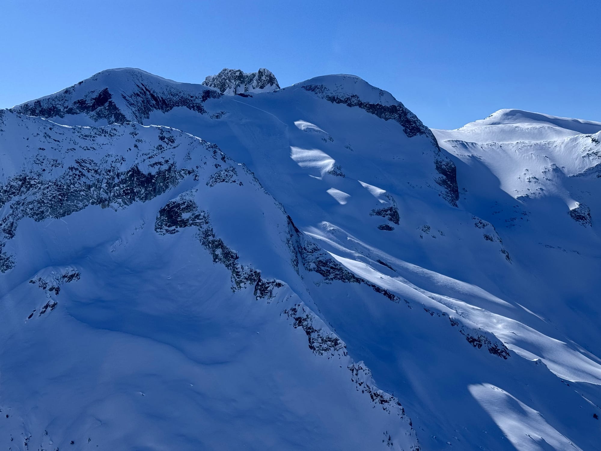
Avalanches! Hibachi Zone windslab (same aspect to top of Anniversary) and Saxifrage windslab, both on Tuesday.
What’s the weather and avalanche forecast?
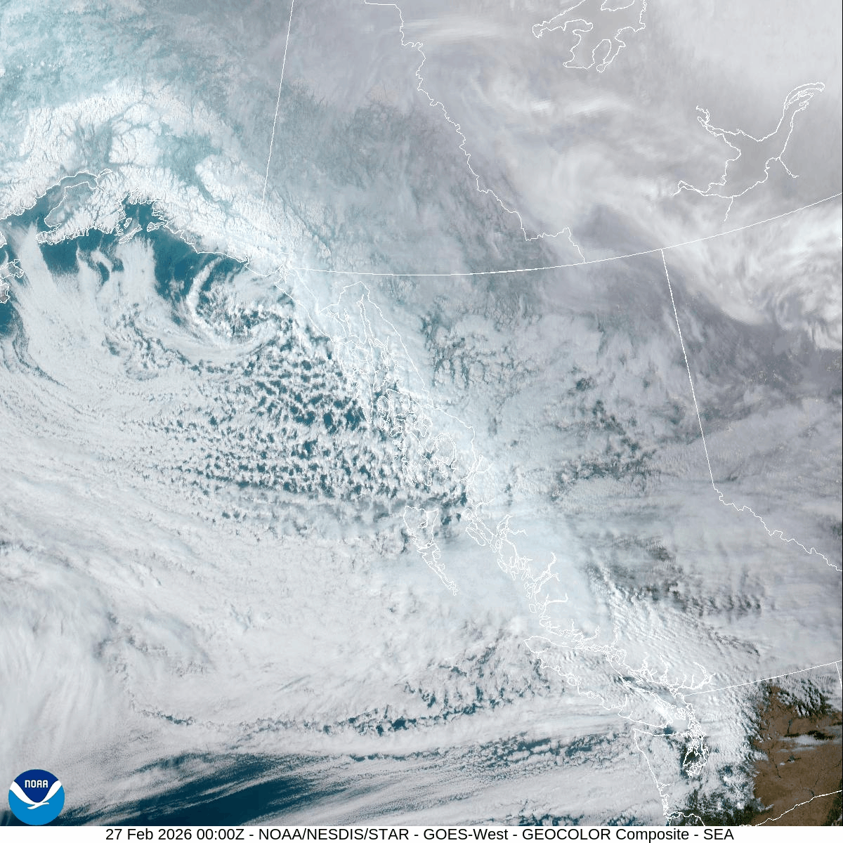
A strong west to northwest flow aloft will continue to bring unsettled conditions through Friday, with flurries at times over the alpine. Ridge of high pressure will build over the South Coast this weekend with dry stable conditions lasting into early next week. The next system could potentially impact the area by next Wednesday with more alpine snow.
Winds speeds:
- Friday: Southerly 40 gusting 80 km/h.
- Saturday: Southerly 30 gusting 60 km/h.
- Sunday: Southerly 15 gusting 30 km/h.
Sea to Sky Freezing Levels:
- Friday: 1000m rising to near 1200m
- Saturday: 500m rising near 1400m
- Sunday: 500m rising to near 2500m with a temperature inversion forming.
Precipitation:
- Friday: 5-10 cm by 4 pm.
- Saturday: Trace to 1 cm by Saturday morning.
- Sunday: Nil
We’re currently sitting at elevated hazard due to building windslab. That hazard will possibly increase over the next 24hrs due to a pulse of precip and continued wind. It doesn’t look like we’re going to get as much as was forecast earlier in the week but it will still contribute to our problem. Then the hazard may taper off slightly as we get into the weekend. Blue skies and nice snow will bring people out so we do need to be aware that we’re working with a unique avalanche problem.
What are my questions for the weekend?
- Is windslab building in the alpine? This seems almost certain.
- Do we have a persistent slab problem? Do we have persistent grains on Feb 7 or Feb 22 that might continue to cause problems if there’s a slab sitting on top of it? It appears we do. These layers really stand out in a snow pit so if you dig - have a look!
- What hasn’t slid?
What will I watch out for or avoid completely?
- Anything that hasn’t slid and flushed out.
- Anything with clearly building wind-slab or where I can feel storm slab sitting on lower density snow. Especially near high ridge-crest. There’s lots of drum sounding wind slab in the exposed locations now.
Closing Thoughts:
This week is more heads up than usual. Remember it’s still more of a winter snowpack and we have some issues lurking that we can’t quite rule out yet. It’s going to go blue this weekend so use caution. Post a MIN report when you do get out!
For more information, check out Zenith Mountain Guides and our local avalanche forecast. Weather forecasts are custom from meteorologist Jason Ross. These updates are supported by SkiUphill Squamish - the best stop for ski touring equipment in the Coast Mountains and made possible by the Sea to Sky Gondola! Use this information at your own risk. Conditions change rapidly from when this report was written!
Member discussion