
Feb 7 - Sea to Sky Snow Conditions
Overall Theme:
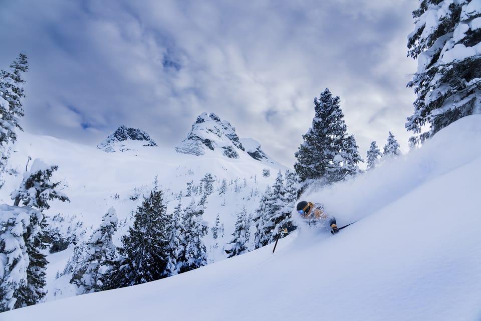
Praise be your higher power of choice, snow has fallen. And its cold and feels like a real winter. Now we have powder to ski and ice to climb. But our Jan 30 interface is lingering throughout the corridor with wildly variable characteristics and depth which means lots of uncertainty and lack of confidence for us.
Where we’ve been skiing:
Squamish, Garibaldi Park, Duffey. The new snow has really helped so many zones come into shape. The low elevations have finally reached their highest snow depths of the year which is helping access out a bit from Squamish to the Duffey. Notably the trailheads and BTL skiing has improved significantly throughout the corridor but especially the Duffey. Eric skied Chief Pascal on Sunday and it was a good option!
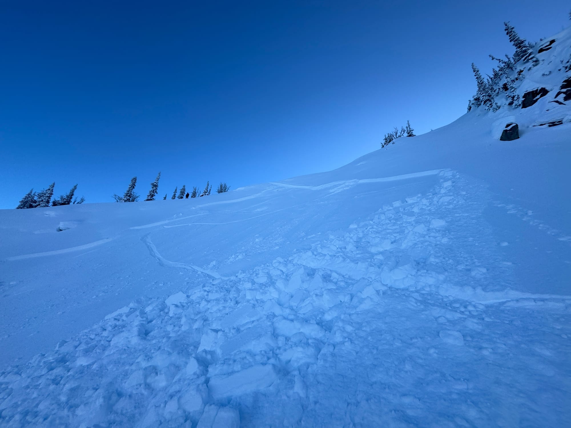
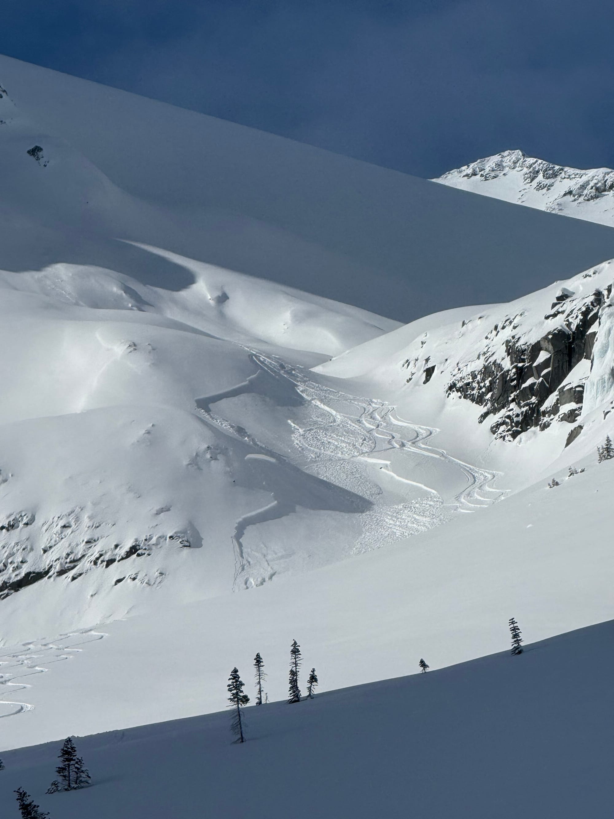
Avalanche activity in the corridor - not huge but certainly enough to hurt someone! Chief Pascal on the left and Mt. Currie on the right.
What’s happened since the last update (weather and general snowpack structure):
Snow, cold and only moderate winds mid storm. The big variable has been how much snow has fallen across the corridor. From the north shore to Squamish the amounts were quite impressive, with storm totals of 120cms+. This number decreases as you move inland, with around 80 in the Callaghan, 40-50 in the Spearhead range and 30-40 in the Duffey and Hurley. Valley bottoms saw a bit of wind, but as soon as you climbed a few hundred meters out of the valleys the winds were non existent. Even up until now we have had only minor winds that have just started to impact the most exposed locations. For example, the Sea to Sky gondola was shut down for a few days from the Arctic Outflow, but in the Stadium drainage there was not a hint of wind effect!
The biggest question/variable is do we have a slab or not. So much of this snow fell at cold temps (-10c and colder) with almost no wind and then cold, clear weather (up to -25c) followed promoting faceting of the new snow with minimal settlement. Basically we have the ingredients for slab avalanches, but the cake hasn’t been baked! Anywhere that has a breath of wind or is steep and unsupported has produced soft slabs up to size 1.5. The mid storm avalanche cycle was not too dramatic but some old debris exists from slides up to size 2 from regular storm performers. In other words, surprisingly little avalanche activity considering the decent size storm with a widespread layer of facets, firm wind surfaces and sun crusts across all snow surfaces from Jan 30. If the cake does end up getting baked, we may still see that happen.
As a result of this set up, we’ve been tip toeing out and sticking to mostly supported terrain with good run outs or bigger features with obvious evidence of having flushed out. Everytime we step out on a small unsupported feature it pops on us in these deeper new snow areas. In the drier areas, with only 30cms of new on the old surfaces it seems easier to avoid problems as there is no slab and the new snow continues to facet with the cold weather (losing cohesion). We would call it a high and delicate time for assessment with high consequences of getting it wrong if you choose terrain that is too big. I (Evan) started my career in a faceted snowpack, so it has instilled in me the survival instinct of never trusting a facet. With out any wind and continued cold we could likely see this problem never really materializing further, but keep your feelers out for the snow stiffening up under your feet and pay attention!
What’s the weather and avalanche forecast?
A weak disturbance will move down the BC coast from the north, spreading flurries to the Sea to Sky mountains late in the day Friday into Saturday. An Arctic ridge of high pressure will rebuild over the BC Interior through the weekend sending another surge of colder temperatures and strong outflow winds to the coast Sunday night and into early next week. Looking at the long range forecast ridging across the eastern Pacific may break down towards the end of next week (Feb15-16) with increased precipitation chances and warmer temperatures.
- Friday: Light W/SW wind with trace precip and freezing levels in the valley bottom.
- Saturday: Light to Moderate NW wind with 1-5cm new snow and FL in valley bottom.
- Sunday Light to Moderate NW wind with trace to 2cm new snow and FL in valley bottom for the north and up to 500m along the Coast.
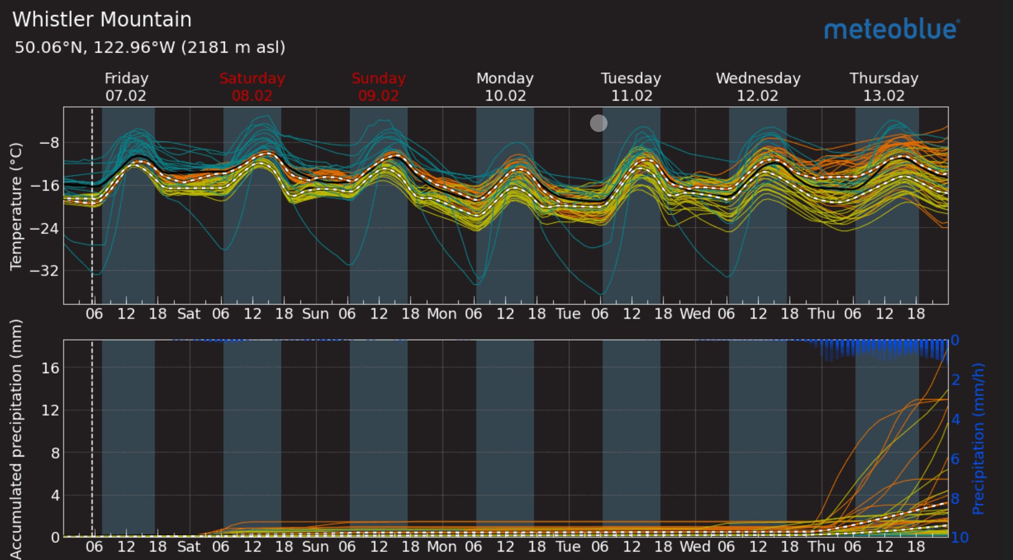
Meteoblue Multimodel forecast (L) showing a pretty steady pattern into next week! Right: image of the day satellite capture of SWBC.
Avalanche Canada has the avalanche hazard at 322 for Whistler and 221 for the Duffey and North Shore. This might be reflective of the fact that more avalanche incidents this week have been reported around the Whistler area. While wind slab is an issue throughout the corridor, Whistler area also has persistent slab listed. It’s unlikely the persistent weak layer created on Jan 30th doesn’t exist in most areas, it’s just that it’s producing persistent slab results in the Whistler area. Complicated conditions!
What are our questions for the weekend?
- Will the snow keep faceting and the wind stay calm? If we don’t see slab development, the hazards will stay similar to what we’re seeing.
- Has something flushed out the run I want to ski? Previous avalanches give a lot of confidence but still treat them with respect!
- Am I in unsupported terrain? Keep the tracks tight and stay in the good stuff, don’t go ranging into the weird terrain to seek untracked snow!
Closing Thoughts
There is so much high quality powder skiing to be done right now without getting yourself into too much trouble. Our mindset will likely be to slowly step out as we gain confidence and the collective starts to step out. With continued cold and faceting and no wind it seems like our options could keep expanding for safe skiing by the day but it can all change in an instant, so stay tuned in to the wind and even the warm sun on solar aspects creating some slabs. Know that the pros throughout the corridor are carefully and slowly coming out of hiding from the avalanche problems of the last week and it’s not a time for big jumps into aggressive terrain.
For more information, check out Zenith Mountain Guides and our local avalanche forecast. Weather forecasts are custom from meteorologist Jason Ross. These updates are supported by SkiUphill Squamish - the best stop for ski touring equipment in the Coast Mountains and made possible by the Sea to Sky Gondola! Use this information at your own risk. Conditions change rapidly from when this report was written!
Member discussion