Jan 16 - Sea to Sky Snow Conditions
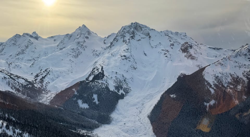
Overall theme:
High pressure has arrived! We’re a bit late on the newsletter as we wanted to get a sense of conditions before going into the weekend. The theme of the week is northerly wind and cold temps. Read on for how we’re thinking about the skiing this weekend and details about the Squamish SAR fundraiser/MountainFilm festival at the end!
Where we’ve been skiing:
Duffey, Hurley, Gondola, Brohm, Whistler-Blackcomb. We’re at status quo for trailhead access and tree skiing (the latter is bad). S2SG and Red Heather road are in good shape. Up in Shannon Basin, from the end of the road to the top of the tree triangle is 5.11ish skinning. Very firm and icy from the trees raining down. Similarly, skiing back down to the road from TL is VERY sporty. Only a thin elevation band at TL is good skiing. In the ALP, the surface is heavily wind affected. Consider the S2SG to be all advanced terrain when you get off the groomed road until it snows again. New snow is needed! Duffey trailheads right off the highway are all a bit of a bummer with some serious BTL warfare to get to the magic 1500m decent coverage. If you can use a road to get higher, those trailheads are in way better shape! This area didn’t escape the melt freeze crust either. Expect difficult ski conditions on all aspects.
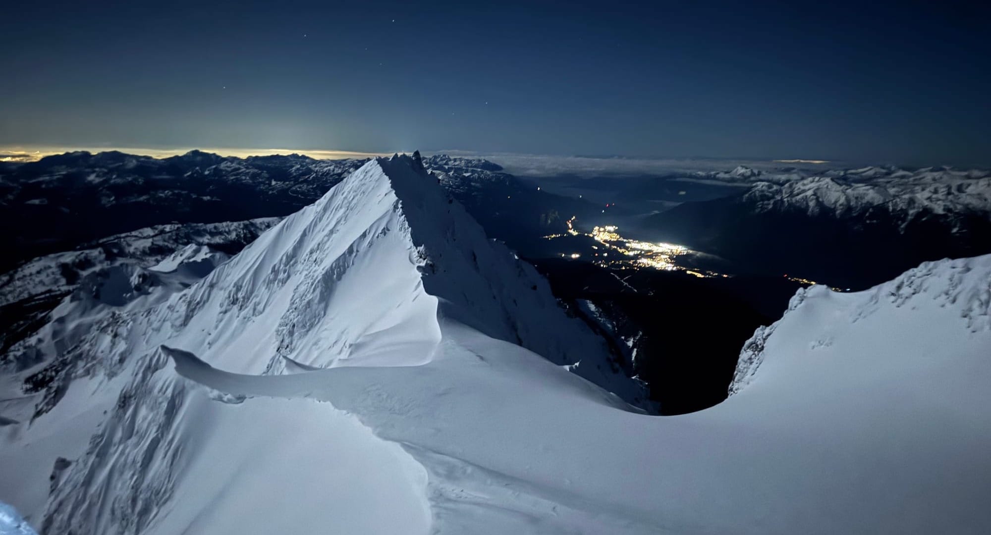
What’s happened since the last update (weather & general snowpack structure):
Over the past week, avalanche activity has tapered off. The majority of the activity took place over the weekend, just after our last major pulse of precip and wind. The majority of these were windslab. While activity mostly tapered off, there still were reports of avalanches into the week, especially in areas where the windslab had formed on top of patchy surface hoar, including an area Evan found near Ronayne. Later in the week as temps increased, loose wet avalanches became a problem and several large wet slides occurred in steep solar terrain and impacted slopes below (beware of overhead hazard!).
While things were looking promising last weekend, the cold air expected was delayed by low pressure and inversion layers. Squamish saw +10deg in town with +6 on Whistler Peak! By Friday however, we saw a switch to north wind and a weak arctic outflow.
Our snowpack overall is quite well settled. In most areas, we have isolated pockets of windslab 10-30cm deep overlying a melt freeze crust that caps well settled mid and lower snowpack. Some areas may be sheltering a layer of surface hoar under the MF crust but it’s unclear if this surface hoar is still reactive. Also of note is the snowpack height (HS). Throughout the corridor we are dipping down to, or below, our 25th percentile in the snow pillow data. We’re not quite down to the worst ever (last year) but we’re in need of more precip!
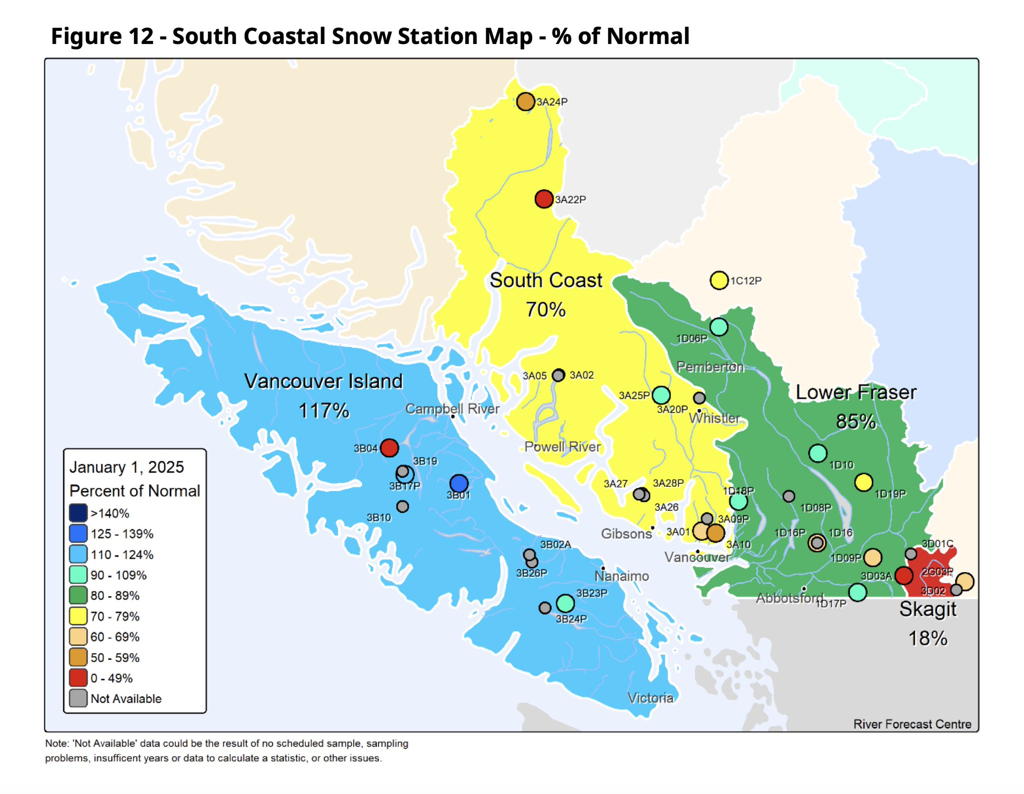
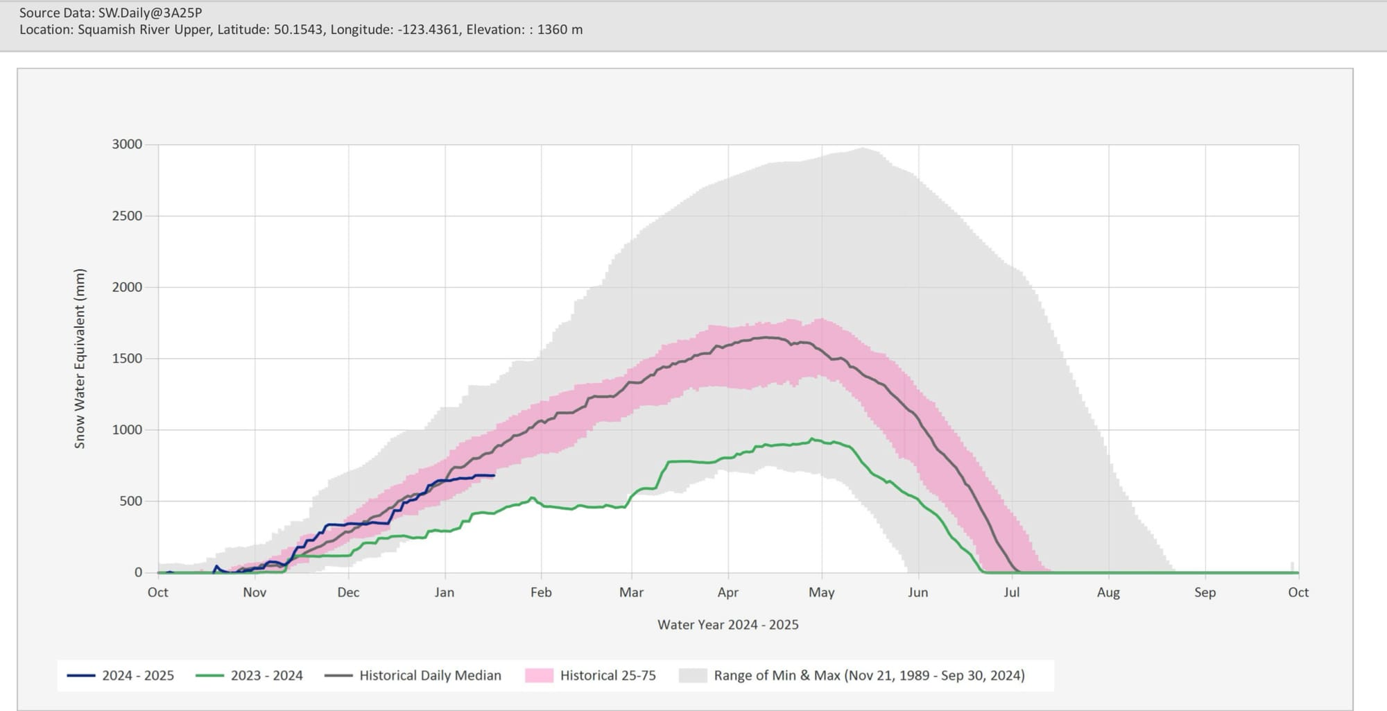
South Coast overview on the left and Squamish River snow pillow on the right. Dipping below where we’d like to be for sure.
What’s the weather and avalanche forecast?
An upper ridge of high pressure will build offshore this weekend with a cool north-northwest flow aloft aimed at the Sea to Sky that will usher in an arctic air mass with below seasonal temperatures. This pattern will remain locked through the weekend as ridging parallels the BC coast. Bottom line for this weekend is to bundle up in the alpine as the morning temperatures are going to be frigid with -10 to -15, with daytime highs near -3 to -6
- Friday: Northerly light/moderate winds with nil precip and FLs at valley bottom.
- Saturday: Northerly light/moderate winds with nil precip and FLs at valley bottom.
- Sunday: Northerly moderate winds with nil precip and FLs at valley bottom.
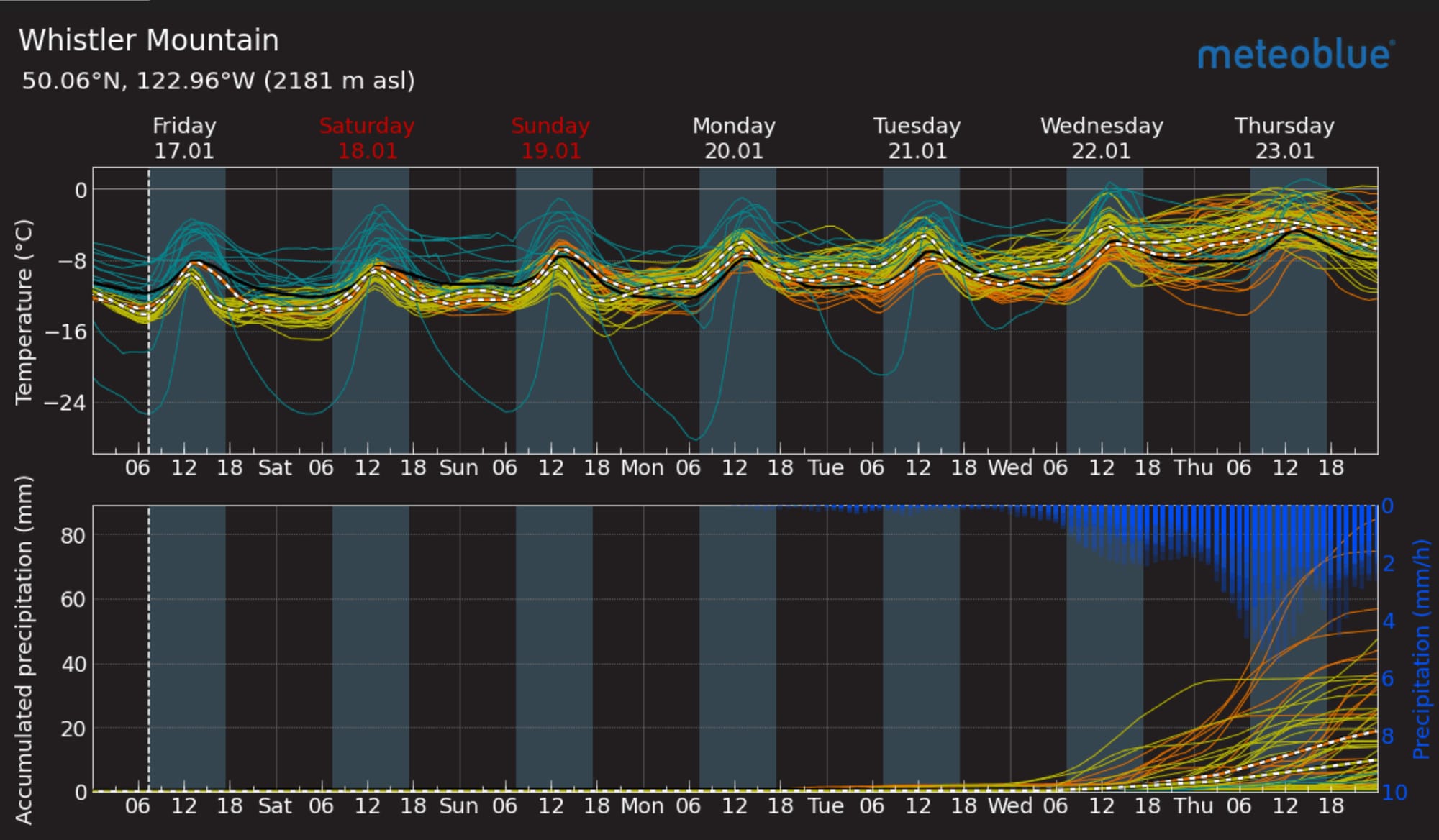
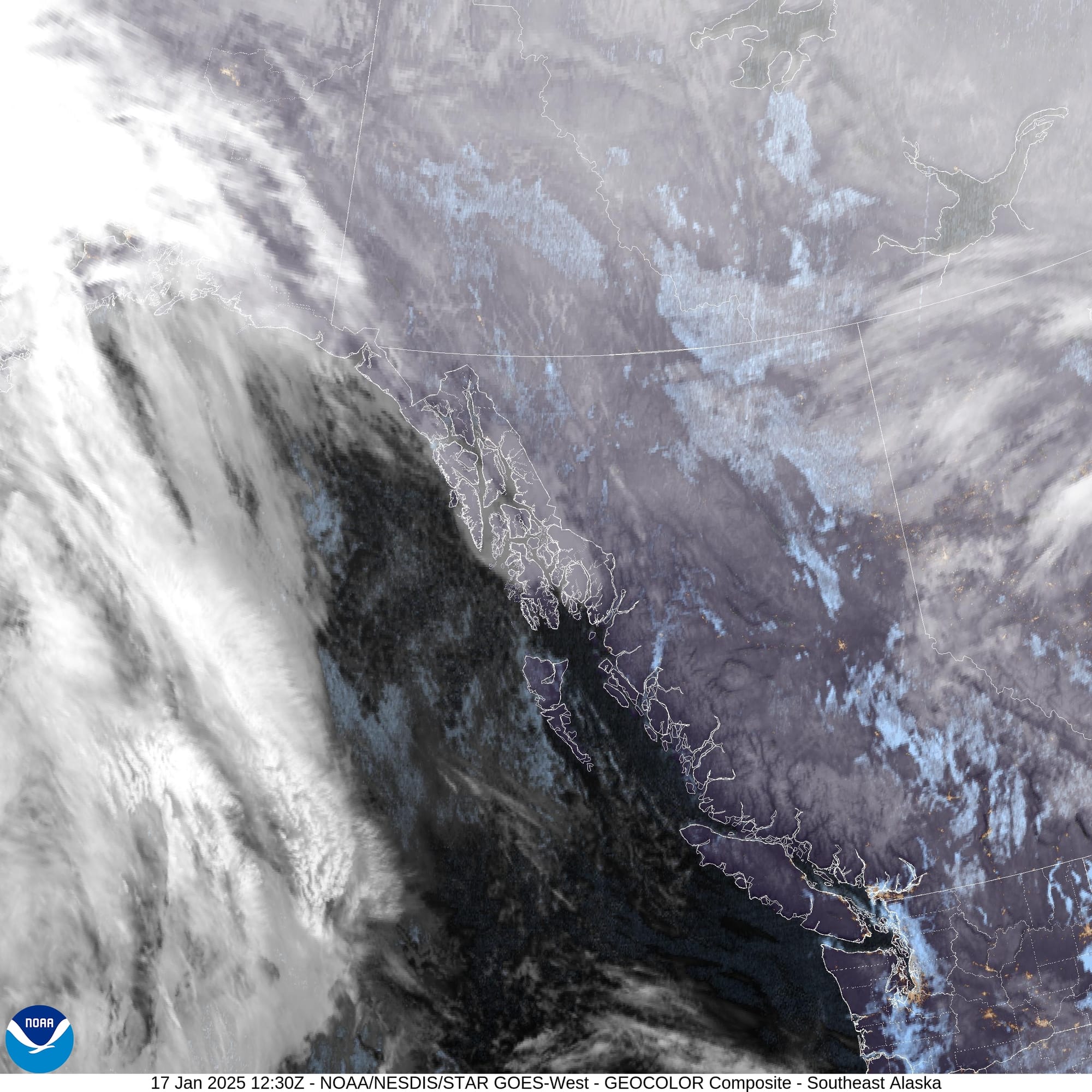
Pretty good agreement between models for the next few days. Is that a possibility of snow a week away? Not holding my breath…
Avalanche Canada has friday hazard at Moderate in the alpine and low at treeline and below treeline with a downward trend towards the weekend. Primary concern is windslab. While we generally see windslab on north facing slopes, given the change in wind direction and possibility for reverse loading, I would treat any aspect as suspect if they have potential to push you into consequential terrain. Last week’s warm temps helped settle the snowpack overall and create what is likely a bridging melt freeze crust in places. If the snow available for transport continues to disappear, we expect wind slab building to slow down.
What are my questions for the weekend?
- We had a weak outflow and those north winds should continue through next week. Did they cause wind slab accumulation and reverse loading?
- Can we find residual wind slab? Will the windslab that built through the week continue to produce results?
- Looking further out, what is the snow surface we’ll have covered in the next storm? Surface faceting is already happening and there’s a decent chance cold temps will create surface hoar as well. The high pressure we’re having right now could be creating our new weak layer after our next storm.
What will I watch out for or avoid completely?
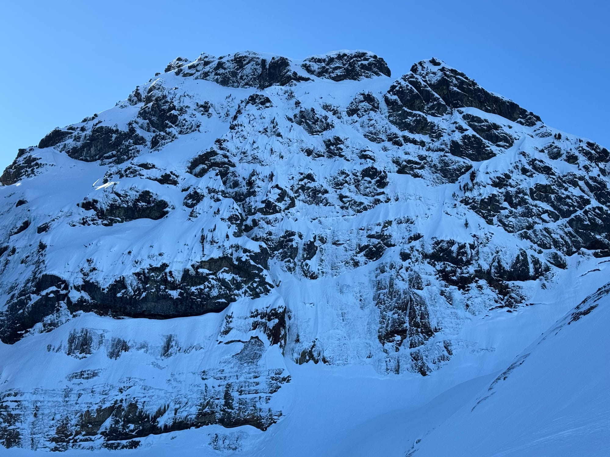
- Steep consequential terrain with windslab. Even if it can’t bury me, it could push me over a cliff!
- Steep windswept terrain - fall and slide for life conditions are incoming!
- Tree skiing - it’s just not the time :(
Closing Thoughts:
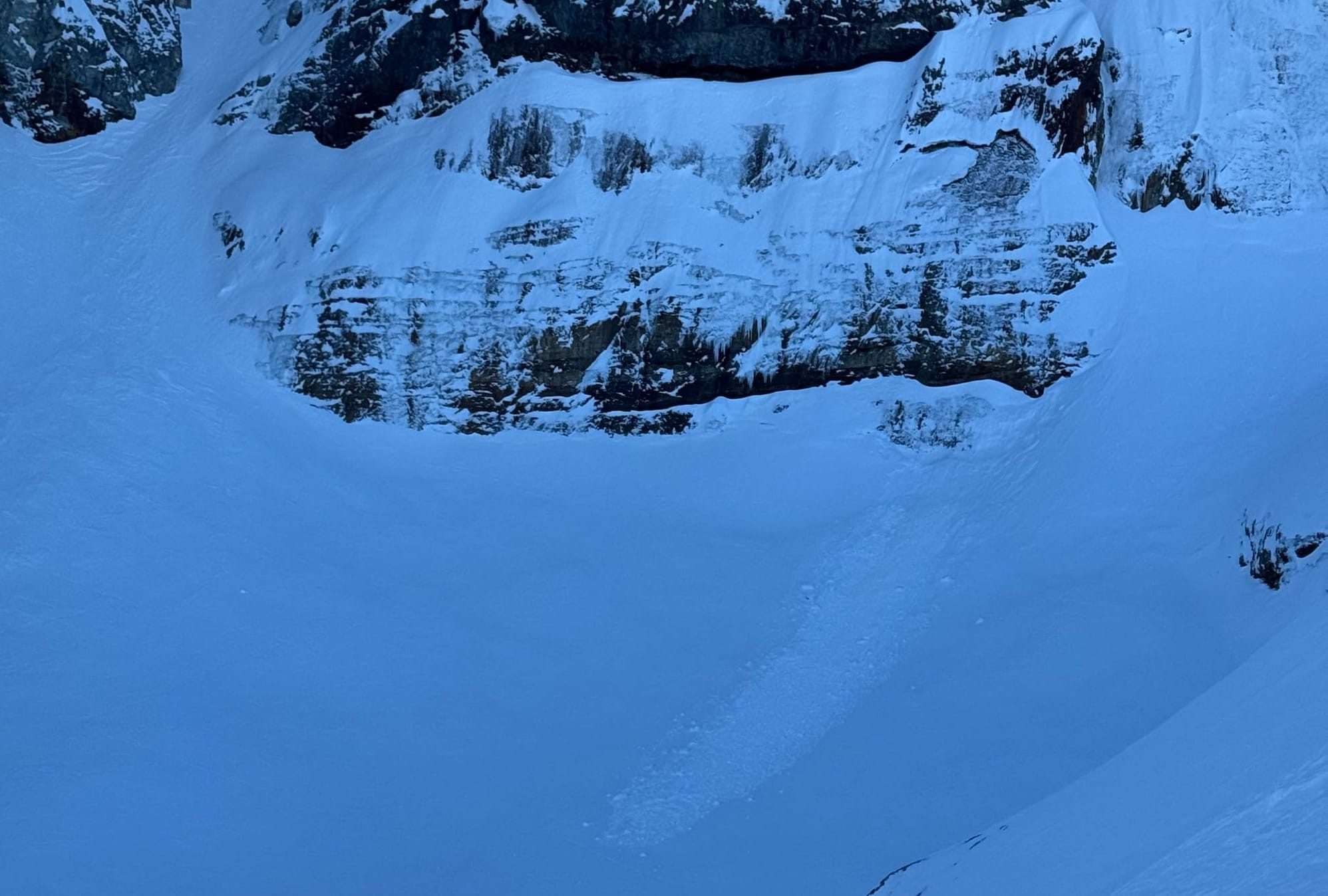
This week is going to require some expert level strategy to find quality powder skiing on the South Coast. The weekend is going to be the best chance for what pow remains. We’ll be looking at TL elevations up north and interior. Anything protected from the wind will ski the best - we found a bit of decent skiing in this zone between dodging the alpine crust and the BTL crust. As the week goes on, the name of the game is going to be looking for interesting travel over interesting skiing. Traverses, summits, and just being in the mountains will be the most rewarding.
It’s also a time to consider the possibility for cold injury - keep an eye on frost nipped noses and cheeks! It will also be harder to hunker down in place in case of an emergency with the cold temps so adjust your kit accordingly!
Speaking of emergencies - our friends at Squamish SAR are hosting the Telluride MountainFilm Festival showing in Squamish at the Eagle Eye Theatre on February 15th. Click the link for tickets and more info!
For more information, check out Zenith Mountain Guides and our local avalanche forecast. Weather forecasts are custom from meteorologist Jason Ross. These updates are supported by SkiUphill Squamish - the best stop for ski touring equipment in the Coast Mountains and made possible by the Sea to Sky Gondola! Use this information at your own risk. Conditions change rapidly from when this report was written!

Member discussion