
Jan 2 - Sea to Sky Snow Conditions
Overall theme:
Big changes - going from too deep to a big warmup. Luckily ski quality hung in there. Now we’re heading into another storm cycle. It looks like a classic SW flow that will hit the coast harder with warm temps and precip while the Duffey will stay cold but get a lot less precip. Fingers crossed!
Are you enjoying the newsletter? Forward it to a ski buddy and remind them it’s free to subscribe!
Also - FYI the next SkiUphill/Zenith Snowpack Talk is coming up at 6pm on January 8th. Save your seat by grabbing a ticket at the link below. Remember all our paid supporters get a guaranteed entry (we’ll send you a confirmation email the day before)! You can still update your subscription to the newsletter to chip in $5 a week at any time.
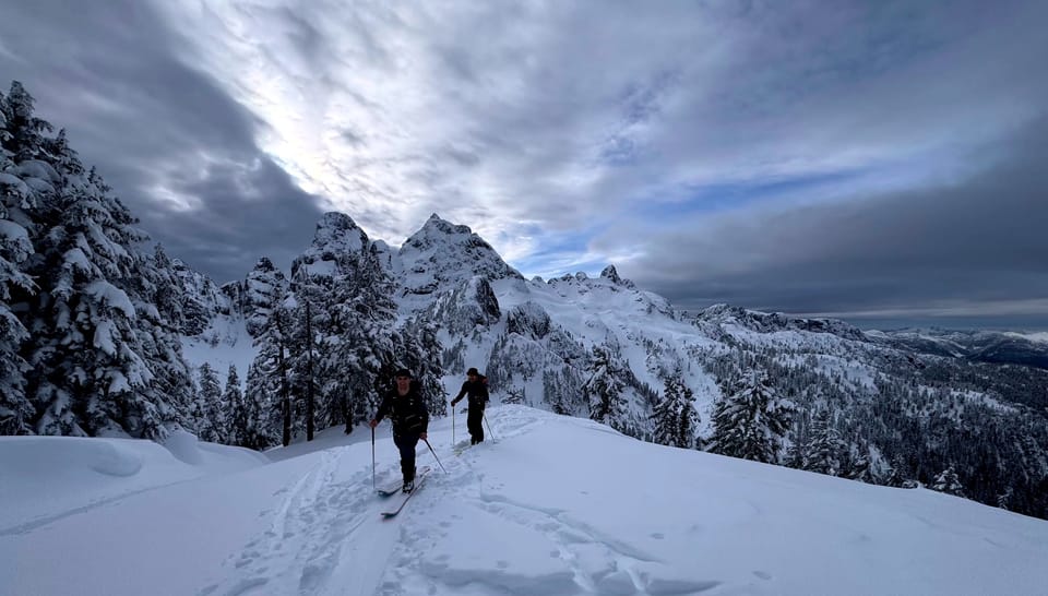
Where we’ve been skiing:
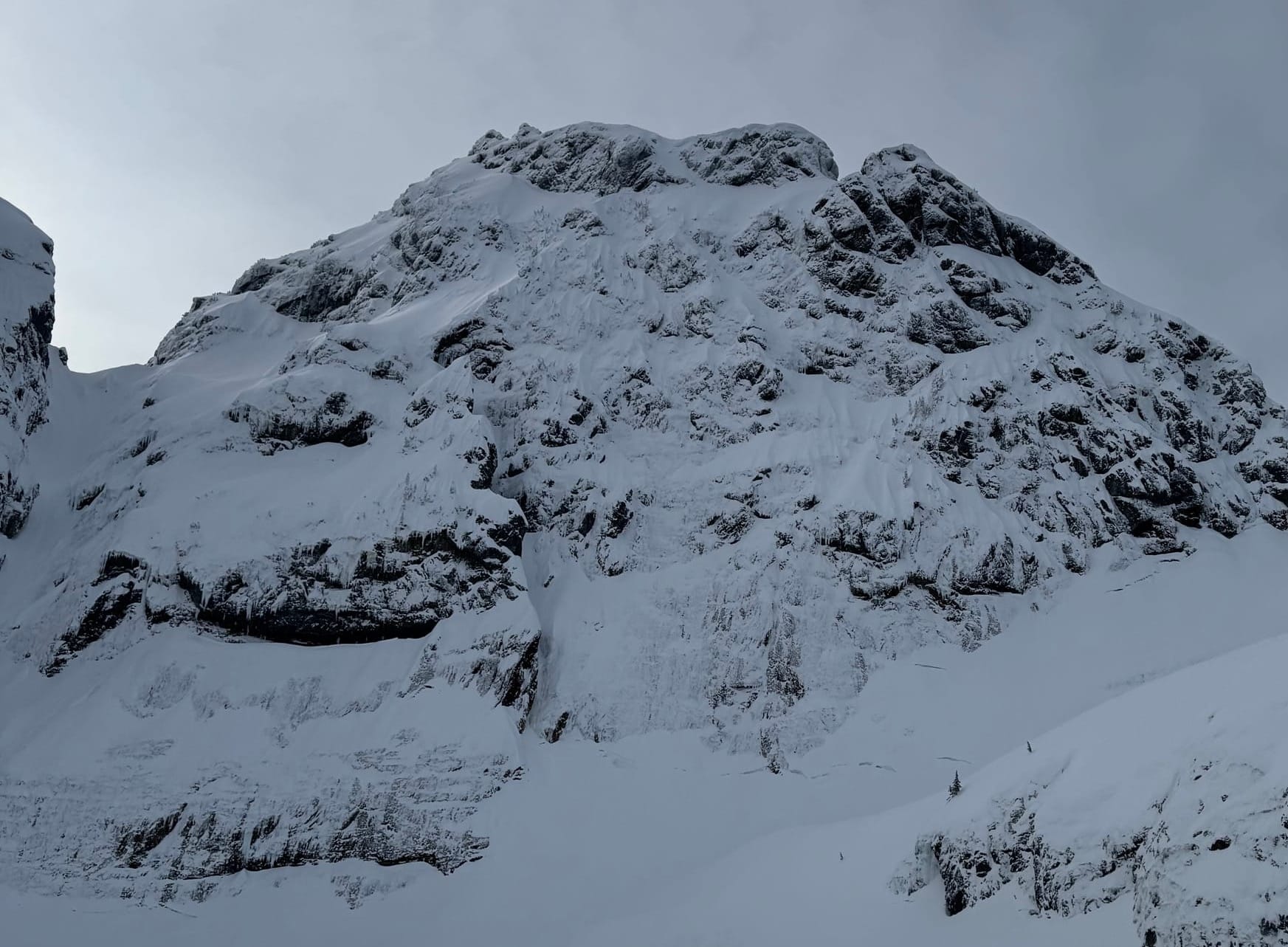
Sea to Sky Gondola, Whistler/Blackcomb, Currie, Duffey, Meager, everywhere! The best snow this week has been further to the interior but there have been pockets of good snow close to the coast as well!
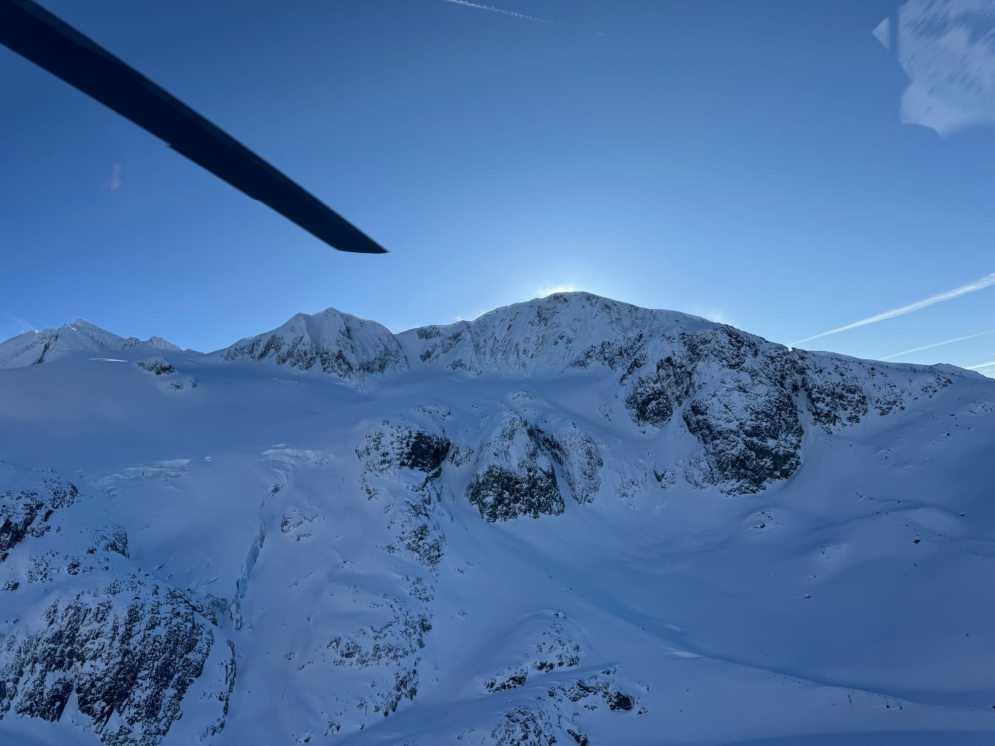
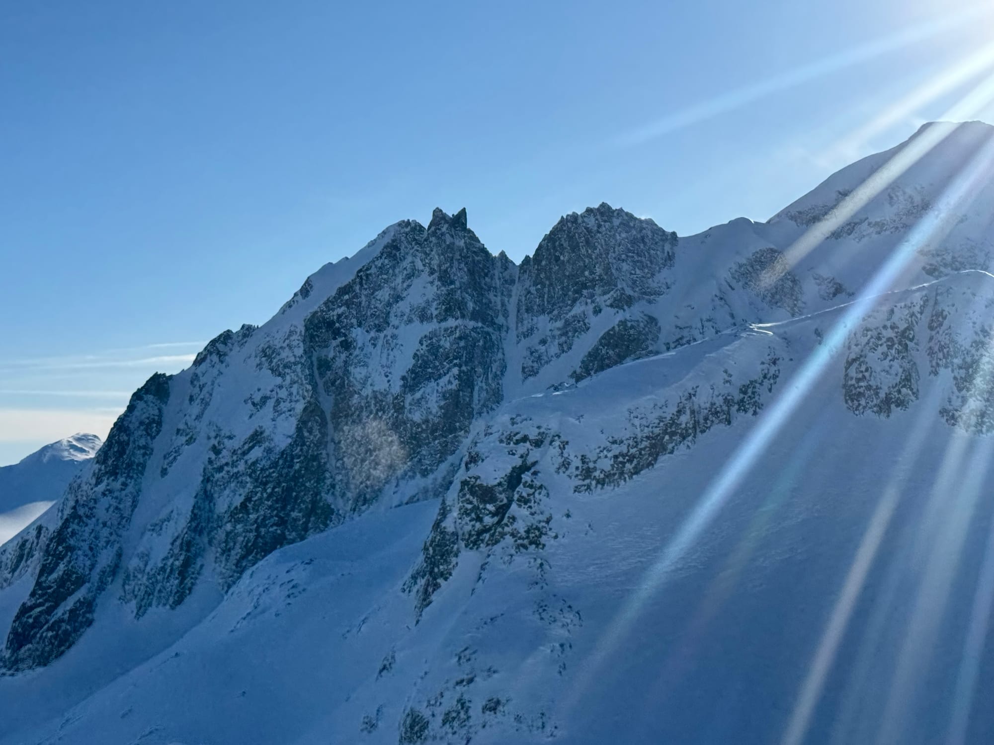
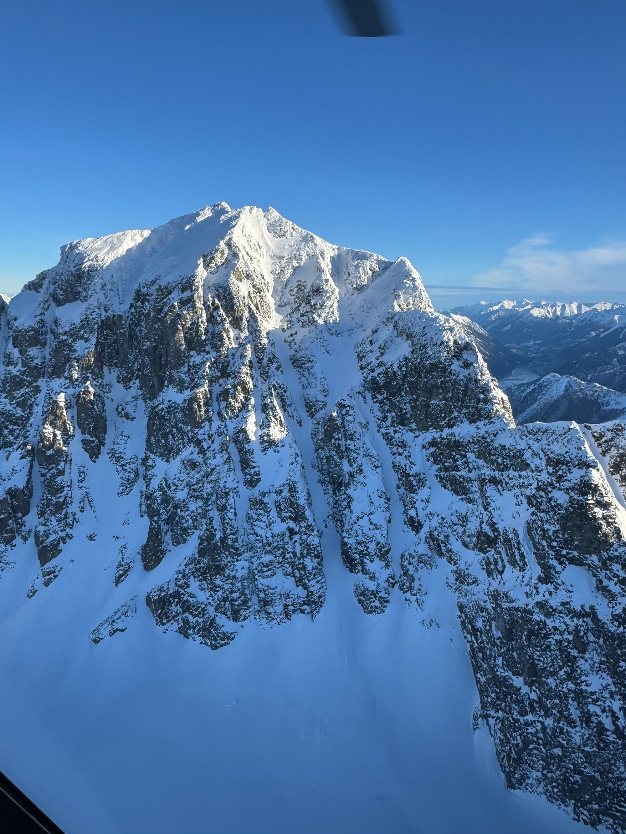
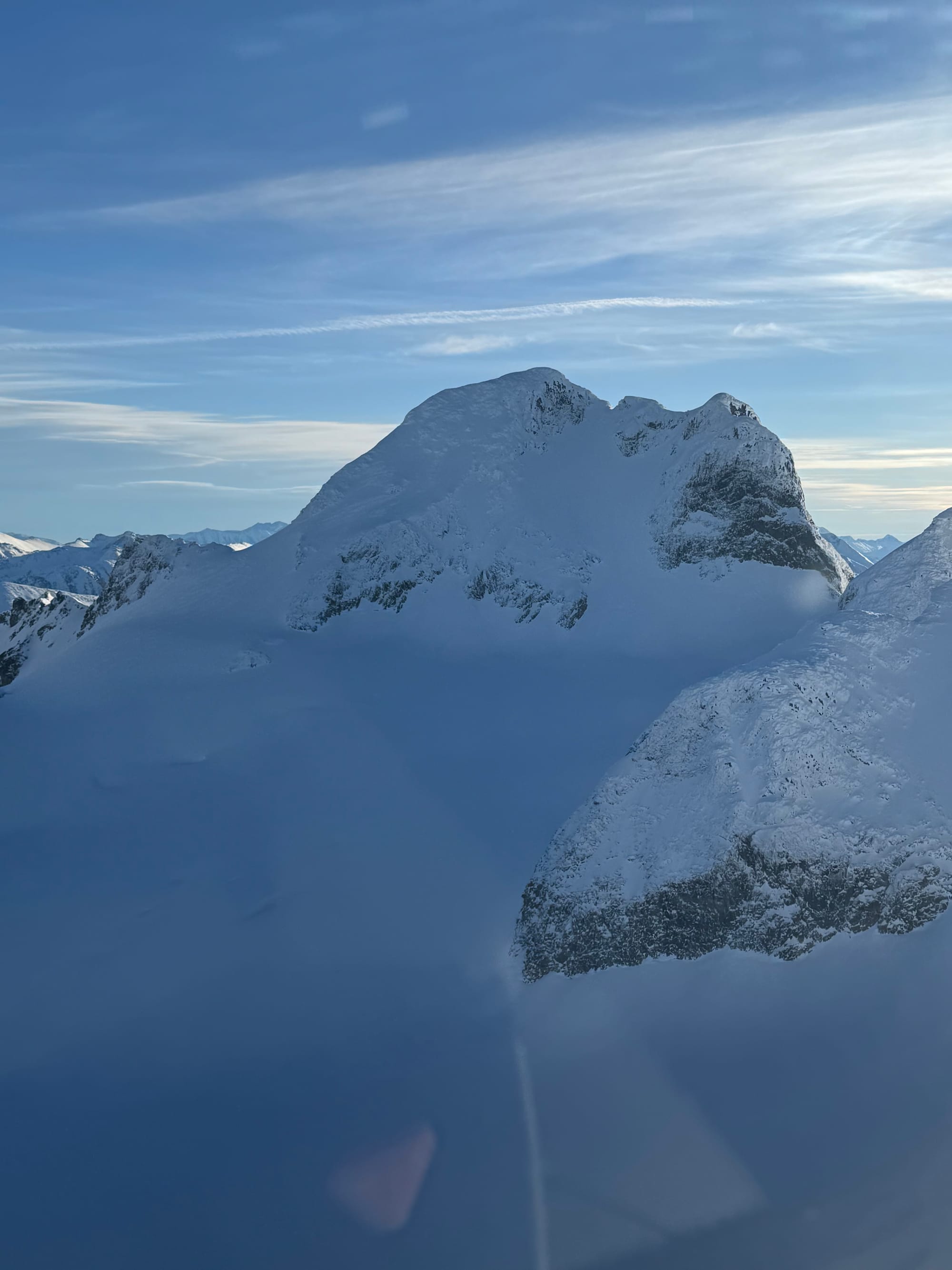
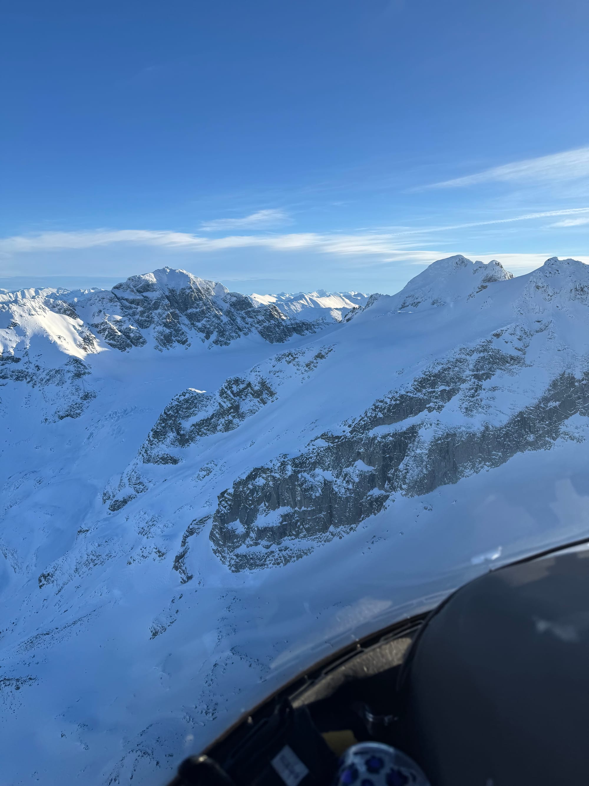
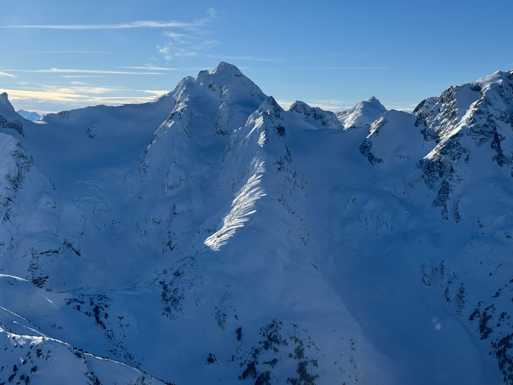
Mt. Cook, The Owls, Aussie Couloir, Matier NW, and Stonecrop face on Slalok.
What’s happened since the last update (weather & general snowpack structure):
We went from monster storm cycle - almost 2m of storm snow finally - to warm inversion. The weak sun angle/intensity at our solar minimum helped keep things from cooking too much, but it was enough for some small size 1s on solar aspects and melt freeze crusts. During the storms we had our normal amount of activity up to size 2.5 from new snow and wind. We have solid coverage in our entire corridor, but we are still below average for our more coastal low elevation locales, while higher elevation and more interior spots, like closer to Bralorne, are at or above average. Just from visual obs, places like the Duffey feel like they have better coverage than most of last season. The best part is that we have access to all of our favorite sliding zones and the snowpack is strong, having gone through the big storms and a warm up helping settle and tighten things. The winds also came through with the high pressure and did some damage in exposed locations, especially anything getting the brunt of southerlies/south easterlies. However, if you found shelter from the wind, you were rewarded with boot-top settled hero snow. We did get a nice spattering of surface hoar/facets from the clear weather - something we will need to keep our eyes on! But the start of the next storm cycle seems to be a bit warmer which could take care of that problem
What’s the weather and avalanche forecast?
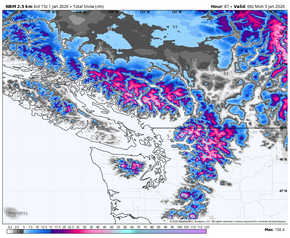
A high-pressure ridge that has persisted over the region for several days has weakened and is gradually moving eastward.This will bring in a more active weather pattern, as a slow-moving low-pressure system associated with an upper trough digs toward southwestern BC, sending multiple waves of moisture toward the Sea to Sky region this weekend and into early next week. Precipitation will commence Friday evening and is expected to ease by Sunday evening. Another system will reach the area on Tuesday. Inversion over the area will get flushed out with the incoming system. The models are slowly pushing the system further east on every new run that comes in, this could change the precipitation amounts.
Winds Speeds:
- Friday: Southwesterly 20 gusting 50 Km/h.
- Saturday: Southwesterly 40 gusting to 60km/h
- Sunday: Southwesterly 20 gusting 40 km/h.
Freezing Levels:
- Friday: 700m rising to near 1000m
- Saturday: 700m rising to near 1200m
- Sunday: Near 1000m rising to near 1500m
Precipitation: General storm total of 30 to 50cm from Pemberton south towards the Coast.
- Friday: Trace to 1 cm.
- Saturday: 5 to 7 cm by 4AM, 10-12 by 4 PM.
- Sunday: 10-12 by 4AM, 10-14 by 4 PM.
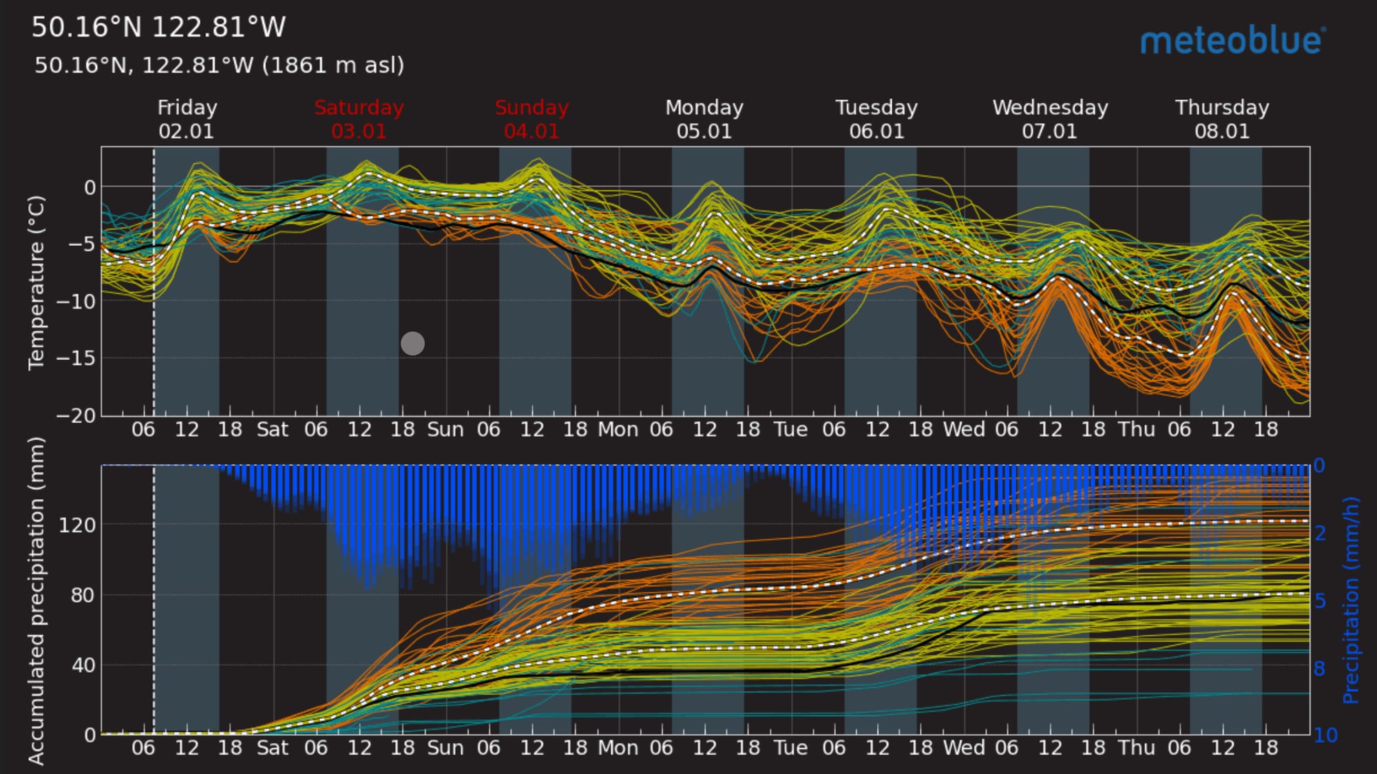
Avalanche Canada brings up the hazard into the weekend, especially near the coast, considering the potential for large precip numbers. Keep an eye out for considerables and high hazard ratings. It’ll be a step back in our strategic mindset as we go from sunny alpine big-line hunting to treeline storm skiing, being mindful of the potential for storm slab.
What are my questions for the weekend?
- Timing and intensity of the storm track combined with freezing levels are the big questions (aren’t they always?). At the moment it looks like FLs will be ok overall but low elevations may suffer slightly.
- What locations avoided getting nuked by the warmth? We found good skiing further north but the Tantalus and Whistler-Blackcomb all had reports of good skiing even after a few days of heat.
- Will surface hoar hang in there as the new snow comes? With clear cold-ish nights, we definitely had SH growth throughout the region. If this gets loaded, it could be a problem for us. However, the warmth and intensity of the storm look likely to knock most of this down before it’s a problem. I’ll be a little careful at high treeline elevations, especially further inland. There’s probably a spot somewhere up north that will have some surface hoar growth and avoid the warmest/wettest part of the storm. I’m looking at you eastern Duffey and Hurley!
What will I watch out for or avoid completely?
- As mentioned, we’re into a step back. If the storm is mega, it’s unlikely we’ll be in big alpine terrain, rather trying to find good tree skiing as high as possible to avoid the freezing level!
- I’ll treat areas that are well sheltered from the wind and warm with a lot of suspicion, especially if I can find surface hoar under the new snow.
Closing Thoughts:
Bring back the storm cycles please! Sun and stability is fun and all but we can save that for March. We need more snowpack building storms! Enjoy them while they’re here and look for areas that stay colder. This storm isn’t forecast to be as good to the Duffey as Whistler but you never know. Sometimes it’s the sleeper storms up there that give the best snow! My money is that the Brandywine zone and Spearhead Range come out of this looking pretty good though!
We still have space on a hut trip to the LQ outpost in the Selkirks February 1-8. This is one of the best trips you can ever do if you like amazing skiing out your door, sauna’s and top notch food. No driving, just hut life and powder gluttony for a week. Get in touch - zenithmountainguides@gmail.com !
For more information, check out Zenith Mountain Guides and our local avalanche forecast. Weather forecasts are custom from meteorologist Jason Ross. These updates are supported by SkiUphill Squamish - the best stop for ski touring equipment in the Coast Mountains and made possible by the Sea to Sky Gondola! Use this information at your own risk. Conditions change rapidly from when this report was written!
Member discussion