
Jan 23 - Sea to Sky Snow Conditions
Overall theme:
It seems like a lifetime ago. Powder. Maybe it was all just a dream. Maybe this is just a dream. When will we wake up…
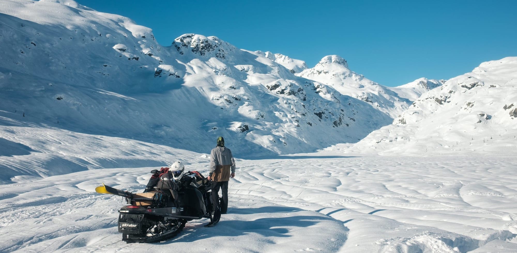
The hated Omega block. High pressure is sitting over western Canada. We don’t know what we did to deserve it but it’s bad. On the bright side - travel is excellent and fast. You can get up high in the alpine and it’s summit season!
Another important note is that we have two spaces in our Pro-Lines course Feb 19-22. This is our advanced decision making course and will be a really interesting one to do with the almost guaranteed persistent weak layer we’re going to be dealing with. We’ll be learning forcasting and how to deal with the spatial variability of the layer throughout the corridor. And we’ll be doing all that while hunting good skiing! Sign up asap!
Want to go somewhere cool? Maybe try a winter traverse or hit some summits? We’ve got some availability this week - send us a note: zenithmountainguides@gmail.com
Where we’ve been skiing:
Just a few days in the Squamish area for Eric but both Evan and Eric are in the interior now. We’ve been keeping tabs on the snowpack though with reports from Squamish, Whistler, and the Duffey. Coast Range has been operating in the area so plenty of obs from them. Either way, it’s best not to talk about the skiing that’s been going on. We’ll be looking forward. Way forward.
What’s happened since the last update (weather & general snowpack structure):
Not often that we get to see a green brick across the entirety of western Canada in January… No new avalanches reported for some time. Ski operations across the interior have closed up shop for the foreseeable future.
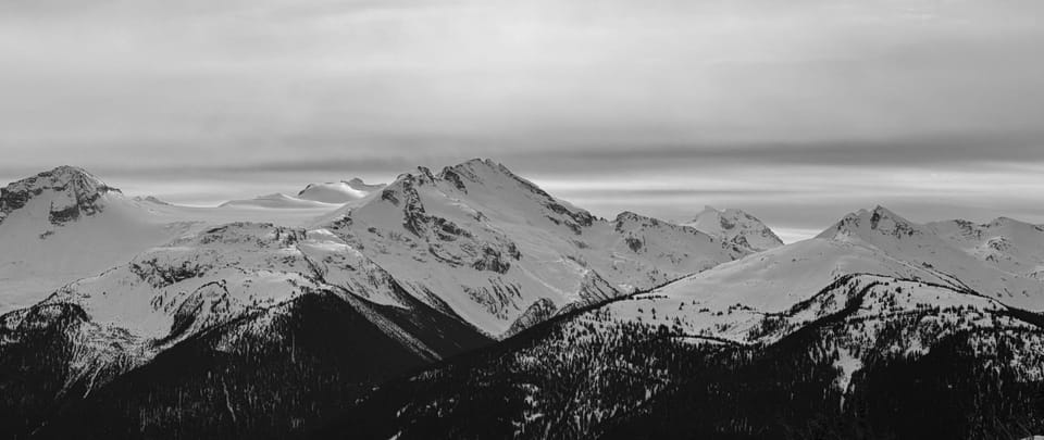
Overall with the high pressure and inversion temps, a melt freeze cycle has occurred on all aspects. This is the crust builder. Some folks found corn skiing on steep solar aspects in the afternoon but it wasn’t full go spring skiing. The sun is still low and the snowpack is still cold! As the week went on, temps dropped and now we have the freezing level in the valley bottom so no melt cycle means no corn at all. On solar (southerly) aspects, the crust is thick. On northern aspects, it ranges from supportive, to breakable, to almost gone at the highest north elevations. Up there, it’s faceting out due to cold and becoming more of a zipper crust with *almost* decent skiing. But only almost and you have to be real high. Below the crust, the snowpack is well settled and rounding. Stability is good but conditions are bad…
What’s the weather and avalanche forecast?
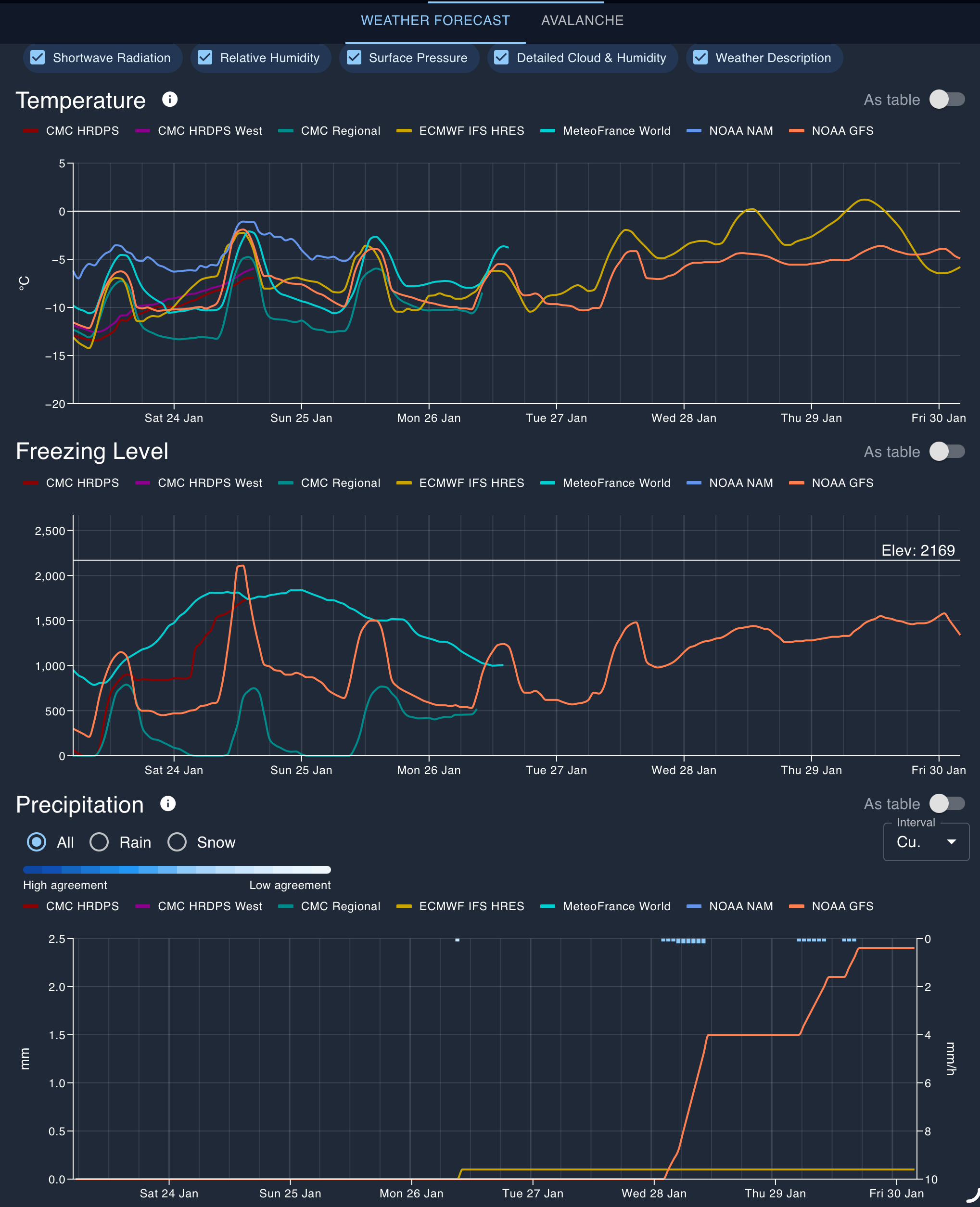
A strong ridge of high-pressure which brought an extended period of dry conditions, with a strong inversion across the Sea to Sky region, has weakened slightly allowing a weak system to pass through the area accompanied by high clouds. The upper-level flow has shifted to a northerly direction, causing freezing levels to drop to the valley in the Whistler area. The high-pressure ridge is expected to rebuild on Friday and persist through the weekend, bringing dry conditions and cooler temperatures. The question everyone wants to know is when this persistent ridge will break down, and when more alpine snow can be expected. The answer to this question is sometime next week looks promising, although details remain unclear at this time. Our Canadian GEM model indicates that a weak system will graze the area on Monday with a chance of flurries, while other models maintain the high pressure ridge and dry conditions. A majority of ensemble models agree that the ridge will break down towards the middle of next week, with a series of systems from the southwest targeting southwestern BC.
Wind speeds:
- Friday: Northerly 20 gusting 40 km/h.
- Saturday: Northerly 20 gusting 40 km/h.
- Sunday: Northerly 20 gusting 40 km/h.
Sea to Sky Freezing Levels:
- Friday: Valley Bottom rising to near 1000m
- Saturday: VB rising to near 1000m
- Sunday: VB rising to near 1000m
Precipitation:
- Friday: Nil
- Saturday: Nil
- Sunday: Nil
As mentioned, the avalanche hazard for the weekend is green. Hard to get an avalanche from a block of ice…
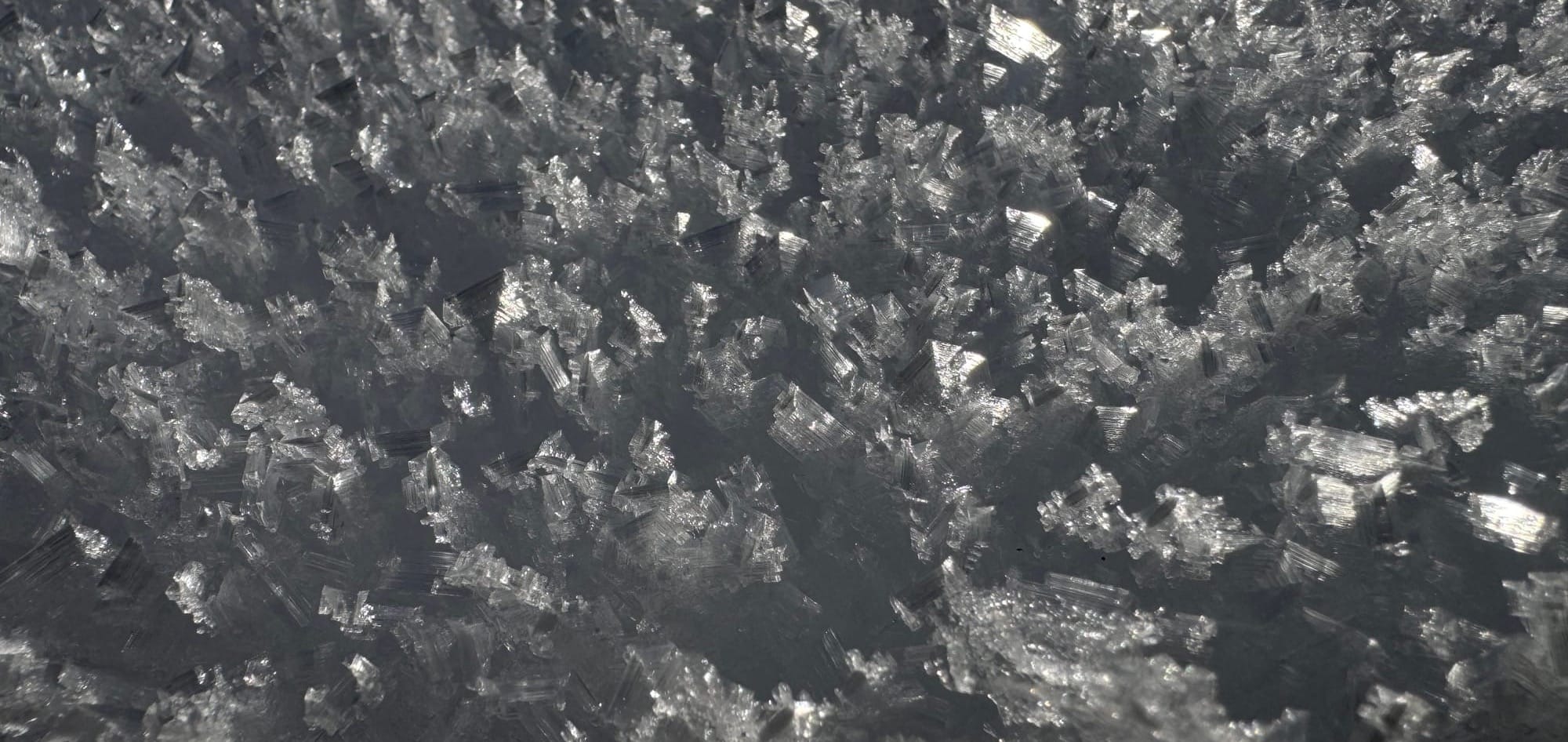
But more interesting is to think about what’s going to happen when we get a substantial snowfall. First consider we have a strong crust. That will bridge over the existing snowpack, but valley bottom freezing levels mean the surface is transforming. At treeline, surface hoar is forming. You may have seen the feathers on the snowbanks, especially in open areas. In the alpine, faceting is happening. The snow crystals at the top of the snowpack are rotting out and becoming little angled cubes. These don’t bond well and when the new snow falls, we’ll have a weak layer. I expect we’ll be hearing a lot about the “late January facet-crust combo” for some time. It will be a great time to do an avalanche course if you want to see some interesting stuff!
What are my questions for the weekend?
- Where’s the decent skiing? Crust and runnels are killing us. Probably best at the moment will be going for travel adventures and tagging peaks. The alpinists and ice climbers are probably watching this with glee.
- When will the pattern break and a storm come? Just pray it comes warm and wet and smooshes out our surface instabilities!
What will I watch out for or avoid completely?
- Slide for life conditions on steep slopes!
Closing Thoughts:
Woof - tough week. Get in the alpine and enjoy the sun and the views. Pow skiing will be back (hopefully in the next week or so) and probably will be a bit scary when it is!
Don’t forget to check out our Pro Lines course! We think this will be a pretty interesting period to be out in the snowpack learning how to make the most of our corridor!
For more information, check out Zenith Mountain Guides and our local avalanche forecast. Weather forecasts are custom from meteorologist Jason Ross. These updates are supported by SkiUphill Squamish - the best stop for ski touring equipment in the Coast Mountains and made possible by the Sea to Sky Gondola! Use this information at your own risk. Conditions change rapidly from when this report was written!
Member discussion