
Jan 29 - Sea to Sky Snow Conditions
Overall theme:
Well… it’s currently snowing! Our snowpack has gotten a whole lot more interesting.
Before you read on, grab a ticket for our February snowpack discussion at SkiUphill. We’ll have the usual talk followed by a showing of a sweet kayak/ski/surf film from the Waddington Range last spring!
Also have a look at Mitch Sulkers' great facebook post about our current conditions. It’s a good bridge between our newsletter last week, and this current one.
Where we’ve been skiing:
We actually have a prize for the 5000th person who made a joke about spotting us in the climbing gym this week. We did get in a bit of skiing though. Eric made a solid attempt on the Spearhead Traverse as the weather arrived on Tuesday. Coast Range had a few days in the field while it was still sunny. The groomers on Blackcomb have been ripping! We’ve been sitting out the latest round of precip and ‘hanging on’(cue climbing gym jokes) for some clearing breaks on the weekend.

What’s happened since the last update (weather & general snowpack structure):
Early in the week was the end of the previous high pressure system. Temps had cooled off and the snowpack was locked up. Alpine climbers rejoiced. Lots of Sky Pilot climbing action, I heard of an Atwell ascent, and a bunch of others. By mid-week, clouds had arrived, then warmer temps, then precip. This is actually a better start to the storm than we anticipated. Last newsletter, we wrote about how the long range forecast showed this storm coming in cold. Thankfully, that changed a bit and instead of getting dusted, we’re getting sludged. Hopefully the new snow sticks to the icy surface a little better than expected! Exactly how that turns out remains to be seen.
We’ll almost certainly have an avalanche cycle today and tomorrow but unlikely to really see evidence until folks are out in good weather on Saturday. In general, the bond between new and old snow should be treated with suspicion until proven otherwise. We;ll be talking about this new Jan 28 melt freeze crust for a while now!
At the moment, there’s no new reports of avalanche activity in the corridor but that’s more likely due to visibility than potential!
What’s the weather and avalanche forecast?
A deep upper low in the Gulf of Alaska will direct a series of frontal systems towards the south coast on Thursday morning, and Thursday evening into Friday, accompanied by rounds of moderate to heavy precipitation. Unfortunately the flow aloft will originate from the southwest which will push the freezing levels to approximately 2000m by Thursday evening. Looking ahead to the weekend, a transient ridge of high pressure will develop on Saturday morning bringing some breaks. A weak system will impact the area on Sunday into Monday with lower freezing levels, alpine snow. Another strong blocking ridge of high pressure will establish itself over the province towards early next week, resulting in rising freezing levels, temperature inversions and warm spring temperatures in the valleys.
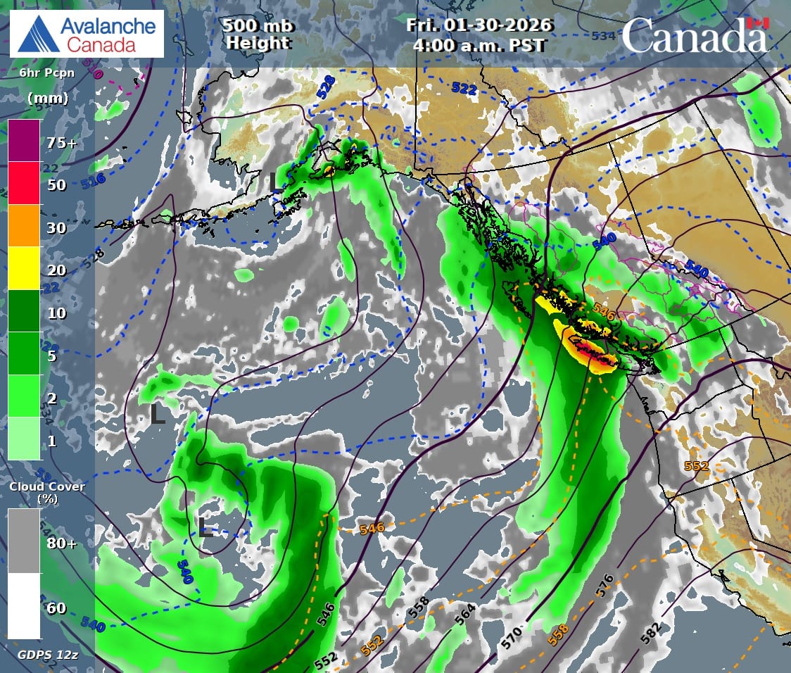
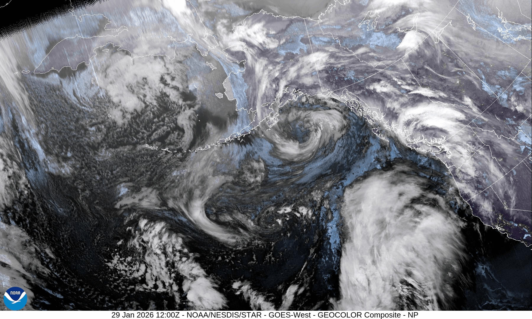
Avalanche Canada 500mb chart showing the green plume of moisture hitting the South Coast. GeoColor satellite imagery showing both storm systems.
Wind speed:
- Thursday: Southwesterly 40 gusting 60 km/h.
- Friday: Southwesterly 50 gusting 80 km/h.
- Saturday: Southwesterly 20 gusting 40 km/h.
- Sunday: Southwesterly 40 gusting 60 km/h.
Sea to Sky Freezing Levels:
- Thursday: 1500m rising to near 2000m by late evening.
- Friday: 2000m lowering to near 1600m Friday afternoon.
- Saturday: 1500m rising to near 2200m.
- Sunday: 2200m lowering to near 1200m
Precipitation:
- Thursday: 20-30cm by 4pm.
- Friday: 15-20 over the high alpine by 4pm.
- Saturday: Nil
- Sunday: 10 to 15 cm by 4pm.
A big part of the weather story this weekend is the difference in snowfall between the Coast and the interior. This is a classic SW flow setup (see the 500mb chart and geocolor image) and comes in warm and wet, slams into the North Shore and then sputters out over the mountains.
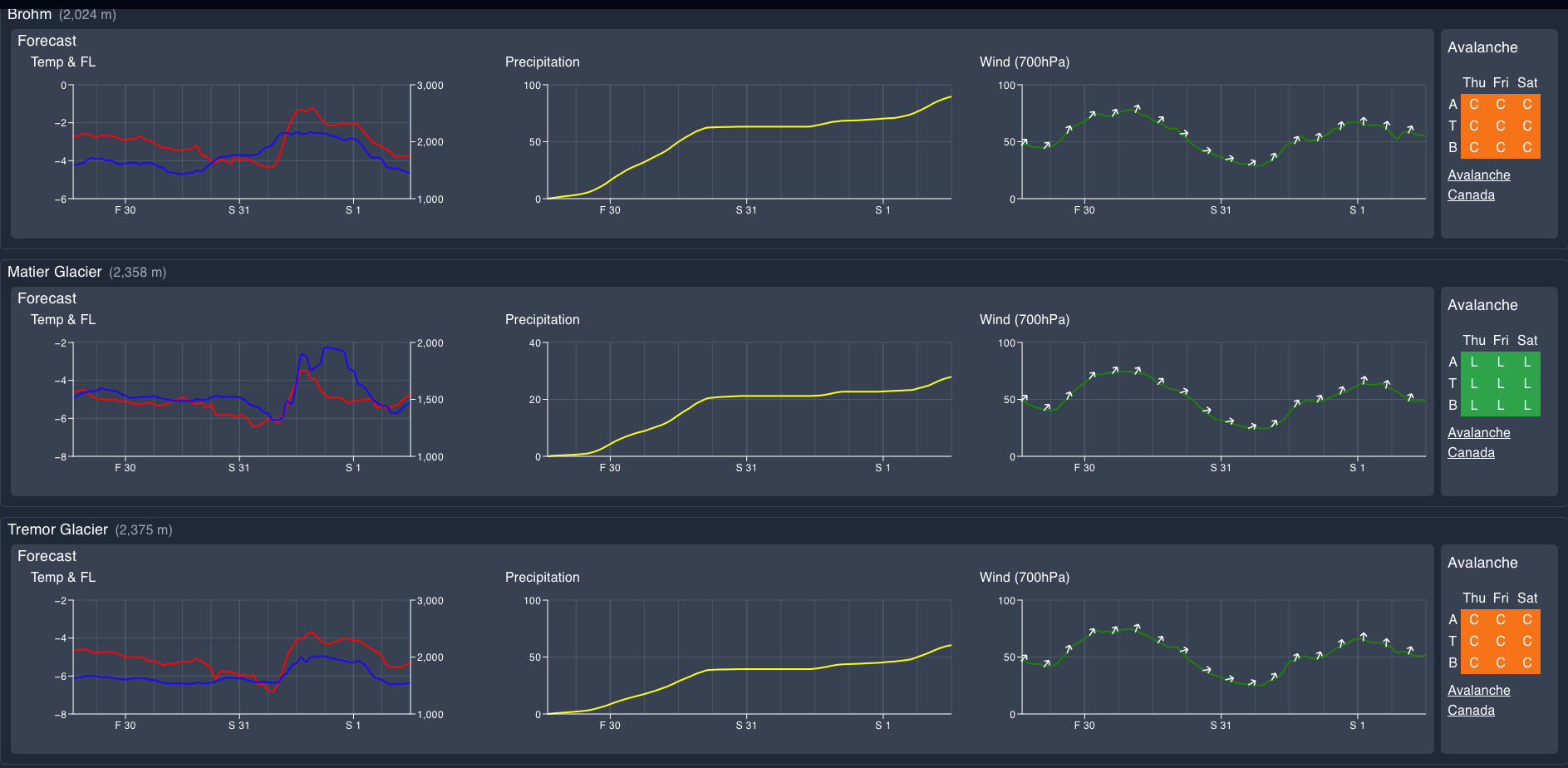
The avalanche forecast has been all over the place as we lead into this storm. As it’s going in earnest now, we have a little more confidence in snow totals so the forecast is stabilising a bit. Squamish and Whistler are sitting in the considerable range with storm slab as the primary problem. This is of course the issue of a ton of new snow falling on a very slick surface. Up on the Duffey, the hazard is low with a windslab problem, primarily because of a lack of new snowfall.
What are my questions for the weekend?
- What will we see for snowfall totals in the corridor? We saw some pretty big forecast numbers, especially for around the North Shore/Squamish. It will be interesting to see what actually falls. On Thursday afternoon, the S2SG only had 20mm of rain at the top station.
- How will the new snow bond to the surface? We’re really hoping for a frosting on cake situation rather than sugar on glass. Pay close attention to this, especially in areas where the storm snow is >30cm deep.
What will I watch out for or avoid completely?
- The chunder down under! Not talking about sketchy Aussie ski guides. But the remnants of our last big avalanche cycle. The debris is big and frozen solid. That will get dusted and be hidden but still ready to rip your bindings off your skis.
- Steeps in the Whistler region. I think the NS/Squamish are getting a warm wallop and will see a reasonably good bond (maybe). Pemby has been faceting out which will give a bit of purchase. But I think there’s a band in between where we’ll see snow bonding poorly to the ice surface below and aside from the avalanche implications, there will still be slide for life conditions!
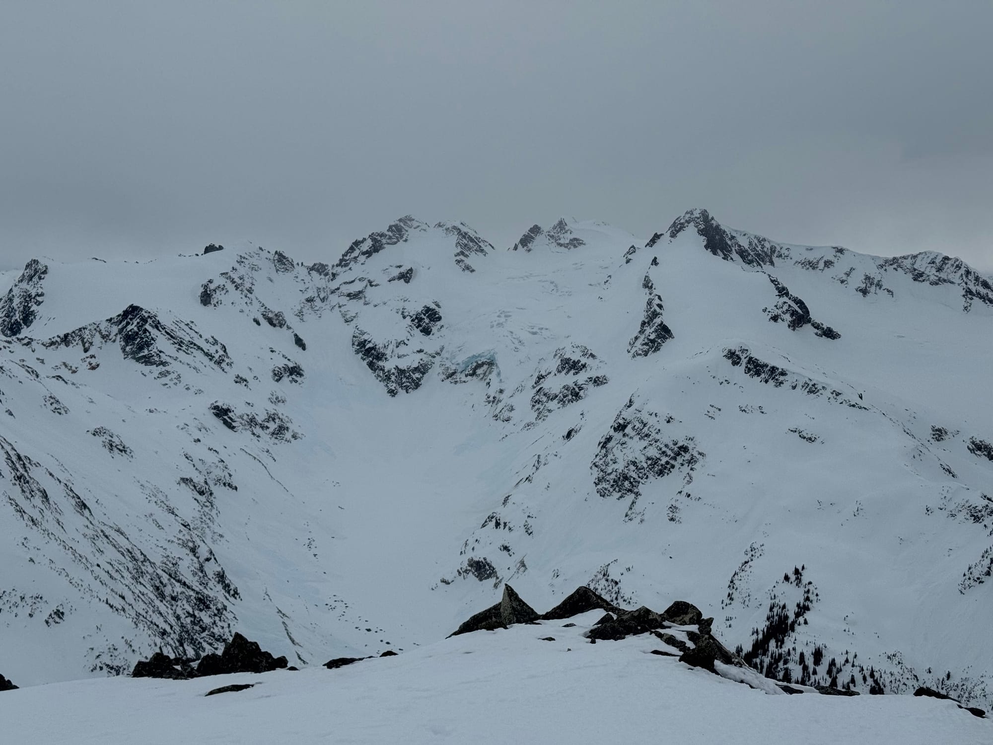
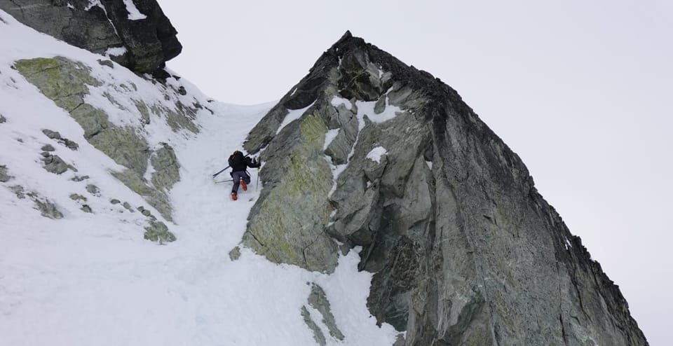
Fitzsimmons, McBeth, Fissile. Fitz doesn't even look like a ski run anymore!
Closing Thoughts:
This is really a tip-toe out and see kind of weekend. Start conservative in assessment mode and gradually gain confidence in the snowpack. Big planar glaciers could treat us well. Don’t look at the long term forecast!
For more information, check out Zenith Mountain Guides and our local avalanche forecast. Weather forecasts are custom from meteorologist Jason Ross. These updates are supported by SkiUphill Squamish - the best stop for ski touring equipment in the Coast Mountains and made possible by the Sea to Sky Gondola! Use this information at your own risk. Conditions change rapidly from when this report was written!
Member discussion