
Mar 27 - Sea to Sky Snow Conditions
Overall theme:
Spring is springing but it sure feels like winter is hanging in there up high. Classic march conditions with pulses of convective precip giving good refreshes but making visibility challenging at times! Snowpack problems are tightening up quickly in most of the corridor but watch out especially in the northern interior with an ongoing persistent slab problem!
Where we’ve been skiing:
Duffey, Currie, Sea to Sky Gondola, Squamish Valley.
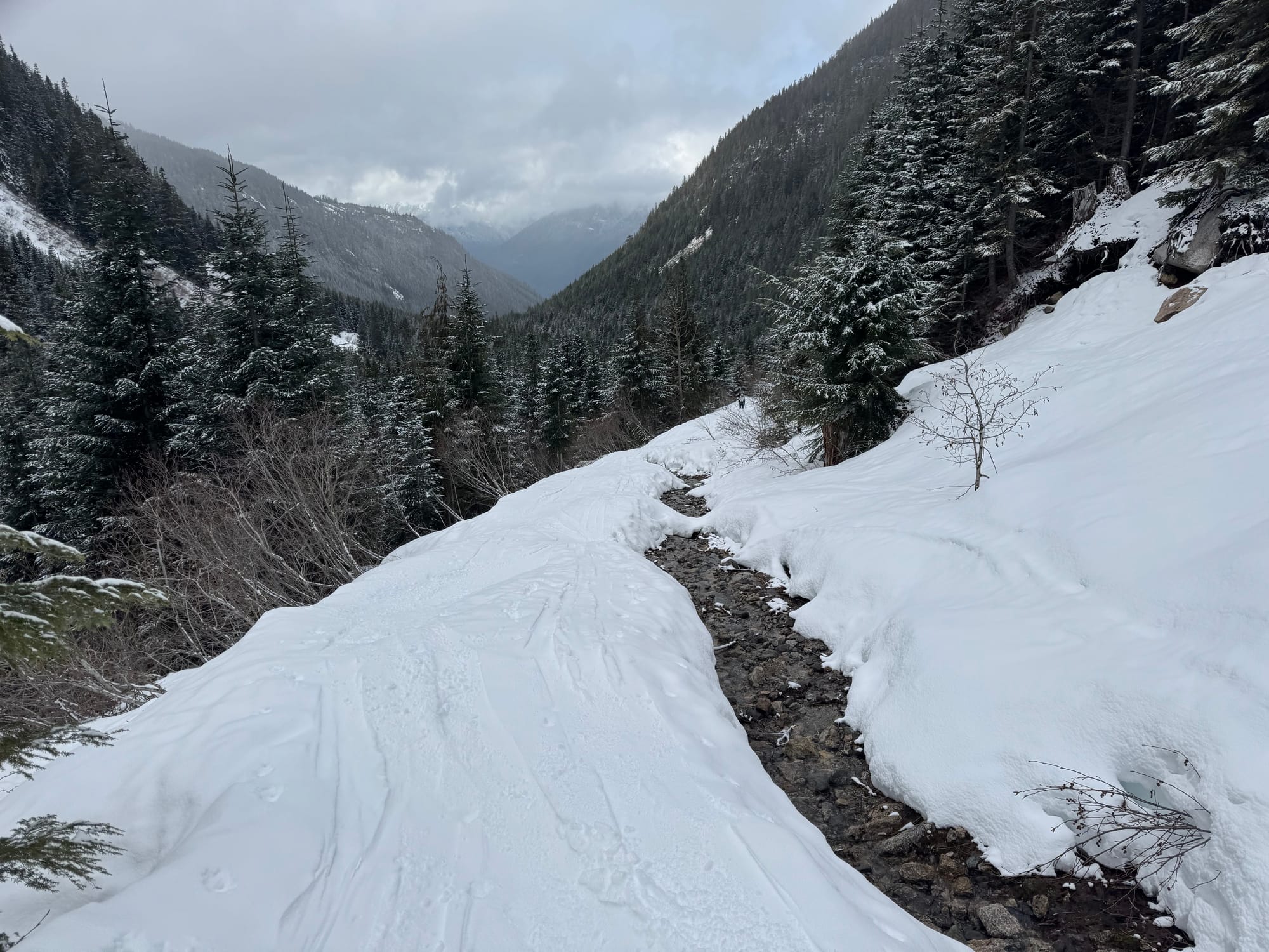
Trailheads made a bit of a recovery - notably Red Heather and S2SG being skiable down low again. Eric’s been at a bunch of the sled trailheads in the corridor this week and almost all of them are 5-10km back up from the highway. Duffey trailheads are all looking good and have gained some snow this week! Below Treeline terrain, especially further south is getting pretty rugged.
What’s happened since the last update (weather & general snowpack structure):
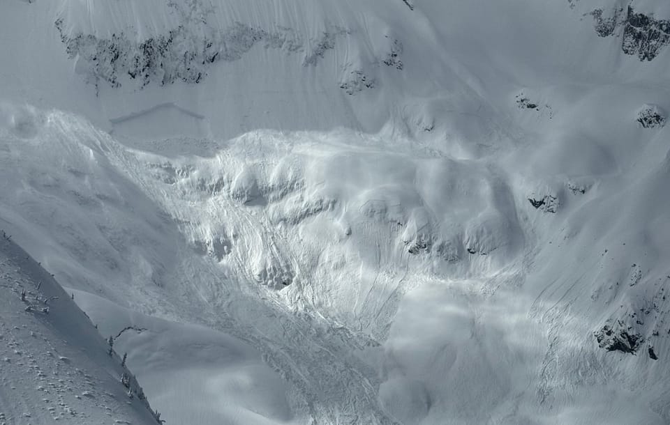
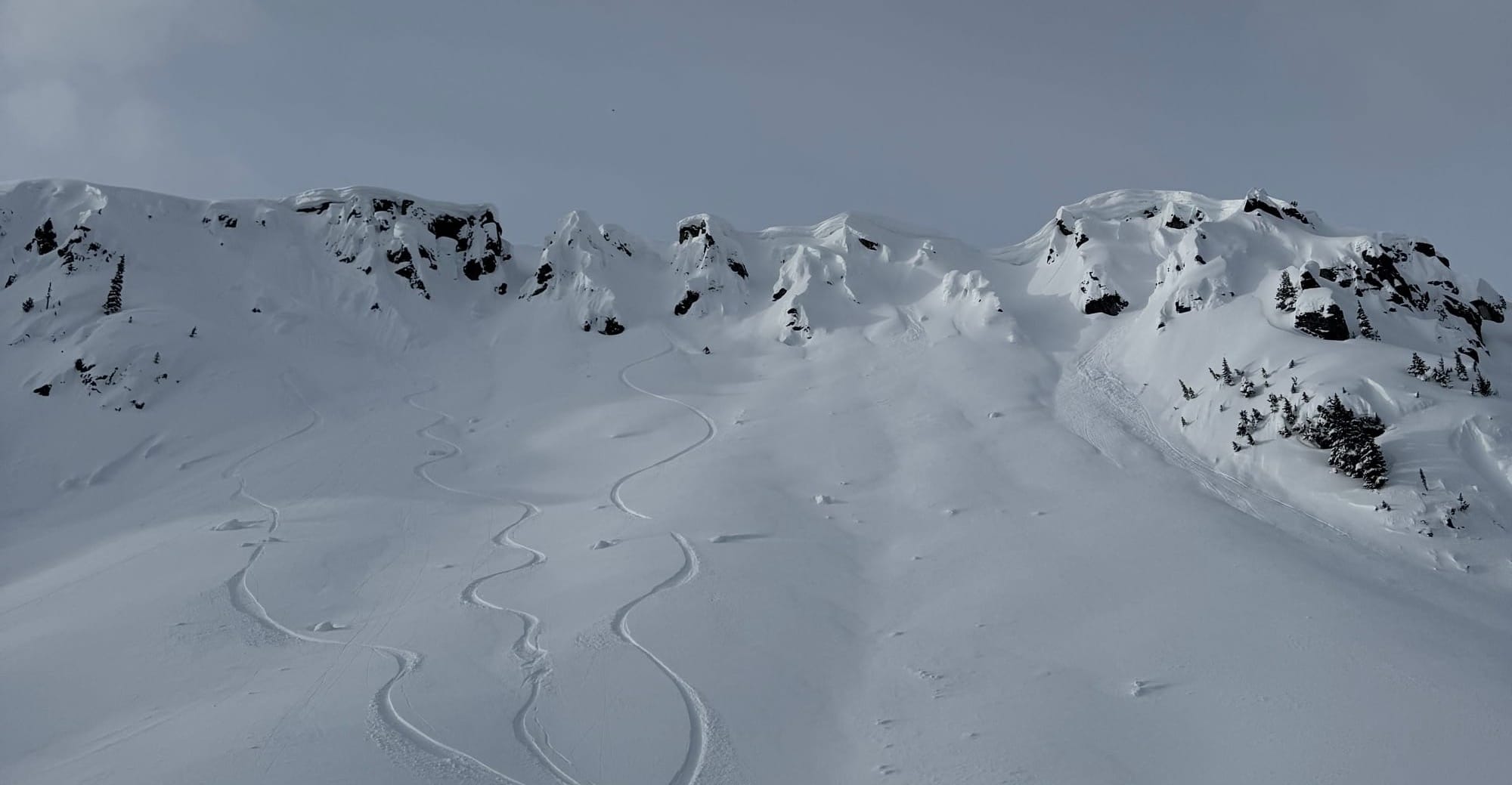
It has been pretty limited alpine access for most of the week so Friday was really just the first day of people getting a little higher and visibility was still challenging. As we rolled into last weekend we got to briefly see the outcome of the massive avalanche cycle that happened during the warmup and rain storm. Lots of big slides to size 3-4. Then the weather moved back in. There was plenty of evidence of windslabs the past couple days, especially where cornice tabs were breaking. Further north, persistent slabs have continued to be an issue with several large avalanches NE of Pemberton.
Overall the snowpack is 40-70cm of recent storm snow that sits on the March 22nd rain crust. Below this, the snowpack is moist or completely saturated.
What’s the weather and avalanche forecast?
A weak ridge of high-pressure will develop over the south coast on Friday through Saturday, leading to drier conditions and warmer temperatures. An upper trough will usher in cooler and unsettled conditions on Sunday, while another ridge of high pressure will redevelop on Monday with some breaks.
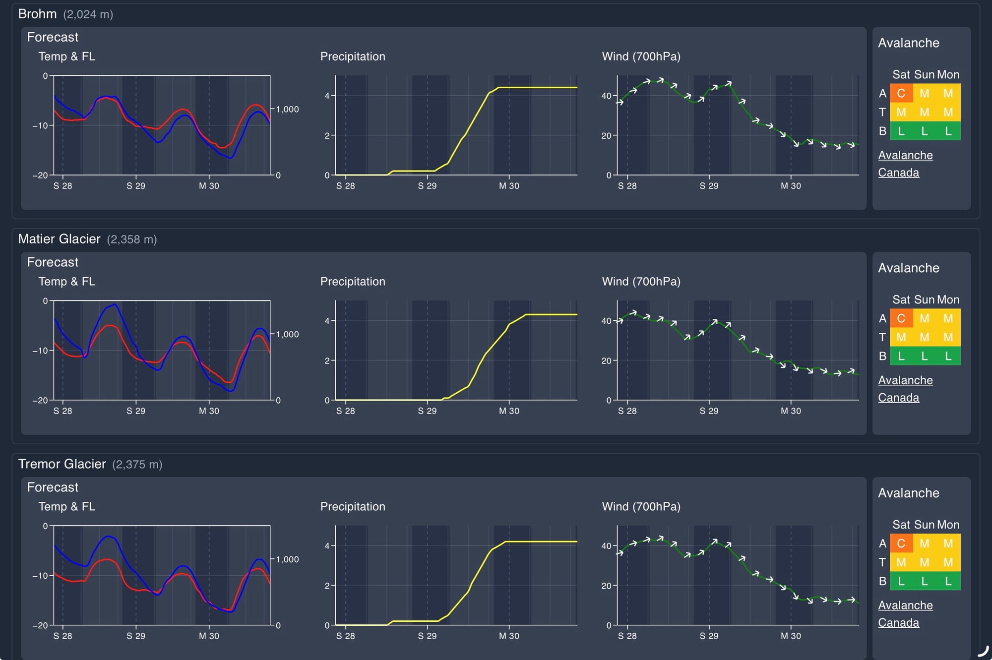
Wind speed:
- Friday: SW 20 gusting 50 km/h.
- Saturday: SW 20 gusting 50 km/h.
- Sunday: SW 20 gusting 60 km/h.
Sea to Sky Freezing Levels:
- Friday: 700, rising to near 1500m
- Saturday: 700 rising to near 1500m
- Sunday: 500m rising to near 1000m
Precipitation:
- Friday: Trace
- Saturday: Nil
- Sunday: 2-5cm
Avalanche conditions have been sitting pretty steady throughout the week, partly because the weather has been consistent with a steady trickle of new snow and moderate wind but also because there have been relatively few alpine observations until today. The warm greenhouse effect will continue to help tighten things up.
What are my questions for the weekend?
- Will warm temps start to tighten things up a bit? It sure seems like this is happening!
- Will we get some high alpine visibility or will it keep clagging in and seeing afternoon convective? Hard to say…
What will I watch out for or avoid completely?
- Cornices. These puppies are huge right now and they’re well saturated by that rain storm. If something cracks off above you or under your feet, you’re getting smooshed.
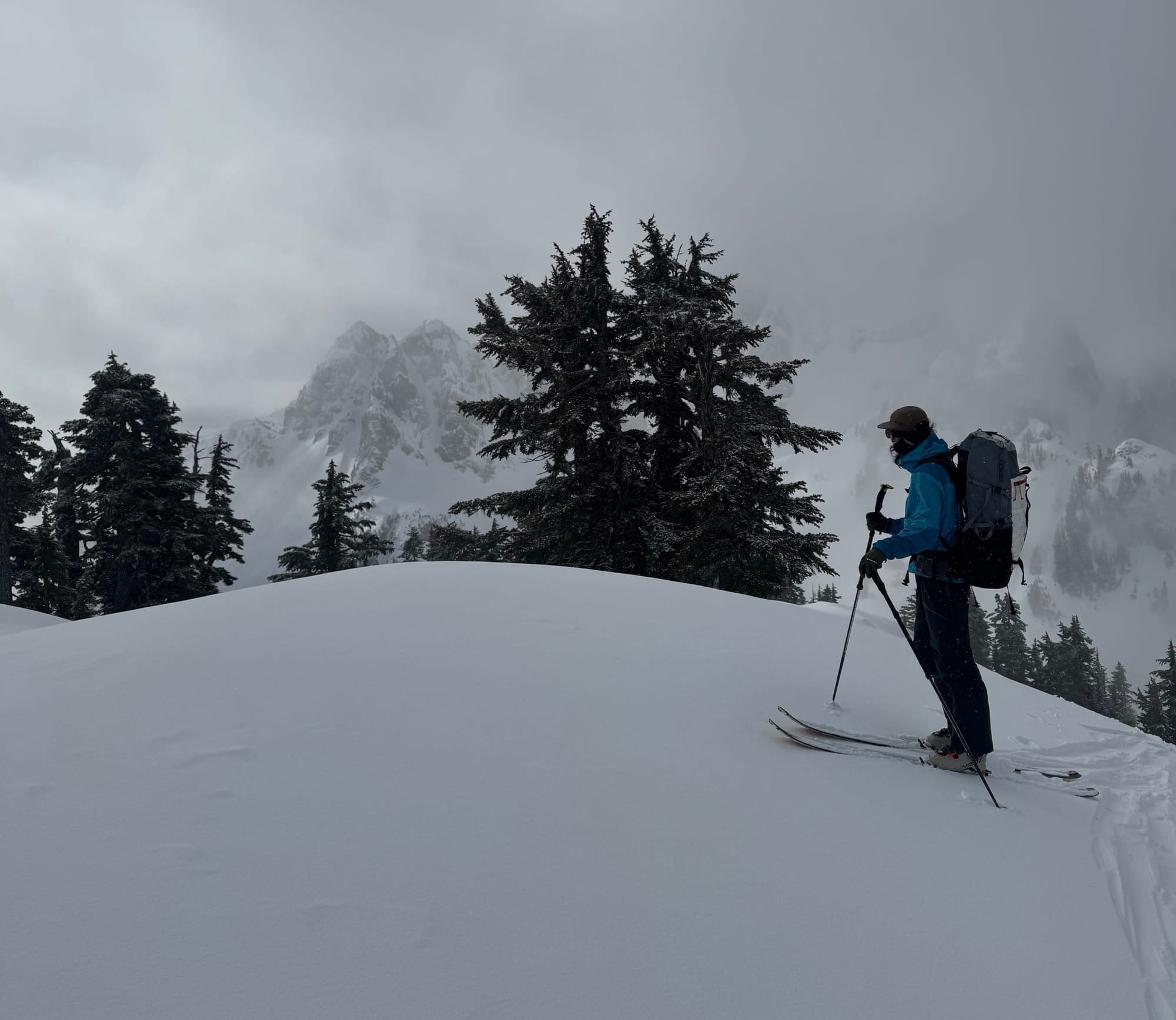
- Not too many people have been high high alpine yet just because of vis. We’ll be careful the next couple days with big stuff near ridgetop.
Closing Thoughts:
Temps have stayed cool and snow has been good. Especially further north where the convection has been stronger and the refreshes have been better. It’s Duffey season!
For more information, check out Zenith Mountain Guides and our local avalanche forecast. Weather forecasts are custom from meteorologist Jason Ross. These updates are supported by SkiUphill Squamish - the best stop for ski touring equipment in the Coast Mountains and made possible by the Sea to Sky Gondola! Use this information at your own risk. Conditions change rapidly from when this report was written!
Member discussion