
Mar 6 - Sea to Sky Snow Conditions
Overall theme:
A small refresh and a settling down of some of the avalanche dragons…but not all. Now we’re bracing for impact for a significant storm - the bigger the better to clean up the rest of our snowpack!
Where we’ve been skiing:
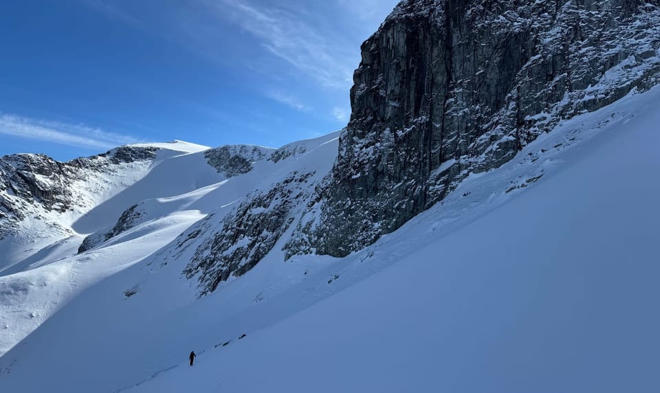
Squamish area (Gondola and Red Heather): low elevation snowpack got hit hard by the warm weather. Red Heather trail is patchy at the bottom and folks are skinning up but walking the last little bit to the car. Gondola is skiable on the road but thin.
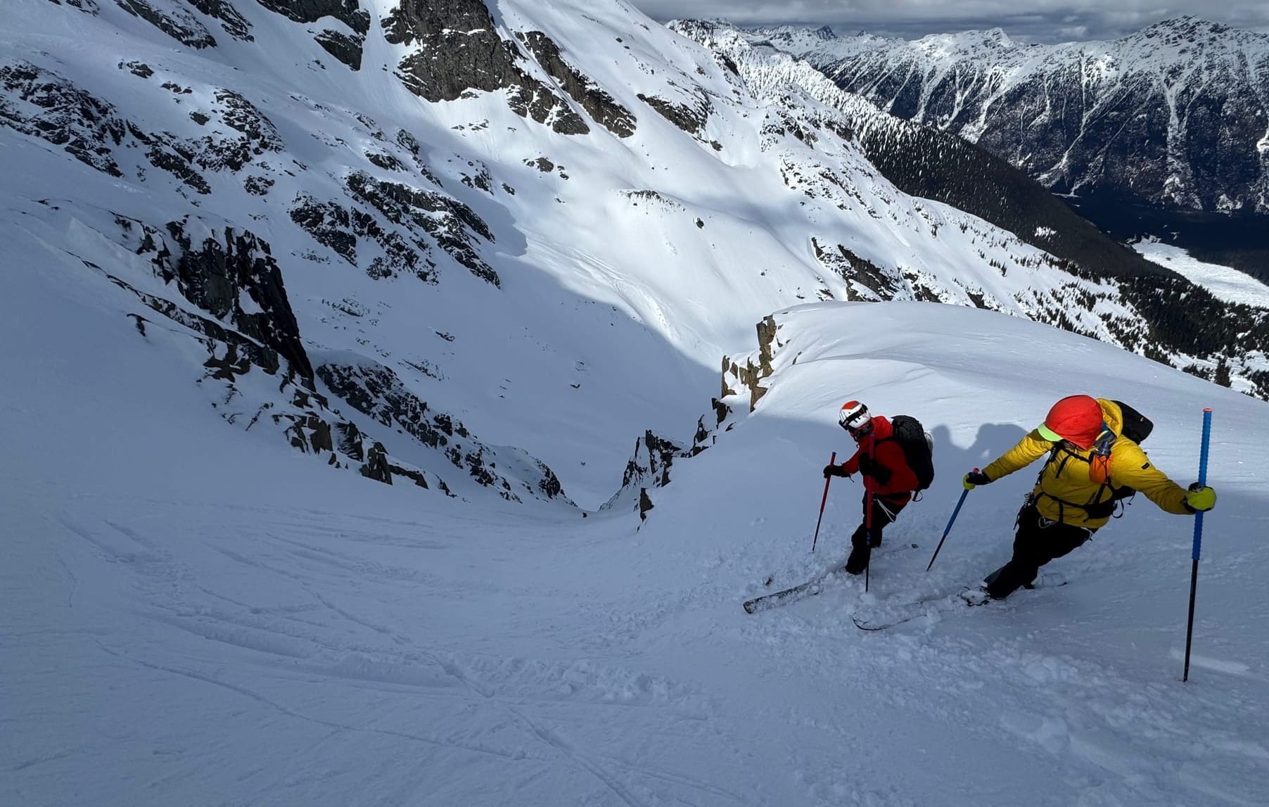
Eric and Evan were both in the Whistler corridor as well as up on the Duffey during the warm spell. Mt Currie zone, Upper Pemberton Meadows area. Basically as much open alpine terrain as possible and minimizing below tree line travel.
What’s happened since the last update (weather & general snowpack structure):
After the pulse of precip that came last week and its accompanying natural avalanche cycle, we had warm weather throughout the corridor. Temps were well above zero to ridgetop and that made for challenging conditions. Over the weekend, the surface snow felt quite spring-like but as you saw from the SPAW in effect, what underlies the surface is not a spring snowpack. The surface snow acts as an excellent insulator and the snow underneath was dry and soft and layers still identifiable.
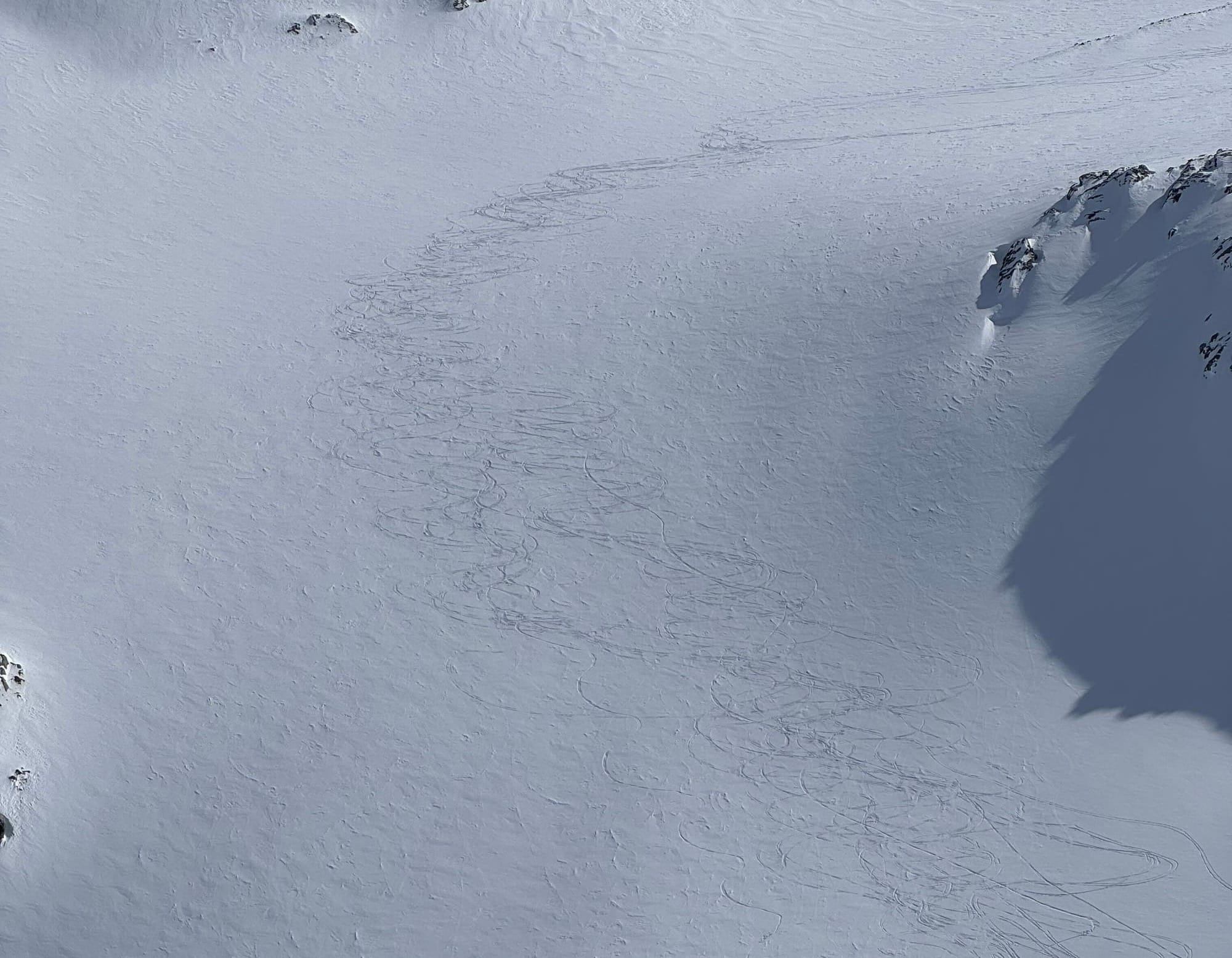
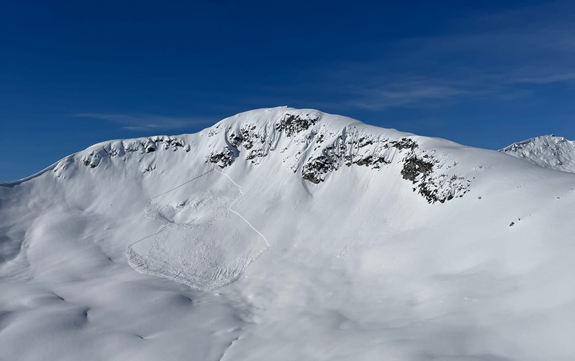
We saw avalanche activity taper off quite quickly over the weekend. Much of the ocean side of the corridor developed a surface crust with the rain and warm temps. Further interior, to the north and east however, the effect wasn’t quite as strong and the Jan 30th PWL remained more active. Blowdown Chute 51 slid on Saturday with control work coming to with in 5m of the road, reminding us that layer is still in play in certain areas. The big defining line in our corridor is where the natural avalanche cycle tapered off. The Blowdown avalanche control is a great example of where the new snow amounts and warmth weren’t enough to cause a cycle. This was similar on the far side of the Hurley as well. On the Pemberton Meadows side, and in the Rutherford and Spearhead ranges, tons of slopes avalanched naturally, and one of the best plays of the week was to ski slopes that had already slid. Basically, if we couldn’t tell if it had slid it made us weary. Luckily it seems like a huge part of the western/southern regions went through a significant avalanche cycle.
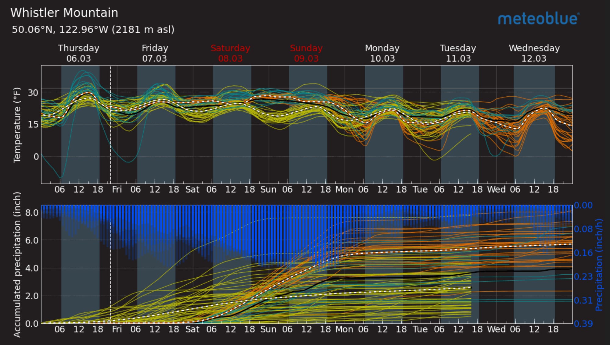
Topping this off was Tuesdays small front that left 10-20cms of new snow very ‘right side up’ - started warm and finished cold with no wind. This thankfully covered up a ton of the breakable crust in the region and made travel and ski conditions much more favourable the last few days. It’s not epic, but the danger is reduced, trail breaking is easy and downhill travel is fast and fun in some sparkly faceted new snow and surface hoar. Oh ya…let's see how that plays out in this next storm. Hopefully it's big enough to flush out this potential problem layer and clean up the last pockets of trouble from before.
What’s the weather and avalanche forecast?
Fingers crossed for a big spring storm to finally materialize for the weekend. A low in the Gulf of Alaska is spinning moisture up from the Pacific and we’re expecting significant precipitation over the weekend. Areas around Squamish could receive between 100 and 200mm of precip by Monday. Hopefully storm and tree skiing are back on the menu!
Weather Synopsis:
- Friday: Moderate to strong winds SW winds, Freezing Levels ~1100m, no precipitation.
- Saturday: Moderate to strong SW winds, FL rising to 1300m, 30-40cm new snow.
- Sunday: Moderate to strong SW winds, FL 1200m, 40-60cm new snow.
Avalanche hazard stays moderate or low on Friday but spikes to high at all elevations throughout the corridor. We’ll see how this new surface hoar gets buried but best case is we see a widespread avalanche cycle. Storm slab will be on the menu through the weekend.
What are my questions for the weekend?
- How much will it actually snow and blow? Hopefully it just hits hard. Temps look normal and decent new snow amounts.
- Will we get enough new snow to make skiing below treeline in the storm decent? Watch freezing levels closely! It’s definitely starting to feel like BTL travel is going away…
What will I watch out for or avoid completely?
- Big alpine terrain and avalanche paths, especially on the dry side of the Duffey and Hurley.
- Surface hoar farms at treeline as the storm starts might be very touchy until the new snow really hits hard.
Closing Thoughts:
Do whatever you have to do to make it snow huge this weekend. Like burn old skis, make promises you will never keep, sell your soul. We need a big storm already and we’re counting on you to help make it happen ;)
For more information, check out Zenith Mountain Guides and our local avalanche forecast. Weather forecasts are custom from meteorologist Jason Ross. These updates are supported by SkiUphill Squamish - the best stop for ski touring equipment in the Coast Mountains and made possible by the Sea to Sky Gondola! Use this information at your own risk. Conditions change rapidly from when this report was written!
Member discussion