
March 14 - Sea to Sky Snow Conditions
Overall Theme:
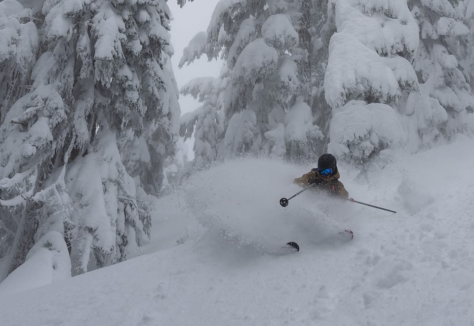
The storm of the season actually delivered and it was memorable! Eric is going to keep his roof replacement on the schedule because that seems to be delivering. We’ve been able to poke our heads out and ski powder every day, but cautiously and strategically. Snow remains in the forecast as well! Everything in the corridor is smartening up snowpack wise, but lots of layers giving us action on the avalanche front. Keep it tight, stick to your safe travel techniques!
Where we’ve been skiing:
Sea to Sky Gondola, Brohm Ridge, Blackcomb, Whistler, Duffey. Freezing levels have been teetering right on the edge of what we need to fill in the lowest trailheads like Red Heather but once you get above 1200m, the snow is STACKING.
What’s happened since the last update:
Snow, snow and more snow. Cumulative snow totals are probably around 140 to 250cms in the corridor (Duffey to Squamish) with well behaved freezing levels. In the intense precip last Sat night/Sunday we did see some warming closer to the ocean to 1500m or so, but that quickly corrected itself and kept refreshing. Every day has delivered a decent amount of new snow, and we are currently in a convective period that’s giving us some classic spring refreshes. March Madness is here!
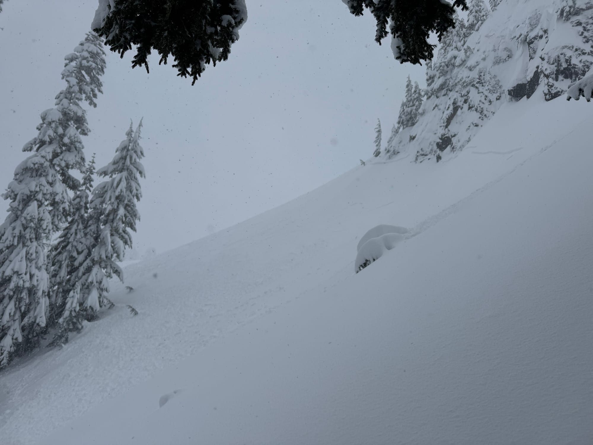
The most prominent layer of concern is the March 7th surface hoar, which sits on some facets and on some crusts on solar or melt freeze surfaces. This has proved quite reactive to storm snow amounts and in the few locations that did not slide big in the last massive natural avalanche cycle it has proved enough to step down to that layer, which is now 150-200cms deep. There are the occasional report of 2m crowns in the corridor. The key thing to remember is that we have barely had any breaks in the storm, so observations are limited and even if something slid during the storm it has likely reloaded beyond recognition.
To break it down, there are some reactive storm slabs from intense precip intervals near the surface. Below the last 20-30cms are some now buried wind slabs from the intense storm periods, now a few days out. At the base of this is the March 7 SH/FC layer, and below this all is the Jan 30/Feb 16 FC complex. Tricky enough for you? Lots of overlapping problems, but luckily it has been a massive load. As soon as it settles and clears we can hopefully start to build confidence again!
Weather:
The active pattern continues this weekend with more alpine snow. A weak area of high pressure will bring some breaks in the action across the south coast on Friday. A trough with an onshore flow will begin to impact the coast on Saturday with alpine flurries. A potentially potent system will take aim at southwestern BC Saturday evening into Sunday with the potential for large snow accumulations and very strong winds over the alpine. Freezing Levels: It's that time of year where the diurnal cycle that consists of warming from solar radiation and increased air temperatures during daylight hours, and cooling overnight can be seen with a daily freezing level.
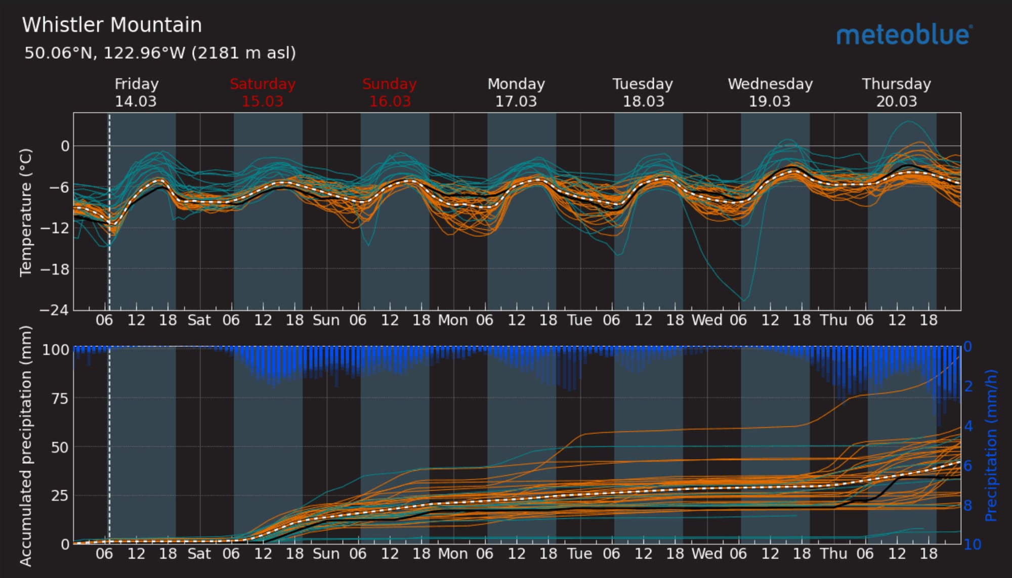

Meteoblue Multimodel forecast for Whistler (L) and GeoColor Product showing trough along the coast this morning (R).
- Friday: Light SW winds, Freezing Level 300m to near 1200m in the afternoon. Trace to 2cm Precip.
- Saturday: Strong SW winds, FL 300m to 1200m. 2-5cm Precip.
- Sunday: Moderate SW winds, FL 500m to 1300-1500m. 15-25cm Precip :)
Questions for the weekend?
- Will the weekend weather be stormy or hold off? We’re entrenched in a moist pattern that keeps delivering new snow, we always want it to snow more. And to be honest, this is the first time this year that tree skiing is actually coming in nicely! Enjoy it while you can.
- Will we be able to get obs of what slid in the last cycle? We’ve had several small and medium cycles during the storm. These quickly get buried making it tricky to know what
- Did Mar 7 surface hoar layer and the old PWLs (Jan 30/Feb16 fc/cr combo) get flushed out completely?
What will I watch out for or avoid completely?
- To be fair we are dialing things back until we gain confidence! Big terrain, fresh cornices, convexities, you name it. It will be a tip toe and poke small features program for another day or two. Ski the trees and low angle terrain.
Closing Thoughts:
March delivers on the Coast. Don’t rush into big terrain, it’s tiptoe time. The more snow we can stack up now, the better our spring skiing will be and that time will come! Enjoy the pow!
For more information, check out Zenith Mountain Guides and our local avalanche forecast. Weather forecasts are custom from meteorologist Jason Ross. These updates are supported by SkiUphill Squamish - the best stop for ski touring equipment in the Coast Mountains and made possible by the Sea to Sky Gondola! Use this information at your own risk. Conditions change rapidly from when this report was written!
Member discussion