
March 20 - Sea to Sky Snow Conditions
Overall theme:
March delivers! Powder is back on the menu and it tastes GOOD. Get it while you can during the storm cycle because warmer weather is on the horizon early next week. Make hay while the sun shines - or smash snowflakes while it’s cloudy. Whatever.
Where we’ve been skiing:
Throughout the corridor. Eric and Evan have been bouncing around from Squamish (Gondola & Red Heather) all the way up the Duffey including plenty of time around Mt. Currie, and up in the North Joffre and Place Glacier zones. The only place we haven’t really gotten is the East Duffey thanks to the PWL that’s lingering in that area.
- Low trailheads are good. Red Heather is skiable to/from the car! Note the road above the chainup lot was unplowed on Thursday (Yes chains are still required!).
- Coverage is improving a ton at TL. Most places have seen upwards of a meter! Lots of treeline runs that I’ve been avoiding this season because of christmas trees are now looking a lot more open and skiable.
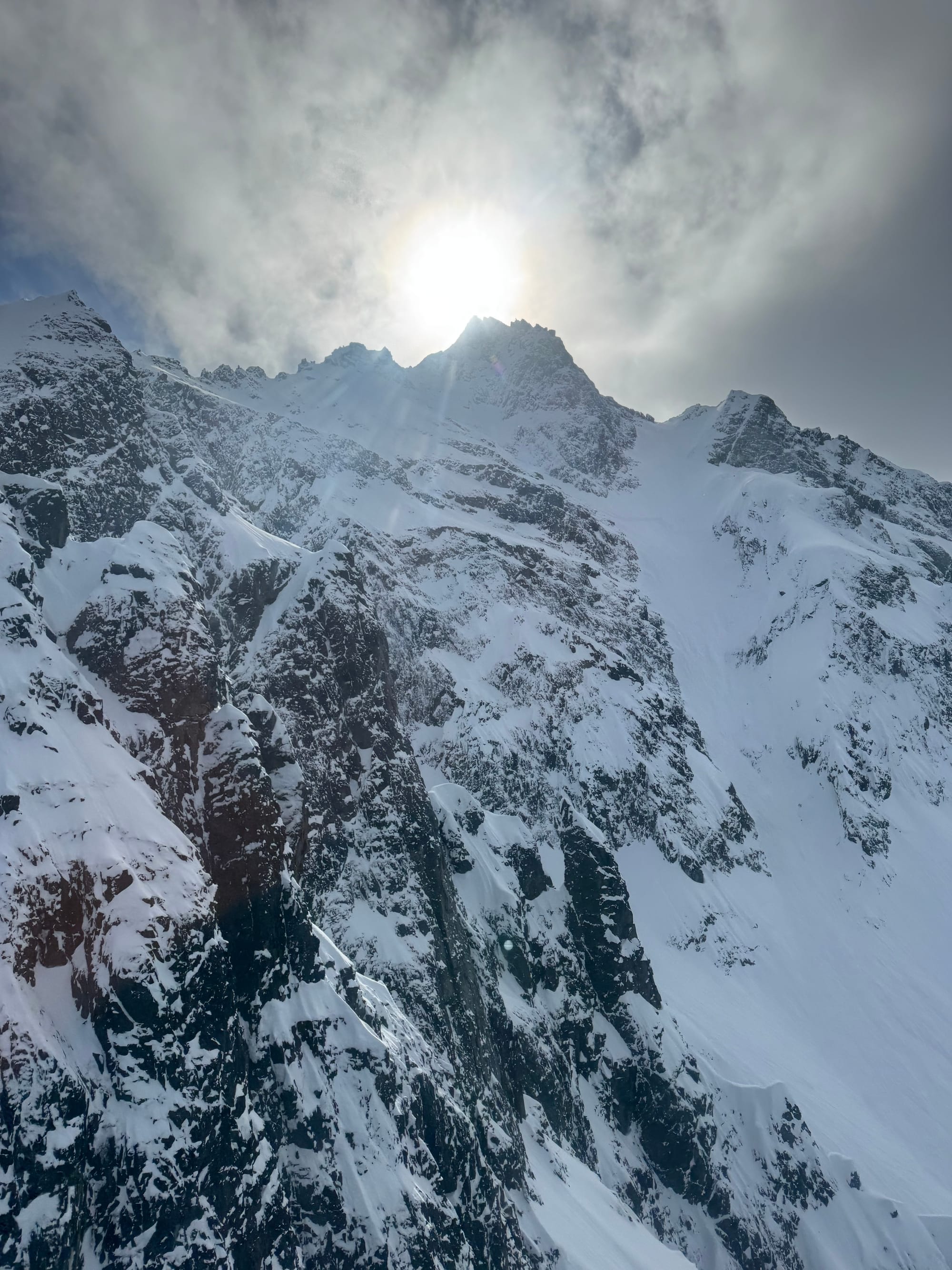
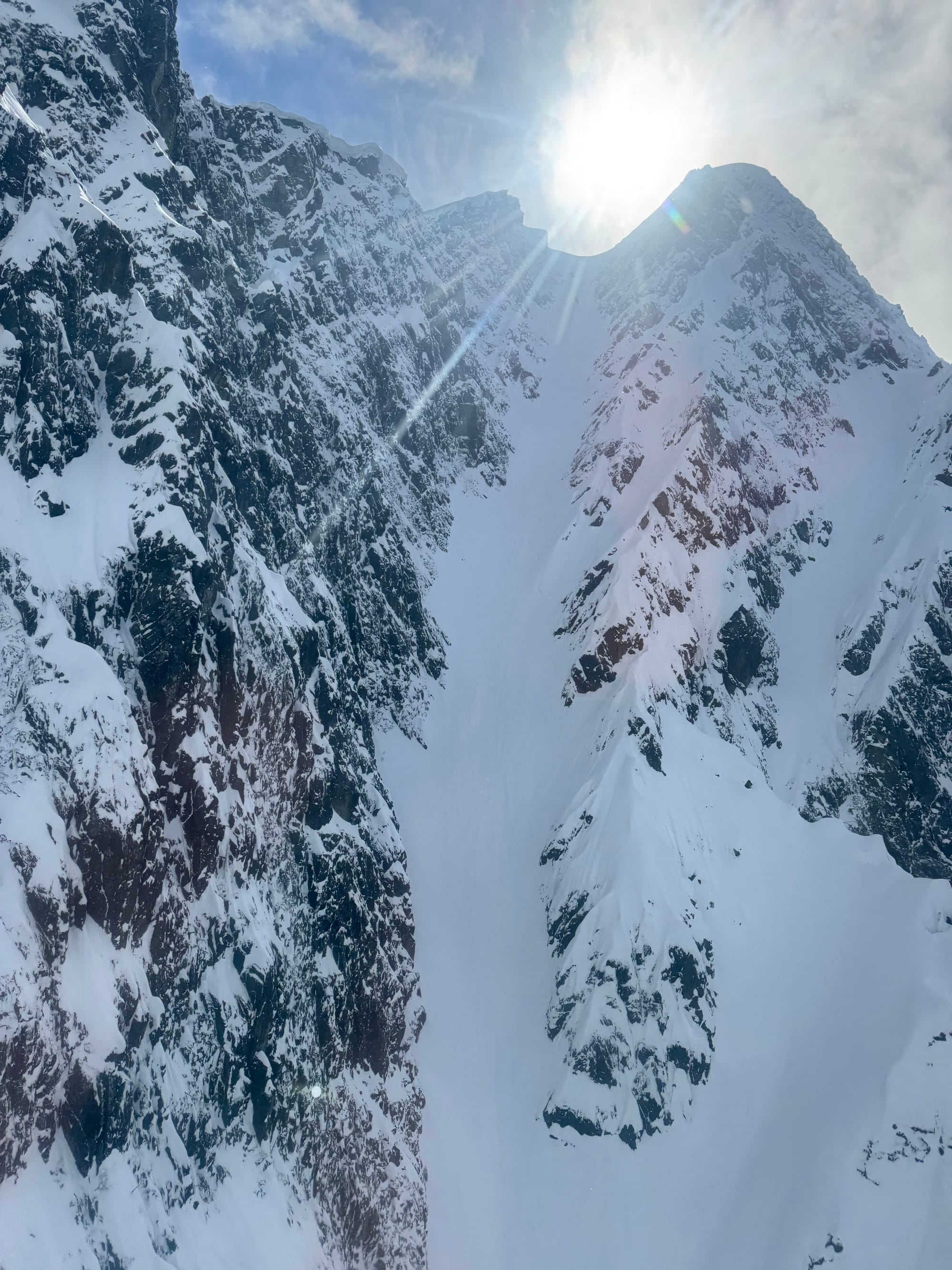
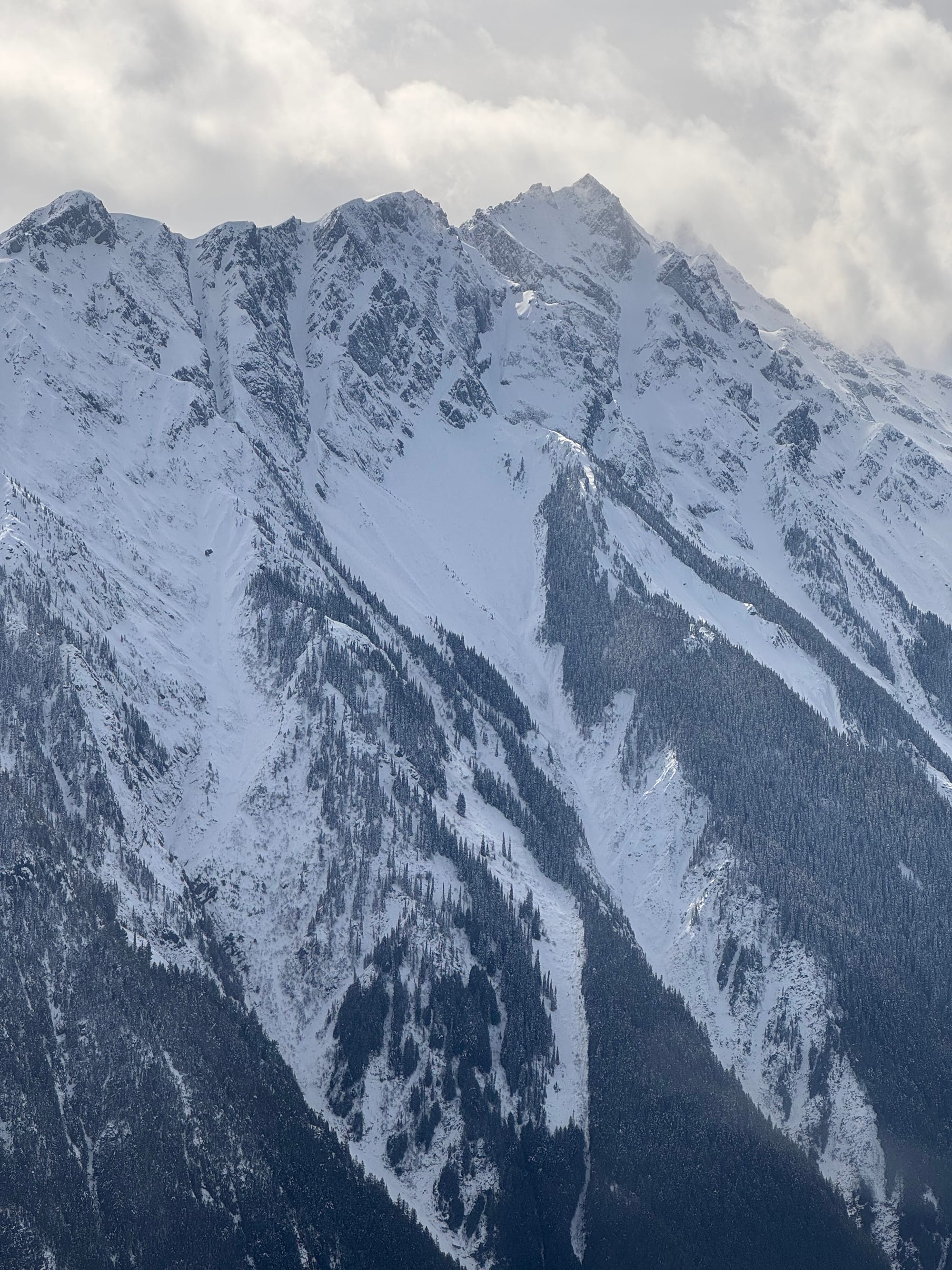
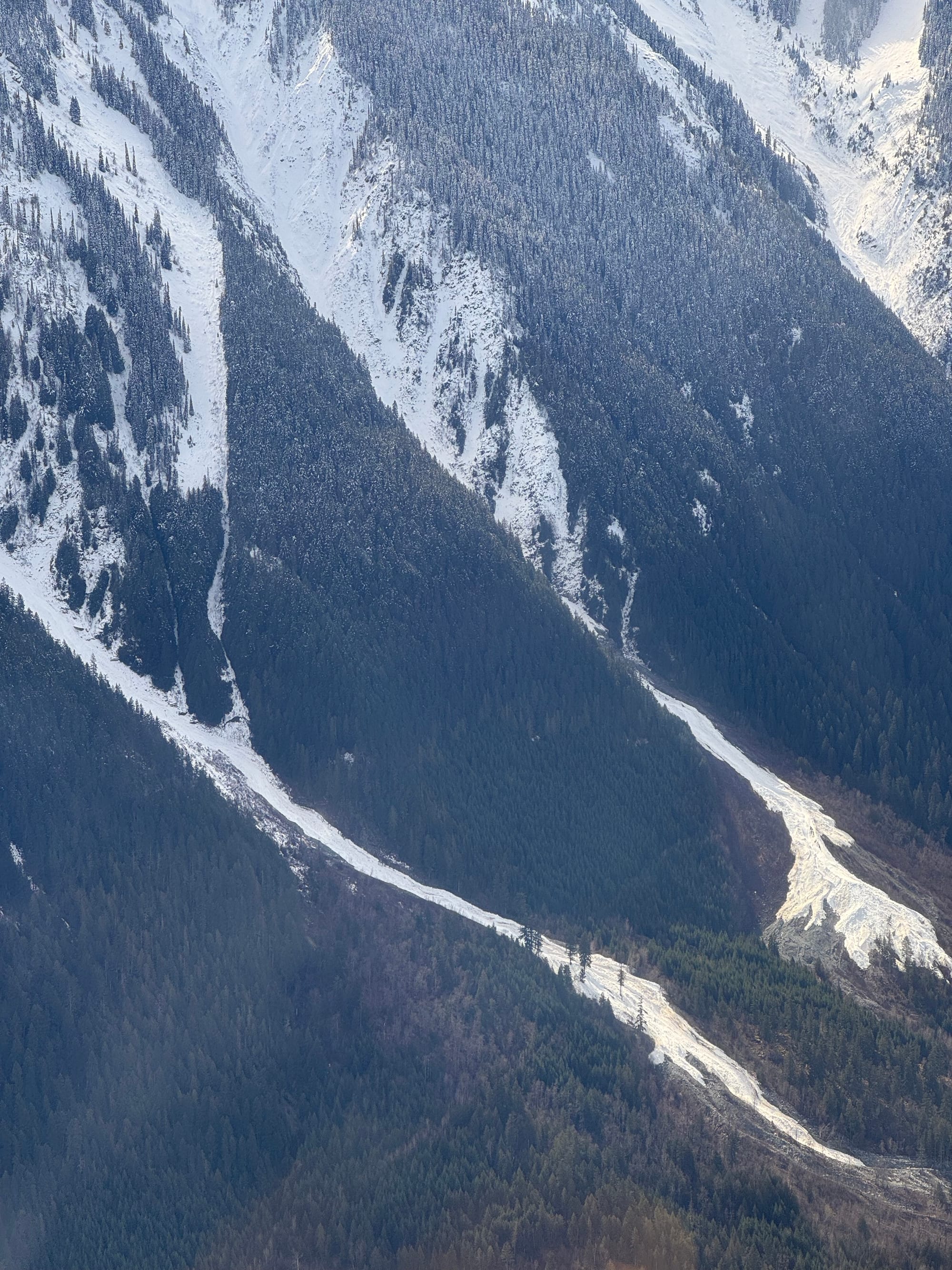
Wondering about Mt. Currie? Pencil and Y (top left) look rocky. Central (top right) looks alright. Both have not huge cornices at the moment. But sadly, the lower portion of the mountain looks grim. The sneak through the forest (bottom left) in the vaguely knife shaped feature looks more like alder than good skiing. The exit into the avalanche path at the bottom (bottom right) has a gnarly glide crack where they come together and the lower track is just debris chunks and no actual snow in valley bottom.
What’s happened since the last update (weather & general snowpack structure):
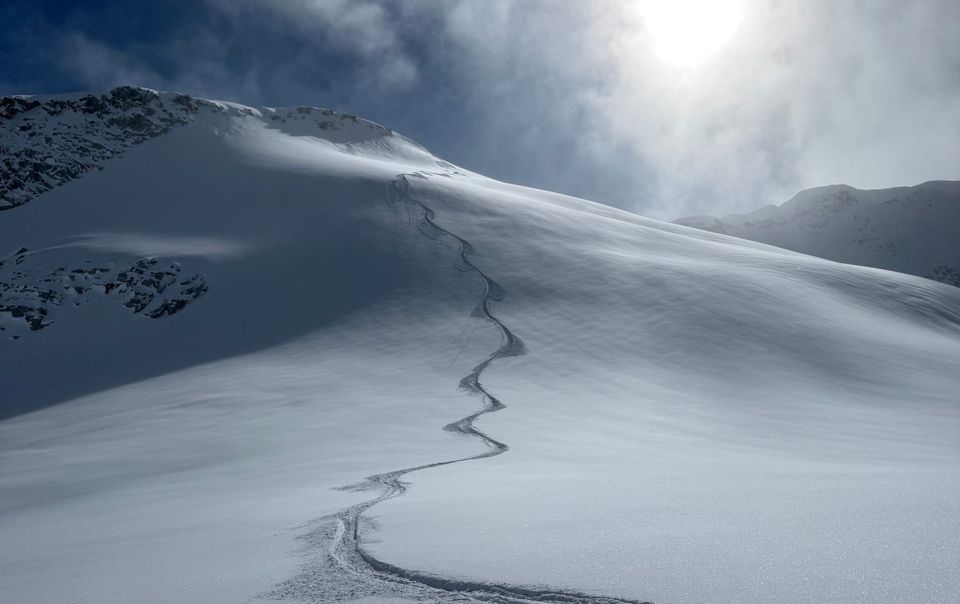
Our storm of the season last week led to some of the best ski conditions of the year. Cold snow at treeline and not super crazy winds made for good stability. Throughout the corridor we were skiing fantastic snow, especially on protected alpine slopes. Some folks were stepping out pretty far pretty quickly, and a few bigger lines got skied. Avalanche activity started strong post storm (Friday the 14th’s Size 3 on Spinal Tap Feature above Circle Lake on Decker!) but tapered off quickly considering the amount of snow that fell. This is likely in part due to the steady nature of the snowfall (no clear weather for weak layers to form), the fast settlement occurring this time of year, and the relative lack of wind.
The major exception is over on the East Duffey. A touring party managed to remotely trigger several large (sz 2.5) avalanches on different aspects in the Steep Peak zone. This was backed up by observations by the MOTI crews monitoring Path 51. These all ran on PWLs from earlier in the season. Hopefully the current storm adds enough load to the snowpack in this area to flush things out but we won’t know until it’s over.
Did the last huge storm cycle work its coastal magic and settle out some layers - or did it clean out some big lines and remove the danger? Some places Eric and Evan ski regularly it was easy to have the observations and confidence in that information. If you don’t have that data then it would have been tough to make those terrain choices with high confidence. Either way, this next pineapple should flush out any snowpack concerns and set us up for a safer spring season…
Overall, from Squamish to Pemberton, we have our new storm snow sitting on 1-1.5m of snow that fell over the past 7 days. This is doing a great job of squishing out the Jan 30/Feb 15 PWLs and these do not seem to be major concerns. The surface snow is currently being redistributed by strong wind.
What’s the weather and avalanche forecast?
The pattern will remain active this weekend with an onshore flow arriving Friday with alpine flurries. The flurries will then gradually taper off early Saturday morning as a weak ridge of high pressure starts to build over the south coast. The next frontal system will arrive on Saturday night with a potent atmospheric river taking aim at the region Sunday into Monday with a steady push of moisture onto the BC coast with soaring freezing levels.
Weather Synopsis:
- Friday: 5-10cm with moderate SW wind. Freezing levels at 800m, rising to near 1300m in the afternoon.
- Saturday: Nil precip with Light to Moderate SW wind. FLs at 600m, rising to near 1300m.
- Sunday: 20-30cm with strong SW wind. FLs at 800m, rising to near 2000m.
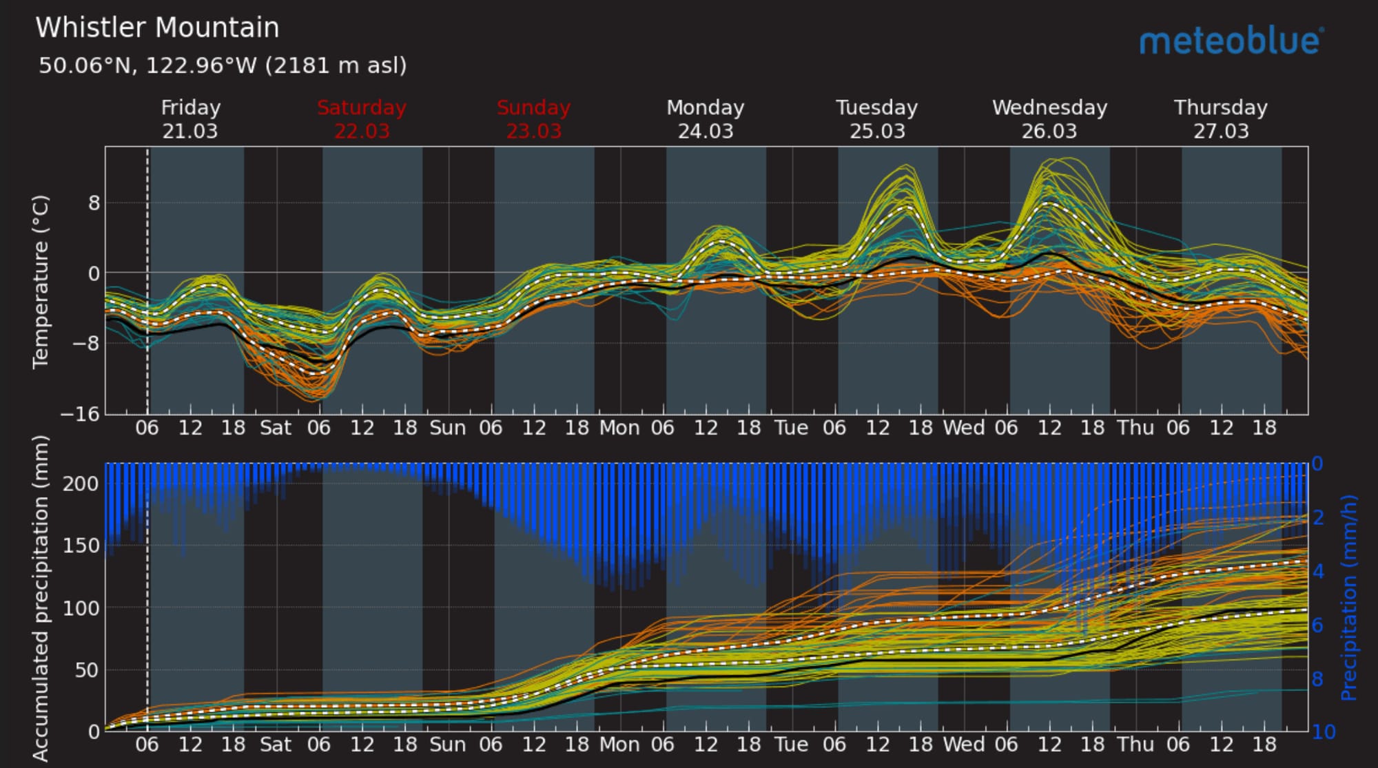
Meteoblue Multimodel for Whistler (L). That’s a lot of precip! Monday might be OK but +8 at 2000m on Tuesday/Wednesday is gnarly. Image of the day (R) is the GeoColor imagery showing the onshore flow push towards the BC coast.
Currently Avalanche Canada has the hazard rated as high in the alpine for much of our region. Storm Slab and Persistent Slab are the major avalanche problems through the corridor. The problem is that no one is very confident where the PS problem starts. It doesn’t seem present in Squamish but as we move north and east, it’s harder to say where it might be. Low probability/high consequence problems are tricky! Much easier right now is the storm snow and how it’s redistributed into storm/wind slab! Manage terrain to avoid these slabs.
Looking further out, freezing levels are set to rise early next week. Monday may stay pretty cool but Tuesday and Wednesday look like they will be at least 2000m. This may or may not be accompanied by a big wash of precip as well. It’s going to plaster our high peaks with snow but the lower elevations will take a hit and skiing will be tough.
What are my questions for the weekend?
- Will this storm be enough to overload the PWLs on the Hurley and east Duffey? 250mm of precip in the forecast for Squamish between now and Wednesday!
- How bad will the warmup be early next week? Right now it looks like Tues/Wed could feature 2000m FLs. Maybe the models will change…
What will I watch out for or avoid completely?
- As the storm is ongoing, I’ll be sticking to the trees and storm skiing as much as I can. I’ll be avoiding big alpine features, especially ones exposed to the wind and wind slab development!
- If the temps spike early next week, I’ll probably avoid avy terrain altogether. This could shape up to be a major spring flush-out. Our snowpack is still decidedly in “winter mode” so a big shift in weather will have bigger consequences than warm temps later in the spring.
- We’re going to be skeptical about big lines and certainly anything further North or East that we’re not confident has slid.
Closing Thoughts:
Get your storm skiing in this weekend before the big warmup but be aware of powder fever. This is a hazardous storm for sure so step out very slowly! The truth of the current scene is its actually the best tree skiing of the entire winter right now! Glades that have not been skiable all season are finally in shape and won’t last long, so get them while you can!
If you’re free on Wednesday the 26th, come join us at SkiUphill for our final snowpack discussion of the season. The evening is a fundraiser for Squamish SAR. We’ll have our usual talk, followed by a screening of Painting the Mountain, and a raffle of some sweet gear!
For more information, check out Zenith Mountain Guides and our local avalanche forecast. Weather forecasts are custom from meteorologist Jason Ross. These updates are supported by SkiUphill Squamish - the best stop for ski touring equipment in the Coast Mountains and made possible by the Sea to Sky Gondola! Use this information at your own risk. Conditions change rapidly from when this report was written!
Member discussion