
May 2 - Sea to Sky Snow Conditions
Overall theme:
Spring is springing fast. There’s still skiing to be found but playing the aspect game is key. Other than VERY high sheltered north, where you’ll find some nice chalky snow, the name of the game is corn skiing and waking up early to time things right.
Where we’ve been skiing:
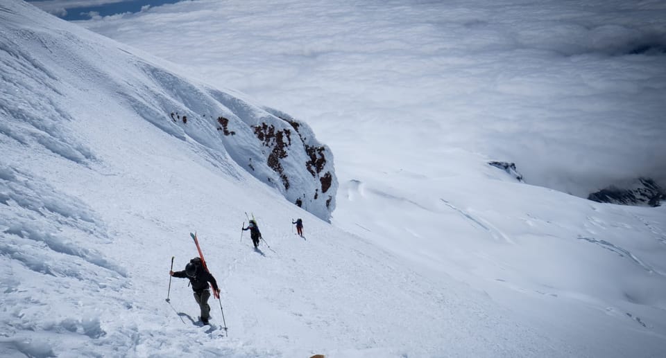
Squamish (Nch’Kay) and Komo Kulshan (Mt. Baker). It’s been hard to resist the pull of the warm valley, especially after getting back from Waddington, but we’ve had a few days out on skis. Trailheads are rapidly melting out. Duffey Lake Road THs are bare at roadside (Joffre Lakes park remains closed). Elfin and Brohm are melting quickly. Blackcomb has a ski-out still (barely) but Whistler is closed and the ski-out is gone. The days of skiing from the car are over and it’s back to carrying skis on the pack for a bit of walking or alternative mechanized methods…
What’s happened since the last update (weather & general snowpack structure):
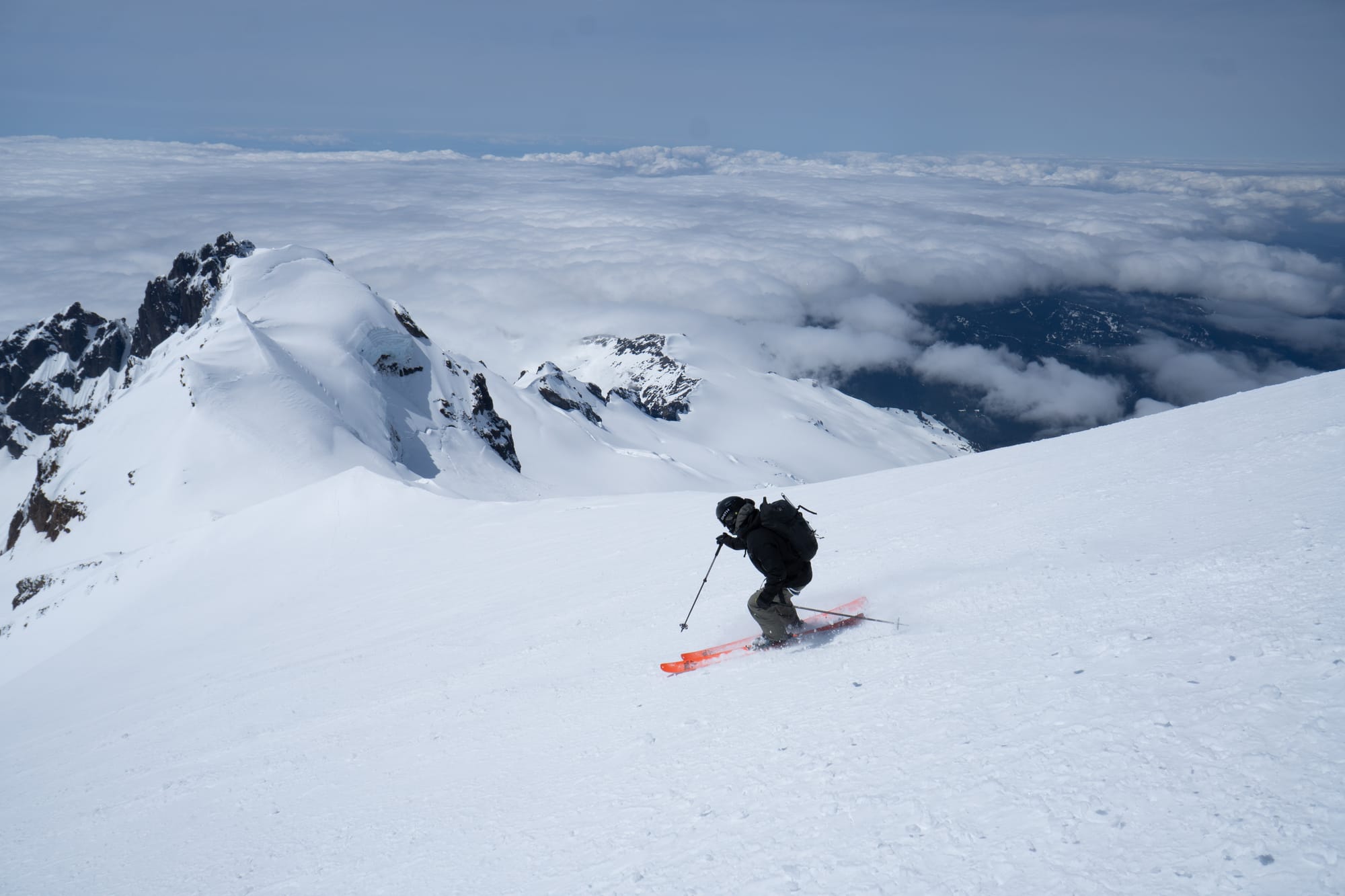
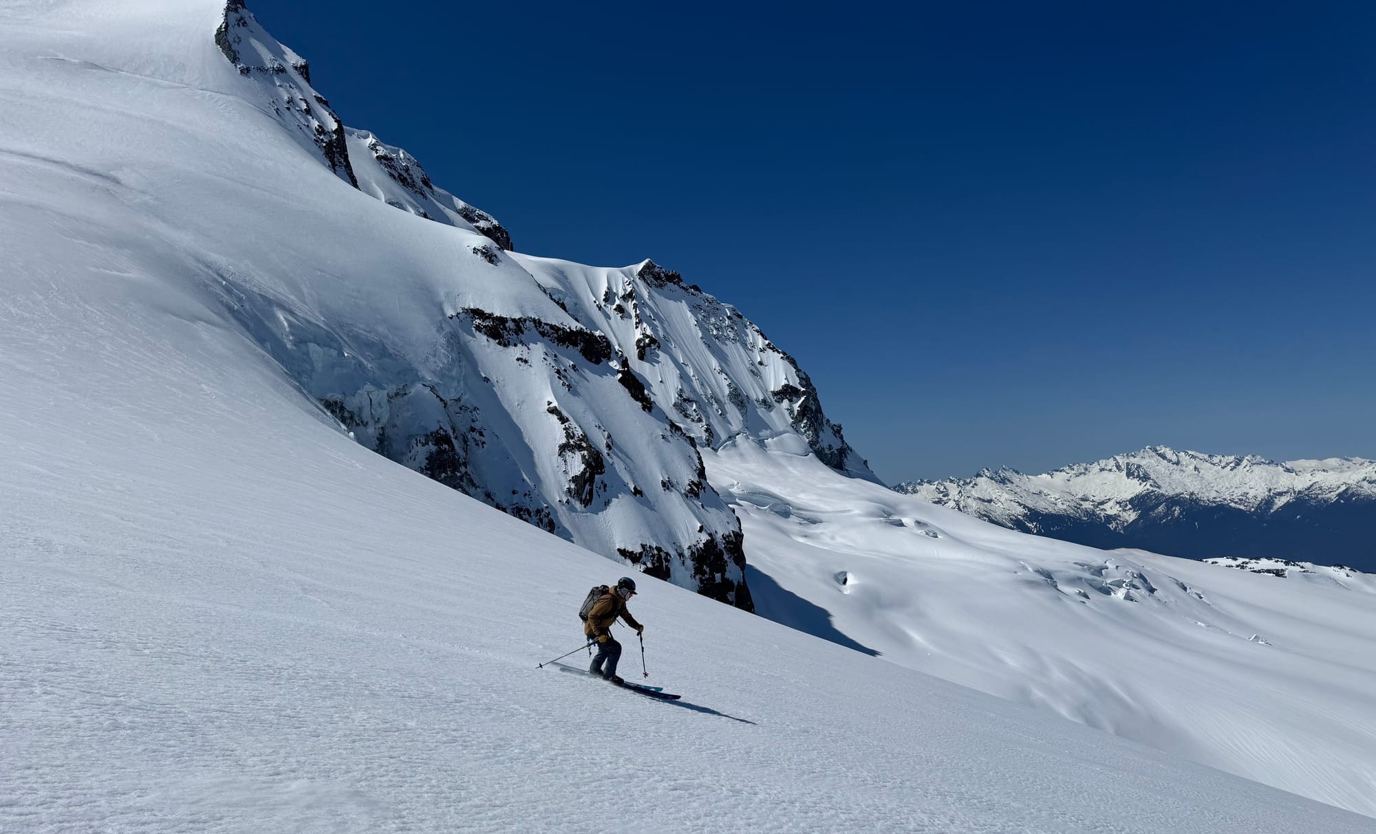
It’s been mostly high pressure since last week but on Wednesday we saw temps spike and stay high overnight. It was clear so radiative cooling helped with some crust recovery but the FL stayed very high and Thursday had lots of wet loose avalanches. Cornice falls are still a big thing. The snowpack itself is now becoming very homogenous with just the surface concerns with daytime warming.
What’s the weather and avalanche forecast?
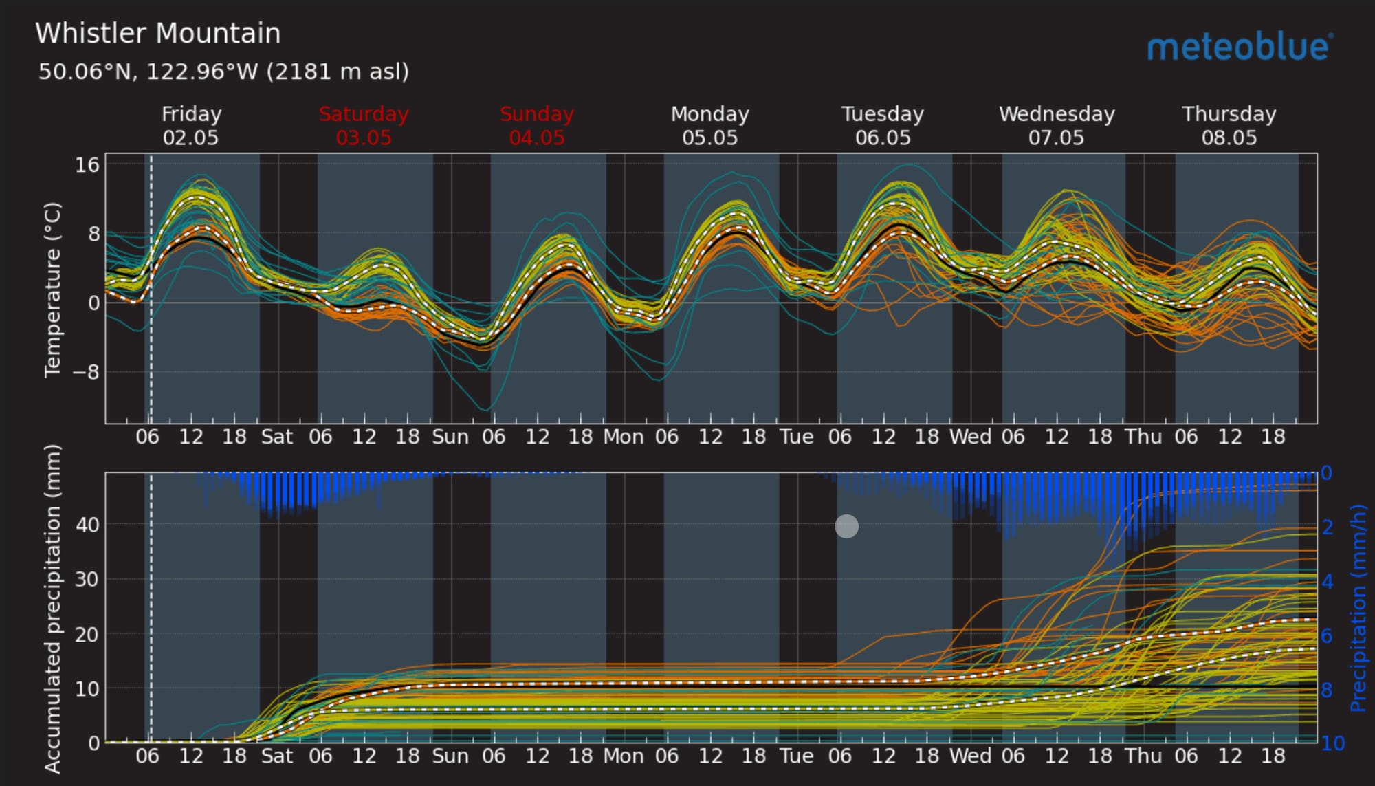
As spring progresses, the sun's angle is becoming more pronounced. High-pressure ridges are intensifying, and weather systems are weakening. A weak system will bring increasing cloudiness and a chance of showers from Friday evening to early Saturday morning as freezing levels drop back below 2000m though only 2-4mm of precip are expected. Another ridge of high pressure will begin to build into the area on Saturday afternoon, leading to an extended period of drier, warmer conditions from Sunday to early next week. The next system is expected to approach the area around midweek.
Avalanche Canada is no longer producing forecasts but their “spring diurnal” messaging is very appropriate. Wet loose avalanches are the primary concern. You might find a bit of windslab up high, especially after some convective storms but they are small. A bigger concern to me is cornices that are still fat in some areas. A large cornice fall earlier this week pulled out a 3+ meter crown slab on the Sharkfin on Brohm Ridge. Large cornice triggered avalanches are visible across the valley in the Tantalus Range.
Use smart spring travel techniques! Keep your antenna up for when freezing levels go way above mountain tops and we stop having overnight re-freezes.
What are my questions for the weekend?
- Will we see any significant precip this weekend? Doesn’t really look like it…
- Will next week’s high pressure get pushed out mid-week or will we have an extended period?
What will I watch out for or avoid completely?
- Give cornices a WIDE berth, especially with warming temps.
- Watch for nights without an overnight refreeze!
Closing Thoughts:
There’s still some awesome skiing to be found. Take advantage of fast travel when the snowpack locks up and time the skiing with softening!
For more information, check out Zenith Mountain Guides and our local avalanche forecast. Weather forecasts are custom from meteorologist Jason Ross. These updates are supported by SkiUphill Squamish - the best stop for ski touring equipment in the Coast Mountains and made possible by the Sea to Sky Gondola! Use this information at your own risk. Conditions change rapidly from when this report was written!
Member discussion