
Nov 13 - Sea to Sky Snow Conditions
Overall theme:
The snow gods giveth and the snow gods taketh away. Perhaps we stoked the FOMO fires too hot and that’s what sent freezing levels to the roof. We may never know for sure. What we do know is that it’s raining. It’s been raining. And it’s gonna keep raining for a bit.
In the gloomy meantime, there is a beacon of hope. Light in the darkness:
Our season opener party is happening on November 30th! Yes, that's a Sunday. We know. Zenith is partnering with SkiUphill for another year to offer you in-person snowpack discussions throughout the year - starting with this opening party, hosted by the Sea to Sky Gondola!
So grab a ticket at the link below and read all the details. We’re showing Blank Collective’s new film Cold Calls (starring local all around good dude Tom Peiffer), we’ll have some discussion and Q&A, and a raffle of sweet prizes. ALL proceeds will be donated to Squamish SAR so get your ticket ASAP - we expect them to sell out again quickly like last year!
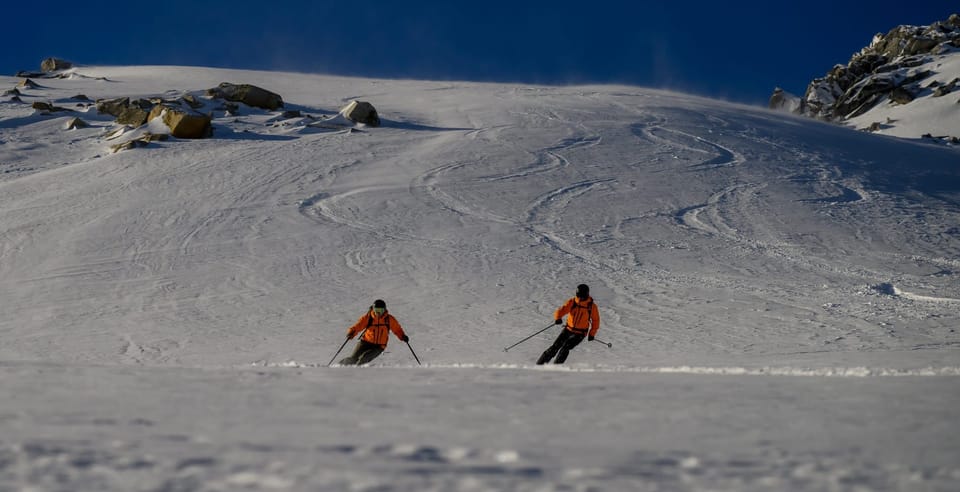
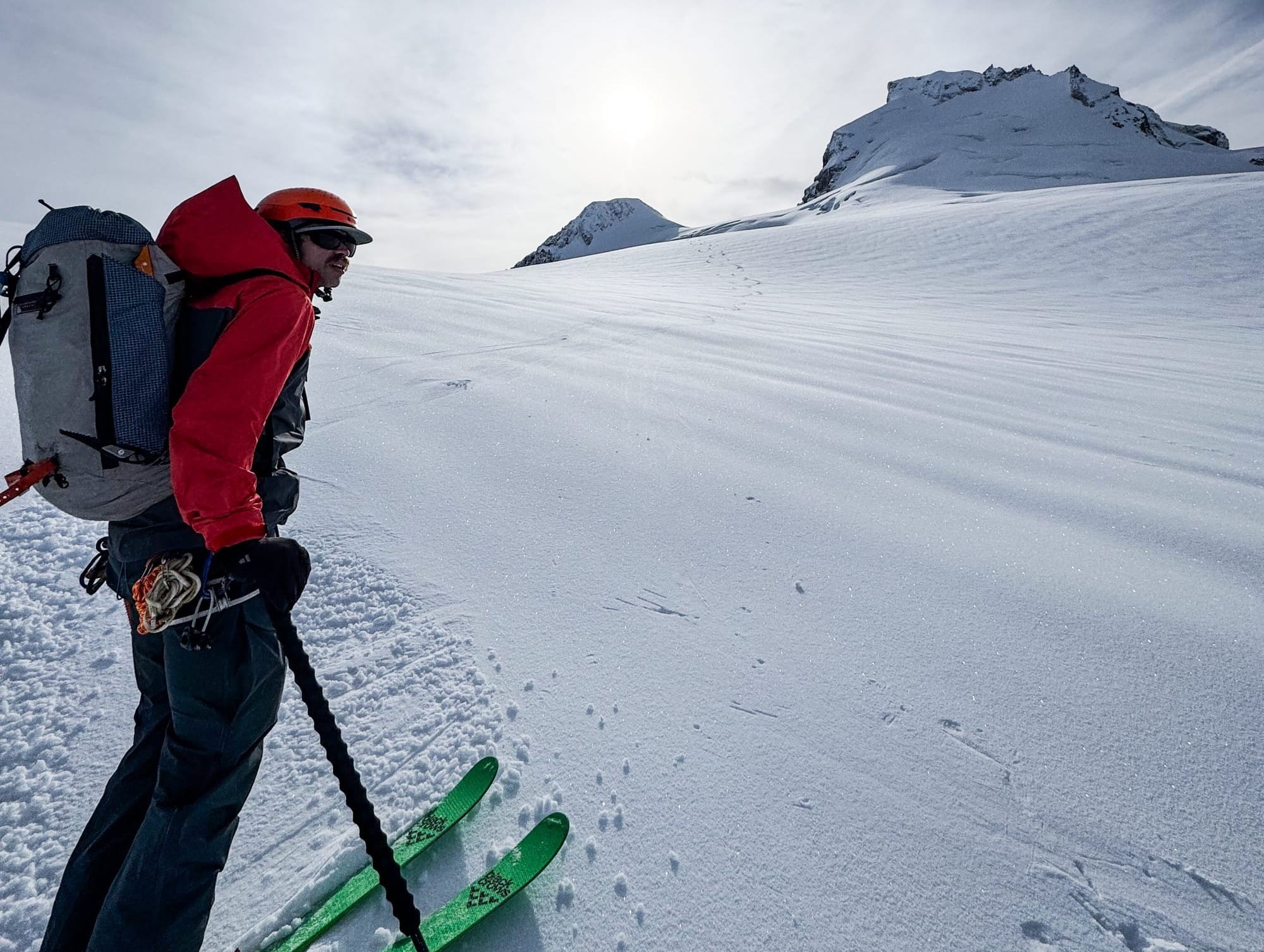
Where we’ve been skiing:
We got up in the Currie area and on the Place Glacier at the end of the weekend and then Eric snuck in a day on Nch’Kay (Garibaldi) during a mid-week lull but it’s been a grim week overall. Skiing up north was decent but by mid-week, snow quality had deteriorated at all elevations and developed a significant crust. At Brohm, the snow line has pulled up almost to the yellow gate and the road remains rocky until the snowmobile cabin at 1500m. I would imagine this means it’s no longer skiable to the road at Metal Dome and nearly to the hut at Red Heather.
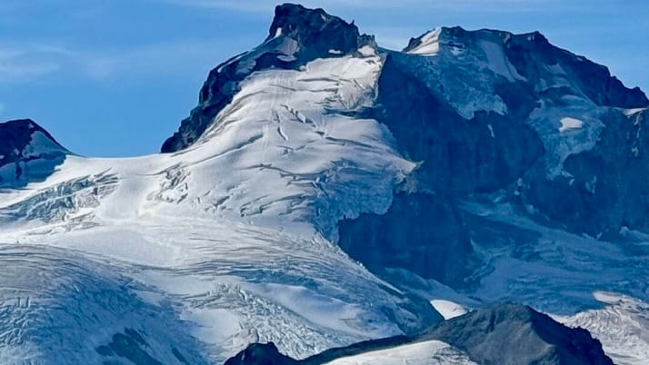
One thing of note is that the normal bergshrund on the NE Face of Garibaldi seems to have disappeared. It’s usually quite large this time of year and while there’s some big crevasses below, the shrund isn’t there.
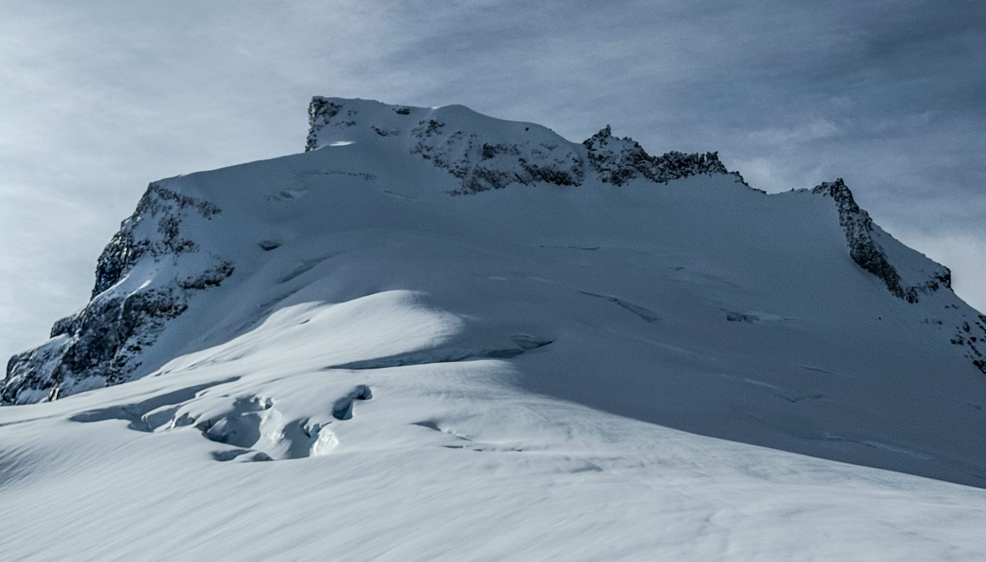
A photo taken in September makes it look like the permanent ice on the upper portion of the face has fallen away, leaving just a moat that will fill in rather quickly. As faces continue to lose their permanent ice, they will become steeper and also require more snow to fill in rock bands. Thanks to Russ F for the photo.
What’s happened since the last update (weather & general snowpack structure):
Very little avalanche activity has been observed in the corridor as it generally seems to be happening during periods of rainfall. That being said, we observed several old avalanches including wet loose slides on solar aspects throughout the corridor and a large slab avalanche on the west face of Dalton Dome. Additionally, glide cracks are forming on slopes with minimal anchoring.
As expected, Place had the least snow of the areas we visited. Here’s some snow depth numbers:
- Place Glacier (1900m) HS = 100cm
- McWaltz Glacier on Currie (1900m) HS = 150cm
- Warren Glacier (1950m) HS = 195cm
- Tent-Garibaldi Col (2350m) HS > 300cm
On Wednesday, we dug a small pit at 1960m on the Warren Glacier and found a 25cm melt-freeze crust that was difficult to penetrate. Below, was progressive density, moist and rapidly rounding snow.
What’s the weather and avalanche forecast?
An active weather pattern is forecasted to continue through the weekend, with a series of systems expected to produce snow in alpine areas and rain in lower elevations. The first weak impulse will arrive later Friday into Saturday morning, bringing light precipitation, while the second impulse will arrive Sunday into Monday. This system will bring rising freezing levels, moderate to heavy rain in lower elevations and snow in high alpine areas. Early next week, temperatures are expected to cool, and freezing levels will decrease.
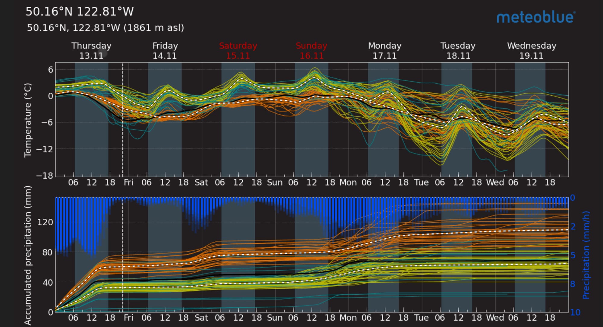
- Friday: Southwesterly 20 gusting 50 km/h with FLs near 1000m, rising to 1400m and no precipitation.
- Saturday: Southwestlery 20 gustling 50 km/h with FLs rising to near 2000m and 6-12cm by 4am.
- Sunday: Southwesterly 40 gusting 60 km/h with FLs near 2000m and 15-25cm over the high alpine.
We could be in for a surprise with this system as the models are struggling with the specifics regarding the position of the low pressure system and the precipitation amounts. Early season conditions could produce.
Avalanche Canada has not started issuing forecasts yet however the warm temperatures and rain will keep the possibility of wet loose avalanches on our minds. As cooler temps arrive and the surface freezes, slide-for-life hazard may be more of a concern than avalanche hazard. Hopefully, the transition to snow occurs slowly allowing time for a bond to form between the old surface and new snow. A snap freeze with precip on top will give us a serious layer of concern! When the weather does clear up, treat the new snow with suspicion, especially if you find a strong bridging crust below.
What are my questions for the weekend?
- Will we see a dip in freezing levels as the storm finishes or will we see the precip stop before freezing levels drop?
What will I watch out for or avoid completely?
- With snow levels higher on the mountain, it’s harder to get on skis. We’ll be waiting a bit to get on snow.
- Wind slabs may be a concern if the storm finishes cold.
Closing Thoughts:
It’s ok to embrace the seasonal depression. Eric is jumping ship on the Coast and heading to the Rockies to ice climb so you know it’s desperate. It will get better though, and in the meantime, you can get your boots punched at SkiUphill, renew your Sea to Sky Gondola Pass, and nerd out on YouTube videos.
Don’t forget your Snowpack Party ticket!
For more information, check out Zenith Mountain Guides and our local avalanche forecast. Weather forecasts are custom from meteorologist Jason Ross. These updates are supported by SkiUphill Squamish - the best stop for ski touring equipment in the Coast Mountains and made possible by the Sea to Sky Gondola! Use this information at your own risk. Conditions change rapidly from when this report was written!
Member discussion