Nov 27th - Sea to Sky Snow Conditions

Overall theme:
Funny times…
Where we’ve been skiing:
Blackcomb, Squamish Valley, reports from up north. High planar glaciers have been the best skiing!
Current skiable snow line around Squamish is ~1450-1550m, while up on the Duffey it seems to be a bit higher. This means most trailheads require some walking - including classics like Red Heather. Thursday’s snowfall was down to 850m at times and may make some of our high road access areas like Brandywine quite tricky. Still the guiding principle is to use easier summer access like trails and roads to get to the good skiing which is mostly above 1900m.
Whistler-Blackcomb continues to open terrain however a ski out doesn’t exist yet! If you drop into Blackcomb Glacier, you must climb back out to regain Jersey Cream or plan for the long walk down the rescue road to the base area…
What’s happened since the last update (weather & general snowpack structure):
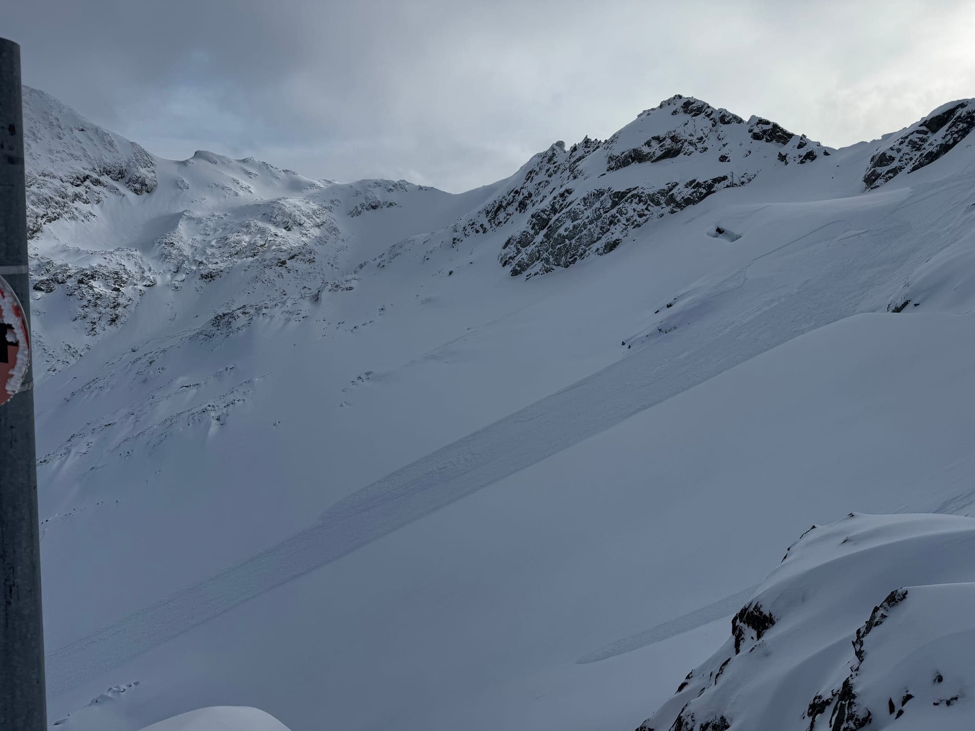
Things are improving but it’s still tricky. Not as grim as last week as we’ve had a few storms that totalled up to 20-40cm of new snow on last week’s crust. This has been accompanied by winds so wind slabs have been on our mind. Temps have stayed cooler with the freezing level in the magic 800-1200m range. High pow skiing has been decent!
Whistler-Blackcomb managed a few explosive controlled avalanches over the weekend but other than that it’s been pretty quiet. A large remote trigger was reported on the MIN on a wind loaded pocket near Motel 66 early in the week. We also heard a report of an avalanche in the Rethel Couloir early in the week but no details. In short, it’s been pretty quiet but there are wind slabs lurking!

What’s the weather and avalanche forecast?
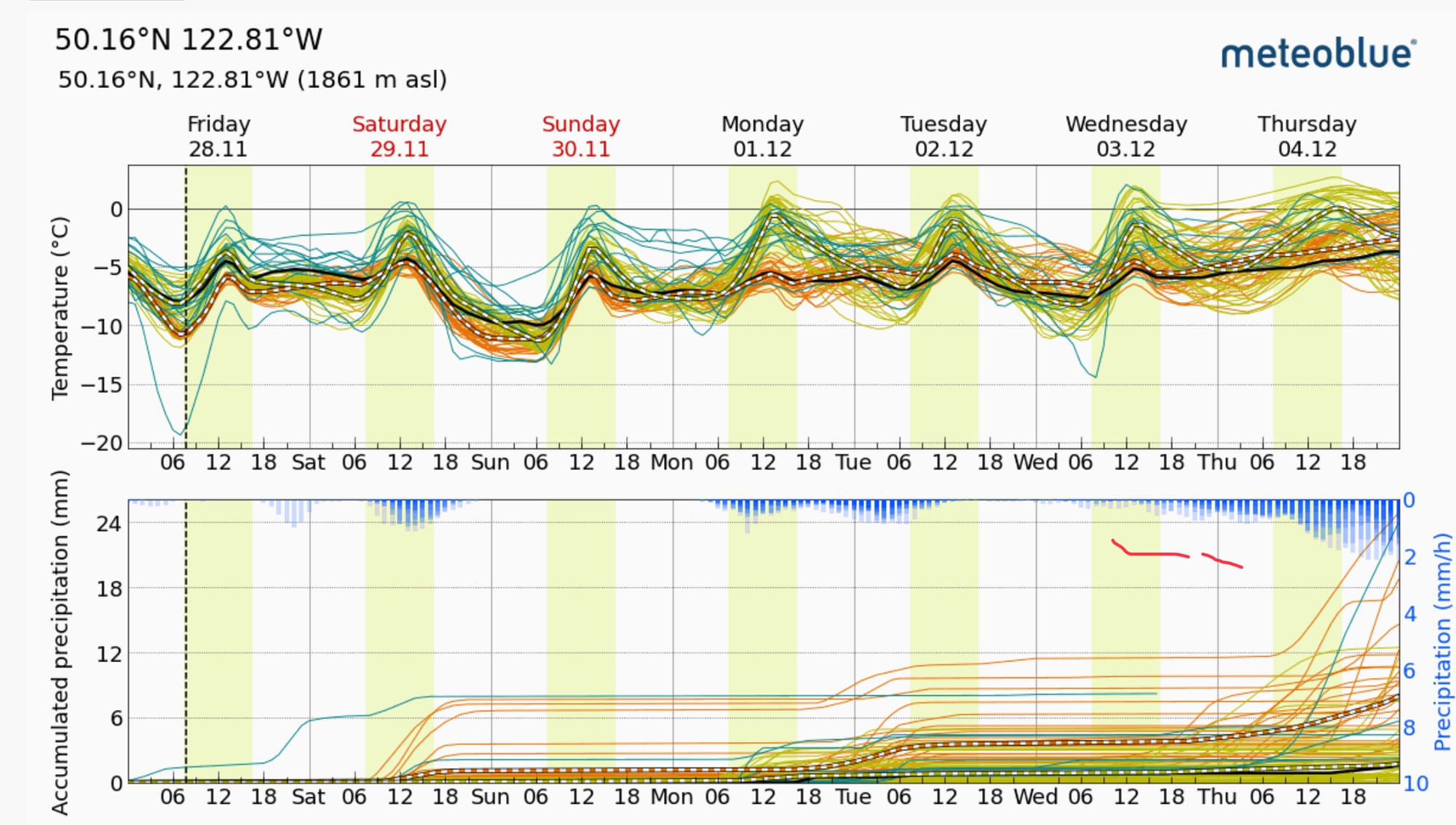
A high-pressure ridge situated over the northeastern Pacific will bring drier conditions to the Sea to Sky region on Friday, persisting into the latter part of the weekend. A weak system may bring a chance of flurries on Saturday. High pressure will rebuild on Sunday, resulting in drier conditions.
Wind speeds:
- Friday: Light to moderate Northeasterly 20 gusting 50 km/h.
- Saturday: Light Southwesterly gusting to 30km/h
- Sunday: Light Northerly 20 gusting 40 km/h
Freezing Levels:
- Friday: 700m rising to near 1000m
- Saturday: 700m rising to near 1000m
- Sunday: Near 300m rising to near 800m
Precipitation:
- Friday: Nil
- Saturday: Trace to 5cm
- Sunday: Nil

Avalanche Canada is back to forecasting for the South Coast! With minimal precip expected through the weekend, the forecast is trending down. There’s still going to be pockets in areas with lingering wind or storm slab. Given the early season conditions, a slide that might be a non-issue mid-winter might have serious consequences this time of year!
What are my questions for the weekend?
- How well is the new snow bonding to the old crust? Seems to be holding together now but early in the week explosive control got some results. Facting is happening on this layer with the clear cold weather.
- How high can I drive now that roads have been dusted pretty low?
What will I watch out for or avoid completely?
Anything that might be holding on to a nasty windslab, especially if it sits over early season terrain traps like rocks, crevasses, cliffs, etc…
Closing Thoughts:
Conditions are improving and skiing up high is quite nice! Enjoy the high pressure - who knows what’s on the horizon! See you Sunday night at the season opener party at the Sea to Sky Gondola!
Next week‘s high pressure looks good for getting a bump into the high alpine. Tantalus drop perhaps? If you’re interested in getting some early season glacier turns with us up high, send us a note at zenithmountainguides@gmail.com!
For more information, check out Zenith Mountain Guides and our local avalanche forecast. Weather forecasts are custom from meteorologist Jason Ross. These updates are supported by SkiUphill Squamish - the best stop for ski touring equipment in the Coast Mountains and made possible by the Sea to Sky Gondola! Use this information at your own risk. Conditions change rapidly from when this report was written!

Member discussion