
Oct 30 - Sea to Sky Snow Conditions
So - here at Zenith, we don’t like to toot our own horns too much but dang we were pretty on the nose with that last newsletter… And just kidding! We love horn tooting! Hopefully we keep our streak going here.
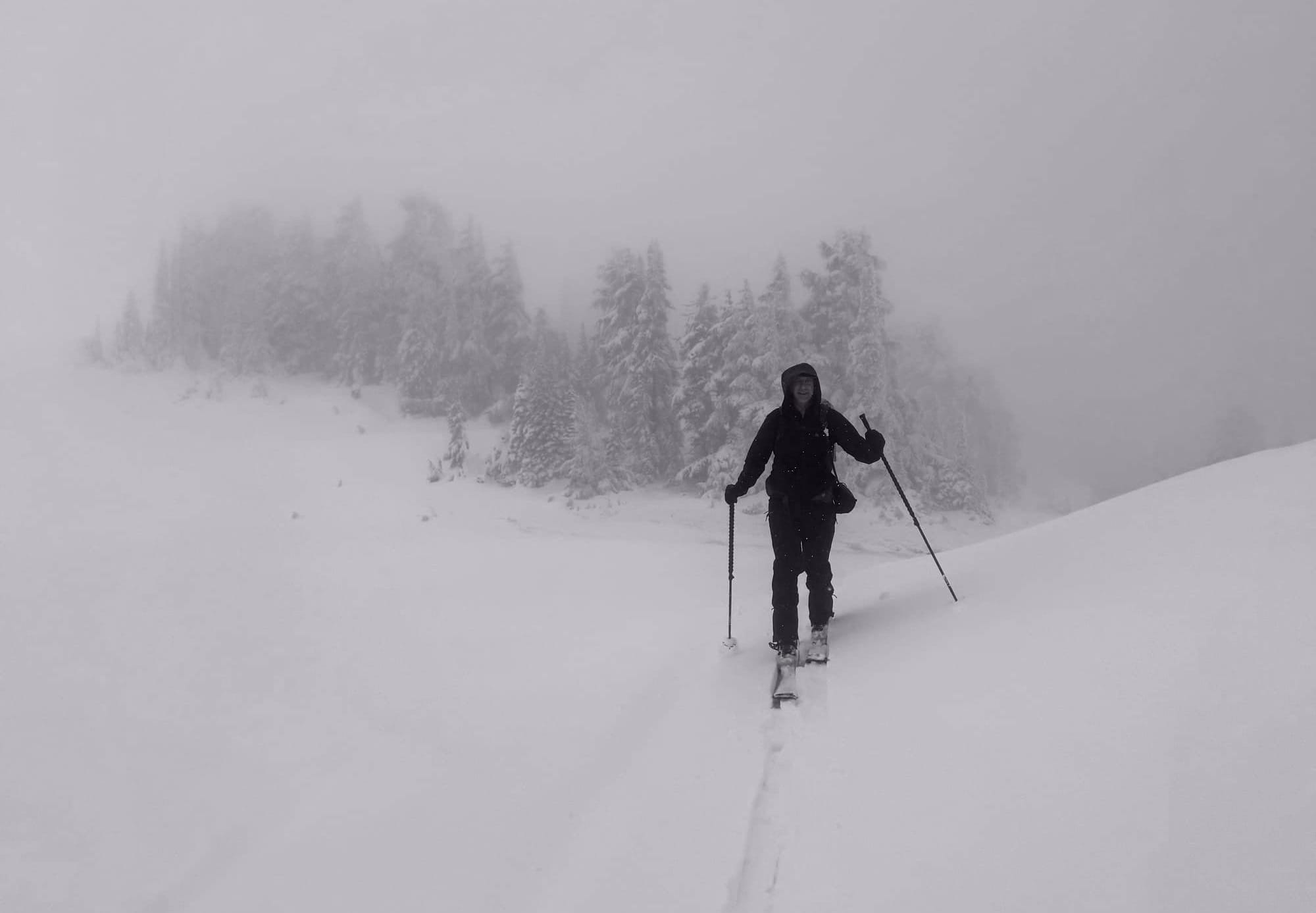
Are you getting ready for that first ski day of the season? Check out our Zenith Checklist for day one. It will keep you from doing that drive home of shame when you forget your skins!
Ok - on to the report…
Where we’ve been skiing:
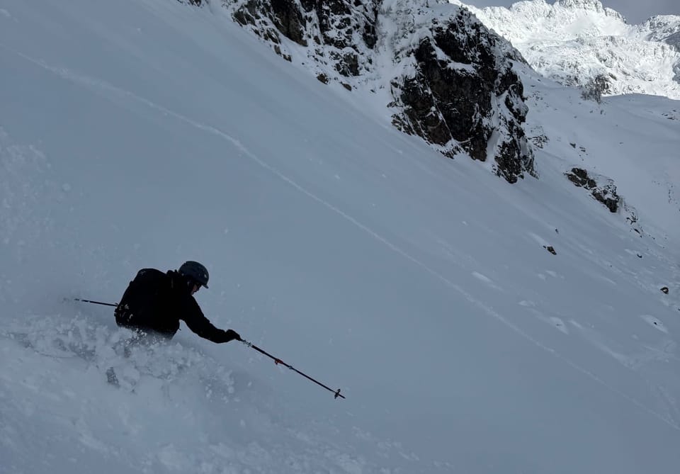
Evan is still down in Vegas but Eric has been out a few days in the Squamish/Whistler zone. There’s several spots in the corridor where it’s possible to drive to the snow line (about 1250m) and skin from the car. With freezing levels fluctuating between 1200m and 1800m, low elevation snow is definitely sloppy. Things improve rapidly however above 1500m.
What’s happened since the last update (weather & general snowpack structure):
With the high winds in the alpine, it’s hard to imagine there was not avalanche activity in the big mountains however we only observed pinwheeling. There is one MIN report of a size 1 avalanche near Whistler that ran during the storm.
At treeline (1750m) in Squamish, Wednesday’s storm dropped 20-30cm of new snow. The storm started colder than it finished so this new snow is moderately “upside down”. Strong winds stripped windward SE aspects and deposited it on NW (Atwell Peak had an incredible “flame” off the summit on Tuesday due to windblown snow). This all sits on a suncrust that formed Sunday and Monday. The total height of snow is ~80cm. At TL elevation, the entire base is relatively saturated and heavy. Good base building snow!
On the East side of the Duffey we hear it’s pretty thin with 35cm at TL and 50cm at ridge-top near Blowdown.
What’s the weather and avalanche forecast?
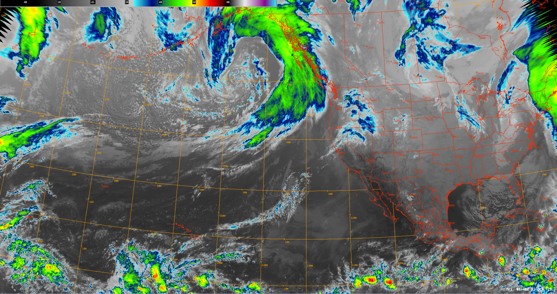
A strong frontal system is anticipated to impact the BC coast on Friday, persisting into Friday evening, with gusty winds conditions, moderate to heavy precipitation, snowfall for highest alpine peaks, and rain for lower elevations. The precipitation will gradually ease to showers by Saturday afternoon. The freezing level will rise to approximately 2500m with this storm, subsequently lowering to 1500m by Saturday morning. A weak ride of high-pressure will bring intermittent breaks in precipitation on Sunday.
- Friday: Extreme SW winds 50 km/h gusting 100 km/h over the peaks. FL: 2500m lowering to 1500m by evening behind the front. No precip.
- Saturday: Extreme SW 50 km/h gusting 100 km/h Saturday morning, easing to 20 km/h gusting 60 Saturday afternoon. FL: 1500m rising to 2200m. 40-60mm precip Squamish area, 30-40mm Whistler area by Saturday morning at 5 AM
- Sunday: Moderate SW 20 km/h gusting 50 km/h. FL: lowering to 1000m. 16mm precip Squamish area, Whistler 15mm area, 17mm Callaghan by Sunday morning at 5AM
In short - freezing levels will be high as the storms arrive but then fall closer to 1000m behind each wave.
Avalanche Canada has not produced a bulletin yet but don't forget you can still check out their reduced Mountain Weather Forecast. Even without a bulletin, several avalanche problems may present themselves. If FLs spike and we see rain in the alpine, wet loose slides will be almost certain. We saw small wet loose releases with sun effect earlier in the week at lower elevations. Rain will do the same up high.
As snow continues to stack up, the accompanying winds are ideal for creating wind slabs. If you’re hitting any of the more classic early season couloir lines from the bottom-up, they could be ripe for wind slab. When we get short clearing windows to explore, my guard will still be way up given the high consequence of an early season slide.
What are my questions for the weekend?
- How much snow will we lose with Friday/Saturday’s rain? We may see snowline creeping back up and previously snowy roads washing off. Coverage at mid elevations (~2000m) might become thinner and again rockier.
- How much snow has fallen in the high alpine? There have been very few true alpine observations. Some of the bigger alpine lines might be accessible and skiable but overall coverage is still thin!
What will I watch out for or avoid completely?
- I won’t be going out while it’s raining mid-storm. This is asking to find wet loose avalanches and storm slabs. Our current snowpack is quite dense so it settles quickly. I’ll be waiting for storms to pass - hopefully being pushed out by cold fronts - before I get in the hills. This might mean waiting until we get another pulse of snow next week.
- I’ll be looking for wind blown aspects for a deeper snowpack.
- I’ll probably be sticking closer to Squamish than Pemberton. Coastal precip totals have been considerably higher than inland. That being said, more inland might have cooler freezing levels!
Closing Thoughts:
Chasing early season skiing is a blast but it’s important to go with low expectations and a low threshold for turning around! Get the gear out, make sure your systems are dialled, and then enjoy a few turns. I’m not holding my breath for this weekend but if FLs are magically a little lower than expected, we could be in business. If not, we‘ve got promising weather incoming next week.
If risking your bases and knees doesn’t sound like a good time, that’s fine! Wax the skis and watch the weather forecast with the rest of us! Either way, take a moment and sign up for one of our avalanche refresher days so your companion rescue skills are dialled!
For more information, check out Zenith Mountain Guides and our local avalanche forecast. Weather forecasts are custom from meteorologist Jason Ross. These updates are supported by SkiUphill Squamish - the best stop for ski touring equipment in the Coast Mountains and made possible by the Sea to Sky Gondola! Use this information at your own risk. Conditions change rapidly from when this report was written!
Member discussion