
Should I be waxing my skis for this weekend??
Eric here while Evan is down climbing in sunny Las Vegas. If your algorithm is anything like mine, you've been getting hit with a bunch of images like this accompanied by clickbait headlines: "storm of the century that's going to drop feet of snow over all of the mountain west" (and if yours is like Evan's algorithm, it's that plus ads for hair loss solutions).
Before we go on though, help us out a little - forward this email to a friend and tell them to sign up! Thanks!
Obviously it's the time of year where we start to pay a little closer attention to this stuff so I reached out to our local meteorologist Jason Ross to answer the question:
Should I be waxing my skis for this weekend?
First, Jason gave the answer that I expect from all meteorologists when we ask for specifics: "the models have a lot of uncertainty with this one".
Well that's fair. But still - I want to be ready if it's go time. Luckily we dove a little deeper into the data. Read on if you want the deep dive. This is a bit of a preview for what some of you will see at Jason's sold out SkiUphill presentation next week!
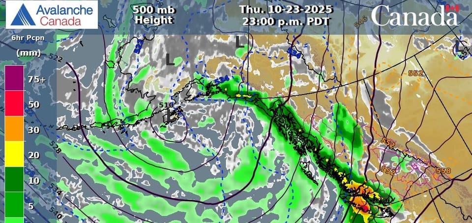
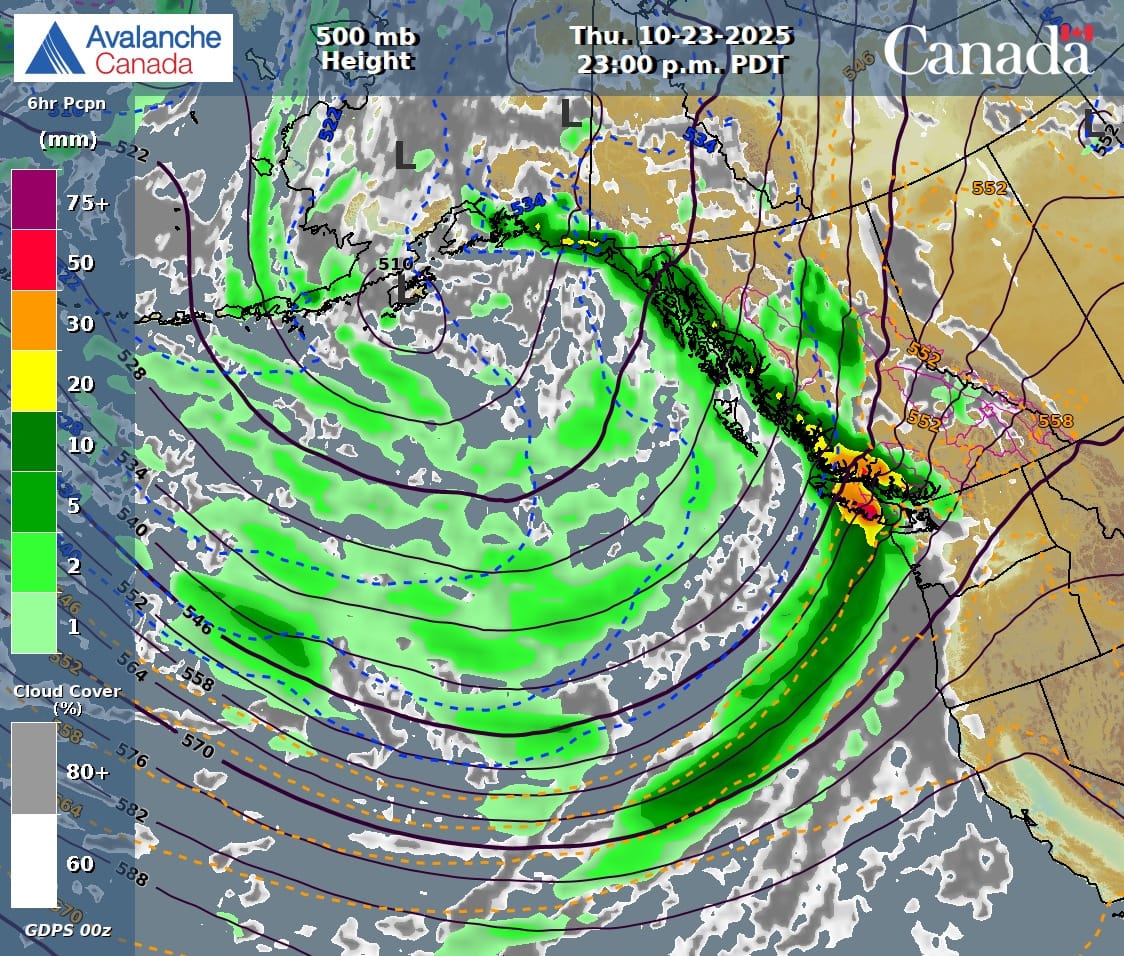
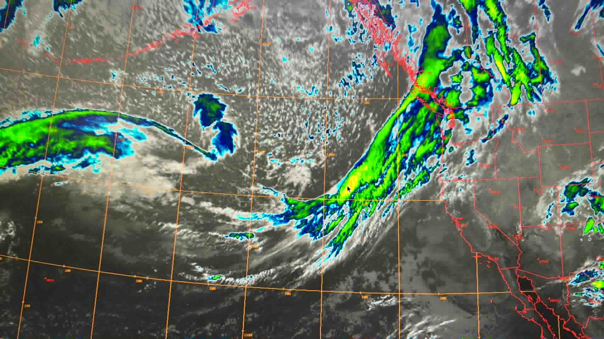
First - looking at the big picture weather maps, there's no question a strong storm is headed our way. This image shows us getting slammed by an atmospheric river with the bulk on Friday. Some variation of this image is what's being spread around social media.
Second - we take a look at different locations around the South Coast. You've heard us talk about this before where areas closer to the ocean are wetter with more precip while further inland sees less precip but colder temps (so maybe more snow). There's usually a sweet spot in the middle where the most actual snow falls. At the moment, this difference in precip is pretty dramatic - for example the current run of Canadian models has >140mm of precip falling in the Tantalus but only 41mm falling at Whistler Blackcomb. That's a huge difference! It tapers off even further as you head up the Duffey.
Third - let's compare models. There's less uncertainty over the next couple days than I personally would have expected. Usually we see a pretty different story between the Canadian and American models but they're pretty close for precip totals.
Finally - freezing levels. The elephant of the South Coast. Even the coldest models are a little less optimisitic now for us skiers. Ah the story of my life - further out it looks cold but as the storm gets closer, the forecast FLs creep up. As of Wednesday morning, Fls have jumped above ridgetop. This doesn't look like it's going to last - probably falling again on Thursday night. They sit steady through the big precip wallop somewhere between 1500 and 2000m. I suspect we'll see them fluctuate around a bit but generally above 1800 should be snow. By Saturday, they drop again, getting closer to that magic 1000m. But of course, that's getting further away and I don't want to be disappointed if they creep back up! Keep an eye on the S2SG Exit Gully weather station - if that dips below 0 deg, we're psyched!
Alright - what does Jason have to say? Here's HIS forecast:
A strong frontal system will shift east of the Sea to Sky area by Friday afternoon, with heavy precipitation transitioning to showers as freezing level lowers from 2200m to 1800m by the evening. A second fast-moving system is expected to arrive on Saturday, bringing strong south to southwest winds, coastal rain, and snowfall at high elevations in the coastal mountains, with a freezing level of approximately 1500m on Saturday.
Details:
- Friday: Southwest 50 gusting 90-100km/h easing to 20-45km/h. Freezing Level 2200m lowering to near 1800m. 50-60mm of rain in Squamish. 20-30mm in Whistler.
- Saturday: Southwest 40 km/h increasing to 80 km/h Saturday afternoon. FL 1500m lowering to near 1000m. 3-6mm rain, 3-6cm snowfall.
- Sunday: Southwest 30 km/h gusting 50 km/h FL: 1000m rising to near 1200m. 10-20cm in the Whistler area, 20-30cm above Squamish.
Early season snowfall is hard to predict with warm surface temperatures, however the upper air temperatures are cold enough to support snow so we may be surprised!
-Jason
So - my take on this is that I'm pulling my rock skis out of the shed and making sure my skins and boots are ready to roll. I'm no Jack Casey but I am willing to do a little bit of hiking to earn my turns. I'm not however expecting to be skinning from the car quite yet. I would love to be pleasantly surprised however if those FLs take a bit of a nose dive and we see some cold smoke on the weekend! If you're not ready to take the rock skis out, then spend the next few rainy days signing up for one of our avalanche refreshers. Or maybe a ski mountaineering skills course!
Member discussion