
March 21 - Sea to Sky Snow Conditions
Overall theme:
Warmaggedon has passed and we are now entering some more normal spring-like conditions. But it is not a normal spring - the heat was good for the snowpack, but not good enough. We’ll go into more detail here, but things remain in a scary Moderate - low probability high consequence scenario with the snowpack, and there is only one real solution to this…
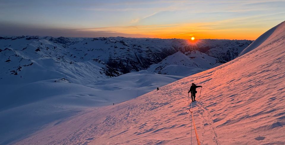
Where we’ve been skiing:
We’ve had days out on Nch’kay, Sea to Sky Gondola, Whistler BC, Cayoosh, Rainbow, Steep Creek. By far and away the best skiing had been solar aspects and harvesting corn or sheltered high north - but the later is tricky to find consistently.
What’s happened since the last update (weather & general snowpack structure):
Thankfully we’ve returned to more seasonable temps, but it’s accompanied by no snow! After a few days of record breaking alpine highs in the 10+ range (including overnight lows!) we are back to a more spring-like diurnal pattern. This did two things for us and it is now a tale of two snowpacks.
On the solar aspects, hot sun helped us out a ton. We really consolidated that upper snowpack, triggered lots of wet slides, and have now refrozen it quite well with decent overnight recoveries in open areas at TL and above. This is bridging our snowpack quite well and we have more confidence so with proper timing and sharp ski crampons, we can travel efficiently and ski some steeper lines on the solars.
However, on the shady side of the compass, all we did was settle that upper 1-2m of snowpack into an even stiffer slab - but the heat was not nearly enough to solve our PWL problem. We’ve had a ton of conversations this week with seasoned guides, heli operators, highways forecasters…and all agree. Our problem is staying with us in the TL and ALP on shadier slopes until we get a significant rain event. The heat was good, but it wasn’t 50+mm of hot rain to really clean things up and lock them down. So unfortunately it’s going to take a bit more patience to move into more aggressive terrain. Are there exceptions? Maybe - perhaps if you can tell something slid quite recently you could ski the bed surface, but if we don’t have hard evidence of recent obvious avalanche activity on higher shady terrain, we aren’t going to tread there. It’s not the news we want right now, but we’re in this for the long game…
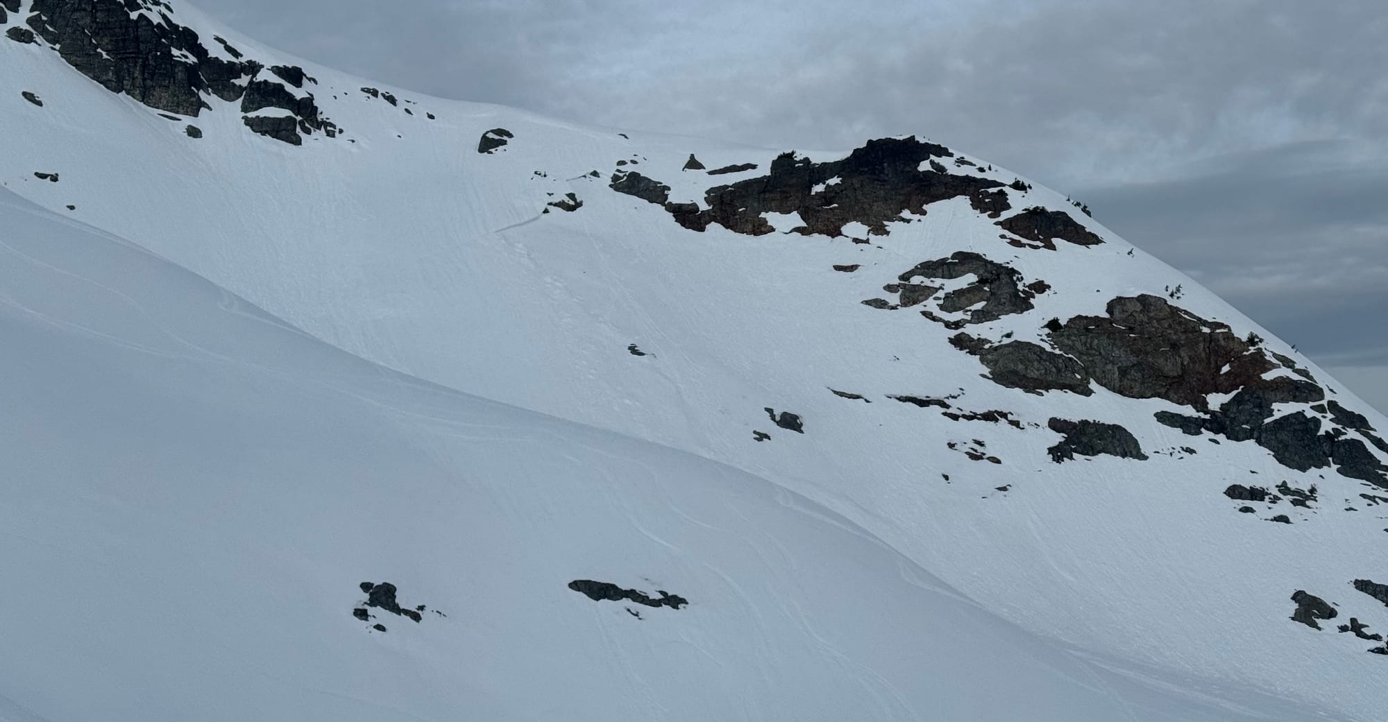
On a similar note, we’ve been observing some of the bigger steep ski lines the last few weeks and there’s been a trend. It shouldn’t be super shocking but the steeper the line, the less well filled in it is. Especially if it’s seen repeated avalanches. For example, around Squamish, Sky Pilot NW Face, Dalton Dome E Face, Siberian Express, Super Couloir, and more look incredibly boney. Most of these appear to be unskiable compared to normal conditions. This is similar in the Duffey. A recent photo of the E Face of Saxifrage was unrecognizable.
Contrast this to some of the slightly more “classic” steep lines that are a little less steep and probably more supported like Nch’Kay NE Face, or the N Face of Decker are quite a bit more filled in.
What’s the weather and avalanche forecast?
I described the weather the next few days as this damp, chilly cloud blanket sitting on us that isn’t packing a punch. The models have been consistent with decreasing and pushing back snowfall of significance, and it looks like now we have to wait until the middle of the week to get a good refresh. Sunday looks like a good window for some missions - a good corn objective or long safe traverse while our coverage is still good!
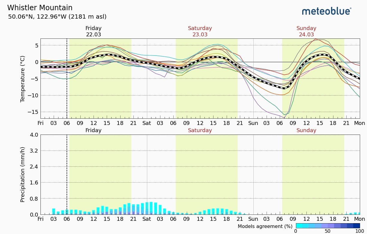
On the plus side, consistent snow starts in the corridor around 800-900m still so low elevation travel is still totally possible. I don’t see this holding on for way longer but this season is one to take advantage of things while they are good.
What are my questions for the weekend?
Will the weather actually clear for Sunday? Will it be clear/cold enough leading up to it that we get a solid crust recovery for a corn cycle? We will be watching overnight lows and cams on Sat night to see if the skies clear and allow for some surfaces to refreeze for some amazing travel conditions on Sunday.
Will there be any precip at all on Fri/Sat to improve the skiing? Looks doubtful but what are we without any hope!
Will we see activity on our Feb 1 PWL? Sadly a lack of activity here is not a green light - but it will be interesting to see if there are some seemingly random big avalanches to keep reminding us of our problem.
What will I watch out for or avoid completely?
Still so weary of the big shady ALP and TL slopes that are not showing any signs of recent activity. This gets scarier the more inland you get, i.e. the Duffey and Hurley.
We will also be watching to see if we get good overnight refreeze and recovery of the crust for safety and travel - this is what will make or break our ski days continuing forward this week.
Closing Thoughts:
There is a good solid month of snow season left in the ALP and coverage is pretty good. Let’s hope we get some refreshes and/or a clean out event to give us a few enjoyable weeks of spring ski mountaineering. Those last two weeks of pow were quite the tease - and remember, that was just over a week ago that we were choking on it so the season isn’t over just yet!
Finally: we still have two spots available for our spring ski mountaineering basecamp. We have one more day to fill the spots so if you’re interested, email zenithmountainguides@gmail.com asap!
Details:
- March 31 to April 4
- North of Pemberton
- Includes Heli from Pemby, Basecamp setup, food/cook and guides.
- $3400 CAD
- Must be fun to hang out with and keen to do some adventure skiing!
Eric Carter and Evan Stevens contributed to this report. For more information, check out Zenith Mountain Guides and our local avalanche forecast. These updates are supported by SkiUphill Squamish - the best stop for ski touring equipment in the Coast Mountains and made possible by the Sea to Sky Gondola! Use this information at your own risk! We are not responsible for your actions in the backcountry and conditions change rapidly from when this report was written
Member discussion