
2023-02-02 Snow Conditions Update
Overall theme:
Last week was good travel but not great skiing! Now we've got a storm coming!
Where we’ve been skiing:
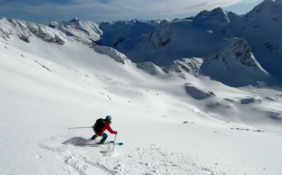
We took advantage of the high pressure over the weekend to do a bit of exploring with a trip around the Spearhead Traverse on Friday and then going as deep as we could on the Hurley on Sunday. The rest of the week with snow quality mediocre, we've kept it closer to Squamish. A few notes:
-Hurley: Overall the Hurley saw lower winds and this week reported softer snow conditions and better ski quality!
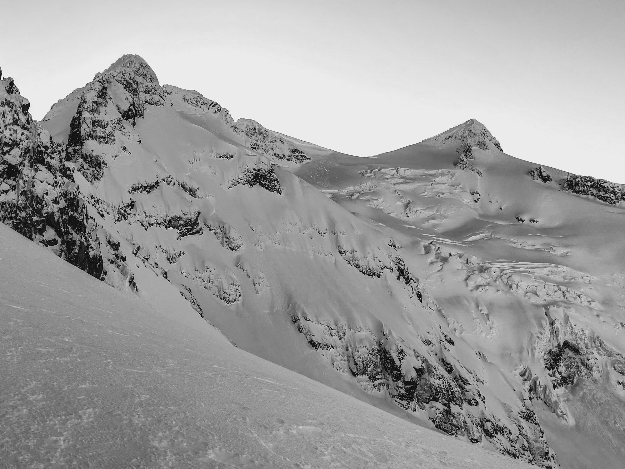
-Spearhead: Lots of open crevasses and sags in the Spearhead Range with low snow throughout. The bergshrund at the Tremor-Shudder Col is significantly exposed and the upper slopes are ice. Most steep north-facing lines do not appear to have enough snow (Hourglass Couloir) while others appear very thin with many cliffs and rock bands (Fitzsimmons NF).
-Squamish: Red Heather and S2SG areas are very crusty below treeline and holding decent chalky snow in the alpine though very wind affected.
General snowpack structure:
-Flurries are falling on a crust that has been forming since Friday (throughout the cold/sunny period). This overlays rounded/faceting grains of ~50cm on top of the mid-Jan crust with faceting boundaries (previous key player).
-Further south we have a saturated lower snowpack under the mid-Jan crust.
-Cold, low humidity nights seemed to be breaking down the surface crust late in the week.
What’s happened since the last update (weather):
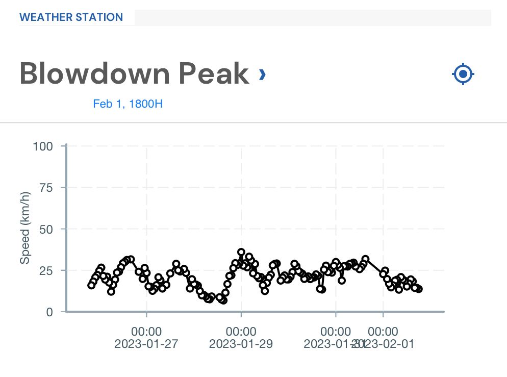
The warmup/inversion of the week prior was indeed followed by a big cooldown. The arctic air arrived in the corridor on Thursday night and into Friday. A thin rime/melt freeze crust had already formed on the snow surface and this was further solidified by the cold and scoured by north winds. Big wind came Saturday night but clear, cold, sunny conditions persisted through the weekend. By Monday the wind was decreasing significantly and the daytime highs warming to be even a bit above seasonable temps.
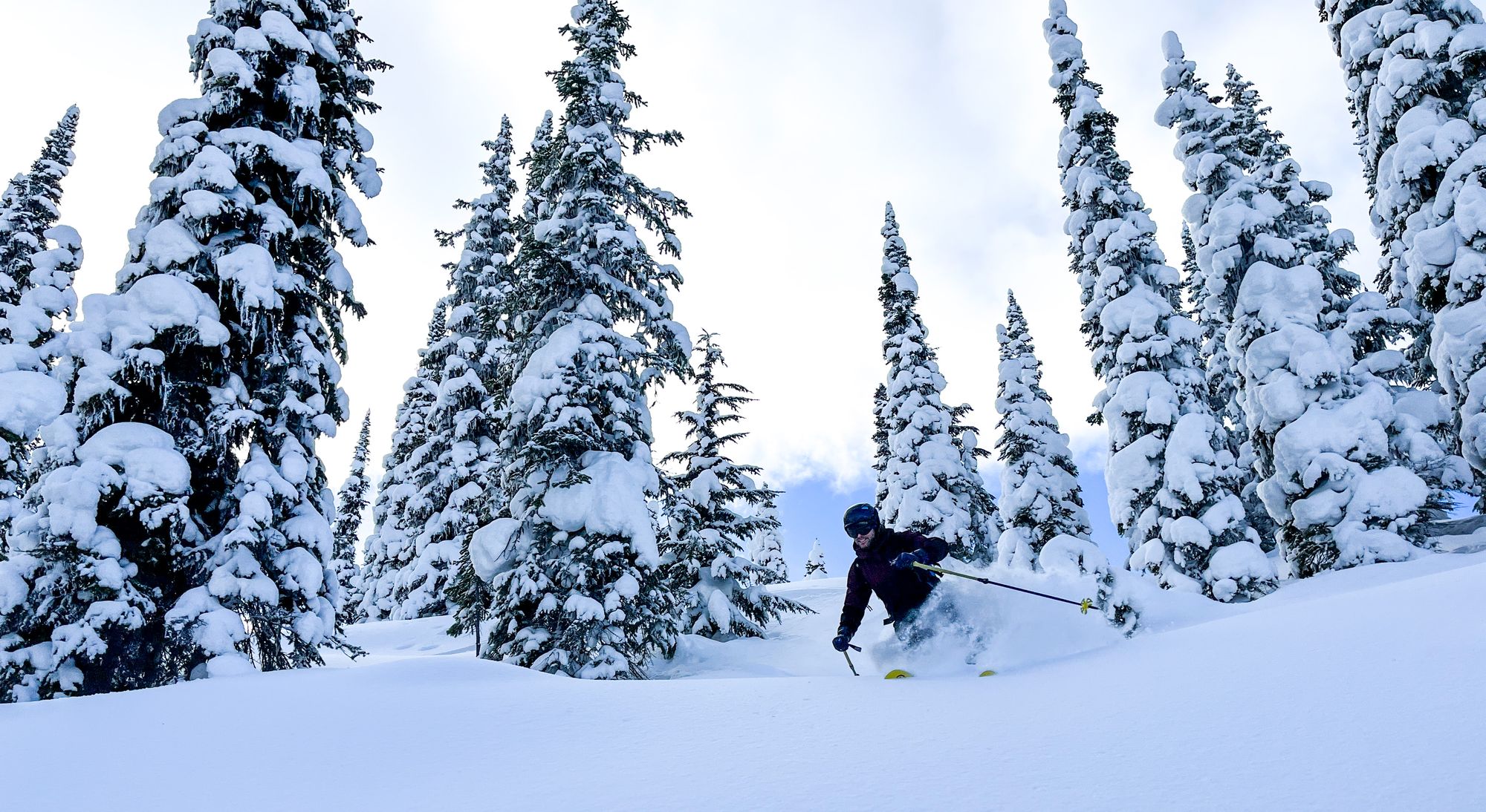
Mid-week was warming with clouds and traces of snow in the corridor. It wasn’t until the morning of February 1st that we woke up to 5-10cm of new snow overnight with snow hitting the valley bottom throughout the corridor. Winds were moderate to strong in the alpine and flurries continued throughout the day. Ski quality rapidly improved.
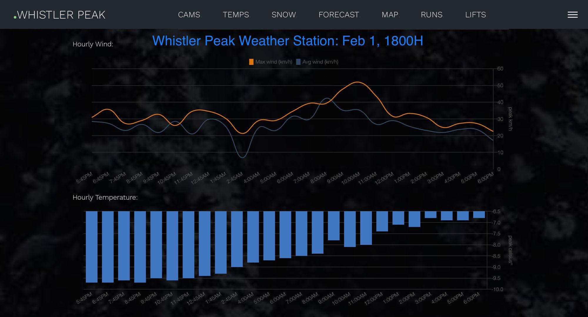
Prior to Feb 1, I wasn’t too worried about the wind. There just wasn’t that much surface snow to move around! It was pretty chalky at best. Maybe a very isolated windslab here or there but generally pretty unlikely. After the new snow of Feb 1, I’m pretty concerned about the wind up high especially as it wasn’t much new snow but with FLs in valley bottom, it’s enough to move around! This was confirmed by a number of size 1 wind slabs reported on Thursday.
What are the answers to last week’s questions:
-Did the warmup/cooldown cause settlement? YES! We saw avalanche activity taper off significantly over the weekend with no new avalanches reported during the cold period. That’s rad to see the prediction come true! Unfortunately it came with a reduction in ski quality.
-Did north winds reverse wind load and strip slopes? Kind of - yes! The winds came but there was not much new snow to move around! Most had been locked up by the rime/melt freeze crust that had formed during the warmup. Small pockets of windslab formed for sure but nothing of huge significance.
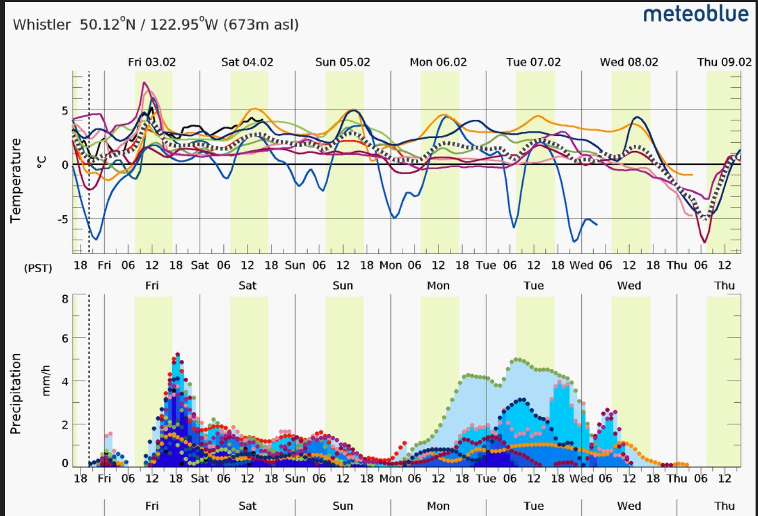
What’s the weather and avalanche forecast?
For the short term, a storm arrives on the South Coast mid-day on Friday. Snow totals will be highest close to the ocean. The bulk of the storm hits Friday evening and overnight with high winds and more precip. Snowline will be between 1200 and 1400m with the storm tapering off on Sunday. From there, precip will continue to trickle in with no discernable pulses at this point. Expect high avalanche hazard on Saturday, possibly extending into Sunday. From here, the hazard may taper off into the week OR may stay elevated longer depending on additional snow and wind.
What are my questions for the weekend?
-How much snow and how much wind? There is definitely a storm coming and it looks like a classic south-westerly that will impact areas closer to the ocean stronger than those further away. How much precip falls and where is key, along with how much wind we’ll experience.
-Will there be sufficient observations? As with any storm period, we’ll be relying on less observations throughout the corridor. This makes it harder to guess where the best snow will be. Telemetry (mostly accessed through the avalanche.ca app) will be extra useful to pay attention to. Submitting MIN reports to AvCan will be helpful to everyone!
-How well will the new snow bond to the crust and how quickly can we step out after the storm? This is the biggest question! The mid-Jan crust was our biggest concern but it was generally bridged over by the newest crust that formed in this clear/cold snap (probably now called Feb 1 crust as it has begun to be buried). Hopefully new snow will stick well to the crust and storms will get successively colder to improve ski quality. It may not however and aside from the simple problem of storm slab during the storm, we may be back to worries about deeper triggering on the old mid-Jan crust. We’ll be trying to get ahead of the storm and see how that new snow is bonding to the old surface. Is it sitting on facets or bonding well? Work the storm like a typewriter and move more interior as the storm arrives before resetting to the Coast when the big loads settle out!
What will I watch out for or avoid completely?
-Probably (definitely) won’t head into high consequence alpine terrain this weekend during the storm. Treeline will be where it’s at with better snow (lower wind) and better visibility. This looks like a classic storm skiing weekend where alpine expectations should be tempered!
-When this storm does pass and we are able to get back into the alpine, expect shallow rocky terrain to still be shallow and rocky! Especially further inland, we'll likely find thin skiing over basal facets that could be problematic! It may not feel like a problem right now but can't totally drop off our minds.
Eric Carter and Evan Stevens contributed to this report. For more infomation check out Zenith Mountain Guides and our local avalanche forecast. This update is supported by SkiUphill Squamish - the best stop for ski touring equipment in the Coast Mountains!
Member discussion