
Feb 10th Sea to Sky Snow Conditions
Thanks for tuning in for the second edition of our email newsletter! We’re hopeful that this is a useful resource. If you’ve got questions or feedback - please let us know! We found a decent amount of good skiing this week throughout the corridor, improving as the week went on!
Overall theme:
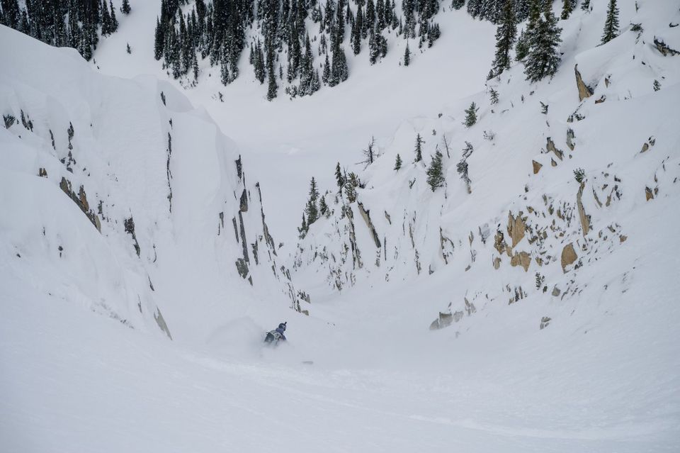
Pow is back on the Coast!
General snowpack structure:
- The mid-Jan crust overlies a saturated snowpack in the south and a series of crusts and other layers further north. It’s this mid to late Jan crust and above we’re most interested in at the moment.
- Above this we have some settled snow and then another crust that formed in early Feb after the spell of high pressure we had.
- Near the top we’ve got 60+cm of new snow from the last weeks that has generally fallen right side up and has been distributed in various ways due to wind. This continues to be loaded with each successive hit of storm snow we receive.
-In some locations the most recent new snow fell on a small layer of facets/facets on a crust or even surface hoar in some sheltered locations
-The dry part of the coast range - inland Duffey and traditionally drier spots like Wedge zone - just got whalloped with a large load. This load was equal to 20% additional volume on the weak snowpack structure.
Where we’ve been skiing:
We started out skiing in the Squamish area early in the weekend during the storm and then headed north to the Duffey on Sunday (Feb 5) to find cooler temps and lower precip amounts.
Mid-week, we were around Whistler where less snow had fallen and slabs did not seem to be consolidating like in the Squamish area.
What’s happened since the last update (weather):
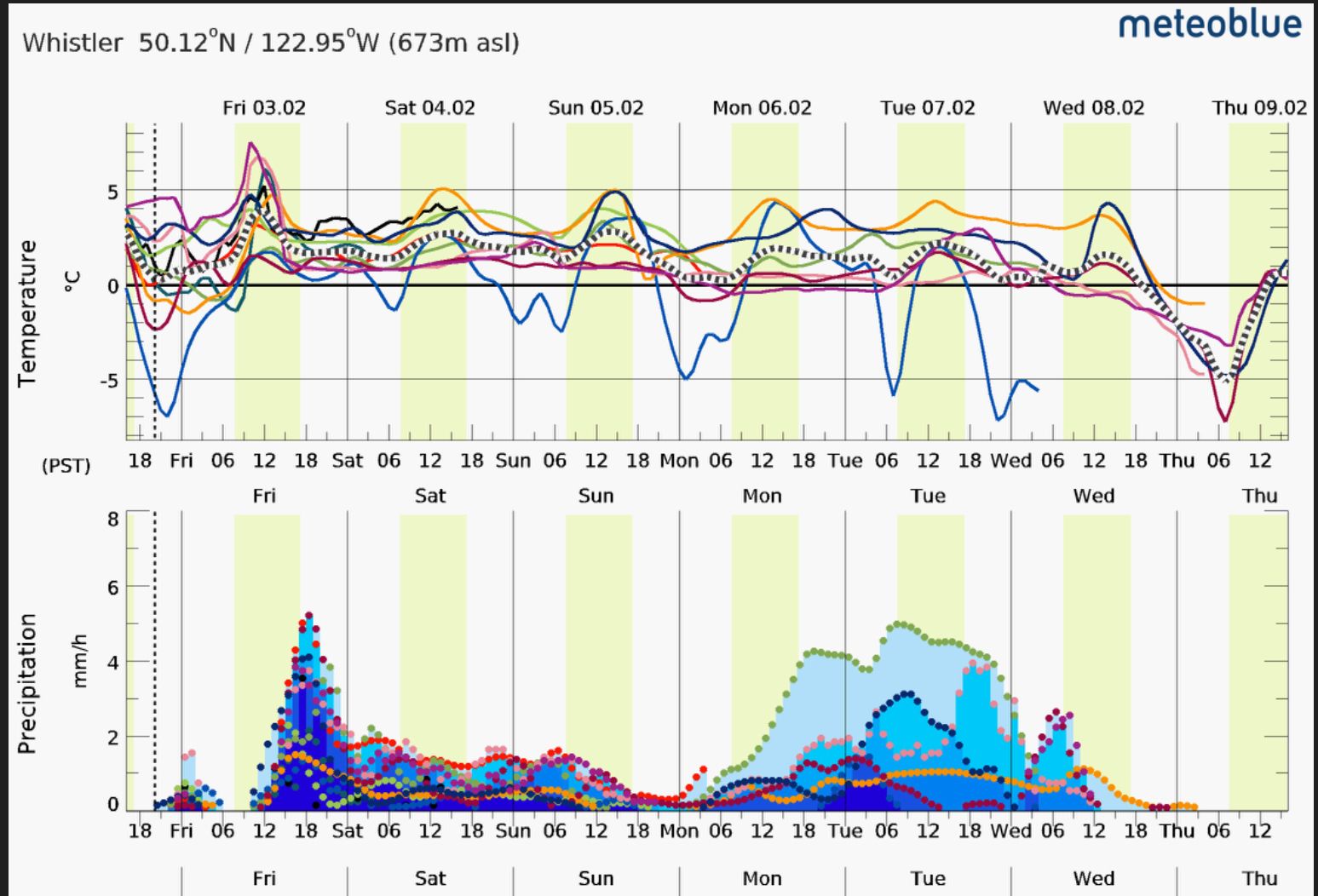
Storm arrived with new snow and wind on Friday (Feb 3), into Friday night. This was 20-40cm in the Squamish area and considerably less further north (15-20 on the Duffey).
On Saturday (Feb 4), FL was above 1200m and TL conditions in Squamish were wet and heavy. Size 1 Loose Wet avalanches occurred when the sun peeked through the clouds. SW wind redistributed snow, especially in the alpine further north. Storm slab problem was the name of the game on Saturday. Size 2.5 reported in Tetrahedron Park!
The storm tapered off on Sunday with sunny breaks throughout the day. Size 1 avalanches reported in the Sky Pilot area. Same in the Spearhead, with wind affected snow at ridgetop. Duffey had much less precip and less wind at TL. Some cross loading on windward slopes and clearly the lee slopes blown in but not slabby. Cold snow made for fast sluffs on the steep terrain.
Monday (Feb 6) mid-morning brought another pulse of precipitation and wind. Almost no observations but significant wind!
Tuesday we woke up to 15-30cm new snow. Much more near the ocean (north shore) if above freezing level - 60cm reported at Red Heather. Snow continued through the morning till mid day (sun poking out in Vancouver) with strong/extreme winds at mtn top. Lots of storm slabs reported in MIN from today including a really amazing rescue on Brohm Ridge!
Wednesday - woke to 5cm new snow and mostly clear skies but seasonably cold temps. Weather deteriorated throughout the day. Another serious avalanche occured on Brandywine.
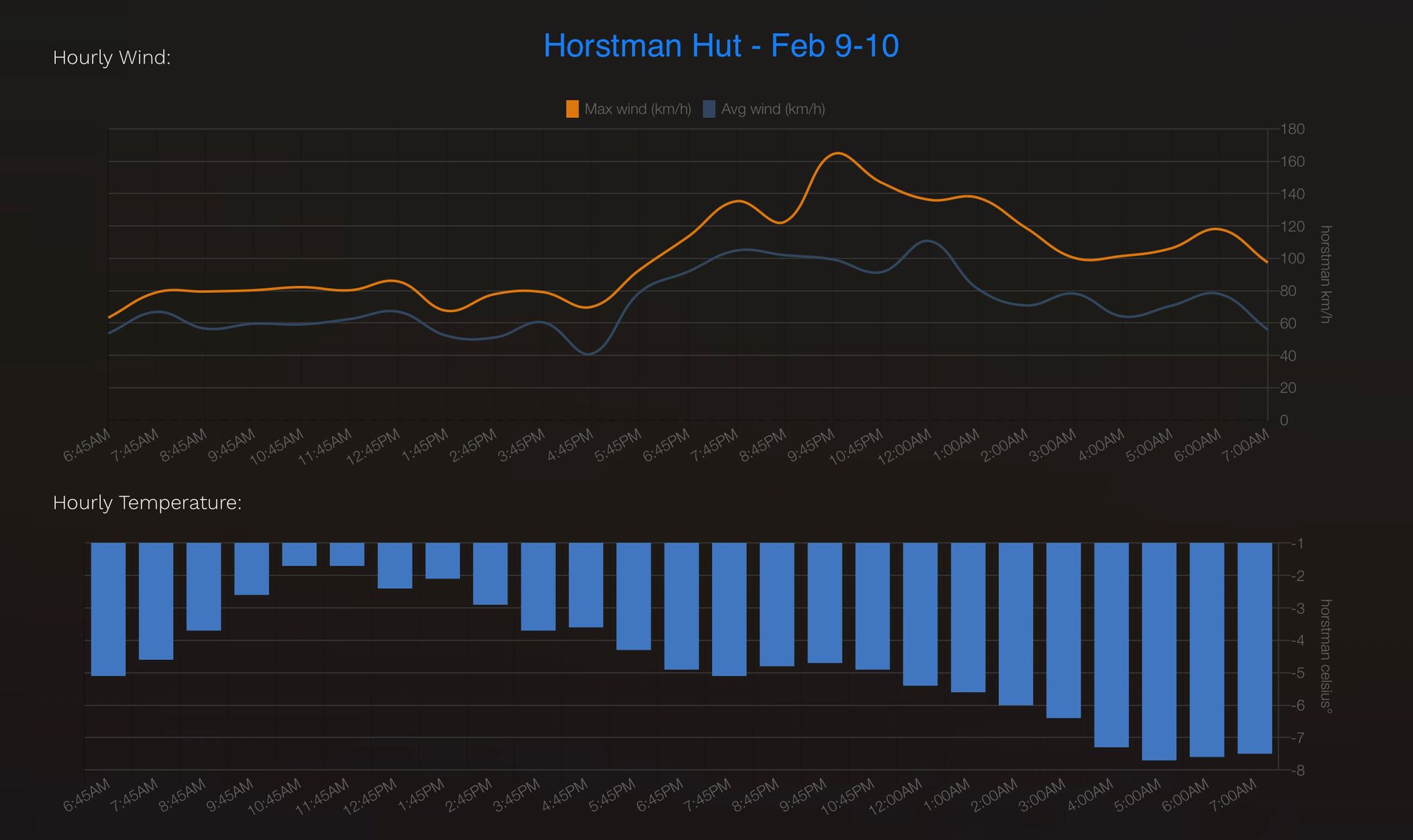
Thursday brought just a few cm new snow. A bit of wind overnight but not a ton. Unsettled conditions with strong wind and precip in the am with warming to ~1600mFL and partially clearing in the PM before starting storming again in the evening. Winds were extreme (160kph at Horstman Hut!) with the majority of the snow (~25cm) falling in the Whistler/Callaghan areas.
What are the answers to last week’s questions:
How much snow and wind? This question was mainly directed on Saturday’s storm. We saw a pattern that seems pretty typical to this season with quite a bit of snow falling in the Squamish zone and tapering off inland with very little snow falling on the Duffey. The temperature/moisture gradient followed a similar pattern. The remainder of the week brought more snow than initially forecasted with a big pulse falling Monday/Tuesday. Both storms were accompanied by significant winds that impacted ability to get up high and alpine ski quality.
Sufficient observations? As usual, we saw minimal observations during the storm last Saturday. There was much more recreational traffic in the corridor on Sunday and good reports of small (size 1) avalanches.
How well did the new snow (storm slab) bond to the older surfaces? Saturday's storm fell warm and initially as a storm slab that was fairly reactive. This did settle well, especially further from the Coast where it fell drier.
What’s the weather and avalanche forecast?
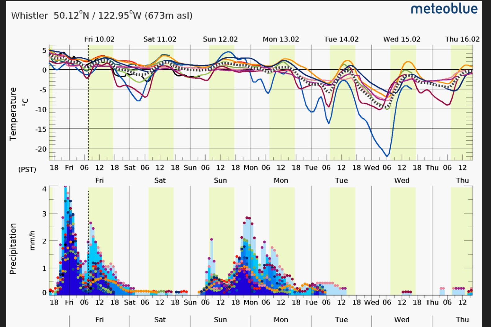
Friday’s storm is the important one in the short term forecast. There also looks like there will be another storm Sunday but perhaps slightly less precip.
From there, we’re looking at improving conditions though the start of the week. As we write this, avalanche hazard is high throughout the region on Friday and then trending lower through the weekend. Depending on the timing of the storm into Saturday and the next one Sunday, I would not be surprised to see that increased as the weekend goes on. We’ll be watching for any more reports of avalanches on the mid-Jan or early-Feb crusts that might indicate the formation of a PWL and cause for more caution.
What are my questions for the weekend?
Timing and impact of Friday’s storm appear to be fairly confident. Less so is Sunday’s storm.
Will either storm fall with wind? Will we see good skiing or just more storm slab? So far this week, the pulses of precip have made for generally pretty good skiing in places. We’ll see if that continues!
Are some of the melt freeze crusts/Facets/Surface hoar acting as PWLs? The Brandywine avalanche failed on the mid-Jan crust. With limited obs from the storm cycle, we will be stepping out cautiously. First will be low consequence, supported terrain that gives us eyes on what has happened lately, because no one will have had a good look around until early this week.
What will I watch out for or avoid completely?
Friday (Feb 10) is going to be storm skiing without question. I suspect that the storm might run into Saturday and we may not see a huge improvement in weather (though I’d be happy to be wrong). For the moment, I’m looking at Saturday as pretty similar and maybe be pleasantly surprised. I’ll be avoiding the alpine and hoping for low enough freezing levels to do some tree skiing.
We might be back into a similar situation as last weekend with moderate temperatures and unsettled weather (if not outright stormy). If it’s stormy, I’ll be looking to tree-ski but ideally in colder zones and not right by the ocean. If the storm tapers off early, I’ll be looking to get to treeline terrain that hasn’t been slammed by the wind. We’re in a bit of a groundhog’s day situation compared to last week!
Sunday (Feb 12) will likely be low vis storm skiing with limited ability to get up high. If we make it through the weekend though, we may be rewarded with some improved conditions in the alpine!
FYI Height of snow in various locations:
- Journey Lodge/Callaghan: 290 @1375m
- Pig Alley/Whistler: 210 @ 1500m
- Blowdown Mid: 132 @ 1890m
- Cayoosh Summit 115@ 1200m
Thanks for reading this week! If you find this useful, we’d be super grateful if you’d consider becoming a paid subscriber. $5 a week is less than breakfast at Mt. Currie Coffee Company and makes it so we can keep producing these!
Member discussion