
April 11 - Sea to Sky Snow Conditions
Overall theme:
April delivers! We’ve had almost three weeks of more seasonable weather and some really excellent skiing. This weekend was no exception with folks skiing throughout the corridor. The weather wasn’t quite as ideal on the weekend so fewer folks going big on things like the Spearhead but definitely a few still getting after it! High alpine objectives have been improving (as long as you stick to the criteria we talked about in last week’s newsletter) and the pow is sticking around on north facing.
Where we’ve been skiing:
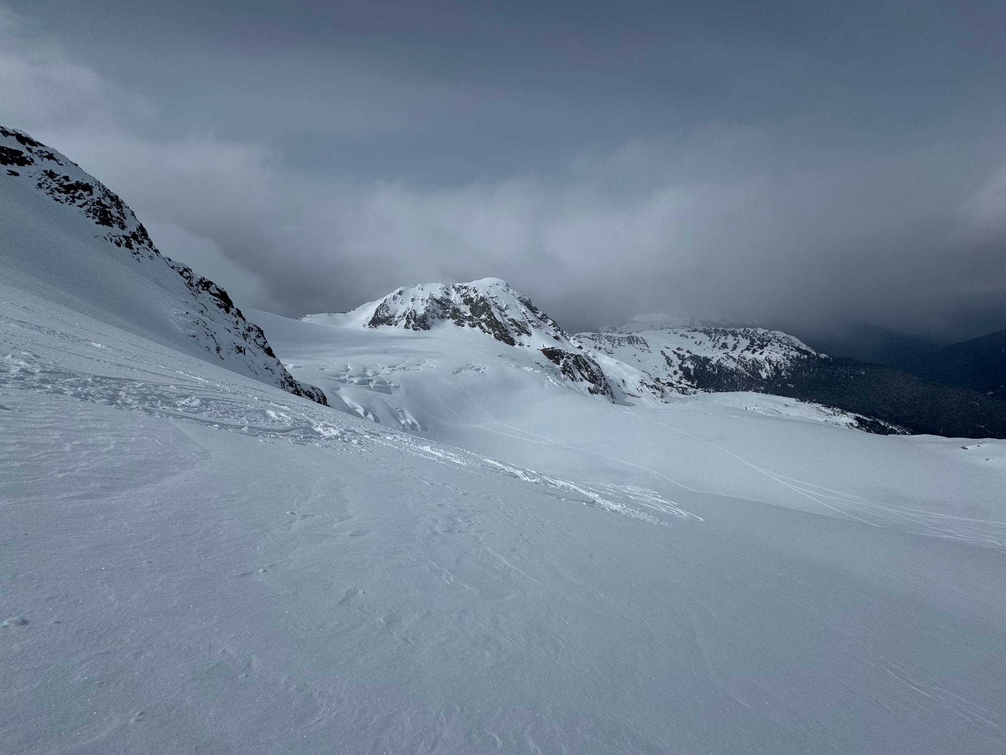
We’ve been throughout the corridor. The theme continues to be using infrastructure to get above treeline for the easiest access to high alpine terrain. Of note, some of our best days this week have been on the Duffey (Cayoosh and Matier), despite very few Duffey days so far this season. The goal has been to get high and find near-north facing terrain that’s well supported and has thick enough coverage. It’s still possible to ski out on both Whistler and Blackcomb but both stripes are getting pretty thin. The Sea to Sky Gondola is hanging in there with good snow coverage on the Sky Pilot Valley Road and above, but thinner on the Shannon Creek Road. Singing Pass is definitively not good with a long walk to the bottom.
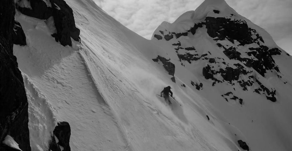
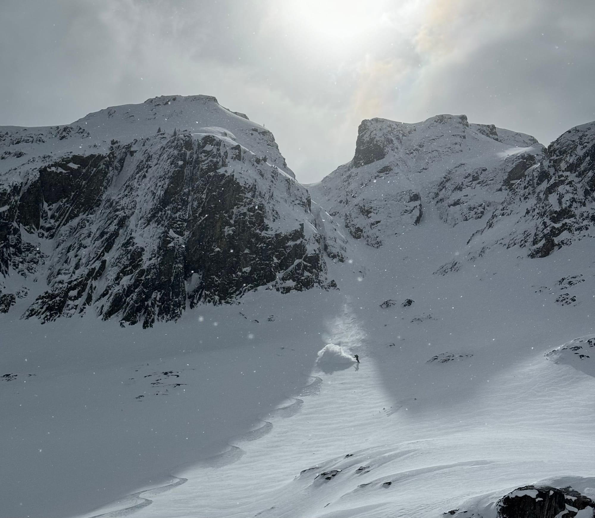
L: View of the Overlord Glacier ski-around to avoid the Overlord rappel on the Spearhead (Fissile E Face in the back). R: Zenith’s Brian Burger shredding the lower glacier on Fissile E Face.
What’s happened since the last update (weather & general snowpack structure):
This week has been more of a mixed bag of weather. We’ve had a few pulses of precip throughout the week but more importantly, the week started off with some north winds that stripped and reverse loaded some slopes but that was quickly filled back in with a refresh from the southwesterly system that we are currently in the midst of. Tuesday’s precip fell low and cold - enough so that the Sea to Sky Gondola snuck in an extra grooming day! It’s been dirty weather most of the week with moderate to strong winds. Wind slab is at the top of mind, especially closer to the ocean where precip totals are higher. On Matier on Wednesday, we found isolated windslab in exposed areas but with careful route selection it was easy to avoid. More snow and more wind is on the way though.
The snowpack is generally well settled with moist snow or melt freeze crust on direct solar aspects and generally well preserved powder elsewhere. In steeper terrain that’s well supported, this is a nicely progressive density upper layer that makes for excellent skiing. If the angle kicks up beyond 45deg or is significantly exposed to wind, expect the surface to be firm or icy.
What’s the weather and avalanche forecast?
Wind and precip taper off Friday evening with what looks like a nice clear day Saturday and through part of sunday before the next system comes in late Monday into the early part of the week. Unfortunately the temperatures spike on Sat and stay high until the tail end of the storm early in the week.
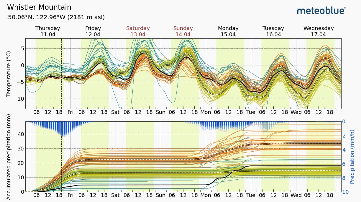
Avalanche Canada shows elevated avalanche hazard on the weekend with a storm slab and wet loose problem. I would be especially concerned with the storm slab issue in the Squamish area or anywhere precip totals are higher than expected. Even more snow as the temperatures get warmer and warmer through the weekend. The last few weeks have been pretty seasonable spring weather so a big warmup brings destabilizing conditions! We’ll likely see a pretty big uptick in activity.
Wet loose is high on the radar (as it always should be in the spring) and solar slopes should be given healthy respect.
What are my questions for the weekend?
- How much snow will fall by Friday? More snow means a bigger slab problem and bigger issues once the warmth comes!
- How warm is it going to get and how much will it affect the snow? It doesn’t look like it’s a quick one-day of sunny weather. Hopefully nights are clear and cold for some recovery and settlement!
- Will the next pulse of precip early in the week come as snow or rain? Please no rain…
What will I watch out for or avoid completely?
- South facing terrain once things start heating up!
Closing Thoughts:
Late March and early April have been good to us. Hopefully we get a few more weeks of this! Get high and find slopes that have snow and you’ll likely be rewarded but patience is needed after these big changes in weather!
Also of note! Blackcomb Mountain closes for the season this weekend. If you want to do the Spearhead from here on out, you’re (of course not) climbing the closed mountain from the base, OR starting on Whistler and finishing out Blackcomb. Know that they often immediately start plowing access roads and of course not maintaining ski-outs so there might be some surprises if you come back inbounds after they close.
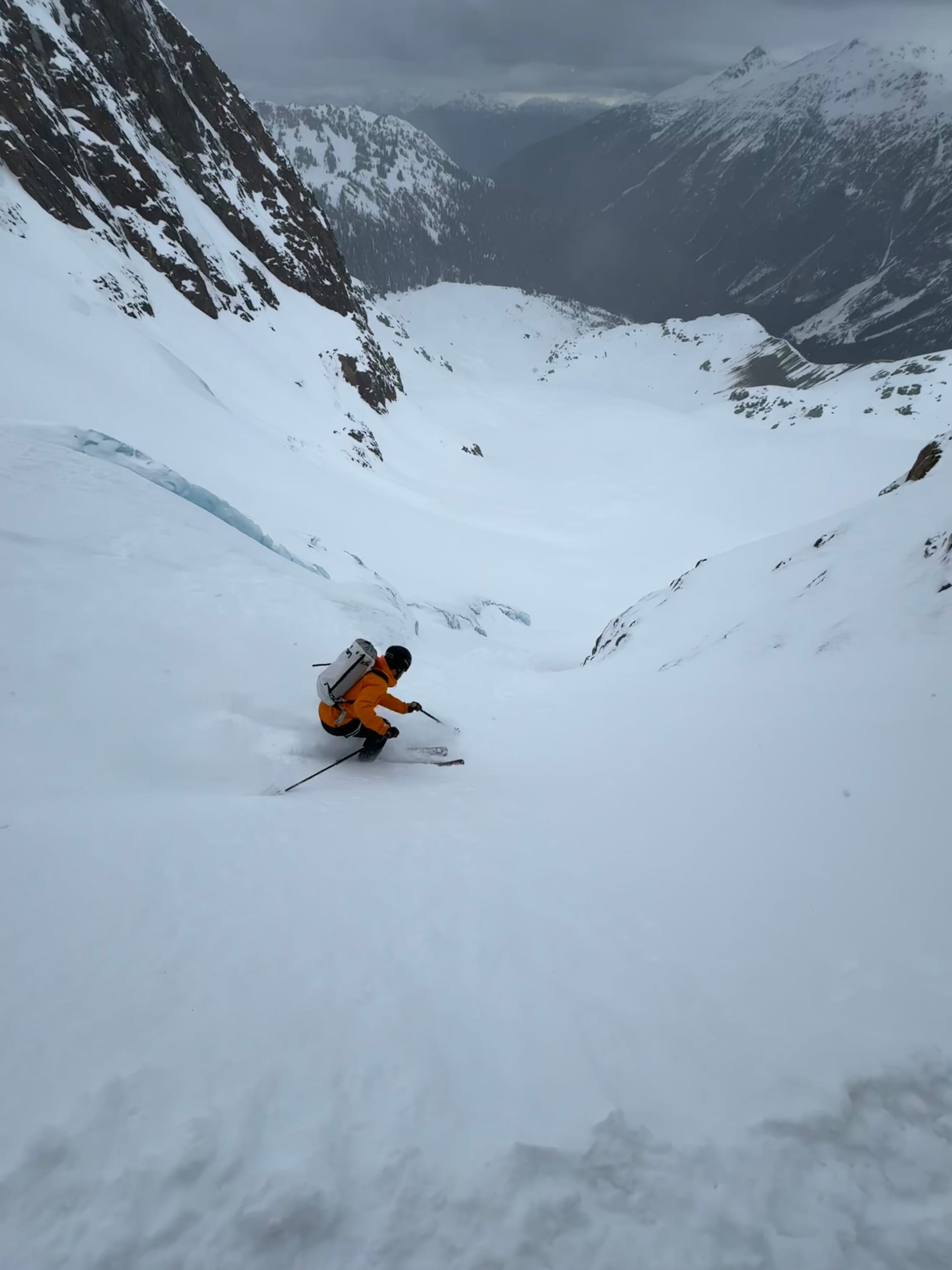
Do you have some unchecked season goals? Zenith Guides is still cranking out pretty awesome days like the shot below. Give us a buzz if you’d like to get that last mission in and we’ll help make it happen!
Eric Carter and Evan Stevens contributed to this report. For more information, check out Zenith Mountain Guides and our local avalanche forecast. These updates are supported by SkiUphill Squamish - the best stop for ski touring equipment in the Coast Mountains and made possible by the Sea to Sky Gondola! Use this information at your own risk! We are not responsible for your actions in the backcountry and conditions change rapidly from when this report was written!
Member discussion