
April 4th - Sea to Sky Snow Conditions
Overall theme:
It’s not over! The key is getting to the goods and the goods are above treeline. Options to get above treeline are limited however...
Where we’ve been skiing:
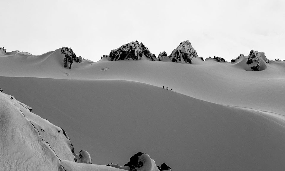
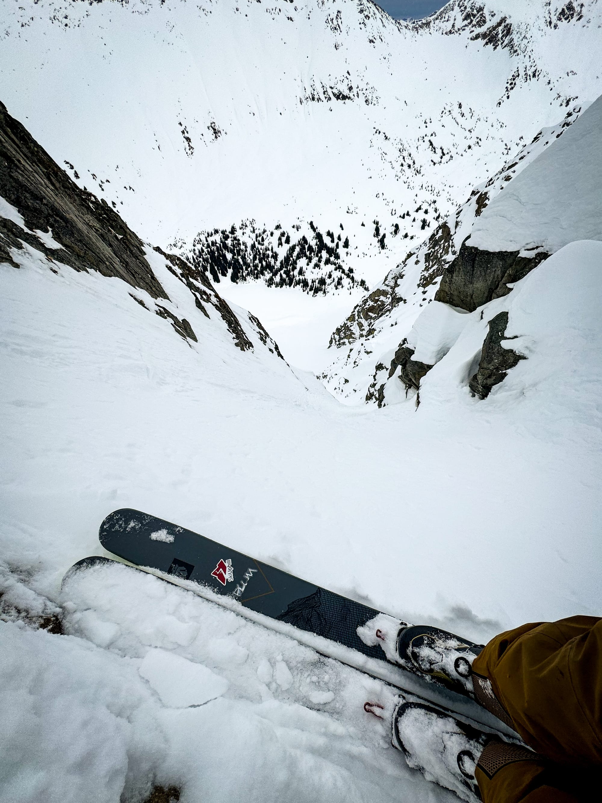
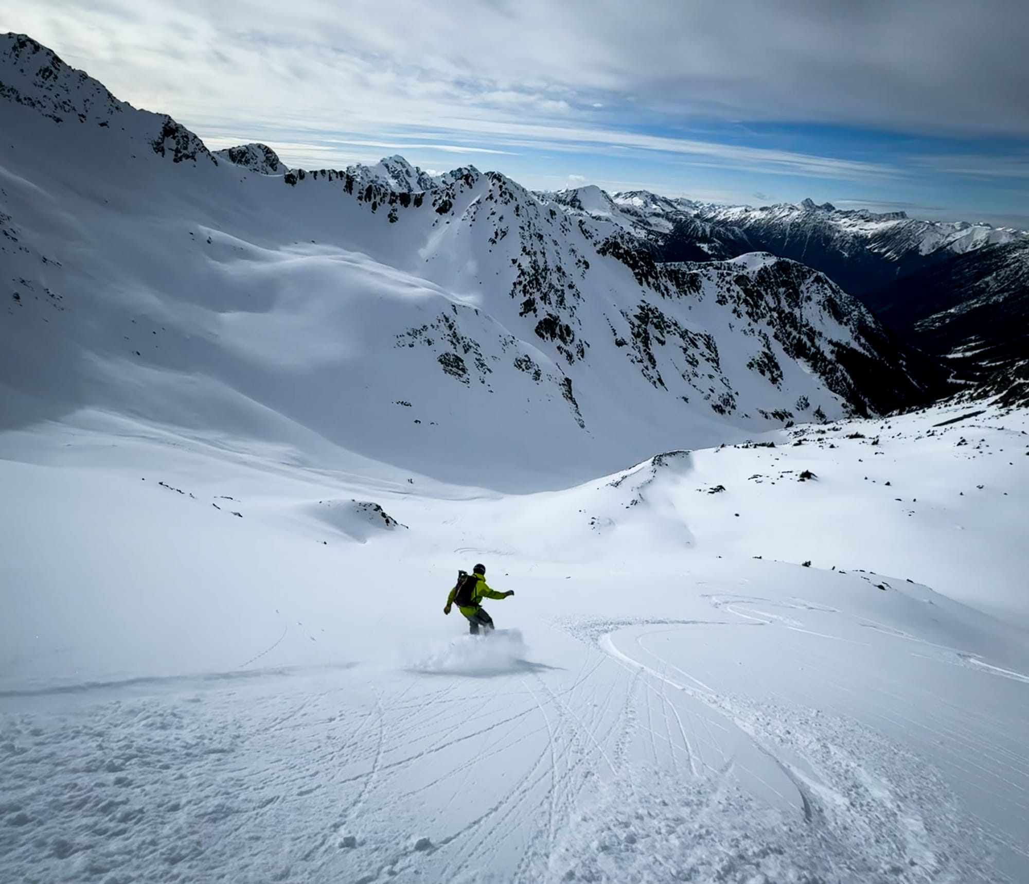
Squamish, Whistler, and the Duffey! One of our weeks getting out well spread throughout the corridor. Last week we talked about skiing well supported slopes with fatter snow conditions and avoiding the steepest lines, especially unsupported, thin slopes with tight walls and cornices that promote runnel formation. This was confirmed poking into steeper terrain. The best stuff is the stuff without a cornice!
What’s happened since the last update (weather & general snowpack structure):
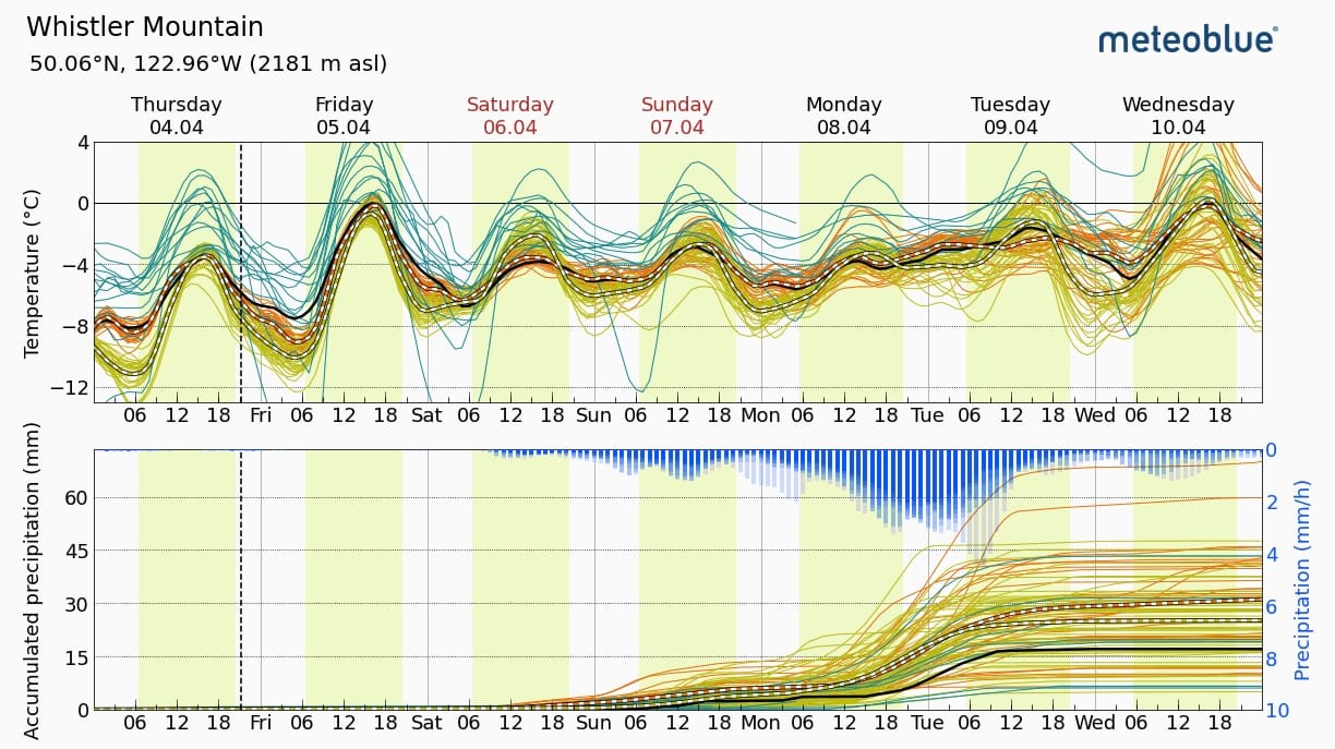
We’ve moved into a fairly typical spring weather pattern. Early in the week we had a frontal system that brought rain but then finished cold with up to 30cm of snow falling in areas in the corridor. Most afternoons are seeing convective clouds building and light to moderate precipitation. Winds have been light to moderate - enough to create windslab in places but we’re not seeing it widespread. One note is that winds have been variable in direction. A few days have had moderate north winds causing some reverse loading. This was evident on Thursday as a small outflow set up causing a decent amount of scouring and wind loading from the Rutherford/Spearhead areas and toward the Coast. The Duffey/Hurley seemed to avoid some of this Thursday wind with the weather stations remaining light/moderate for wind speeds.
The snowpack itself in the alpine is 20-30cm of storm snow that sits on either moist isothermal snow (on southerly aspects) or a firm crust on all but high north aspects where the storm snow sits over dry snow. The new snow is rapidly settling and the underlying snowpack is well settled.
What’s the weather and avalanche forecast?
At the moment, Friday looks like the best day for cloud cover however the freezing level goes up to 1800m. The weekend clouds over with precip possible on Sunday and freezing levels more moderate at 1300m. Precip may continue early into next week with freezing levels rising after the weekend.
Any time we get solar input, it’s going to pack a punch. The biggest concern on my mind at the moment is wet loose avalanches on southerly aspects. This could happen fast when breaks in the cloud occur. This Wet Loose avalanche problem is at the front of my mind for sure.
As mentioned before, the possibility of some reverse loaded wind slabs is real. Warm temps are promoting settlement quick however. I’ll be watching the wind speeds each day to see if we get any spikes, especially if it’s accompanied by new convective precipitation.
What are my questions for the weekend?
- When and how strong will we see the sun this weekend? Friday looks like the sunniest day so I’ll be on my guard but if the sun does pop out of the clouds on Sat/Sun, it could be an issue!
- Will we see clouds and precip on the weekend? Mostly this has an effect on how much we can push it in the alpine when visibility is compromised. It’s not looking to be shaping up like the last few weekends where there was an obvious day to push the big objectives. It might be a weekend to be a bit more conservative with going into big alpine terrain!
What will I watch out for or avoid completely?
- Any day we get the sun, we’ll be steering clear of those solar aspects and the possibility of wet loose avalanches!
- Isolated fresh windslabs on those steep, high elevation slopes we are so keen to get on this time of year. Our PWL seems to be dormant until huge loads start coming into the equation, so it's nice to be focused on some simpler problems right at our feet.
- Related to this, on cooler/cloudy days, southerly slopes may re-freeze and present a slide hazard! Crampons, ice axe, and ski crampons are critical this time of year.
- I keep saying it but very steep, unsupported/thin couloirs with cornices are pretty much off my list.
- Below Treeline terrain - it’s less of an avalanche hazard issue but the travel BTL is either in shoes or it just sucks real bad.
Closing Thoughts:
It’s prime ski mountaineering season if you can get to it. Use the lift systems or our highest access roads and you’ll be rewarded. It’s less access points than usual for this time of year but it’s still possible.
On another note, with bare patches starting to open up on the lower road at the Sea to Sky Gondola, it’s looking like grooming there will be wrapping up. We’re still holding out hope for a nice meter and a half wallop of snow down to sea level but that’s feeling more and more unlikely. We’d like to thank the S2SG for all they’ve done for our touring community. Between the grooming, supporting this newsletter, and working to build a snow study program in the Shannon Basin, they are looking out for the skiers up there. Get your pass renewed while they are having their annual pass sale! There’s still plenty of skiing to be done in the Sky Pilot group though - just expect to take the skis off a couple times before continuous skinning!
Finally - we’ve got a great prize giveaway this weekend from our supporters over at Coast Mountain Collective! For members of our Discord conditions chat, anyone posting observations from this weekend is eligible to win a Mammut Alugator Light Shovel and 320cm Probe - the same ones we use and love! If you didn’t get in the chat this season, make sure to become a newsletter supporter next season to participate!
Eric Carter and Evan Stevens contributed to this report. For more information, check out Zenith Mountain Guides and our local avalanche forecast. These updates are supported by SkiUphill Squamish - the best stop for ski touring equipment in the Coast Mountains and made possible by the Sea to Sky Gondola! Use this information at your own risk! We are not responsible for your actions in the backcountry and conditions change rapidly from when this report was written!
Member discussion