
April 27 - Sea to Sky Conditions Report
Overall theme:
Summer is incoming! A handful of heads up days and then maybe back to something reasonable?
Where we’ve been skiing:
Last week continued the unsettled skiing in the Sea to Sky Corridor. Rain in the valleys meant snow up high and the alpine snowpack really bumped up from where we were a month ago. A good reminder that peak snowpack in the alpine often happens in May even while it seems like summer time in the valley.
Evan has been down in the North Cascades sampling some of the high elevation options on Mt. Shuksan and Mt. Baker (can confirm the road is still washed out before the trailhead). Temps have been a little warmer in this zone though until mid-week the skiing was good! Glide-cracks have been opening up very fast and present a new hazard that has been a little further out of our minds.
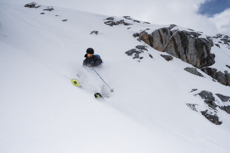
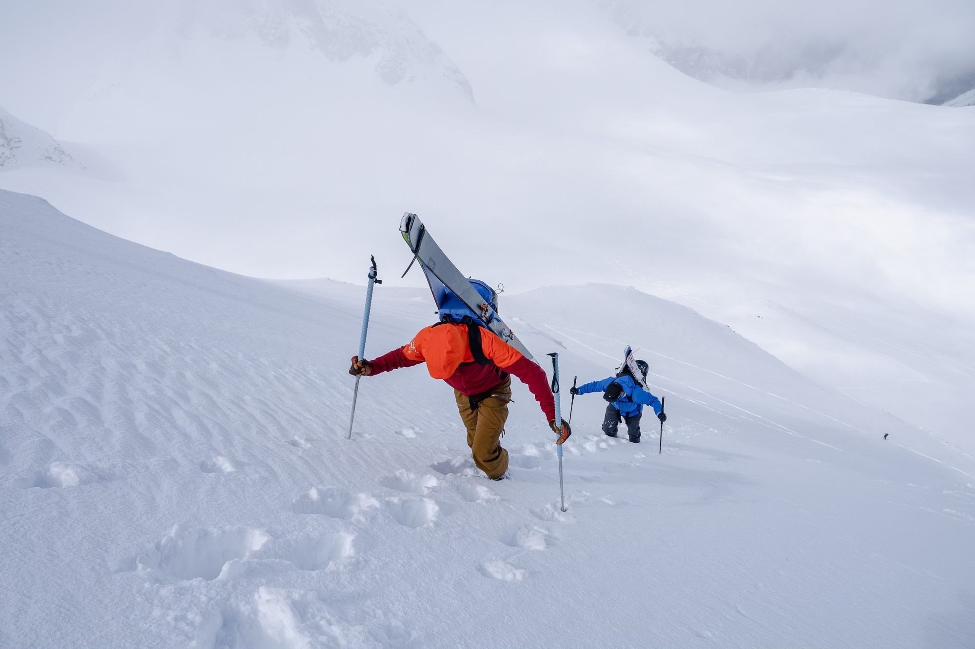
Eric returned from his Waddington expedition after experiencing over 200 cm of snowfall in 8 days with a bit of good skiing. Locally, he skied around Squamish, as well as some classics on the Duffey and in the Wedgemount area. High north facing terrain skied extremely well through Tuesday and there were no signs of naturally occuring avalanches.
What’s happened since the last update (weather & general snowpack structure):
By mid-week, the snowpack under 1700m was generally quite saturated and not seeing much or any overnight freeze. Above that, it was in a good melt-freeze cycle with rain having as much input as the sun. Powder was accumulating quickly above 2000m with excellent snow pasted onto the higher summits! Increasing wind at ridgetop started the formation of windslab in exposed terrain at the highest altitudes.
Overall the snowpack was well settled but we do have our lurking deep week layers that we've had at the back of our minds all season and may see waking up this week!
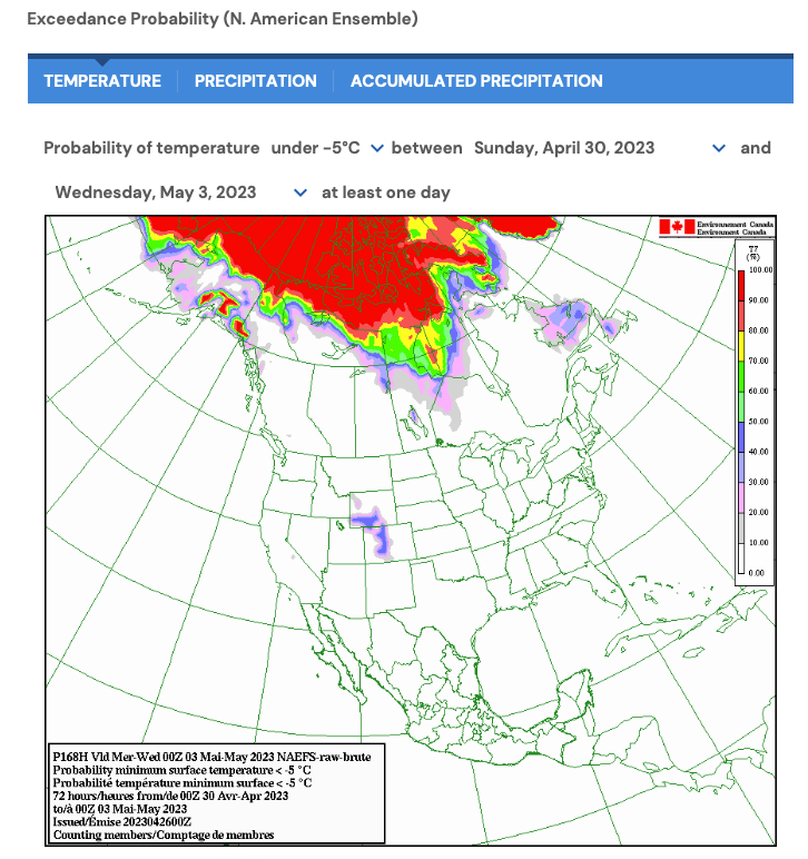
What’s the weather and avalanche forecast?
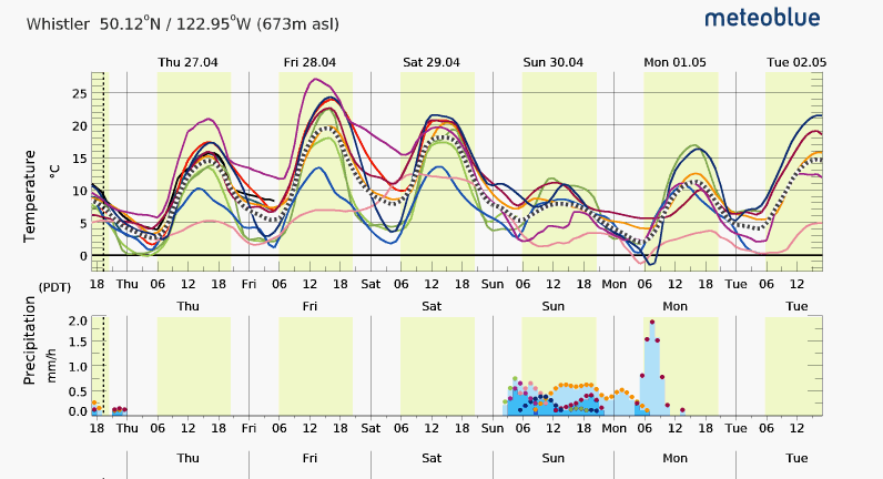
On Wednesday morning we saw a strong switch from -5deg in the alpine to above zero. Thursday we'll see freezing levels increase further up to 4000m on Friday and Saturday. This is going to have a major destabilizing impact on an already unstable snowpack!
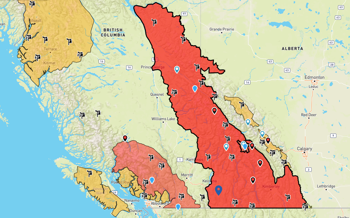
Avalanche Canada has already rated almost all of Western Canada at high avalanche hazard. This is both for wet loose slides that occur as the snowpack becomes warm and sloppy and the more unpredictable and potentially more destructive deep persistent slabs that occur as the entire snowpack is destabilized! I expect we will see AvCan to continue to raise hazard as the weekend continues.
AvCan forecasters put out a great blog post explaining more details about the heat and the persistent slab hazard here.
Why aren't the North Shore and Vancouver Island rated high? The hazard ratings are based on both the liklihood and size of expected avalanches. In both these zones, the size isn't as big so the hazard is set as considerable. This could still change as the week goes on and these zones are getting hit with the same heat as the rest of southern BC.
What are my questions for the weekend?
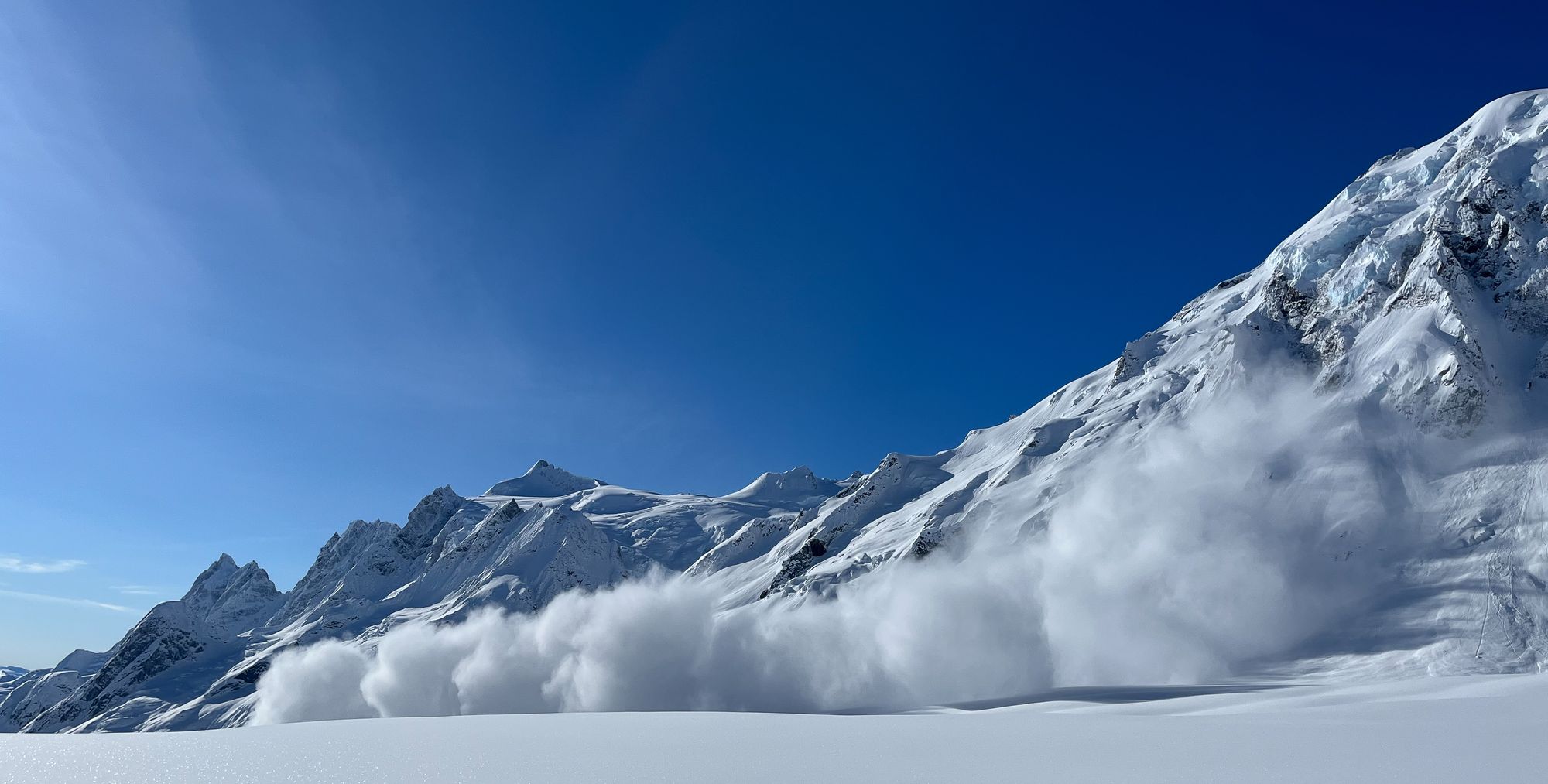
How much carnage will happen Thursday - Saturday? We suspect that a natural avalanche cycle already started on Wednesday with Whistler-Blackcomb reporting several Size 2 Wet Loose avalanches. This is almost certain to continue to escalate as the sun and extreme warming continue towards the weekend. Melt water will percolate through the snowpack and trigger large to very-large avalanches! So we'll wait and see what happens!
Will we see a return to seasonable temps after the melt-d0wn? We know it's going to get hot but it's hard to say if things will cool off a bit and we'll get a "spring" snowpack or if we're into summer from here on. The long-term forecast doesn't look great for next week but fingers crossed that improves and we have a chance for some overnight crust recovery and corn skiing!
Watch the Mountain Weather Forecast for more on the extended forecast!
What will I watch out for or avoid completely?
We're two of the last people who will suggest not going skiing, but for the next few days I will be paddleboarding, trail running, and rock climbing. I won't be going into the mountains until I see overnight lows that allow the snowpack to tighten up and recover.
When we do get a return to seasonable temperatures, I'll be potentially looking at high north facing terrain if there is precip that makes the skiing decent OR corn skiing if it remains high pressure, but only if I can avoid the hazard from wet loose at lower elevations.
Cornices have been big and will be popping hard the next couple days. This isn't just a little bonus listed on the avalanche forecast - they will be a real hazard for anyone travelling underneath as well as potential triggers for those deep persistant slabs!
Closing Thoughts:
A fast switch from winter problems to summer means lots of change in the snowpack. Big changes mean big avalanches. This isn't a "storm" but is still an extreme weather event and should be treated as such. If you must go into the mountains, avoid avalanche terrain as much as possible! Even areas that might normally be considered outside of avalanche terrain should be considered risky with any possible overhead hazard.
Are you a paid subscriber? Expect an email in the next week or two detailing how we will treat subscriptions over the summer, and perks for staying on going into next year!
Eric Carter and Evan Stevens contributed to this report. For more information, check out Zenith Mountain Guides and our local avalanche forecast. This update is supported by SkiUphill Squamish - the best stop for ski touring equipment in the Coast Mountains!
Use this information at your own risk! We are not responsible for your actions in the backcountry and things change rapidly from when this report was written!
Member discussion