
Apr 21 - Sea to Sky Snow Conditions
Overall theme:
Winter up high, spring down low, transition in between...
Where we’ve been skiing:
We have been on various missions/work lately so scattered all about. Evan is just south of the border in the Shuksan/Kulshan area, and Eric is north on a camp trip I am sure we will hear all about. Regardless the conditons have been the same...snow, snow, and more snow, and even quite low down!
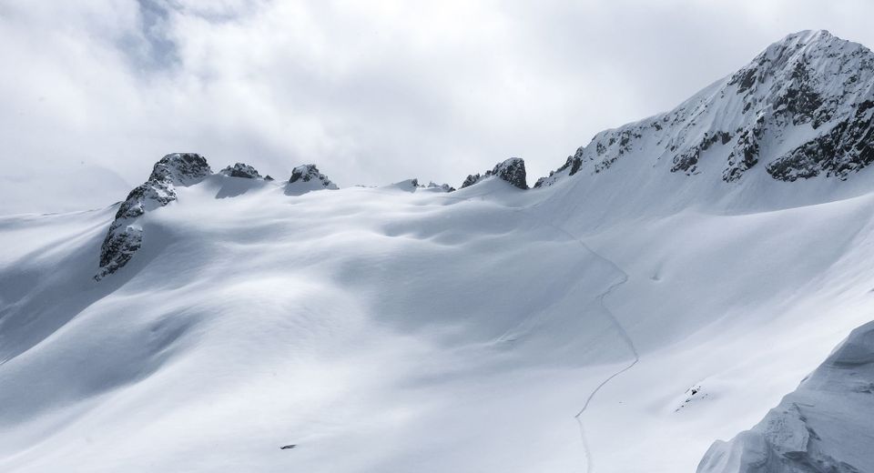
For lots of folks in the corridor it turned back into midwinter pow skiing almost everywhere. Paul Ridge, Gondola, North shore, WB, Duffey, Mystery...its all been mid winter pow skiing with out too much of a struggle to get up high as it has been snowing down low! Occassional pockets of light have allowed for some decent forays into the alpine, with boot top/mid leg trail breaking on the shady slopes. Of course its April, so it only take the sun about 5 min to do its dirty work to any snow slope around. Plan accordingly.
What’s happened since the last update (weather & general snowpack structure):
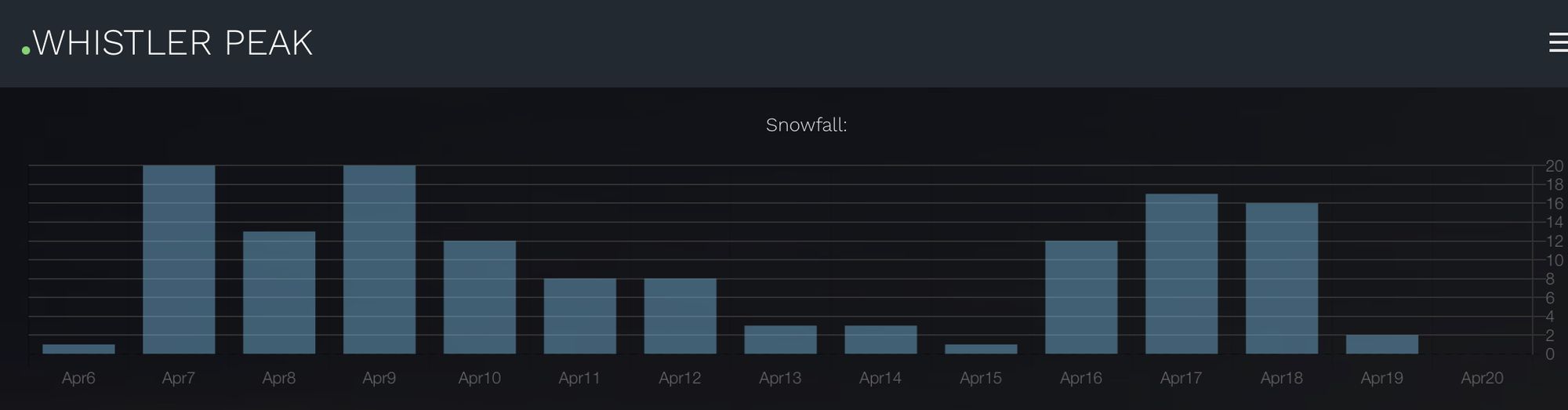
The snow keeps coming. Thursday during the day Whistler saw 25cms in a few hours. Of course this was accompanied by some strong winds. But generally its been snow, and lots of it. April 20 isn't updated on this graph, but it should read the biggest day in the 14 day period. But basically thats 14 days in a row of new snow at 1500m in April.
What’s the weather and avalanche forecast?
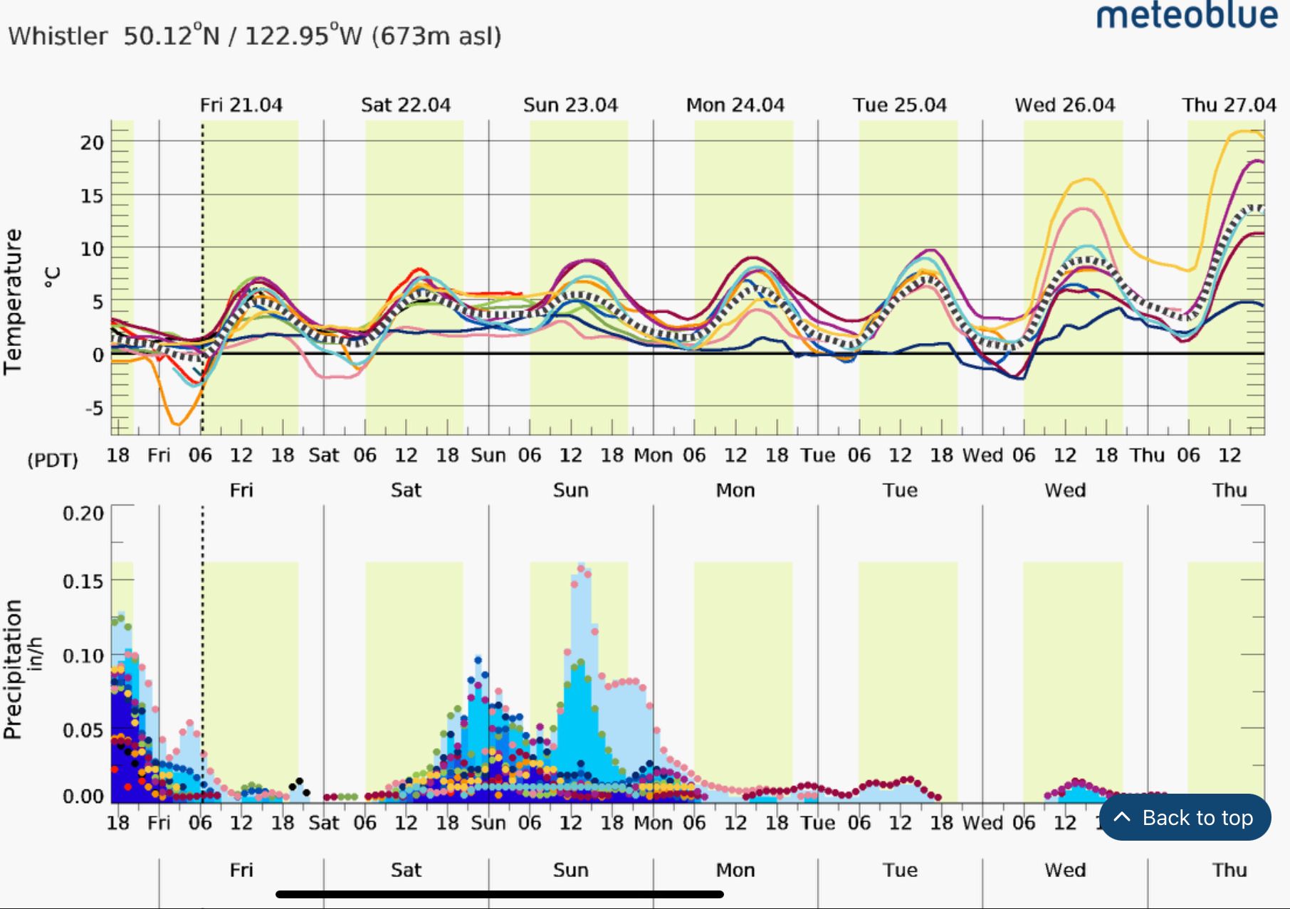
Two more days of storms and then we are in for a big change in weather. We have not had a warm dry high pressure yet, and it looks like its about to knock on our door. Almost all of the models agree, and some are even saying 20c in Whistler by the 27th!!!! So how do I read into this all? Today and Saturday morning are your last chances for cold dry snow at many elevations. Then we start to change from winter to spring and maybe even summer in a hurry. Can you say avalanche red flags?
What are my questions for the weekend?
When will it start to get really warm on Saturday? How high will it rain? Friday was super windy, and now there weill be some buried wind slabs in most exposed locations. The good news is that storm snow settles quickly this time of year. But remember the snowpack is acting like winter up high, and that will be slower to change and settle.
What will I watch out for or avoid completely?
The sun! Always the sun! And finally on Wednesday and Thursday next week it will be high freezing levels and rapid warming that the snowpack has not seen all winter. Is this going to be our big spring cleanse? Maybe, but I will certainly put on the rock shoes or ride my bike on the hot days next week (gasp)
Closing Thoughts:
Obs are dwindling down, and the snow has been piling up. Yes, its spring and stuff settles quickly, but many people have been getting surprised by new slabs on solar suncrusts, or just plain old windslabs hiding under copious amounts of new pow. Remember the weather chart, 14 days in a row of new snow and cold temps, so its winter, think winter problems!
Eric Carter and Evan Stevens contributed to this report. For more information, check out Zenith Mountain Guides and our local avalanche forecast. This update is supported by SkiUphill Squamish - the best stop for ski touring equipment in the Coast Mountains!
Use this information at your own risk! We are not responsible for your actions in the backcountry and things change rapidly from when this report was written!
Member discussion