
Apr 7 - Sea to Sky Snow Conditions
Overall theme:
Open season is on pause with a monster storm on the horizon! Winter continues!
Where we’ve been skiing:
We’ve been limited to the Squamish and Whistler areas this week but pulled in a few reports from friends on the Duffey Lake Road and elsewhere.
What’s happened since the last update (weather & general snowpack structure):
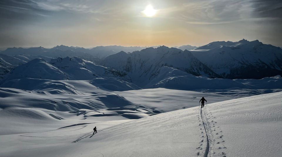
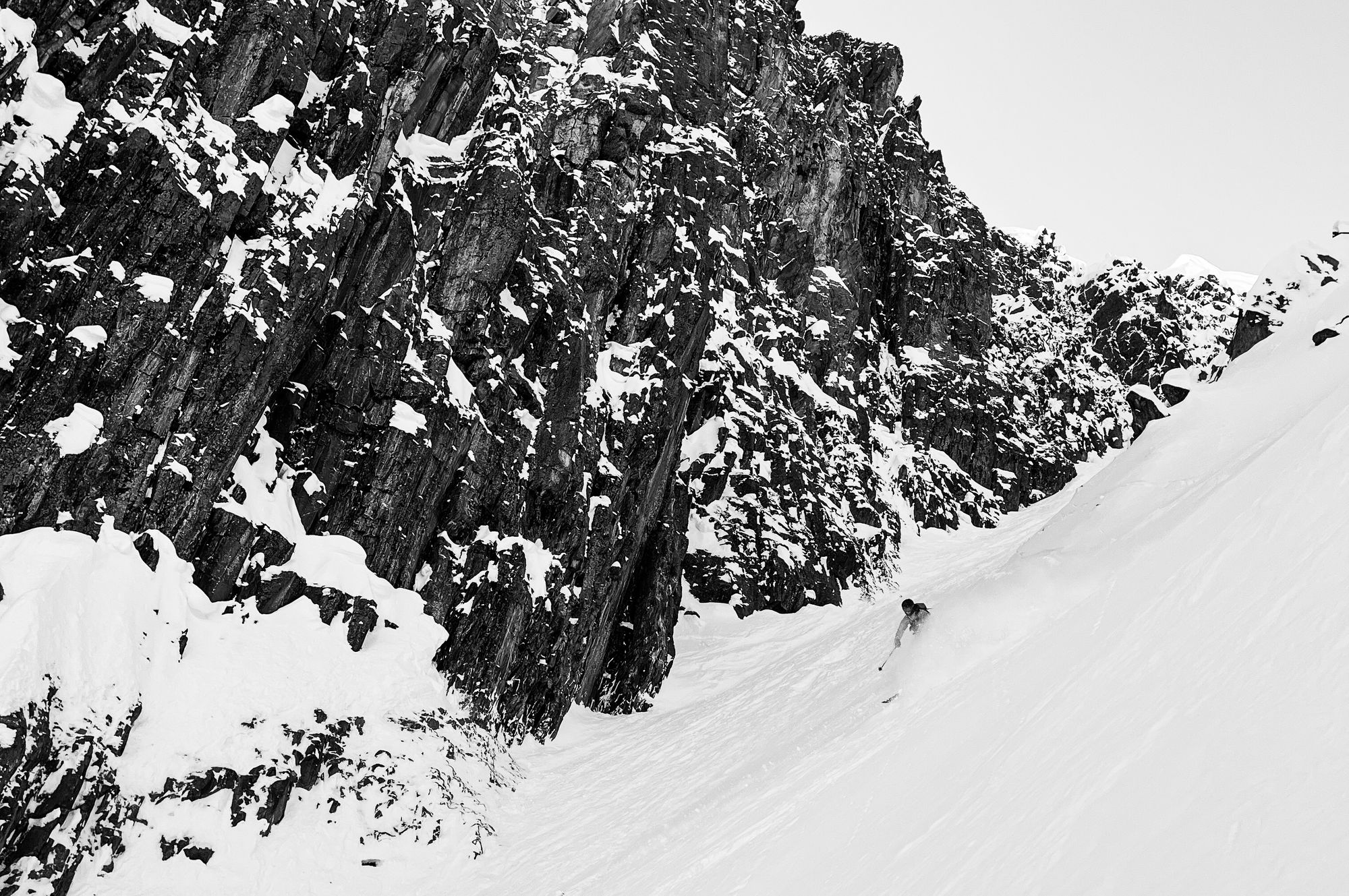
We predicted open season and lots of good skiing was happening around the corridor but that’s not the end of the story. Sunday brought a big dump of snow, especially on the south end of the corridor. “Best snow of the season” was definitely getting thrown around though we didn’t get a chance to ski that day. Spring storms are pretty great! Typically a touch warmer, the new snow generally bonds pretty well to the existing surface. One group however had a near-miss in the Ledge Couloir after triggering an avalanche while skinning (?) up! Their MIN report has a great photo of the crown line. This could easily have been worse and we’re glad the group is all alright!
During the week, we had a pattern that brought a pulse of precip followed by a few days clearing and increasing stability, then repeat. This kept snow conditions fresh but also made things a little sportier than expected for wind slab. Check out this MIN report. People were definitely getting at it though with big lines being skied, as well as most of the classic traverses (Tantalus, Spearhead, Neve) found in good conditions.
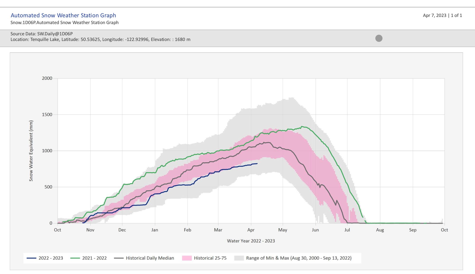
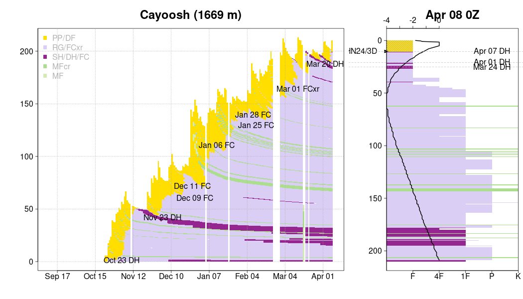
The new snow on the surface sits over a generally well bonded mid-pack however we do still have the deep weak layers, especially up north, that may start rearing their head soon!
What’s the weather and avalanche forecast?
This is the exciting part! We had a solid dump of snow in the corridor on Thursday with Whistler reporting 15cm. Another 15cm fell overnight Thursday into Friday morning. There is a break in the storm on Saturday but it looks like Sunday we get whalloped again. Storm totals Thurs-Sun are close to 1.5 meters! It’s a fairly typical storm for us so areas closer to the ocean will see more precip and warmer temps while further north will not be hit quite as hard.
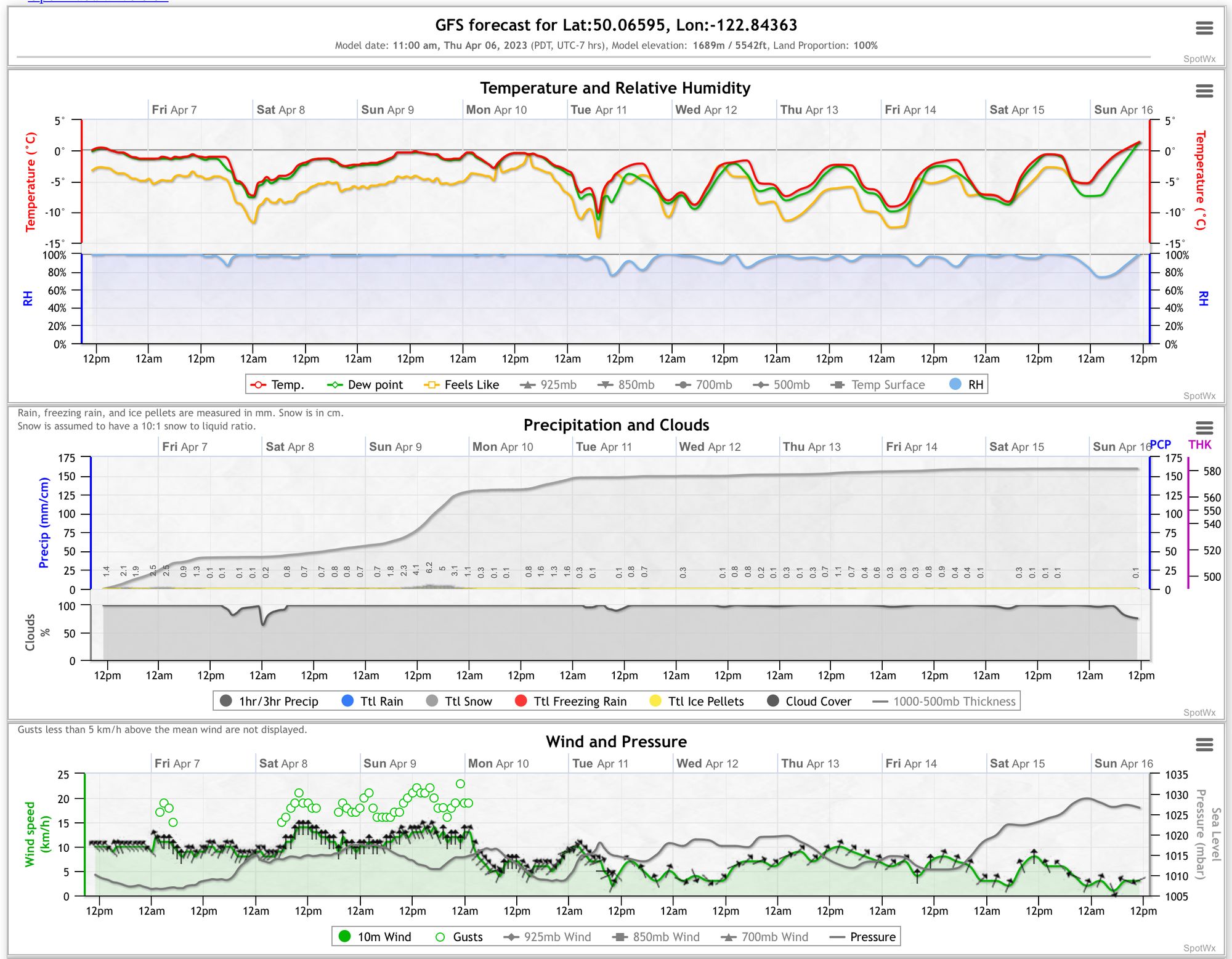
Avalanche hazard is increased this weekend, with a spike to high on Sunday Problems are likely limited primarily to storm slab and potentially wind slab. Likelihood of triggering avalanches is much higher than the previous week and the big storm load means destructive size is way bigger as well. We’re not in business as usual here and need to wait to see how the dust settles from this storm before stepping out.
What are my questions for the weekend?
Questions are pretty simple - for this ongoing storm we need to see how much wind accompanies just how much precip but also where the freezing levels sit. At the moment it looks like we get the trifecta of big wind, lots of precip, and low FLs but I do think there’s a good chance of a freezing level spike at some point that could cause a natural avalanche cycle. Even today (Friday) we're seeing freezing levels rising above treeline elevation.
The other question is what follows this storm. At the moment, the forecast continues to look pretty dirty with a continued trickle of snow. This isn’t great for getting big alpine objectives but any continued snowfall will keep spring at bay for a little longer which is good because it’s just the start of April!
What will I watch out for or avoid completely?
Big storms mean big terrain is off-limits until things settle. I’ll be sticking around tree line until we see a change in stability.
When the weather does improve, a big factor will be the effect of the sun. The sun packs a huge punch at this point in the spring so with a huge load of new snow, its impact on stability will be significant.
Closing Thoughts:
It’s an interesting time of the year. It’s the optimal time for a deep stable snowpack, with still enough snow down low for efficient travel. So, if the weather lines up, its go-time. This storm puts go-time on pause for a bit for sure though. The trick over the next few days is getting to a good freezing level location, with not much overhead hazard and being patient with those big objective.
Gentle reminder to stay vigilant to conditions and that even with spring approaching, our mountains need a healthy amount of respect! A few incidents in the last few weeks should be a reminder to keep selecting objectives that make sense for both the actual conditions as well as your ability level.
Eric Carter and Evan Stevens contributed to this report. For more information, check out Zenith Mountain Guides and our local avalanche forecast. This update is supported by SkiUphill Squamish - the best stop for ski touring equipment in the Coast Mountains!
Use this information at your own risk! We are not responsible for your actions in the backcountry and things change rapidly from when this report was written!
Member discussion