Dec 26 - Sea to Sky Snow Conditions
Overall theme:
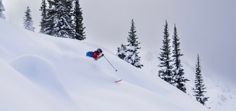
The holidays deliver! Big change in weather over Christmas means a step back but also good skiing.
Where we’ve been skiing:
Whistler, Hurley, Pemberton, Squamish! Early in the week, the best skiing was above 1800m and Whistler north. Visibility in the alpine was the crux so timing it with clearing breaks or finding the skiing with some sort of visual reference was key. With the Christmas/Boxing day storm, we’re pushed back to treeline for storm skiing. The increasing coverage, especially in the more interior ranges, was only hampered by snow quality with some high rain events but the cooling trend with lots of precip is changing that for the better in most locations in the Sea to Sky.
What’s happened since the last update (weather & general snowpack structure):
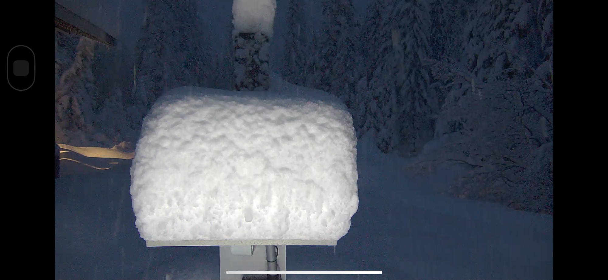
Last weekend’s storm finished cold and the snow line dropped through the corridor. Accompanied by strong/extreme wind made for slabby conditions in some areas but protected snow skied very well. The main event however arrived Christmas Day with more new snow, primarily along the Coast (the Duffey didn’t see as much benefit from this storm until the end with 15-20cms). 50+mm of precip during the day and then another ~20mm overnight was accompanied again by strong winds. During the storm, snow line dipped as low as 800m and our low elevation zone access improved significantly. Below treeline skiing in Squamish was essentially out of play and even the access roads were in rough shape.
The Christmas snowfall definitely helped out with access and the S2SG, Red Heather, and Callaghan all got a conditions boost! It’s still survival skiing down low in the trees. 1200-1300m and lower close to the ocean is basically where it starts to deteriorate. As you go more inland this number drops slowly. Things are improving and one or two more big pulses of snow will help a lot. Further north, trail access on the Duffey is decent and continues to improve. Also of note is that parking for the Hurley is now at valley bottom and you should not try to drive up the groomed snowmobile road!
Early in the week, there was a decent natural avalanche cycle to size 2-2.5 with direct action from the storm event. The more interesting layer that may have been a factor in the Ipsoot avalanche on Monday was some low density preserved stellars on one of our melt freeze crusts. That crust/low density snow combo was most prevalent between 1700 and 2000m in the whistler zone. Above that elevation things stayed mostly snow - from Whistler and more interior. In a remarkable event, everyone survived the Ipsoot avalanche and the response from emergency resources was outstanding. Great work by everyone involved from Whistler Heli Guides, to the Whistler/Blackcomb Patrol, Whistler SAR, Blackcomb Heli…there’s a ton of help around in this corridor if you know how to activate it and communicate, so carry the appropriate communication devices. Radios are priceless in these parts.
We’ll be keeping our eyes open for bonding on the Dec 22 crust just above treeline in the Whistler and Pemberton areas. On Christmas and Boxing Day, we expect a widespread natural cycle to have occurred, especially as you get closer to the Coast. We observed several large natural avalanches that likely occurred early Thursday morning in the Squamish area.
What’s the weather and avalanche forecast?
An unsettled weather pattern will persist through the weekend. A weak frontal system will brush the South Coast Friday, bringing a slight chance of flurries. From Friday evening into Saturday, the next Pacific frontal system will deliver another round of heavy precipitation along with strong southwesterly winds to the alpine. Storm total amounts of 20 to 40 cm can be expected over the southern sections of the Sea to Sky and the South Coast by Sunday morning. Another system will arrive late Sunday; however there is uncertainty regarding position and strength of this system due to different model solutions struggling with the strength of high pressure over the interior. I would expect light precipitation amounts ranging from trace to 5cm.
- Friday: Light wind, with FL rising from 700-1000m by afternoon and trace precip.
- Saturday: Strong SW wind, FL rising to 1200m with 20-40cm new snow by end of day.
- Sunday: Light wind, FL dropping to 700m with trace to 5cm precip.
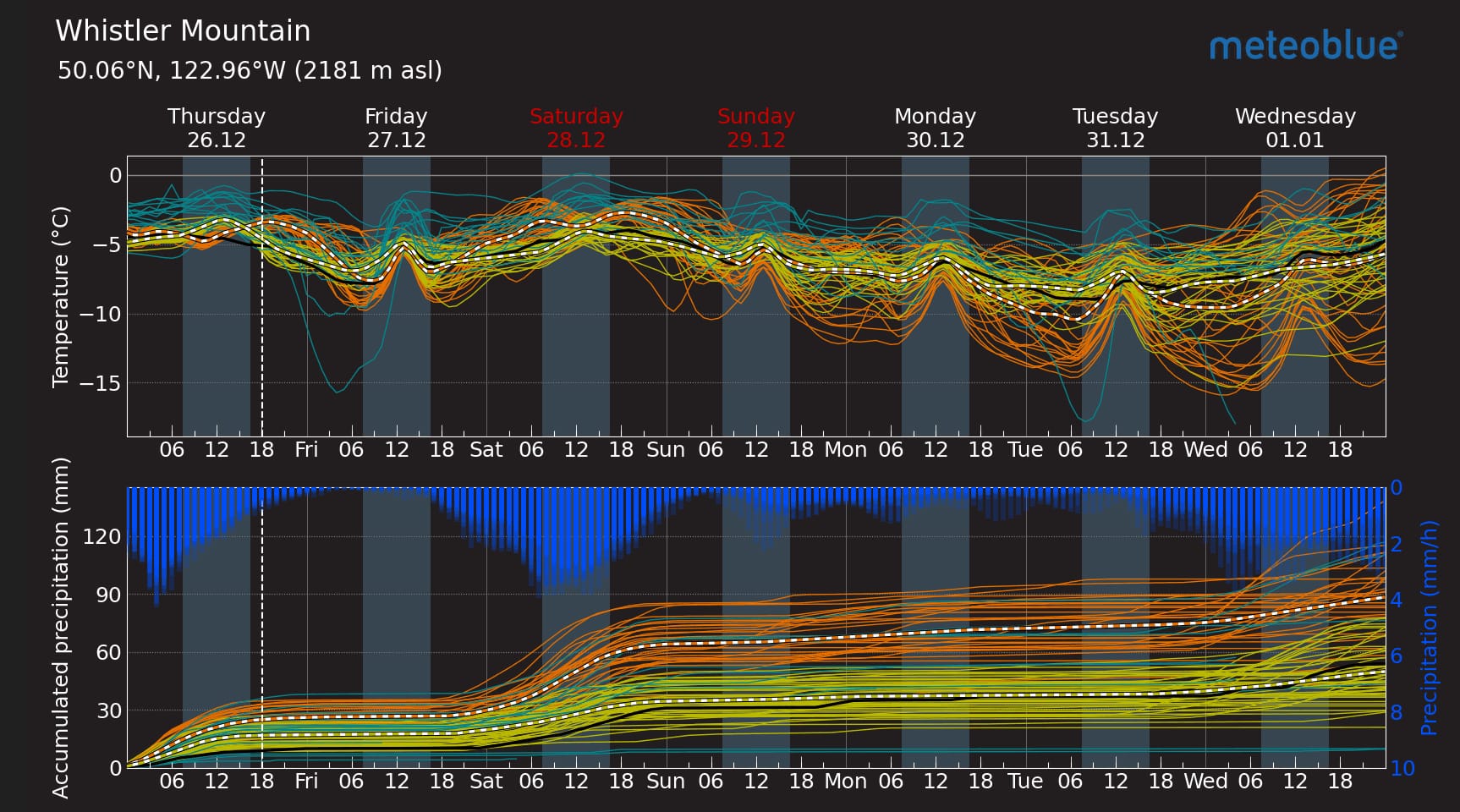
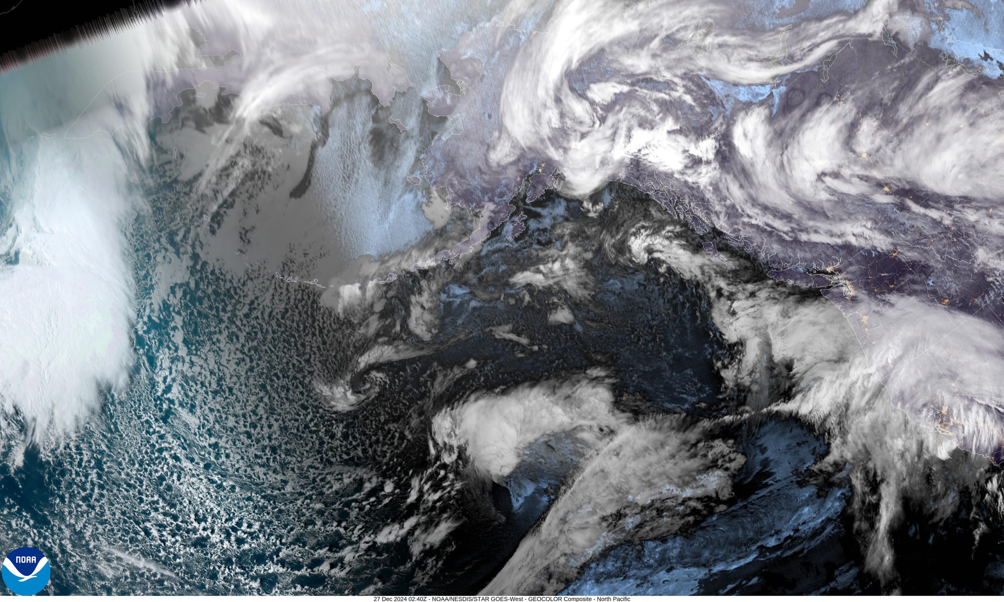
Meteoblue Multimodel Forecast for Whistler (L). Goes West satellite image (R)
Slabs are the main concern as the snow is ongoing. We’ll be watching the wind and the possibility of increasing wind slab through the week. The temps are still quite warm so we do expect the snowpack to be settling quickly. This appears to be reflected in Avalanche Canada’s forecast as well with a downward trend in hazard through the weekend.
At the moment, the public bulletin is 332 for all areas in the region on Friday and Saturday with the primary concern of wind slab at all elevations.
What are my questions for the weekend?
- What happened in the alpine!? We expect quite a bit more snow in the high alpine around Squamish than has been observed. Areas like Brohm Ridge likely got quite a bit of new snow! Whistler also recorded pretty steady strong winds through the storm so it will be interesting to see what happened there.
- What slid naturally on Boxing Day? We observed a few natural avalanches that had run early morning at TL around Squamish but there were minimal alpine observations during and after this pulse of precip.
- Will we get much more snow? Will there be more wind for slab development? There’s a LOT of uncertainty in the forecast. For example, at the moment, AvCan’s Saturday forecast for the South Coast has 25-70mm of precip! That’s a big range and you can understand why confidence is low.
What will I watch out for or avoid completely?
The next few days, we will mainly be looking for sheltered areas where the storm and wind slabs aren’t cohesive. It will be tempting to step out further if visibility improves but the current snowpack will need some time to settle. Some of the storm skiing is finally coming into shape, so it’s nice to have some great options on the table once again.
Closing Thoughts:
Ski conditions are improving and we’re moving into a storm skiing period. Make hay while the sun shines? Or snow falls? Just go skiing!
For more information, check out Zenith Mountain Guides and our local avalanche forecast. These updates are supported by SkiUphill Squamish - the best stop for ski touring equipment in the Coast Mountains and made possible by the Sea to Sky Gondola! Use this information at your own risk. Conditions change rapidly from when this report was written!

Member discussion