
Mar 12 - Sea to Sky Snow Conditions
Overall theme:
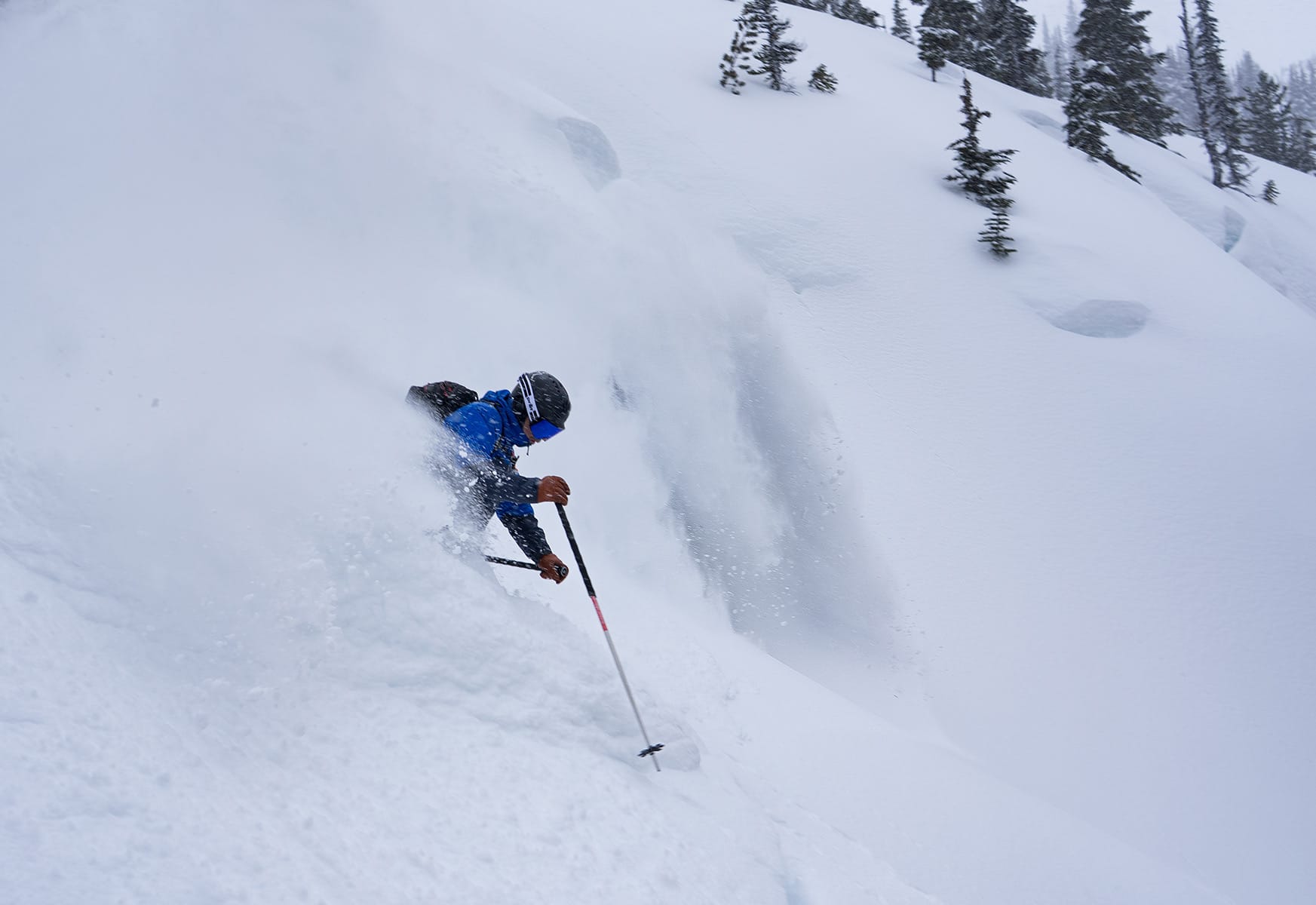
This week is probably best summed up by calling the weather volatile. We’re into a cold period now but it was accompanied by serious wind. It’s a tricky one because it feels like we should be making hay while the sun shines- or rather harvesting the cold crop before the freezing level spike - but we also need to let this wind slab situation settle out a bit before going big! At the same time, weather coming in next week makes us want to get out before things change! The treeline snowpack is the fattest of the year and lots of sheltered pow is ready to smash.
Where we’ve been skiing:
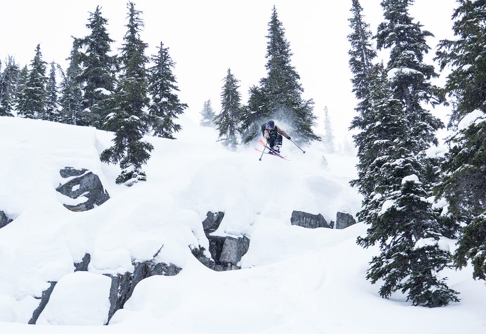
Sea to Sky Gondola, Currie, and all over the Duffey. Access continues to improve this week with freezing levels dropping and snowfall at low elevations - it snowed in Squamish! Gondola and Red Heather are in way better shape than last week. Duffey access trails are really looking good. It’s still thin below 1500m but the alpine is looking excellent. This week has been all about playing the game of finding areas the wind hasn’t touched as much. That will likely continue to be the game…
What’s happened since the last update (weather & general snowpack structure):
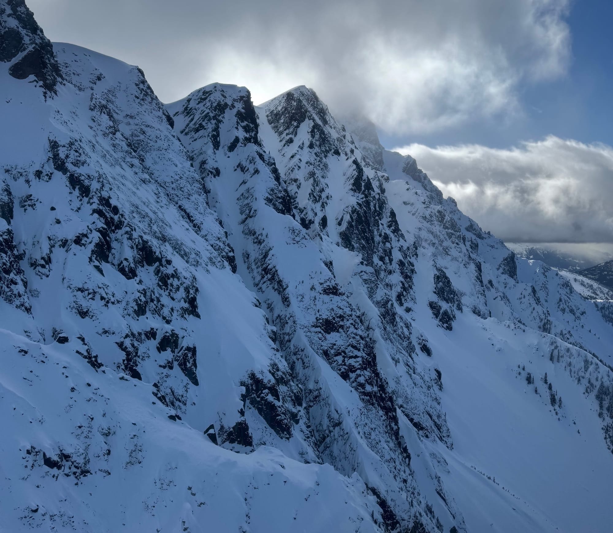
Avalanche activity in the corridor? It’s likely a widespread natural avalanche cycle occurred on Wednesday into Thursday. It was so windy that it knocked down Whistler Peak! Eric had a small skier accidental on Thursday on the Duffey in a small cross loaded pocket near ridge crest - a good reminder to be mindful of terrain!
Backing up though, the weekend was notable for a warm storm on Saturday that dropped rain to mountain top. We think this has mostly nuked out our Feb 22 surface hoar problem layer. There’s still a possibility it could be lurking but it’s pretty unlikely. Temps cooled and the rain briefly turned to snow but then things cleared up on Sunday and the mountains were mostly a crust surface (folks are calling this the Mar 7 crust). Snow on Sunday night really started improving things and then it’s been trickling in all week to really smarten things up. If it weren’t for the pesky 100+ kmh winds on Wednesday night, we’d really be in good shape! Unfortunately though, it’s wind slab city in the alpine. We’ll see how this tightens up!
What’s the weather and avalanche forecast?
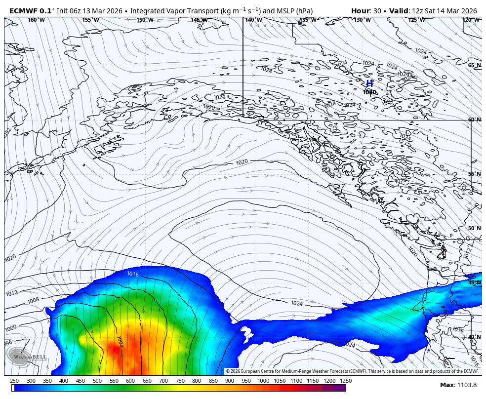
A ridge of high pressure will start to build offshore later Friday into Saturday morning, pushing a weak system to the south with clearing over southern BC. The building ridge of high pressure will bring a cool northwesterly flow with a small chance of flurries on Saturday. A strong Pacific system will take aim at the BC coast later Sunday into Monday, with a warm front pushing the freezing levels up to 2500m to 3000m with an atmospheric river setting up over the area. Very strong winds can be expected over the alpine early next week.
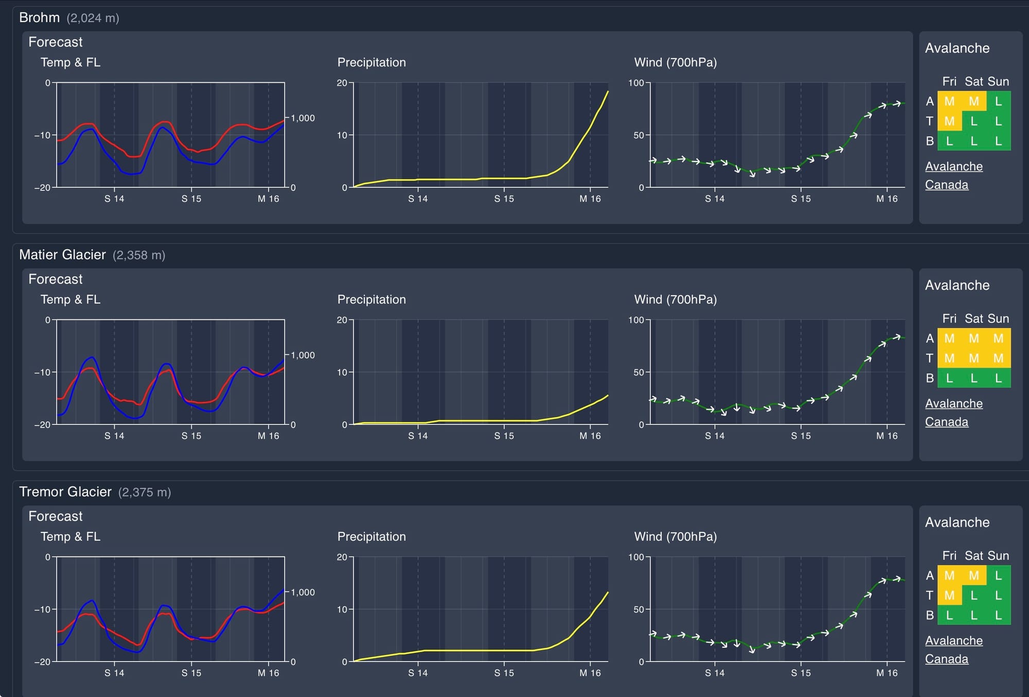
Winds Speed:
- Friday: Southwesterly 10 gusting 30 km/h.
- Saturday: Southwesterly 10 gusting 30km/h.
- Sunday: Southwesterly 40 gusting 80 km/h.
Sea to Sky Freezing Levels:
- Friday: 300m rising to near 1000m
- Saturday: Valley bottom rising to near 1000m
- Sunday: 200m rising to near 700m
Precipitation:
- Friday: Trace to 1cm
- Saturday: Trace
- Sunday: Trace to 10cm by Sunday afternoon at 4pm.
The current avalanche hazard is mostly a storm/wind slab problem. This is expected to settle out quickly but it still remains to be seen just how well it’s bonding to the March 7th crust, especially in the alpine as not a ton of operators have been up high since the wind. It’s likely we’ll see the hazard decrease as we get into the weekend and then increase again early next week as the freezing levels increase.
What are my questions for the weekend?
- Will the new wind slabs settle out and bond well to the Mar 7 crust? I’m going to step out slowly to bigger alpine terrain.
- What kind of precipitation will we see with the high freezing levels early next week?
What will I watch out for or avoid completely?
- Wind loaded alpine terrain for the next day or two!
Closing Thoughts:
Get it while you can this weekend. Saturday is the day before the weather changes, so stay tuned in to see what people find out there on Friday.
For more information, check out Zenith Mountain Guides and our local avalanche forecast. Weather forecasts are custom from meteorologist Jason Ross. These updates are supported by SkiUphill Squamish - the best stop for ski touring equipment in the Coast Mountains and made possible by the Sea to Sky Gondola! Use this information at your own risk. Conditions change rapidly from when this report was written!
Member discussion