
Mar 20 - Sea to Sky Snow Conditions
Overall theme:
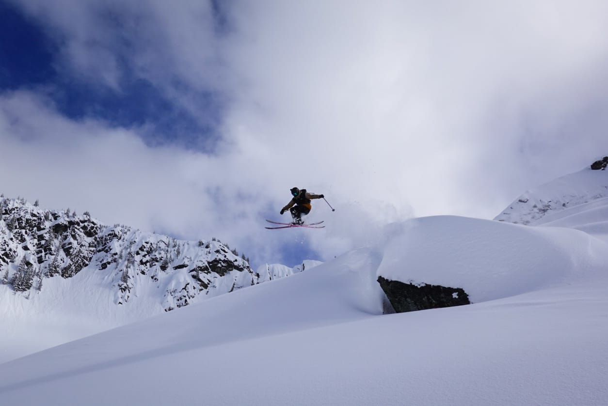
Yes it’s been a wet week. We’re still optimistic (even if Evan is currently on a flight to Europe). The skiing last weekend was all-time and it was sad to watch it flip to rain but the freezing level has only tickled mountain-top and overall, snow has been accumulating in the high alpine. Down low is taking a beating but as the freezing levels drop, it’s going to shape up real nice.
Where we’ve been skiing:
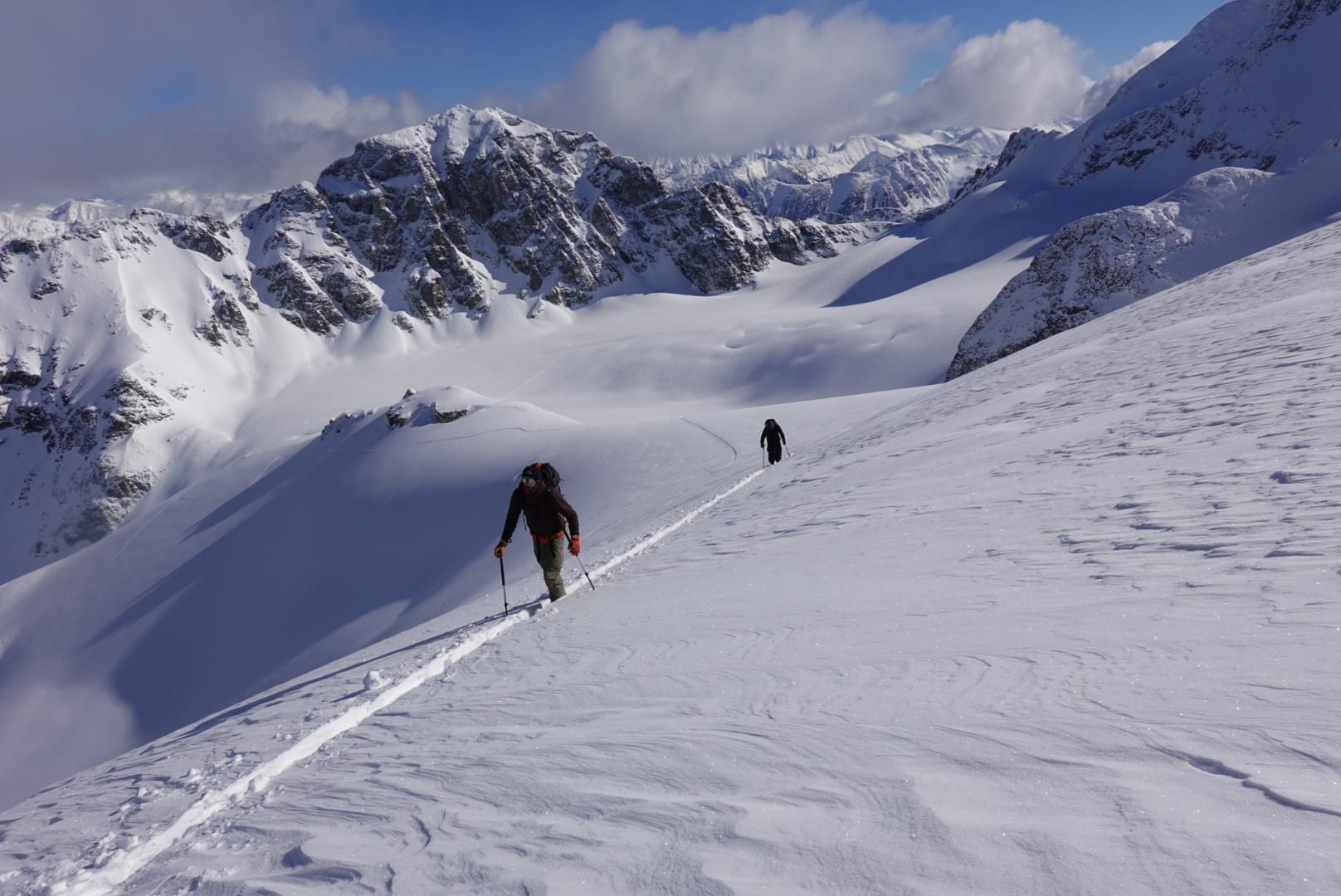
Last weekend, mostly Duffey and a little bit of Squamish. The Duffey was where it was at. These spring style storms tend to just dump up there and it glues on really well. When March comes around, that’s where I’m thinking about the most! Since Monday, we’ve been in the climbing gym…
For access routes, we’re taking a real hit. We expect the Squamish zones to have melted back up above the trailheads (likely to the lookout at Red Heather for example) while further north things like Rubble Creek and Singing Pass will also be in poor shape. Duffey trailheads should be fairing better as they were in quite good shape before. There will certainly be some ice and chunder to contend with but we don’t expect those will be fully out.
What’s happened since the last update (weather & general snowpack structure):
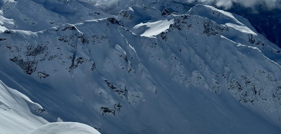
Last weekend, avi activity dropped to a minimum - the deeper instabilities from early and mid-February had pretty much dropped off our radar. Since Sunday, very few folks have been in the alpine but it’s likely we’ll see evidence of a widespread avalanche cycle in the alpine and at treeline. The Duffey was closed on Thursday a few hours for avalanche control and it did end up covering the highway! Activity should be tapering off significantly even by Friday evening into Saturday.
What’s the weather and avalanche forecast?
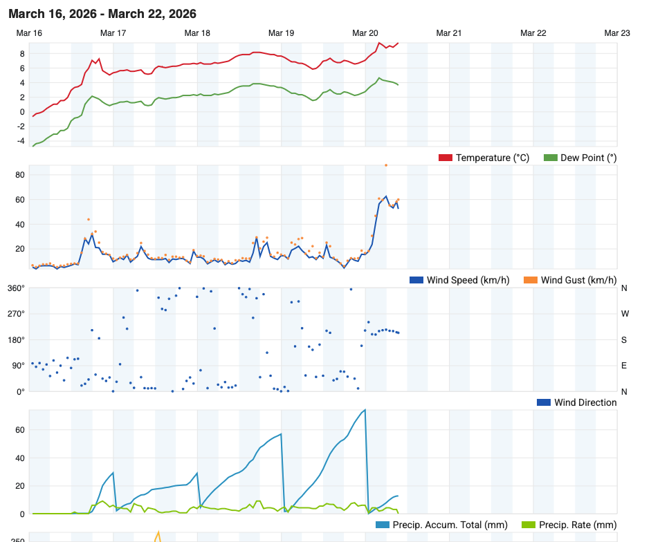
An atmospheric river will persist in bringing warm and wet conditions through Friday, with elevated freezing levels between 1500-2000m. A cold front will impact the south coast on Friday afternoon, bringing strong winds and lower freezing levels. A high-pressure ridge will introduce drier and cooler conditions on Saturday, followed by a weak system that will brush the area Saturday evening into Sunday morning resulting in showers and alpine flurries.
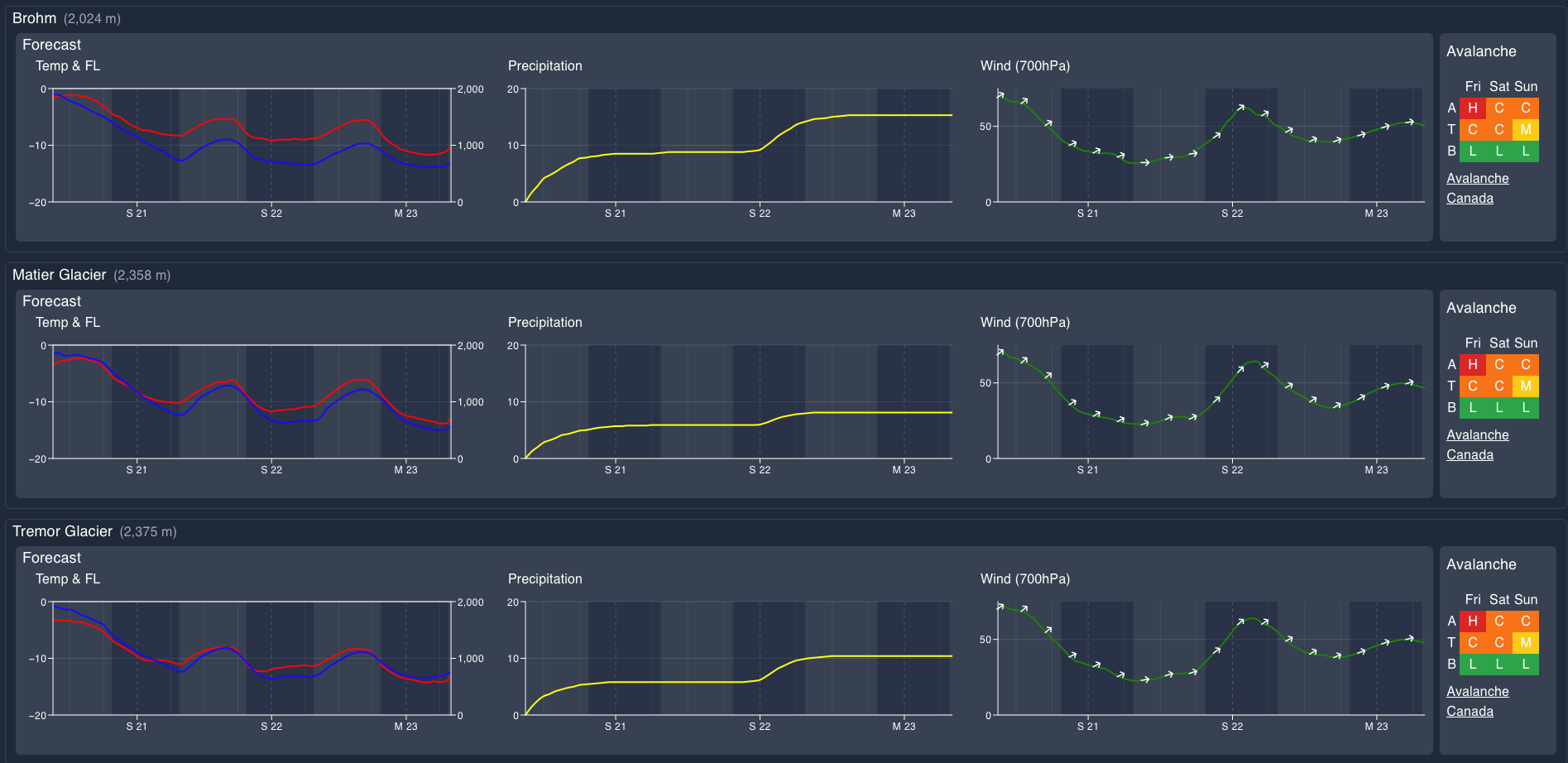
Wind Speeds:
- Friday: Southwesterly 50 gusting 90 km/h. Need to watch for strong winds at the S2S gondola with the front moving through Rod and Caitlin!
- Saturday: Southwesterly 10 gusting 30km/h.
- Sunday: Southwesterly 40 gusting 60 km/h.
Sea to Sky Freezing Levels:
- Friday: 2000 lowering to near 1500m
- Saturday: 600m rising to near 1200m
- Sunday: 600 rising to near 12000m
Precipitation:
- Friday: 15-20mm with high amounts over the high alpine.
- Saturday: Nil
- Sunday: Trace to 7cm by Sunday afternoon at 4pm.
Avalanche hazard is considerable to high depending where you are throughout the corridor. This is related to the rain on snow and heavy snow event that is ongoing - wet slabs, wet loose, and storm slabs all together. We’ll see hazard decrease throughout the weekend as the temps cool and the snowpack tightens up. We’ll switch from a worry of entire parts of the snowpack failing to primarily surface instabilities. Watch for wind/storm slab problems into the weekend and be wary of any lingering wind post-storm.
What are my questions for the weekend?
- When will the freezing levels drop with regards to the remaining precip? It’s a great switch from warm to cold but how much of that cold snow will fall?
- Will we see the sun and how much punch will it pack? With a saturated and then refrozen snowpack, we expect it to have a little less punch than if it was hitting a winter snowpack but we’ll see.
What will I watch out for or avoid completely?
- Ski quality will be a big deciding factor for my next few days. How can I get high enough above the mush and majorly rain saturated snowpack?
- In the high alpine, wind slab will be a major concern and so will be watching for that to settle out over the next couple days.
Closing Thoughts:
This week was less depressing than I think a lot of people worried it would be. Certainly BTL terrain too a huge hit and low access will be worse but the temps are slowly dropping and more and more of the precip is falling as (wet) snow. By Sunday, we might be sitting on pretty darn good skiing, especially if visibility improves. The storm pulse coming Tuesday/Wednesday looks really promising for mid-level accumulation. The best skiing will be up high when conditions allow - look for those surface instabilities to heal and then we’ll be thinking about high Garibaldi, Spearhead, and Duffey zones.
Make the most of the remaining season by booking in for a Spearhead Traverse or jumping on the final spot in our Icefall traverse!
For more information, check out Zenith Mountain Guides and our local avalanche forecast. Weather forecasts are custom from meteorologist Jason Ross. These updates are supported by SkiUphill Squamish - the best stop for ski touring equipment in the Coast Mountains and made possible by the Sea to Sky Gondola! Use this information at your own risk. Conditions change rapidly from when this report was written!
Member discussion