
Mar 28 - Sea to Sky Snow Conditions
Overall theme:
We have reached saturation point. Not sure what else to tell you but it’s tricky everywhere.
Want a distraction? Watch Eric’s new video waking you through tactics on the Spearhead Traverse. Seem too complicated? Book a traverse with Zenith! Send us an email: zenithmountainguides@gmail.com
Where we’ve been skiing:
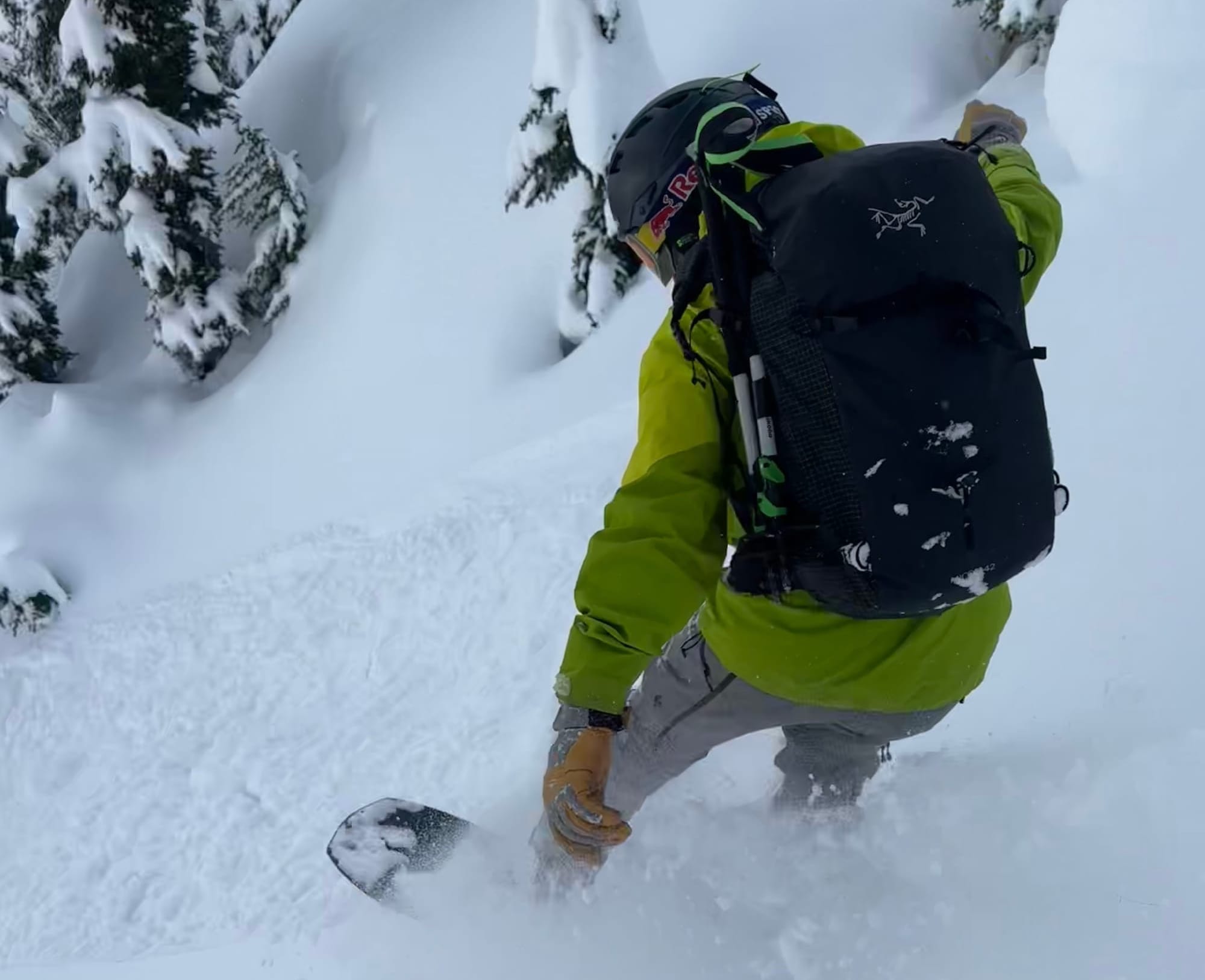
We were both skiing up on the Duffey on the weekend before the Pineapple Express started. There was great skiing in a lot of places as long as you avoided the slopes still affected by the PWLs. Since the warmup, we’ve mostly been avoiding skiing. Eric was out on Thursday for a conditions check at Blackcomb and found a few good cream cheese turns up high but a lot of mush down low.
What’s happened since the last update (weather & general snowpack structure):
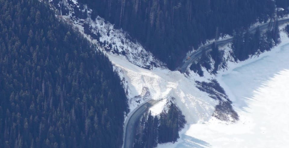
Avalanche activity seemed to taper off over the weekend however people were still generally skiing conservatively. A few of the common performers had slid giving opportunities to get into steeper terrain but it definitely wasn’t a green light. By Monday, the snow had mostly turned to rain and Tuesday/Wednesday brought freezing levels that touched ridgetop throughout the corridor. Precip totals were much higher in Squamish (~40+mm) compared to the dry side of the Duffey (~15mm) but we saw a large natural avalanche cycle throughout the corridor. Chute 51 (Blowdown) hit the Duffey Lake Road Tuesday evening and has kept it closed for several days for cleanup. On Thursday, some clearing allowed us to see into Garibaldi Park and the very large avalanches out on Decker, Fissile, Iago, and Fitzsimmons. There were also numerous sz 1-2 avalanches on smaller features like moraines and steep cliffs throughout the park. These were a mix of wind slab and wet slab avalanches, with some potentially stepping down to the PWL. Several may have been cornice triggered but many appeared to have been triggered by rain.
Overall, all the storm snow that fell over the last 10 days has now been saturated and turned into a wet slab. This sits on the March 4th melt-freeze crust. The strength is doubtful due to the large avalanches all around. The saturated upper snowpack gains strength as the pack cools but that hasn’t been happening yet so along with our slab problem, loose wet avalanches will be easy to trigger in the near future. Until we get some cold temps and less rain, the snowpack will remain weak!
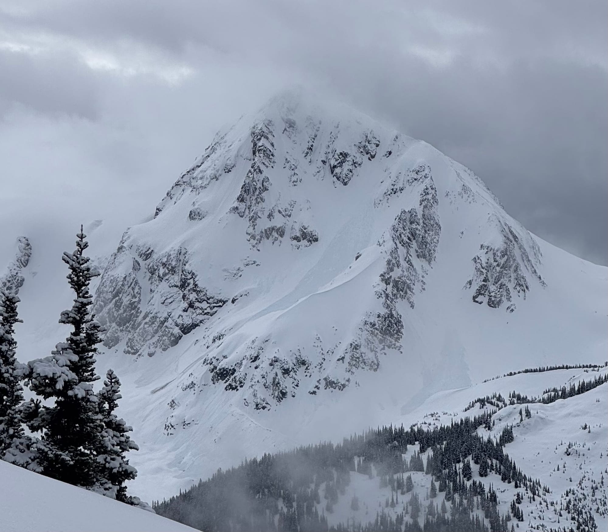
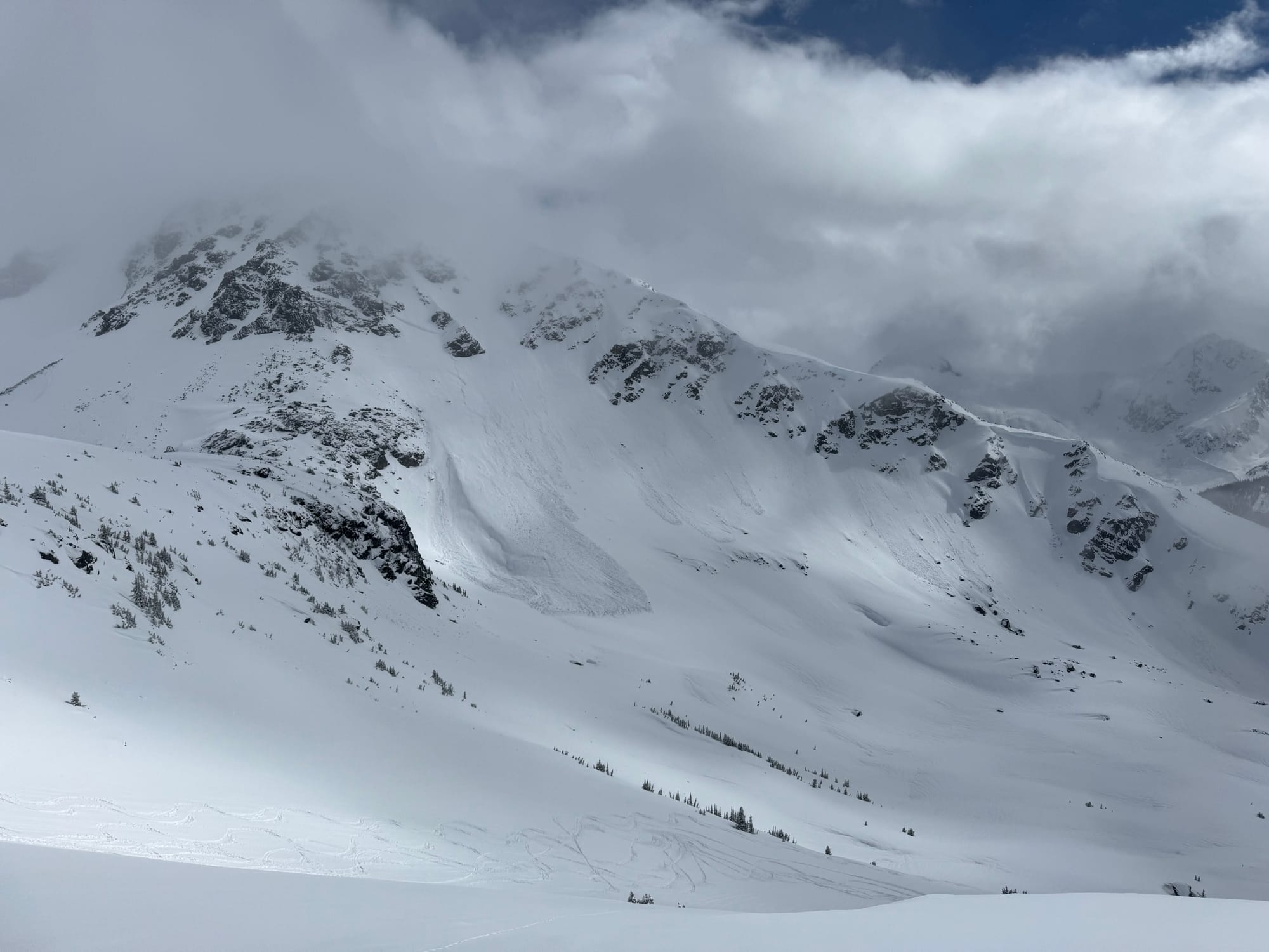
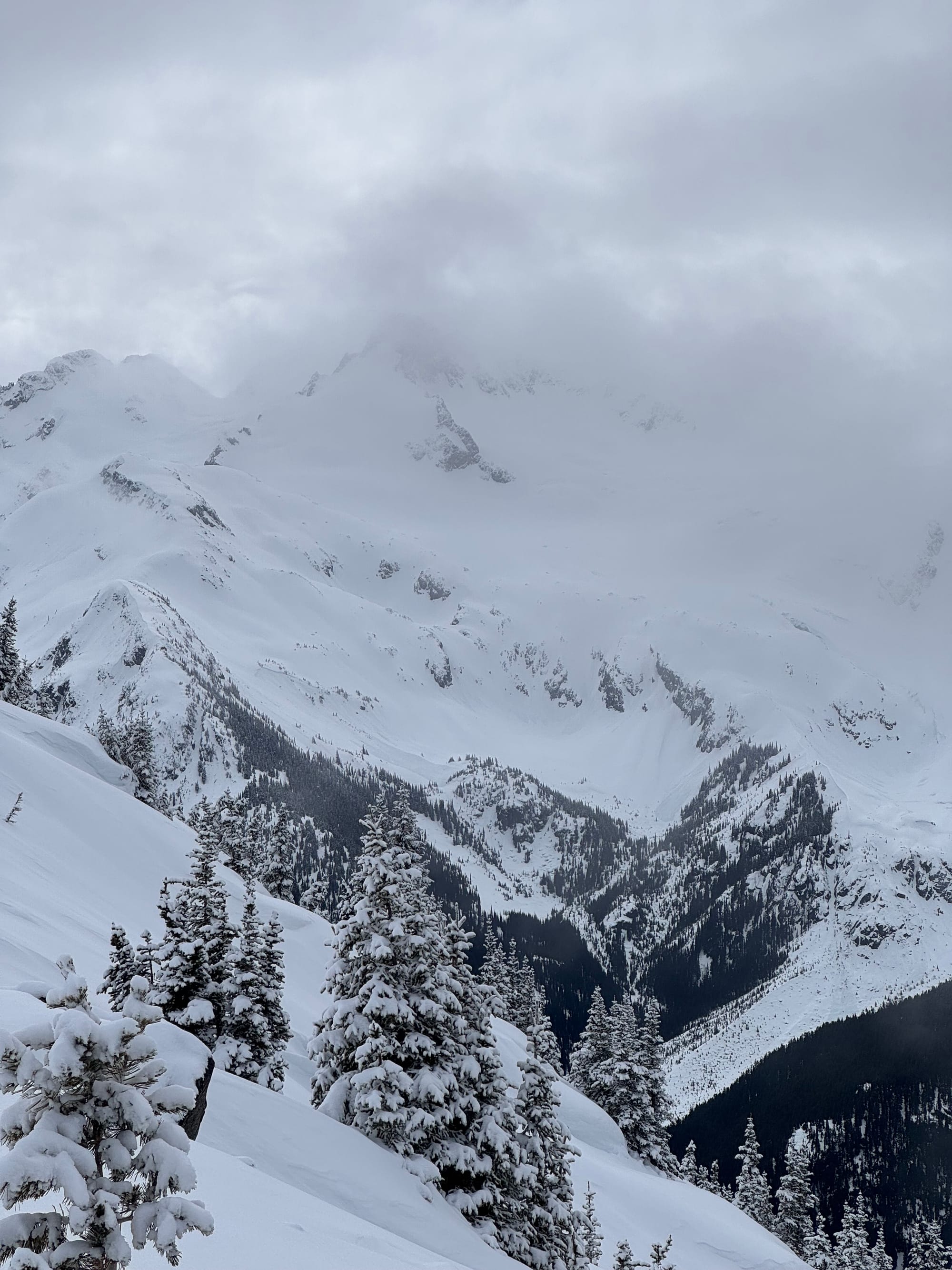
Garibaldi park avalanches - Fissile, Decker, Overlord moraines (L to R)
What’s the weather and avalanche forecast?
An upper low off the BC coast will bring convective bands of precipitation into southern BC before weakening on Saturday. Flurries and rain showers can be expected at times, with freezing levels remaining between 1,200 and 1,800m on Friday and Saturday. A weak ridge of high pressure will provide a brief break on Sunday, with the freezing level rising to 2,000m. Another low-pressure system approaches the coast on Monday, bringing cooler temperatures and alpine snow.
Synopsis:
- Friday - 5-10cm new precip with light southerly wind and freezing levels 1200-1800m.
- Saturday - 5-10cm precip with light SW wind and FLs 1000-1800m.
- Sunday - Nil precip with light to moderate SE wind and FLs 800-2000m.
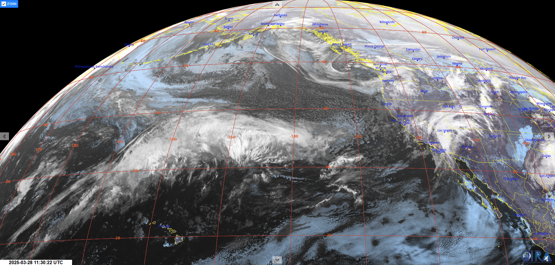
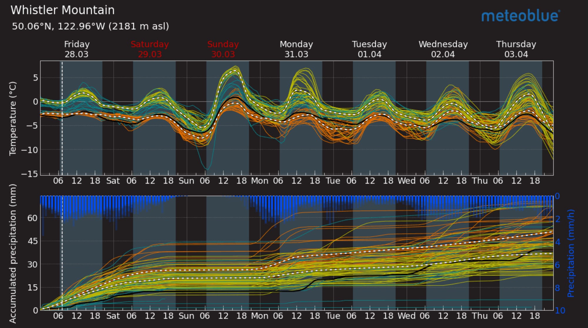
GeoColor imagery showing a trough of low pressure off the coast (L) - this is our current firehose. Meteoblue Multimodel forecast for Whistler (R).
Avalanche hazard stays elevated throughout the weekend. Currently the north shore is expected to get close to 50cm of new snow in the alpine and the hazard is high. The rest of the corridor is seeing lower snow totals but will be dealing with new snow problems even as the slushy snowpack starts to heal. Expect elevated hazard the next few days.
What are my questions for the weekend?
- Can I find anywhere that’s cooled enough to help set up the upper snowpack?
- Did the rain cause enough of an avalanche cycle in our dry areas (E Duffey, Hurley, etc) to clear the PWL?
What will I watch out for or avoid completely?
- On Thursday and today, we are completely avoiding avalanche terrain.
- On the weekend, we’ll not likely be stepping out much but looking for terrain that allows us to get into the mountains while having less exposure to steep lines and overhead hazard until it cools off.
Closing Thoughts:
This is a tricky one. A lot of people have given up on winter already but we’re not there yet. Conditions like right now are good for getting in the fitness and tuning the gear. Watch for a return to a more settled weather pattern and then get ready for good spring skiing! The onshore flow means we’ve got big precip falling right now. FLs dancing around the 1200m line are tempting. If you’re trying to get out now, get above that line! 1 degree makes all the difference to us.
For more information, check out Zenith Mountain Guides and our local avalanche forecast. Weather forecasts are custom from meteorologist Jason Ross. These updates are supported by SkiUphill Squamish - the best stop for ski touring equipment in the Coast Mountains and made possible by the Sea to Sky Gondola! Use this information at your own risk. Conditions change rapidly from when this report was written!
Member discussion