
Nov 14 - South Coast Conditions Update
Welcome to the 2024 season of the Zenith Mountain Guides snow conditions newsletter! The purpose of this weekly email is to help skiers on the South Coast stay up to date on conditions and avalanche hazard and to better prepare for days of skiing! We want you to get as rad as possible but as early as possible.
We’re committed to keeping this newsletter free so everyone can benefit. If you find this useful, please forward it to your ski partners and let them know to sign up as well! If you find it REALLY useful - consider becoming a paid subscriber. It’s cheaper than grabbing a coffee before you go skiing and (maybe) more useful than the caffeine! There’s a few benefits to being a paid subscriber:
- Access to our chat group. This is where we’ll be adding the extra details that we don’t have space to fit into the newsletter (we can only fit so much). If you want to see the pit we dug or the snowpack test video we did, extra conditions photos and more will all be here. You’ll be able to ask questions and chat with other highly engaged skiers who are part of the group!
- Early access to all Zenith Guides courses and ski days. If we see a good day for skiing big lines in the Tantalus coming up, you’re going to hear about it first!
- Support us - we’re putting a lot of work into making this a high quality report and if you value that, subscribing is the best way to say thank you!
We’ll be sending these out on Thursdays going forward so you can best plan for the weekend. OK - on to the goods!
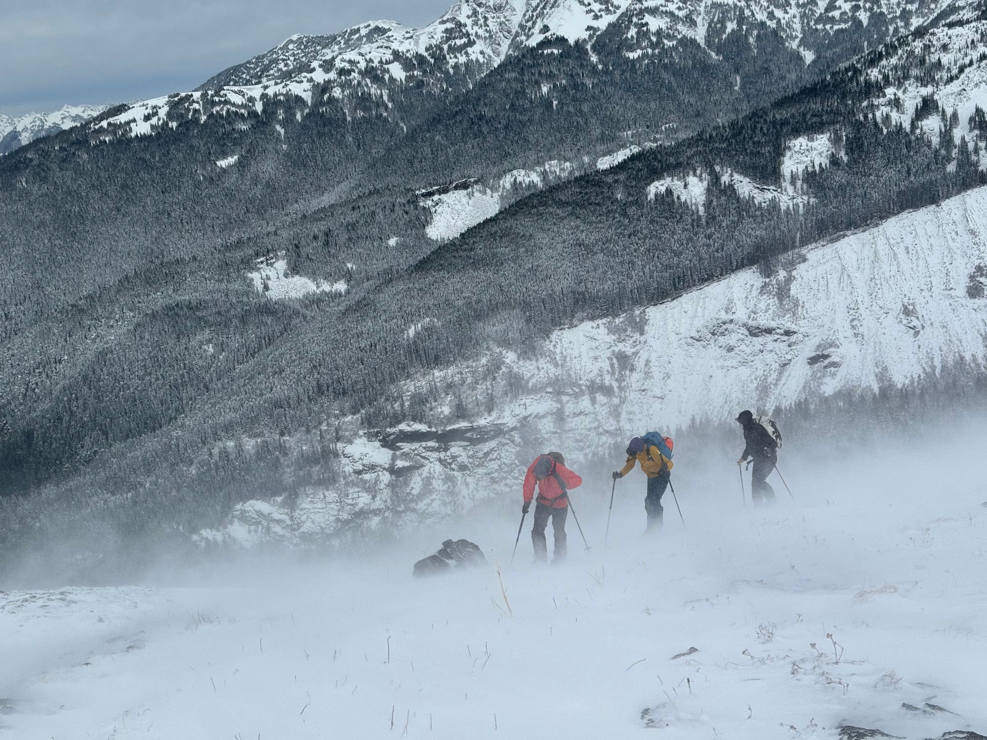
Where we’ve been skiing:
We’ve both spent a few days in the Squamish area around treeline. Eric went for a little field trip down to check things out on Heliotrope Ridge at Mt. Baker. We’ve also gotten a handful of reports from the Duffey.
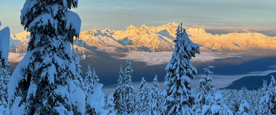
Goat Ridge, Co-Pilot, and Tantalus from Red Heather all showing current snow line.
What’s been happening:
We had minimal snow before November 9th. 50-100cm fell in the corridor overnight Friday Nov 10th. This storm was accompanied by significant wind, mostly from the S-SW. Another 10-20 fell overnight Saturday and 15-25 overnight Sunday. This was also accompanied by wind in the alpine but not as wild as the first big storm on the 10th. This storm came in with good early season style. Warm and wet especially to 1200-1500m, and generally would finish colder. This is good base building weather because the mountains get sludged with cement and then good pow on top for skiing.
The increments and temperatures described above have led to rapid snowpack settlement. For example, the total height of snow (HS) was 75 cm on Saturday at 1450 meters, and even with 50 cms of new snow the HS in the same spot on Monday was only 90 cm! That’s good for our snowpack!
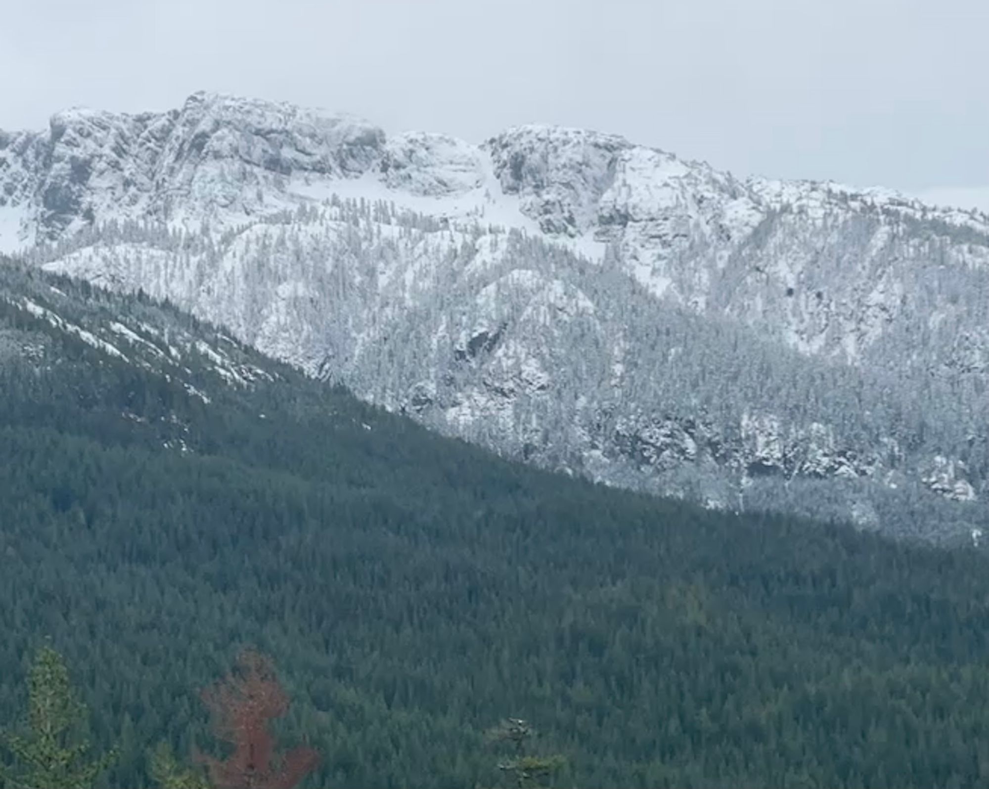
Around Squamish, snow generally starts at 1000m with skiable coverage by 1200m and off-road skiing around 1400m. These numbers are a bit higher both for the North Shore, and the Duffey (there was snow on the highway over the weekend). This may change quickly with weather! As always, don’t forget that thick forest cover will reduce the snowpack dramatically, so going for easy access and open to the sky terrain is going to be your best bet. Near treeline is currently the best ski quality where the snow surface and pow is less disturbed. Alpine is a bit more wind scoured with pockets of windslab. Contrary to deeper snowpack times, we are looking for areas that are wind pressed/wind loaded to find fatter, supportable, filled in terrain. The biggest factor however, is ground cover. We ski for a living so making sure we are riding over heather slopes and not talus is how this will be a long season. No November ski run is worth risking the entire ski season for!
What is the weather and avalanche forecast?
Clearing on Wednesday before a new frontal system arrives Wednesday night and a return to unsettled conditions into the end of the week.
While Avalanche Canada has not started their public bulletin yet, there is absolutely increasing avalanche hazard throughout the region. Any time we see snowfalls in the 30+ centimeter range, we can expect increased avalanche activity. A bigger issue this week has been the wind that came with our storms. This was less noticeable at treeline but in the alpine, winds were strong or extreme.
Small terrain is likely to only produce small avalanches (<size 1) but there is still significant terrain trap/trauma risk. Bigger alpine terrain with significant snow and wind loading might see avalanches up to size 2.
If the weather clears enough to poke up into the alpine, we would certainly anticipate the possibility of fresh wind slabs. Fortunately there was almost no early season snow previous to Nov 10, so pockets of facets on the ground are a low probability. Despite this,we will still treat any high north facing alpine terrain as suspect until we gather enough info to be confident.
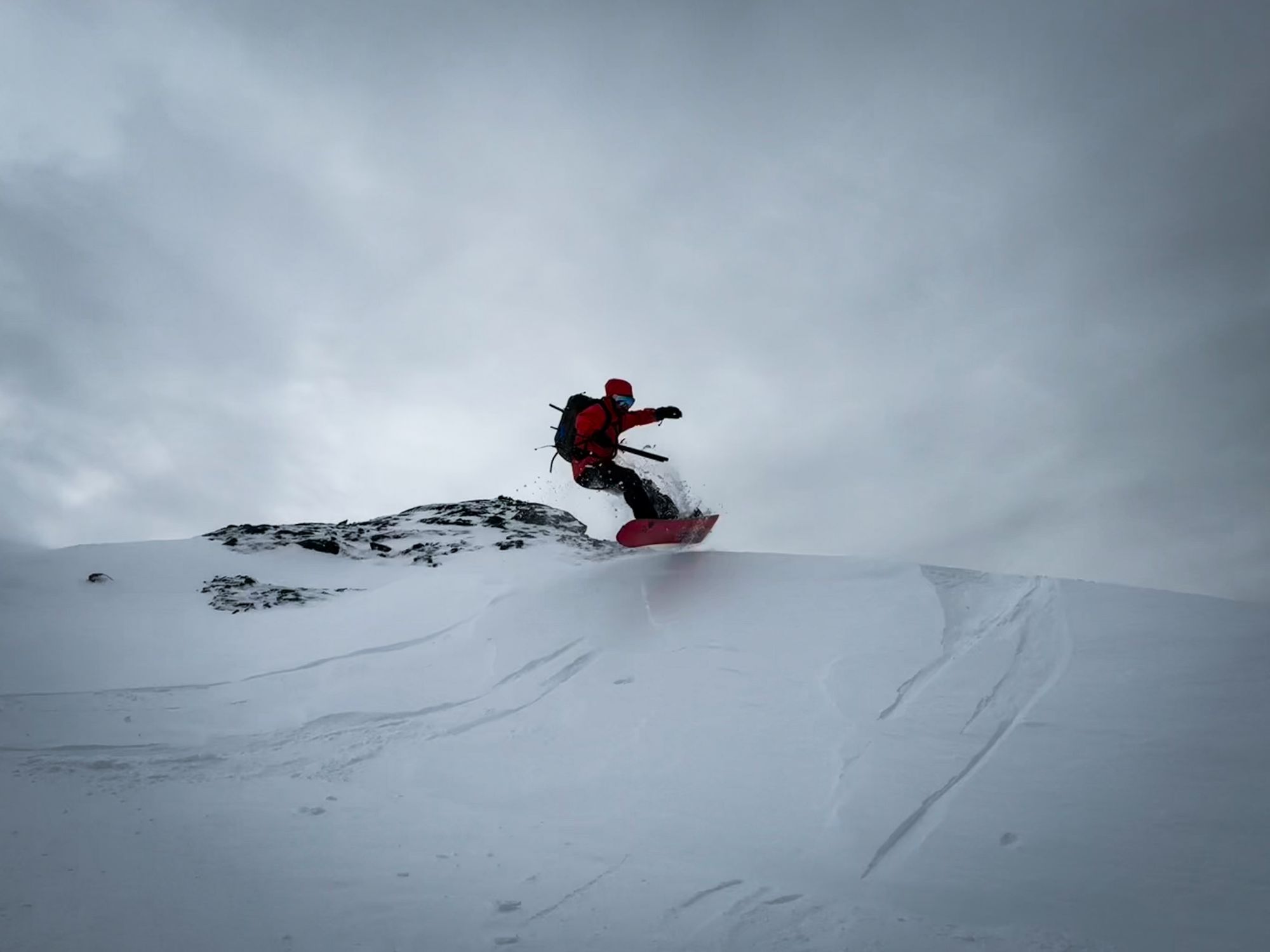
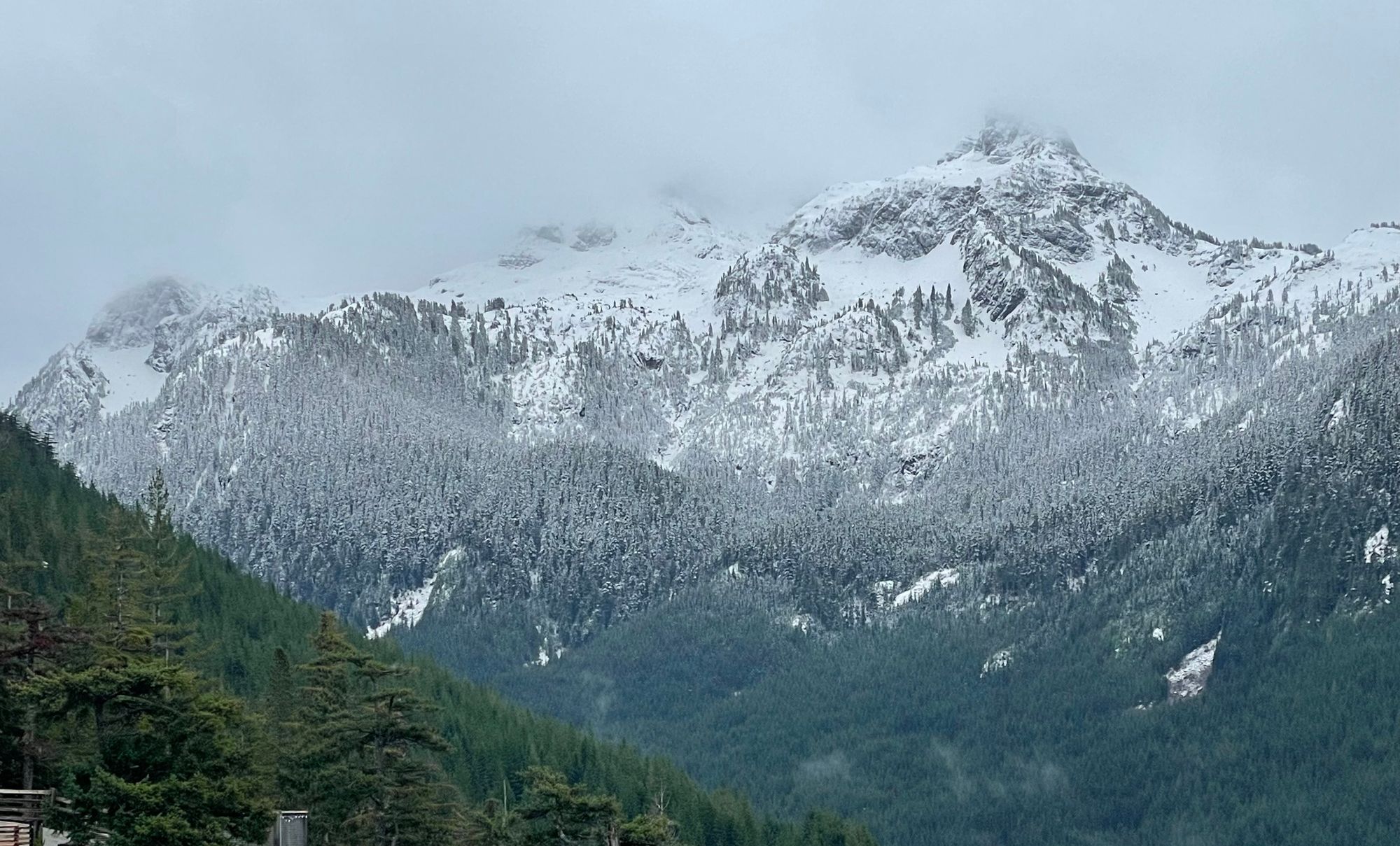
Windy conditions above treeline at Mt. Baker made for interesting wind features to play on!
What are my questions for this week?
- How much wind scouring occurred above treeline and did bigger lines sluff off or build significant wind slabs?
- Were there any pockets of lingering snow at the base of the snowpack in high alpine terrain?
- How much did it snow and stick to what in the big alpine?
What will we watch out for or avoid completely?
We’ll probably be keeping to relatively simple terrain this week. There’s absolutely still all the early season risks - trees and rocks to hit - and we don’t want to end our season hitting something silly. Big lines are just developing their base and the wind is a major factor for how they will flush out for the months to come.
Closing thoughts:
It's storm watching time. We don’t mind wet warm storms this time of year, it builds our base. Keep your eye on the local cams and weather stations to track snowline and new snow amounts. Look for smooth roads that get you to higher elevations. Lakes are almost certainly not trustworthy yet. It’s time to cautiously start exploring ski season!
BONUS: What are the weather forecasts and webcams we’re watching right now?
- Sea to Sky Gondola Weather Station - located at 900m and a good representation of Red Heather Trailhead.
- Brohm Ridge Webcam - 1450m
- Whistler Blackcomb Pig Alley Snowstake - 1650m but not being cleared regularly yet.
- AvCan Mountain Weather Report - the best regional big-picture weather report.
Member discussion