Nov 28 - Sea to Sky Snow Conditions
Overall theme:
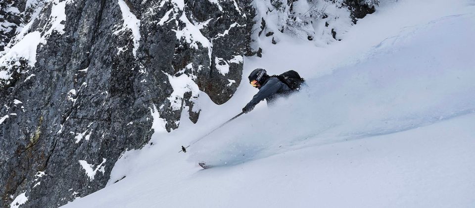
All that snow followed by high pressure and a decent snowpack has made it feel like game on! Most folks we’ve talked to don’t remember skiing this many days already in November! Consider them bonus days and brace for incoming Coastal weather :)
If you’re one of the lucky 100 folks who grabbed a ticket to our snowpack talk/season opener party next week, get excited! We’ve got our snowpack talk as usual, a short ski film, an awesome raffle and some fun games all while you have the option to grab dinner and drinks from the S2SG summit lodge restaurant! We’ll see you up there!
Where we’ve been skiing:
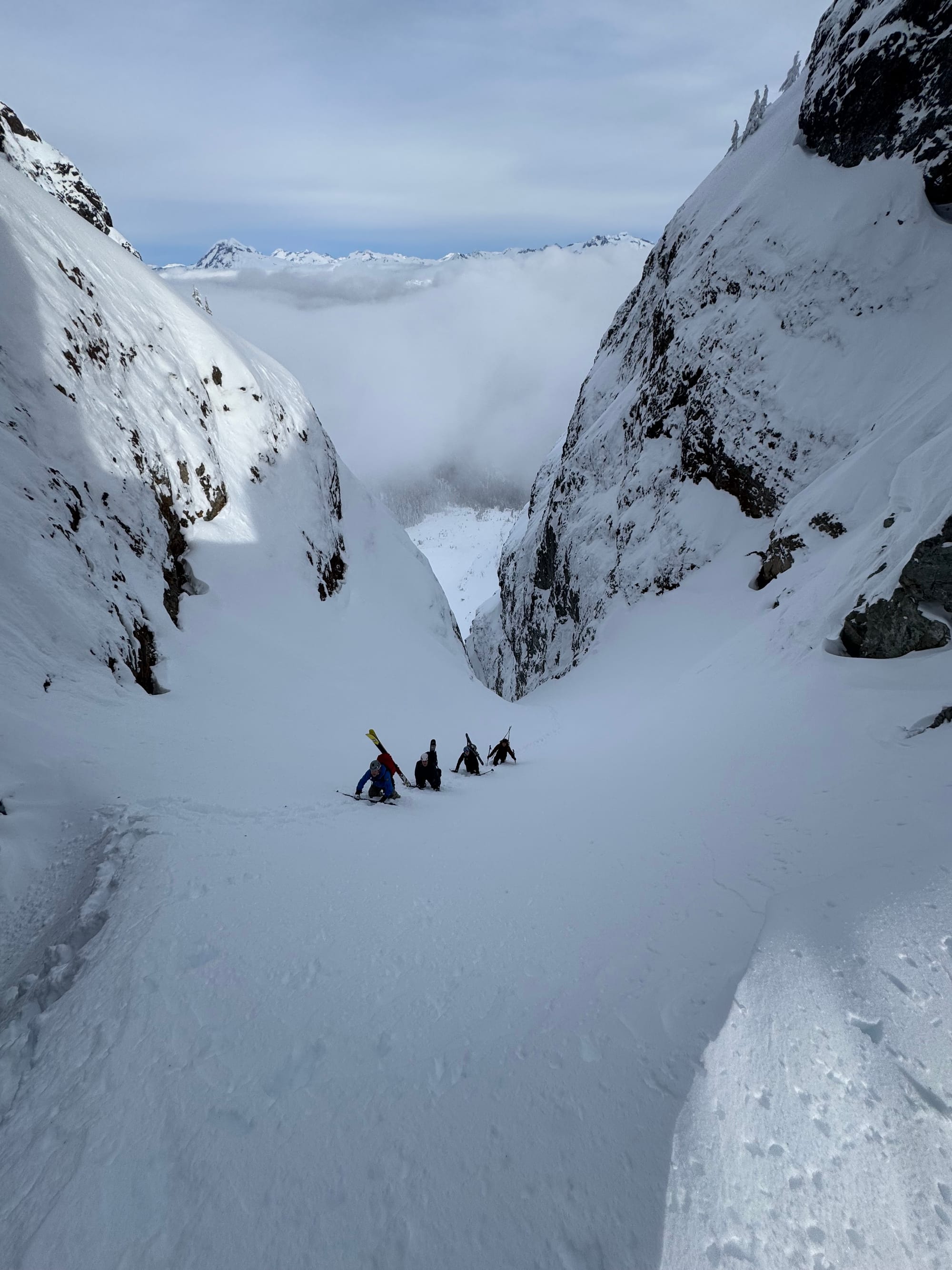
Sea to Sky Gondola has been in good shape. The road requires a short walk out to Ultraviolet Cliff but then is groomed to the snow study plot and cat turnaround. There’s a bit of alder bashing at the end of the road and then skinning up the tree triangle is 5.11ish skinning (Eric bootpacked on Thursday). Over a 2 meter snowpack at tree line!
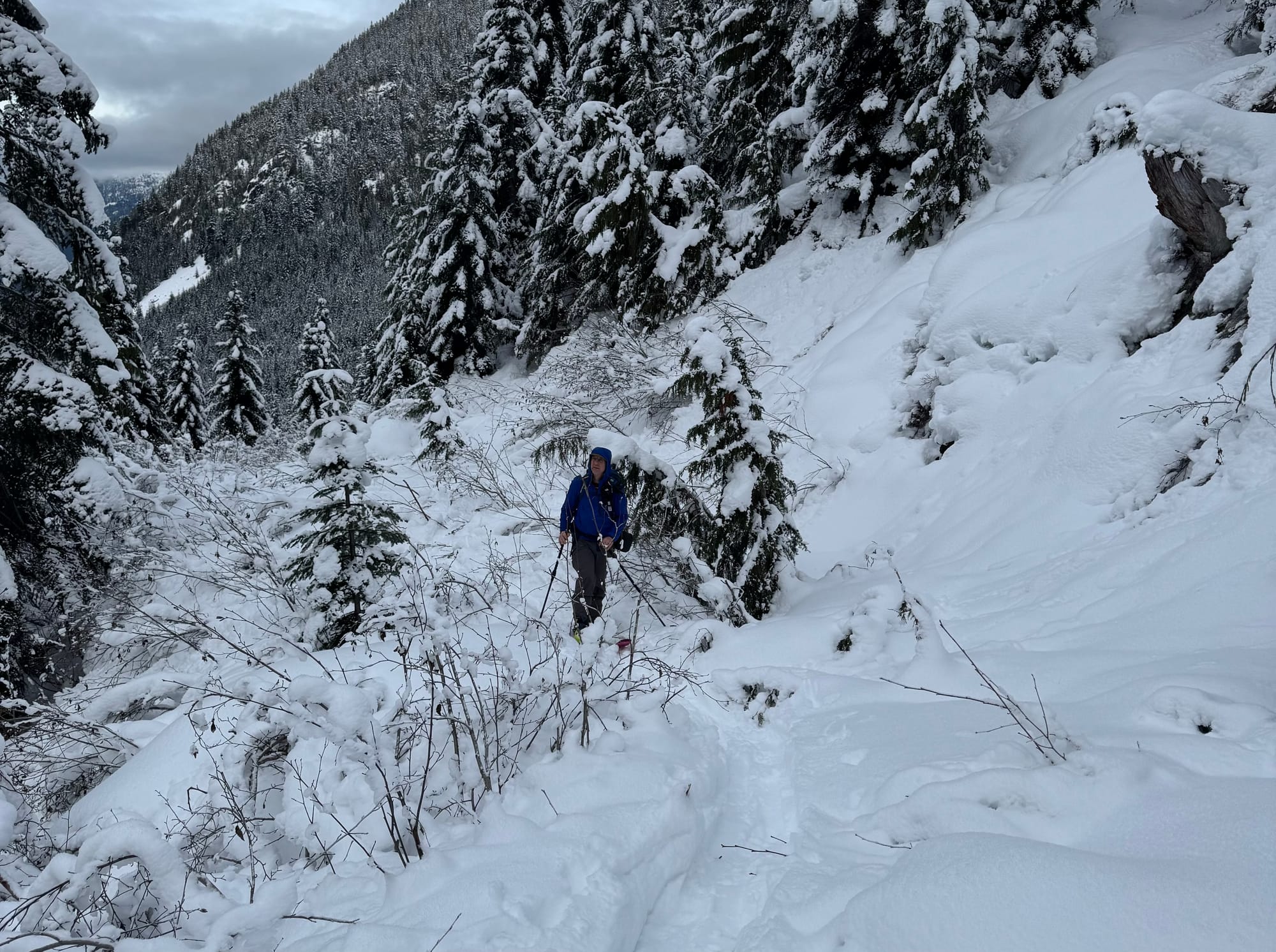
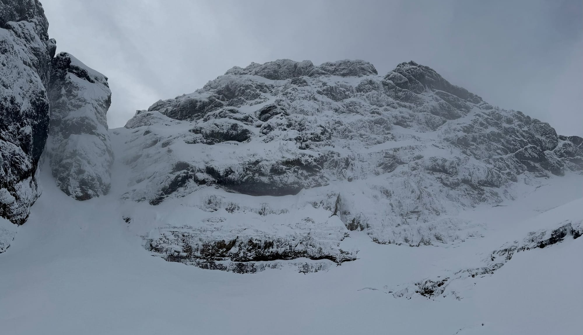
Still a bit of alder at the end of the gondola road (L)! Image of Sky Pilot NF for the climbers! Note the small crowns at the base of the face. Gunsight Gap Couloir looks fairly filled in but several parties turned around on Friday due to snowpack.
Evan cruised around the Rutherford range and skied some of the high elevation glaciers noting a strong snowpack but lots of evidence of wind.
Notes from the Whistler/Blackcomb Backcountry is that upper lifts still have not opened but touring is possible. Ski out to the valley bottom is possible on the Blackcomb side for sure. Watch for crevasses on all glaciers - it’s full ski mountaineering season!
Our team also had eyes or skis on snow in the Callaghan, visuals on Birkenhead zone, and the Hurley area. Folks have been getting up Shovelnose and Red HEather and it seems like logging roads are generally drivable to between 700 and 900m depending on road aspect and vehicle. Major sled zones are now becoming sled zones so watch out that you don’t block roads!
People have been getting adventurous and exploring, but the most important thing to keep in mind is its still November and it's an ‘average’ season! We keep seeing some aggressive ski behaviour and folks hungry to get after it; ourselves included! It’s really easy to bite off more than you can chew, and just because lots of things look better than most of last season…doesn’t mean they are good to go. Just today, Evan chunked his new skis on some rocks in the Alpine above 2100m - this is a result of being too greedy for the time of year and, especially alpine features, combined with glacial recession results in lots of lines not being filled in yet. There is so much more to go explore right now for sure, and we are set up nicely. Just be picky, and don’t force lines that aren’t ripe yet, because there are plenty of features that are good to go!
What’s happened since the last update (weather & general snowpack structure):
High pressure has settled in, and with it cool temps, rapid snowpack settlement and surface hoar in sheltered locations. We’ve seen settlement rates of 20% or so as the storm cycle abated. We’ve had some winds pressing/slabbing/scouring exposed alpine ridgetops and faces especially above 2200m in the Rutherford zone.
This has translated into a strong snowpack reflected in the current 1-1-1 forecast from avalanche Canada. The surface hoar has created a lovely skiing surface (listen to the shushing) over a fairly firm base. Boot pen is relatively deep in areas while ski pen is very shallow. Eric was surprised dropping into a couloir at the S2SG, finding it very stiff on skis after a major wallow up!
What’s the weather and avalanche forecast?
A weak system from the Gulf of Alaska will slide down the BC coast later today into Saturday morning, spreading light precipitation to the area. Later this weekend, a strong ridge of high pressure will build over southwestern BC, setting up a strong temperature inversion that will maintain drier conditions with morning fog and cool overnight temperatures through early next week.
- Friday: Freezing level near 600m with no precip and light to moderate winds.
- Saturday: FL rising from 600 to 1000m with 5-10cm of snow possible and light to moderate wind.
- Sunday: 1000m FL in the morning with a temperature inversion setting up in the evening and no precip. Light to moderate winds.
We don’t really love buying in to the long range models when they don’t give me the results we want! All fingers are pointing to a warm series of systems as the storm track drifts more northward with a south westerly flow… Expect that middle and late next week will be warm and possible wet!
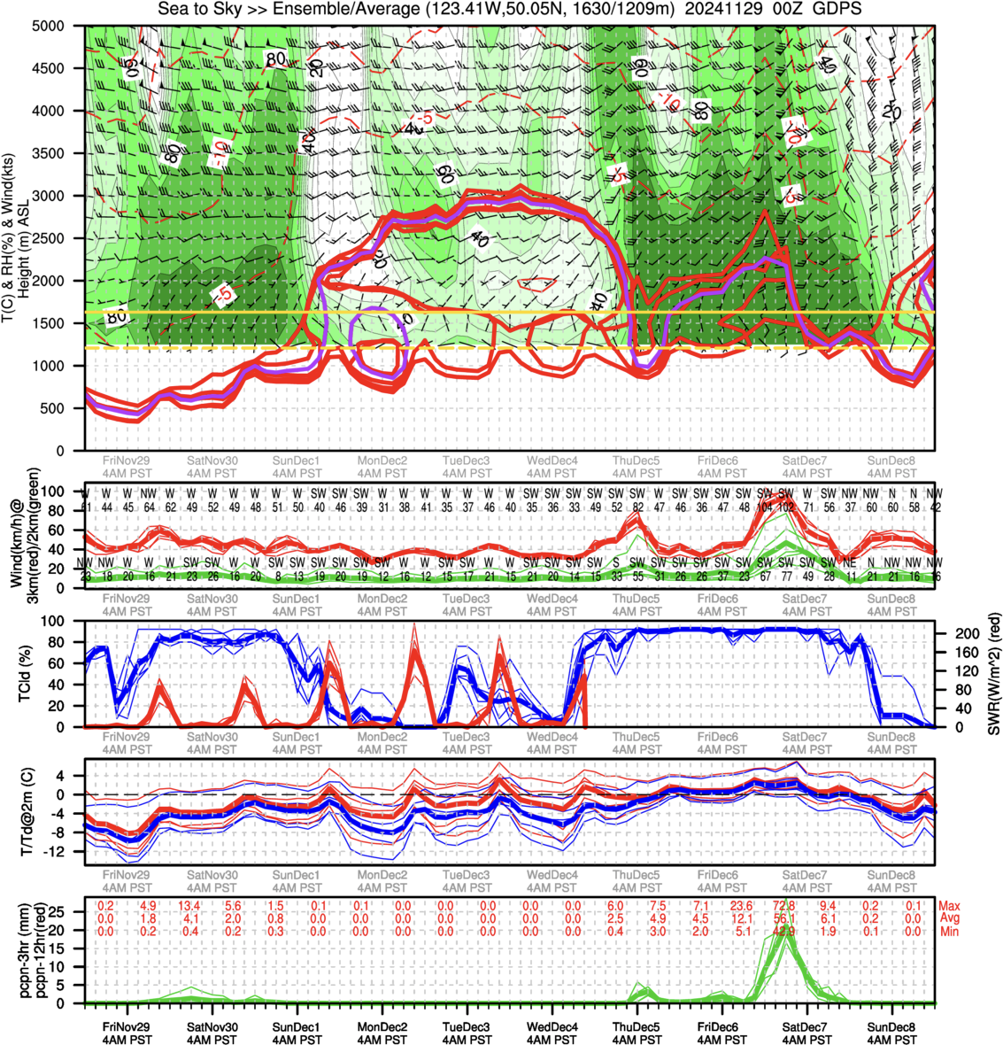
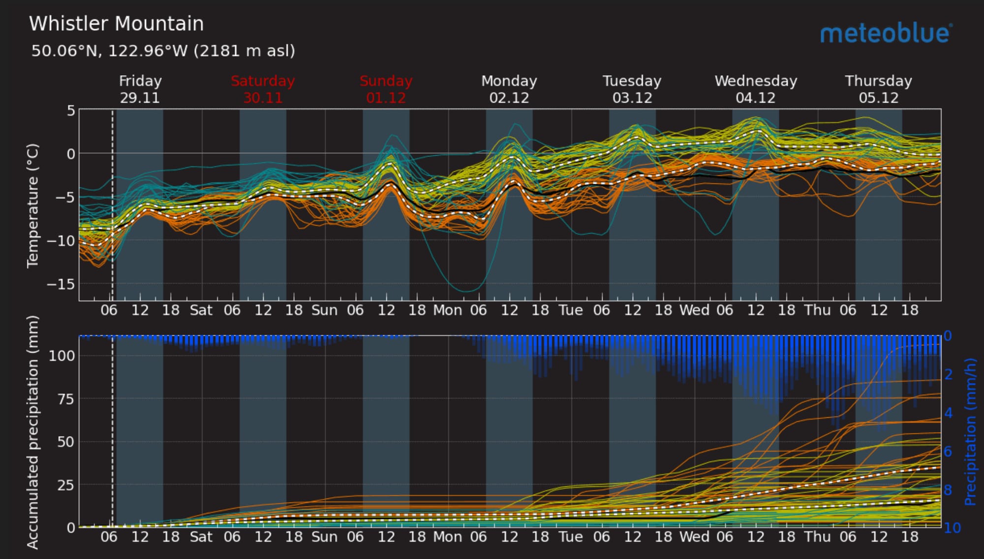
Image of the day from the Canadian Meteorological Centre (CMC) Global Deterministic Prediction System Ensemble Average showing the alpine temperature inversion setting up Sunday into next week (L). Meteoblue ensemble forecast for Whistler (R).
Current avalanche forecast remains relatively low hazard with a green brick across the sea to sky. Continue to watch for wind slabs and if we have more significant precip on Saturday, that could elevate the hazard for Sunday. You have likely noted or read about surface hoar forming throughout the corridor and that is a concern if it gets buried! This is the upside of our incoming warm storm that should saturate and crush our thick surface hoar layer.
What are my questions for the weekend?
- Any remnants of wind slab? Operators are still listing it on the board and it is getting mentioned here and there so keep an eye open?
- When will the warmup happen and how much will it impact skiing? Looks like the weekend should be craggy but decent temperatures. After that, it might be a bit unpleasant in the mountains for a little while!
- What will happen to the widespread surface hoar? As mentioned above, we’ll be watching to see if the surface hoar is buried in snow (bad) or crushed and soaked by rain (good) and the impact it has on the snowpack.
What will I watch out for or avoid completely?
- It’s still early season! I’m watching for rocks and wood hazards and very nervous on glaciers. We’re at peak time for crevasses to be hidden but not supportive! Snow immersion is less of an issue with the settlement we’ve had but any more storms and that will be back at the top of my list.
- We’ll be avoiding poorly anchored terrain (rock slabs etc) that might not be holding our still relatively thin snowpack very well.
Closing Thoughts:
It’s November. We’ve already had a lot of “best days of the season” and there will be more! Keep easing into it and know that conditions will improve and coverage down low will get better! Now’s the perfect time to do an avalanche tune-up and we have space both days this weekend if you want to join in click this LINK!
For more information, check out Zenith Mountain Guides and our local avalanche forecast. These updates are supported by SkiUphill Squamish - the best stop for ski touring equipment in the Coast Mountains and made possible by the Sea to Sky Gondola! Use this information at your own risk. Conditions change rapidly from when this report was written!

Member discussion