
Dec 14 Sea to Sky Snow Conditions
Overall theme:
It’s a trickle at least. Conditions remain difficult and major hazards haven’t changed. It’s also not a good time to get complacent.
Where we’ve been skiing:
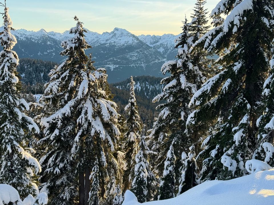
We’ve been moving around the Squamish area a bit where the snowpack is still currently the thickest, especially at treeline. Eric snuck a day in off Blackcomb and Evan escaped to the slightly deeper interior! We’re not seeing a major change in the conditions overall. The alpine around Squamish is a bit deeper overall with better rock coverage except in highly wind-exposed areas. Treeline in the Whistler corridor might have the most snow in that area but the alpine is very wind stripped. The Duffey continues to be very thin.
What’s happened since the last update (weather & general snowpack structure):
Our big questions last week were around the intensity of the weekend storm and how likely we’d see the buried surface hoar layer preserved in the snowpack. The storm did come in hard and dropped 15-25cm of snow down to relatively low elevations on Saturday. The new snow was accompanied by significant wind which led to the formation of wind slab in specific areas. Unfortunately, freezing levels spiked on Sunday and instead of a glorious post-storm pow day, we had rain falling on new snow.
What do those ingredients add up to? If you guessed a decent avalanche cycle, you’re right! Skiing around the Sea to Sky Gondola on Sunday, we saw evidence of avalanches in the Exit Gully and triggered a small wind slab in the Stadium Gully. Size 1 and 2 slab avalanches were reported throughout the corridor on Sunday and Monday as a result of this storm.
Monday and Tuesday brought clear and cold temperatures that turned the rain soaked top of the snowpack into a new melt-freeze crust and started again with forming new surface hoar on top; however daytime temperatures have been relatively high with alpine inversion so the snowpack has settled significantly.
A new weather system rolled in with a bit of a fizzle on Wednesday. While most of the corridor had a crust on the surface of the snowpack, some very high areas in the north of the region may have seen some snow redistributed with the strong winds that accompanied the front. It did snow a small amount overnight into Thursday with various operators reporting between 10 and 20cm.
So in short, if you get above the freezing level, you’ll find some fresh storm snow on top of a thin crust that gets thicker close to the ocean, covering another ~20cm of snow and all that sitting on a very thick (Dec 5) crust. We’re still seeking out those smooth, open terrain locations, and maybe even those small features that the wind filled in a little bit more to try and find the best riding. Think easy access to the alpine if the weather is good, but like we said, avoid glaciers!
What’s the weather and avalanche forecast?
For the forecast period, we’re continuing to look at very small trickles of precip and continued warm/inversion temperatures. Yep - that sucks! If the wind keeps up, we’ll see wind slab developing but the warm temps and low snow totals may keep that in check somewhat.
What are my questions for the weekend?
- How high are we going to see freezing levels spike? Hopefully this doesn’t cause too much damage in terms of snow loss and perhaps is even decent for promoting settling within the snowpack.
- If we get visibility to go into the alpine, how widespread will the existing wind slab be? We haven’t actually gotten much for alpine observations, especially around Squamish. It will be interesting to see if there is more than we expected.
- Other than reports on the Hurley, we haven’t seen any of the recent surface hoar layers. Is there anywhere this layer is hiding that we’ve missed?
What will I watch out for or avoid completely?
- Same thing we’ve been saying the last few weeks now: early season hazards make things a little scary! Ski carefully and save your body!
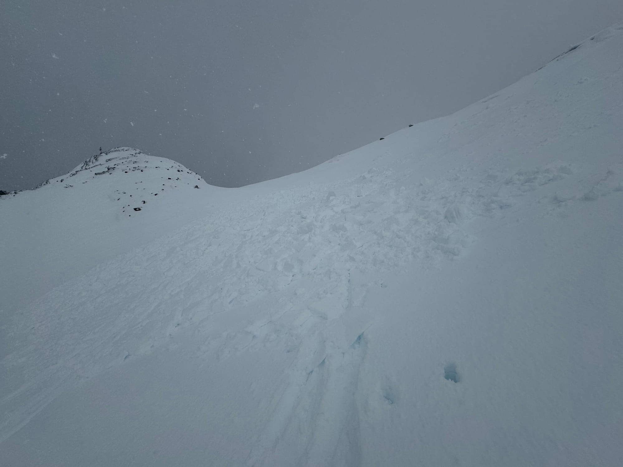
- Glaciers - so scary right now. I got a close-up view of the Blackcomb Glacier and was even surprised to see new crevasses on the Horstman Glacier!
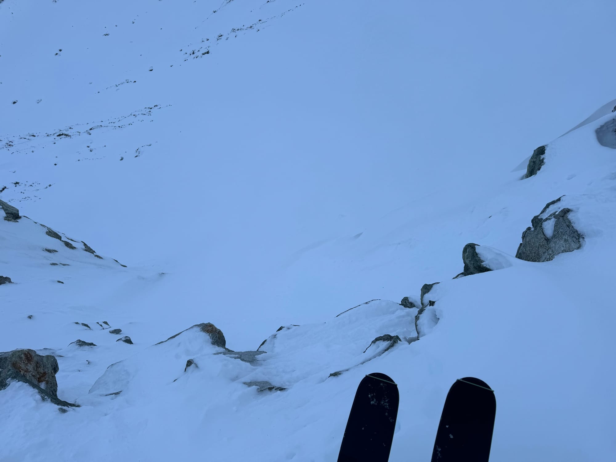
Entrance to Blackcomb glacier (L) looking really thin still. Bring a rope! The glacier itself (R) is heavily crevassed with thinly covered holes.
Closing Thoughts:
My mindfulness app can only help me meditate through so many days of alpine rain but as we close in on the December holidays, we’re hopeful that we might see a return to seasonal freezing levels and some decent skiing. Keep those rock skis handy for now.
On a different note, we want to take a moment to express our condolences and appreciation for Rich Prohaska who passed away earlier this month. Rich was a highly experienced mountain guide and adventurer in Pemberton. Rich was incredibly generous, truly loved the mountains, was always sharing his knowledge and experience with a big smile, and will be missed throughout the corridor. There is a GoFundMe to benefit his family HERE.
Eric Carter and Evan Stevens contributed to this report. For more information, check out Zenith Mountain Guides and our local avalanche forecast. These updates are supported by SkiUphill Squamish - the best stop for ski touring equipment in the Coast Mountains and made possible by the Sea to Sky Gondola! Use this information at your own risk! We are not responsible for your actions in the backcountry and conditions change rapidly from when this report was written!
Member discussion