
Dec 21 Sea to Sky Snow Conditions
Overall theme:
“What have we done to deserve this???” OR “Salvation inbound?”
Current level of optimism all depends on which weather forecast you look at or how many holiday cookies and festive drinks you have had. Avalanche Canada seems to be on the optimistic side but consider us a little skeptical. At the very least, we like to have expectations low and results high. Unfortunately weather trends/patterns are hard to break. Read on..
Where we’ve been skiing:
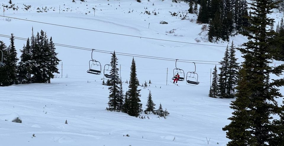
Whistler Blackcomb backcountry and the Squamish area. Nothing exciting. Mostly the gym… 😦
What’s happened since the last update (weather & general snowpack structure):
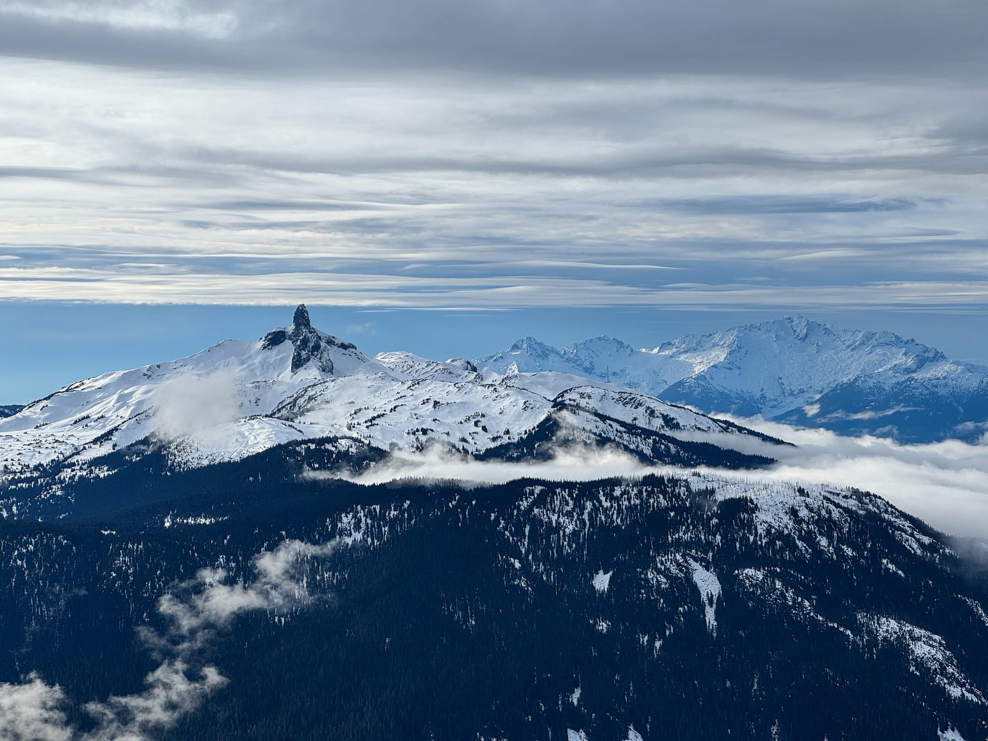
After our last newsletter, we saw a final pulse of precip fall as snow and then turn to rain. Freezing levels fell slightly on Saturday the 16th, our last day resembling anything “seasonable”, and a widespread crust developed. Sunday we watched in horror as FLs went to the top and stayed high throughout the week.
We haven’t checked how much rain fell through the week but it’s safe to say it was a lot. All this helped saturate the snowpack in the alpine and at tree line and wash away a considerable amount of snow below tree line. Total height of snow (HS) at almost every elevation band went down as snow settled or washed away.
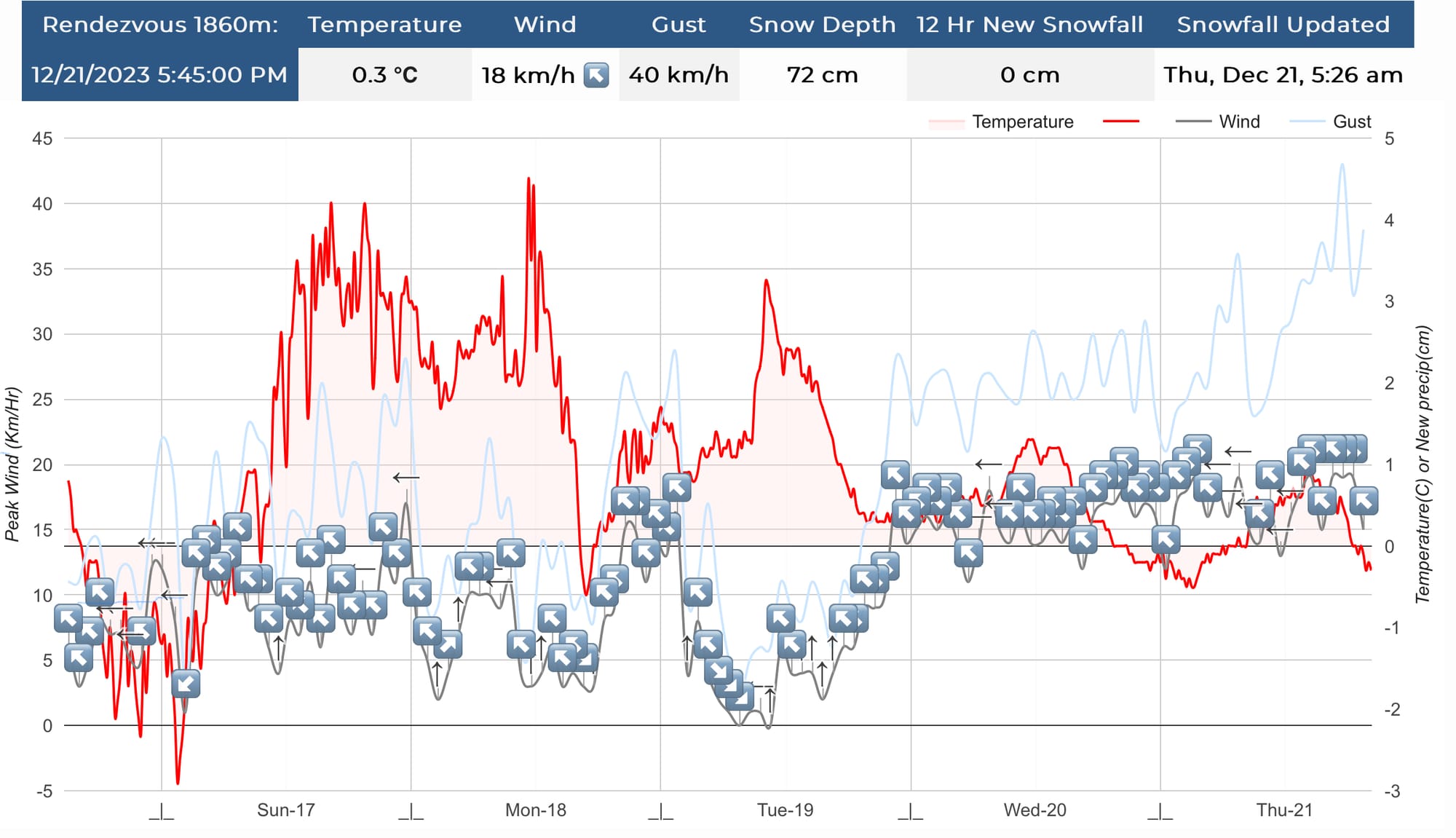
Thursday saw a small drop in freezing level with snowfall as low as 1600m and accumulation of ~20cm at 2100m.
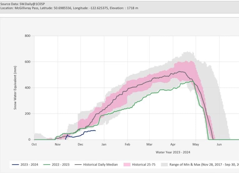
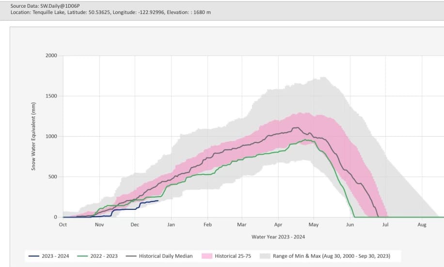
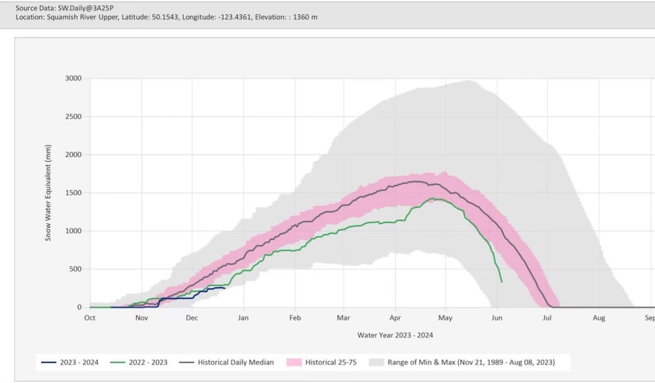
Snow Pillow data from McGillvray Pass, Tenquille Lake, and the Upper Squamish River. Convincingly the worst snow year in the Squamish Valley since 1989.
What’s the weather and avalanche forecast?
Here’s where things get more interesting. Freezing levels will drop throughout Friday and we’ll see below freezing at valley bottom over the weekend with somewhat normal diurnal temperatures. The biggest chance for precip is on Friday. We’re also seeing moderate to strong winds accompanying any incoming snow.
The big excitement really starts on Monday with some models showing a storm bringing 100-200cm of snow by Wednesday or Thursday. Is that pretty far out in the forecast? Yep. Will that storm be accompanied by warmer temps? Yep - it looks like freezing levels there could be around 1500m and possibly creeping up as we get closer. Am I getting my hopes up? A little…
Avalanche Canada has the danger rating in the alpine for Friday and Saturday at Considerable with a wind/storm slab problem. We’re not really thinking about the low- or mid-snowpack. It’s surface instabilities at the moment. Especially where wind is hitting terrain and moving more of that new snow around.
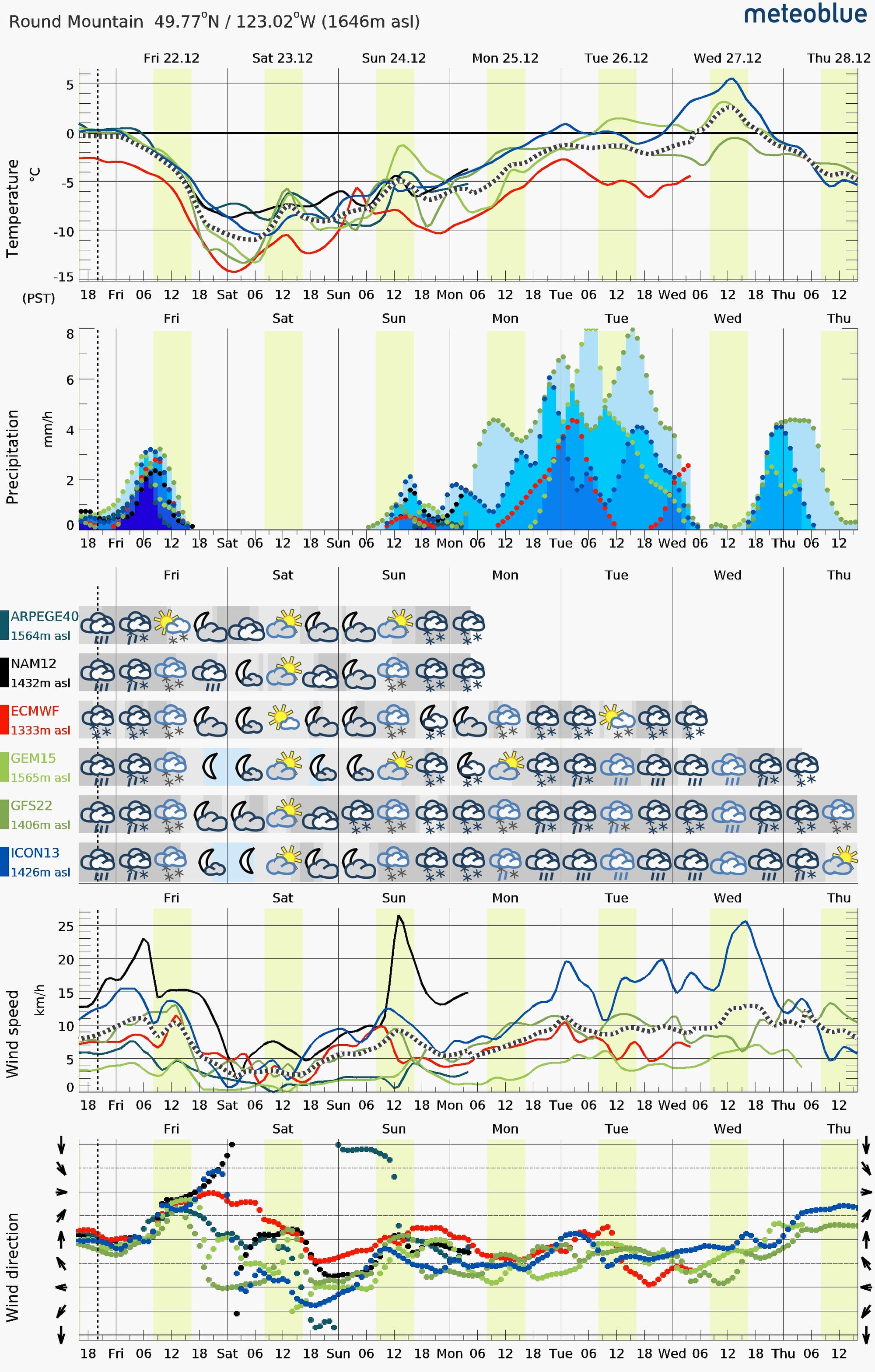
Meteoblue.com multi model forecasts for Spearhead Glacier and Round Mountain (note the elevations) show the occasional spike in FL with our Xmas storm.
What are my questions for the weekend?
- How quickly will we see the temperature drop on Friday? If it snaps cold, we expect a poor bond between the crust and any new snow. If FLs drop slowly, the bond tends to be better. So far it looks like the latter.
- How much precip will fall Friday? Right now, it looks like 15-25cm for the S2S region. With wind, that could create some decent wind slab. A bit more and the possible size of an avalanche bumps up further.
- Wait - does the forecast say something about inversion on Sunday? Hoping that doesn’t materialize. If anything, it will probably help with stability of the new snow but surface conditions could suffer a bit.
- Will anywhere in the corridor avoid above freezing temps? We’ll be watching!
What will I watch out for or avoid completely?
- I’m going to be quite careful at ridge crest or anywhere wind could deposit that new snow substantially deeper. If we have 25cm, that’s already a decent slab - wind will make it thicker and scarier!
- As we’ve been saying, a small windslab will create big problems for a skier getting swept over early season hazards. Even if you’re not buried, it could be pretty bad. Watch for terrain traps!
Closing Thoughts:
I think we all agree we could use a win soon here weather wise. It seems like it’s a possibility so let’s keep our heads on straight and not dive too deep into complex terrain if we see a major change in conditions in the corridor!
Eric Carter and Evan Stevens contributed to this report. For more information, check out Zenith Mountain Guides and our local avalanche forecast. These updates are supported by SkiUphill Squamish - the best stop for ski touring equipment in the Coast Mountains and made possible by the Sea to Sky Gondola! Use this information at your own risk! We are not responsible for your actions in the backcountry and conditions change rapidly from when this report was written!
Member discussion