
Dec 28th Sea to Sky Snow Conditions
Overall theme:
Get high for the best turns when the visibility (and hazard) allows!
We’ve passed over 1000 readers! We love that this snowpack information is getting shared with so many people in the corridor and it’s getting used to help make better decisions! If you’ve got touring buddies, please forward this along and let them know to subscribe. In celebration of our milestone, we’re doing another giveaway!
Anyone who is a paid supporter is eligible to win (click over to snow.zenithguides.ca to access your account and upgrade!). Our prize this week is a Mammut Alugator Avalanche Shovel and Mammut Probe from Coast Mountain Collective. At only $15 per month, you’re making it possible for us to keep these newsletters coming and you’ll also get access to our private chat group. We’ll choose the winner randomly from all supporters (new and existing) next Thursday!
On to the important info…
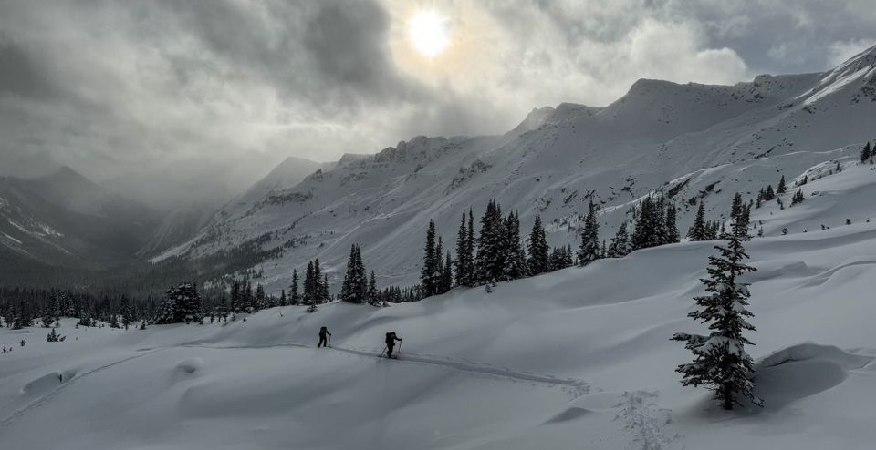
Where we’ve been skiing:
Squamish, Whistler, and the Duffey!
Mostly this week it’s been nice to have a ski pass to get up to higher elevations. Squamish has generally been pretty warm with the snow line creeping up the mountain and difficult ski conditions. Alpine access when the weather allows has been the key to finding good skiing in the Spearhead or the Duffey where we’re finally getting above threshold for skiing in some areas.
- Skiable snow at the S2S Gondola starts around the Habrich Trail turnoff (but looks challenging above that). Red Heather is skiable above the lookout still but very thin below the waterfall.
- Blackcomb cranked the snowmaking and got their ski-out back in shape however Whistler Creekside lower runs are very brown still.
- Callaghan XC is open and groomed on the tracks but the Hanging Lake Trail has very little (<20cm) snow in the trees at the start.
- No snow on the ground in Pemby. Wendy Thompson trail has snow at the car park but is rocky in the forest. Similar with Cayoosh. Van Horlick Creek and Steep Creek are thin on the roads with snowy alder making travel unpleasant under 1850m. Above 1900m on central Duffey has good coverage and good skiing. East Duffey is very thin.
What’s happened since the last update (weather & general snowpack structure):
Morale was at a season-low here when we published the last newsletter. Since then, the weather has been… chaotic... Read on for the blow-by-blow of the week.
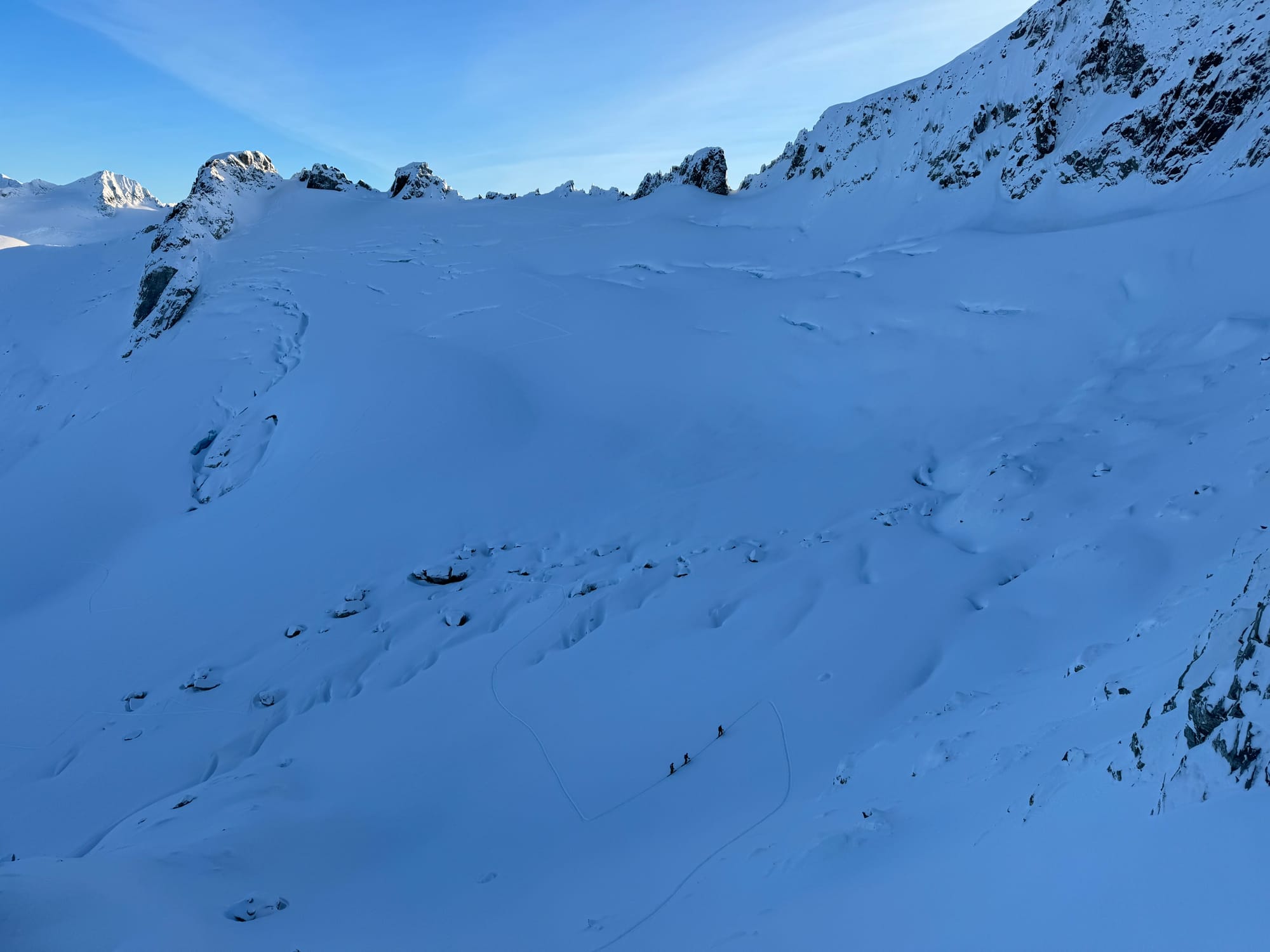
Luckily a much needed 20-40cm was delivered on Friday with a nice, gentle temperature gradient that allowed for a decent bond to the surface. This was the first load applied to what’s now being called the Dec 20 crust. This was followed by two days of generally clear and cold weather with the development of surface hoar and suface facets on the new snow. Conditions were fun! We explored the Blackcomb backcountry and went crevasse and rock hunting in the alpine. Areas not wind-stripped were decent though crevasse coverage is still shockingly poor.
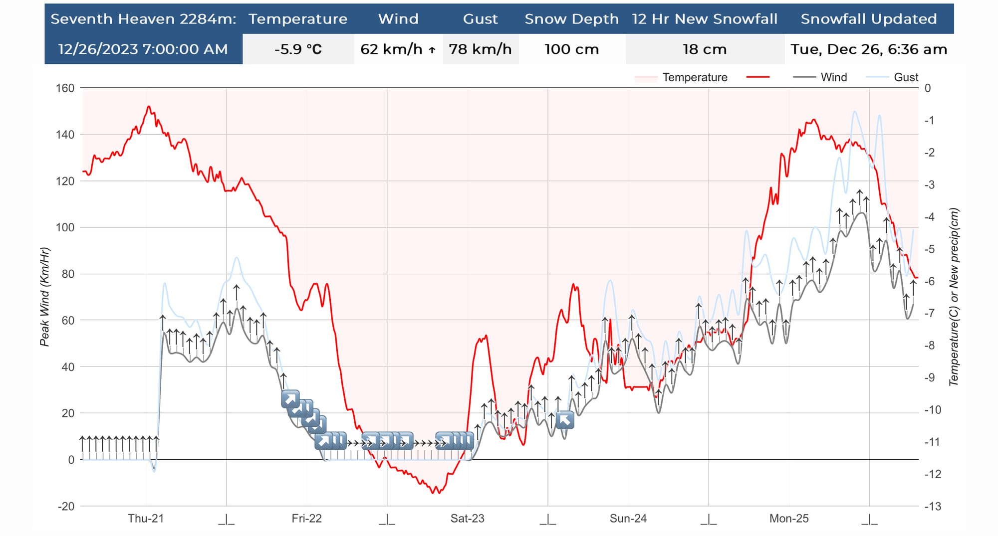
Christmas Day brought another wet daytime storm. FLs were relatively low to start which meant snow on the Sea to Sky Highway but by afternoon, they started creeping up the mountain. 10-20cm of snow fell on the existing new snow sitting on the Dec 20 melt-freeze crust and burying the recently formed surface hoar. This was accompanied by strong to extreme southerly winds. The next day, clear skies lured folks out despite a High avalanche danger forecast for the region and one result was a size 2 skier accidental avalanche on Disease Ridge with a crown 50-100cm thick and depositing directly into a rocky terrain trap. Another group reported a natural size 2 avalanche in DOA. Neither MIN report describes the layer that these avalanches failed on but the majority of the avalanches triggered by ski patrol in the area are running on the Dec 20 crust.
Wednesday and Thursday had continued wind, warm temperatures (inversions) and some snowfall. Whistler-Blackcomb has continued to report explosive triggered avalanches up to size 2.5.
In general, new snow (~40-50cm) throughout the region has been redistributed by strong southerly winds and sits on top of a solid melt-freeze crust (Dec 20). Some areas are reporting surface hoar sandwiched within the storm snow. The snowpack is settling quickly with warm alpine temperatures. The lower snowpack is well settled and well bonded having been saturated at all but the highest alpine elevations. As you go from south to north, the snowpack in Squamish is much more homogenous with surface instabilities while the snowpack on the Duffey and further north has more layers with snow in between.
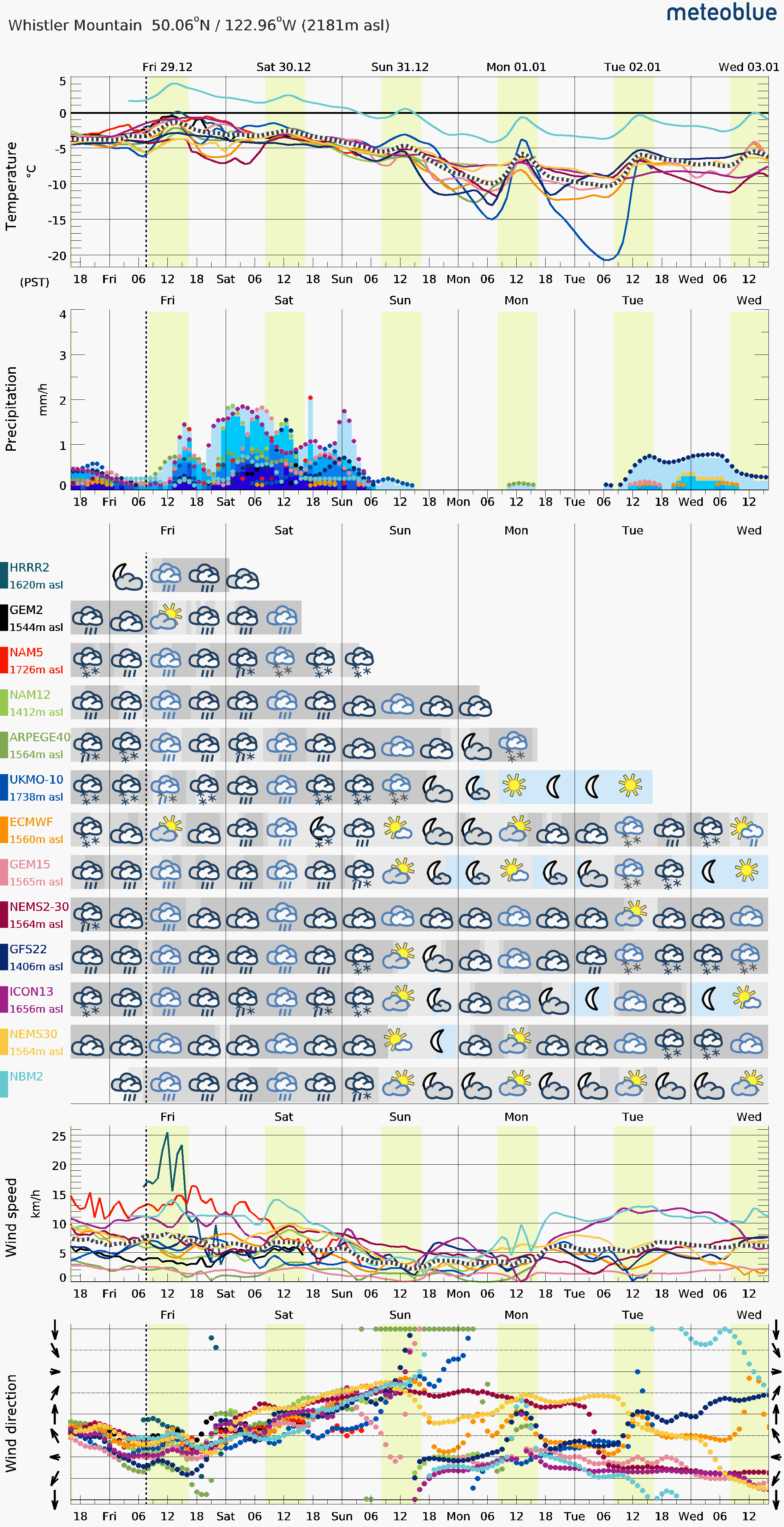
What’s the weather and avalanche forecast?
Friday continues with warm inversion temps and FL rising to >2200m. This will be followed by a pulse of precip on Saturday with freezing levels remaining high. It does appear that Sunday will be clearing with freezing levels dropping to 1400m and potentially continuing to drop into the new year.
For now, we’re dealing with a continued storm slab problem as well as a persistent slab buried approximately 50-100cm down. This is still reactive to human triggering and capable of producing avalanches that could easily bury a human or push them into a terrain trap. The forecast is conducive for helping settle the snowpack however the weak layers don’t inspire confidence going into a wet weekend.
What are my questions for the weekend?
- How much precip will fall on Saturday and will it contribute to our storm slab problem?
- Will freezing levels drop to seasonable levels as we swim into 2024?
What will I watch out for or avoid completely?
- Anything complex through the weekend I’ll be pretty skeptical of. Friday might have some decent skiing ahead of the warm front but our persistent slabs will be lurking. Convex rolls and wind loaded areas at ridge crest are high on my list for avoidance. I want well supported and low angle until I feel better about the persistent weak layer.
- Anything with a terrain trap! Crevasses are still outrageously gnarly. Don’t want to get swept into something!
- Saturday looks like a washout. I’ll probably be avoiding that…
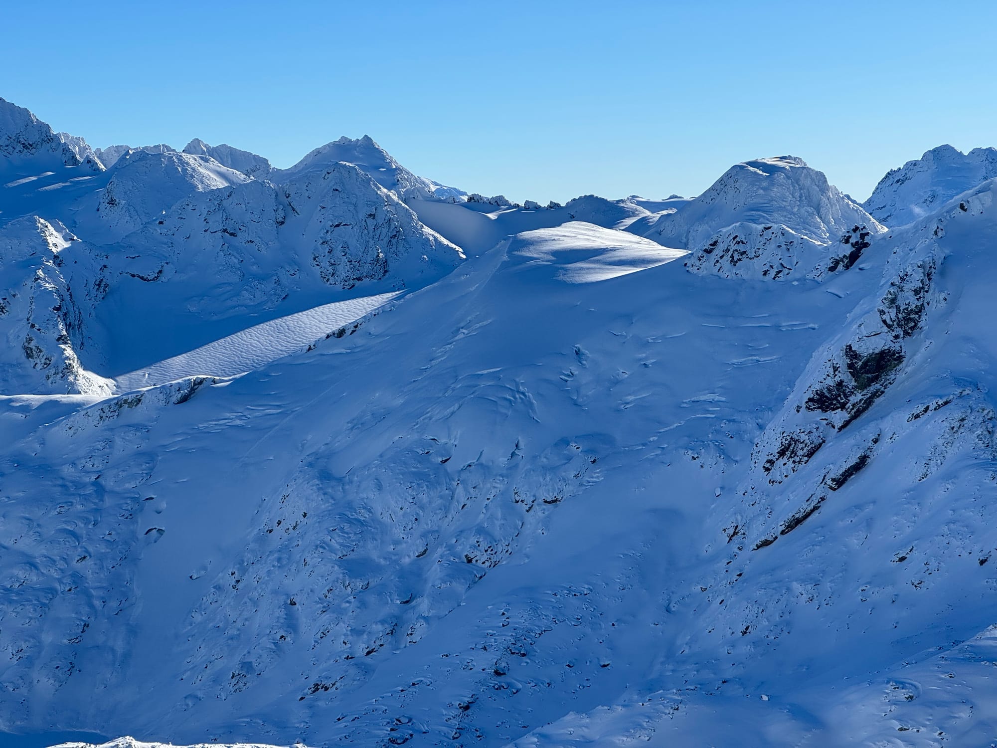
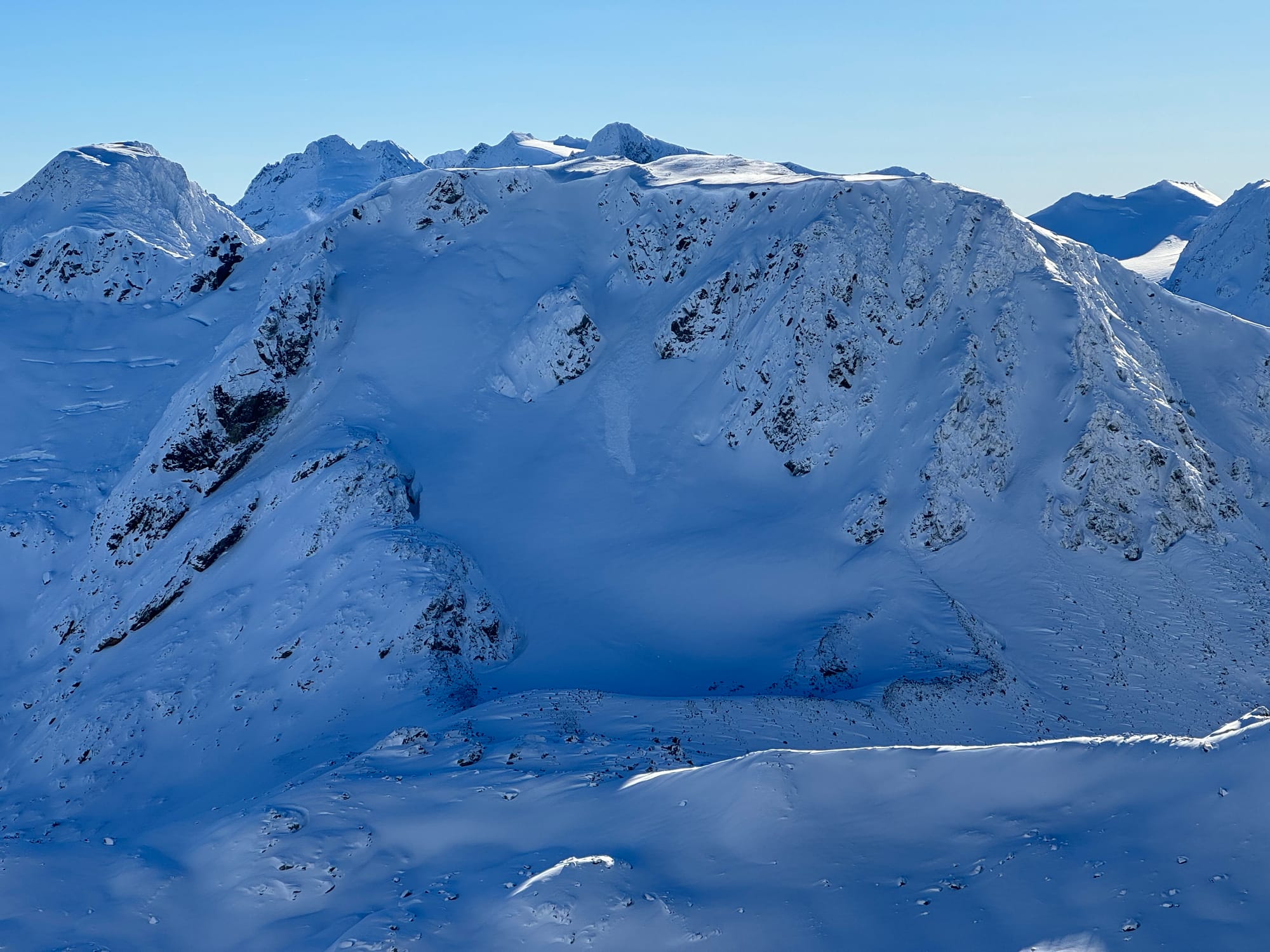
Decker Glacier left side; Decker Peak/NF; Spearman Glacier (Guide’s Notch centre top).
Closing Thoughts:
If you can get high enough, there’s good skiing to be found but it’s not a green light. We’re sitting in an assessment mindset as conditions are changing rapidly each day. Don’t get too excited and avoid getting stung! Crevasses remain a major issue and cornices are now entering the equation!
Eric Carter and Evan Stevens contributed to this report. For more information, check out Zenith Mountain Guides and our local avalanche forecast. These updates are supported by SkiUphill Squamish - the best stop for ski touring equipment in the Coast Mountains and made possible by the Sea to Sky Gondola! Use this information at your own risk! We are not responsible for your actions in the backcountry and conditions change rapidly from when this report was written!
Member discussion