
December 1st Sea to Sky Snow Conditions
Overall theme:
Weather incoming! All of our prayers to whatever higher powers we do or do not believe in have been answered. The big question is how will this incoming atmospheric river track? The two major long range models I have been following all week are the GFS (which trends colder with higher precip amounts so of course we love it) and the GEM, which have been consistently showing major incoming precip with a spike in freezing levels for a sustained period of time early next week. What’s important is that this is consistent in both models, on every model run every 6 hours. This gives the forecast a reasonable amount of certainty in our minds. But one thing we all know - the weather does whatever it wants! So keep the sacrifices coming.
The good news is that it will precipitate a LOT, and this event will most certainly give us a new baseline to try and start the season on. With the amount of ground cover still exposed at all TL and BTL locations and even in most ALP locations, our mountains currently look like they should in the end of October or early November.
Where we’ve been skiing:
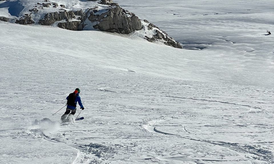
Squamish, Callaghan, Brandywine, Rutherford Ranges. We were fortunate enough to be able to do some reconnaissance work to really see the state of the snowpack before we hopefully flip the switch to real winter. Sadly what we’ve seen has not been inspiring - see lower down for some height of snow numbers.
What’s happened since the last update (weather & general snowpack structure):
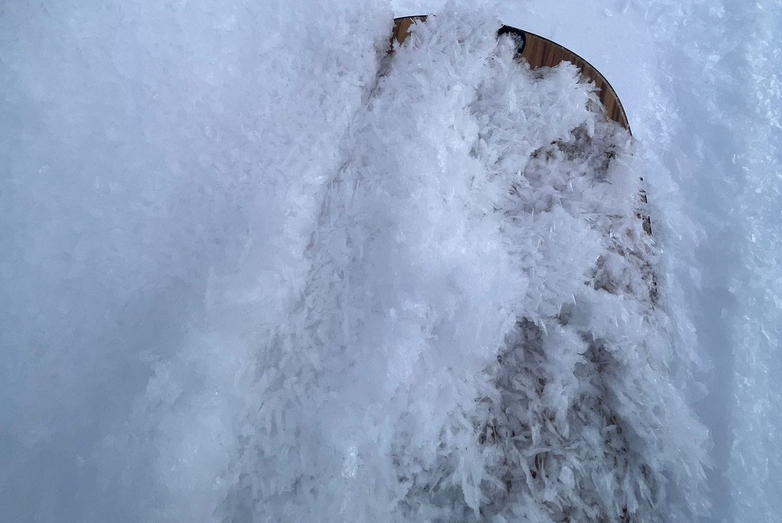
Surface hoar has continued to develop in many of the sheltered and shady locations. Solar aspects are sporting sun crusts in many spots. Faceting was limited to the top 15cms of the snowpack in most locations we traveled this week. Melt freeze/rain crusts buried down 10-20cms in some locations have been mostly breaking down.
Generally the height of snow at treeline and above is in the 60-80cm range. SHALLOW. This has led to some historically poor conditions on all of our glaciers. I did not see many glaciers that I wanted to ski on anytime soon in all of my travels this week. I want to see a windy two meters of heavy snow that starts to settle before I begin to entertain skiing on any glaciers. Our friends at Black Sheep Guides did an awesome photo flight and put together current state of the glacier photos here.
Important snowpack depths:
- Cayoosh Summit (Hwy Pass): 26cm
- Blowdown Mid (Duffey East): 34cm
- Pig Alley (Whistler): 54cm
- Mt. Cayley (Squamish North): 33cm
- Paul Ridge (Squamish): 64cm
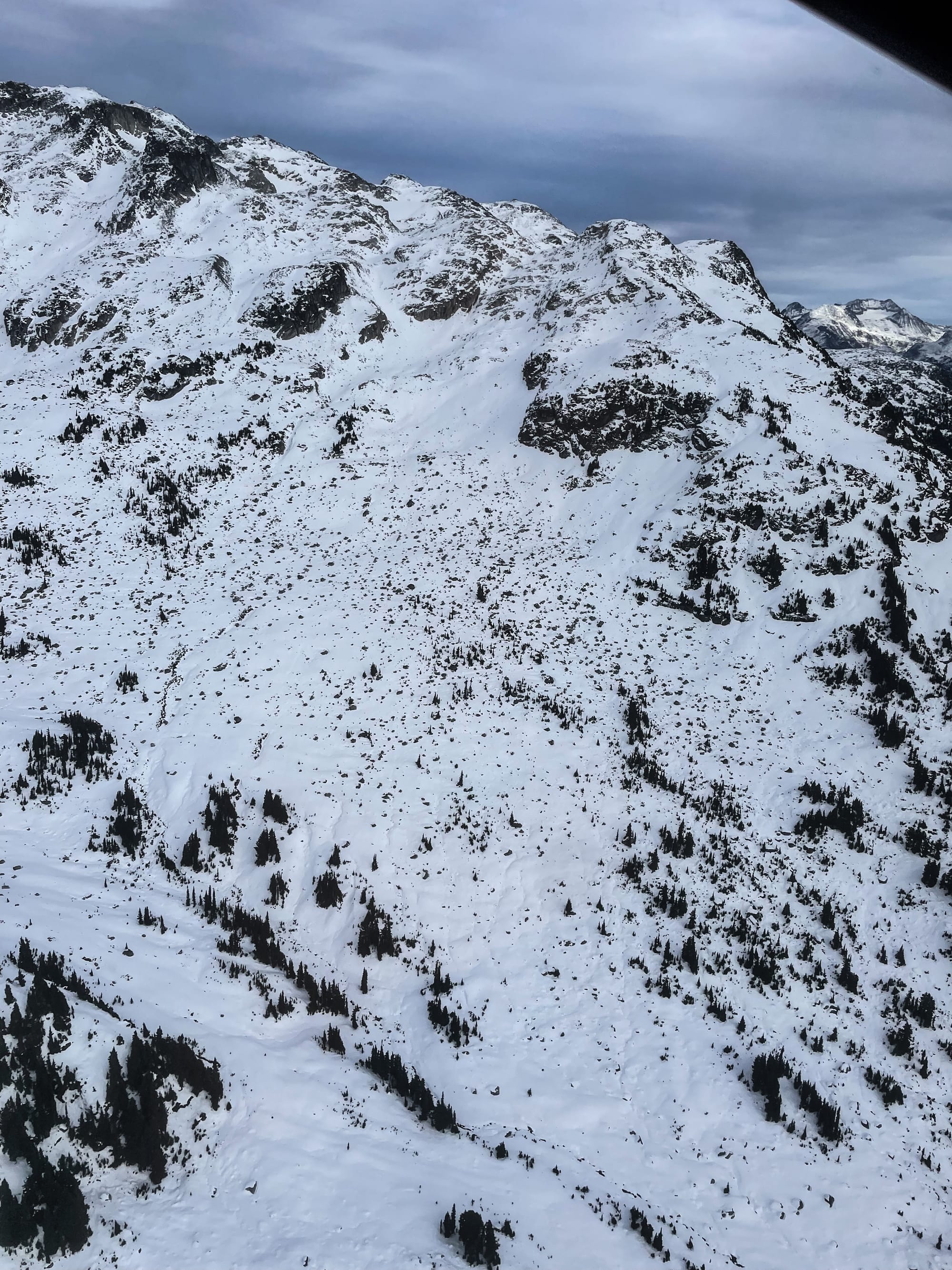
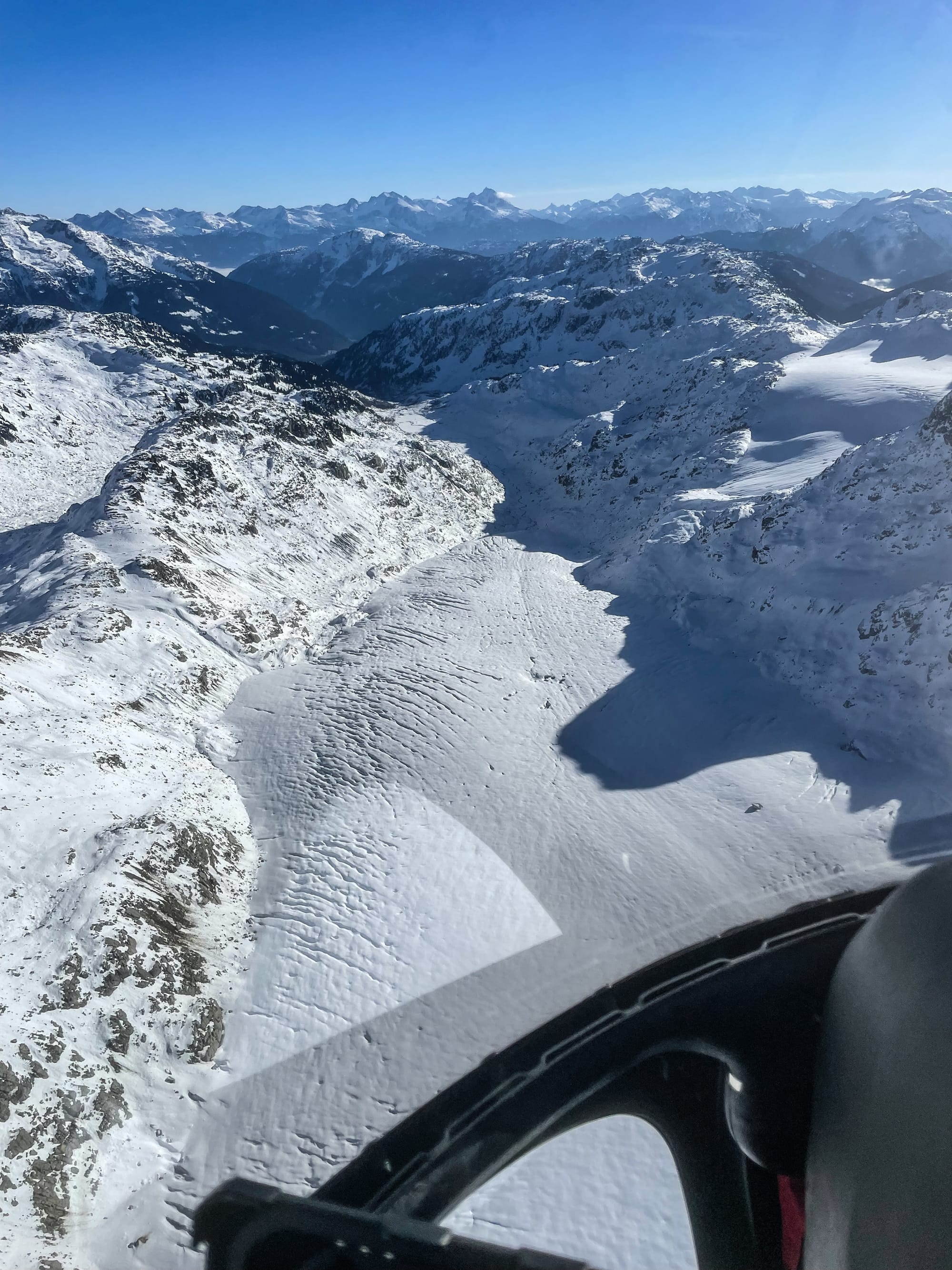
Rainbow Mountain (Gin & Tonic) on left and Ape Glacier (Rutherford) on right showing LOW snow!
What’s the weather and avalanche problems?
As noted above, lots and lots of precip with the big questions of timing, intensity and freezing levels. This will be a day by day, hour by hour reassessment period. WE’ve had lots of questions around the widespread surface hoar that has formed, especially around tree line. We anticipate that the SH along with the other weak layers in the snowpack will be flushed out or crushed into the ground cover variation if the precip totals (100-200mm) hold true. The big exception will be the high shady north aspects, like 2000m and higher where the thin, highly faceted snowpack may not get as much of a new load.
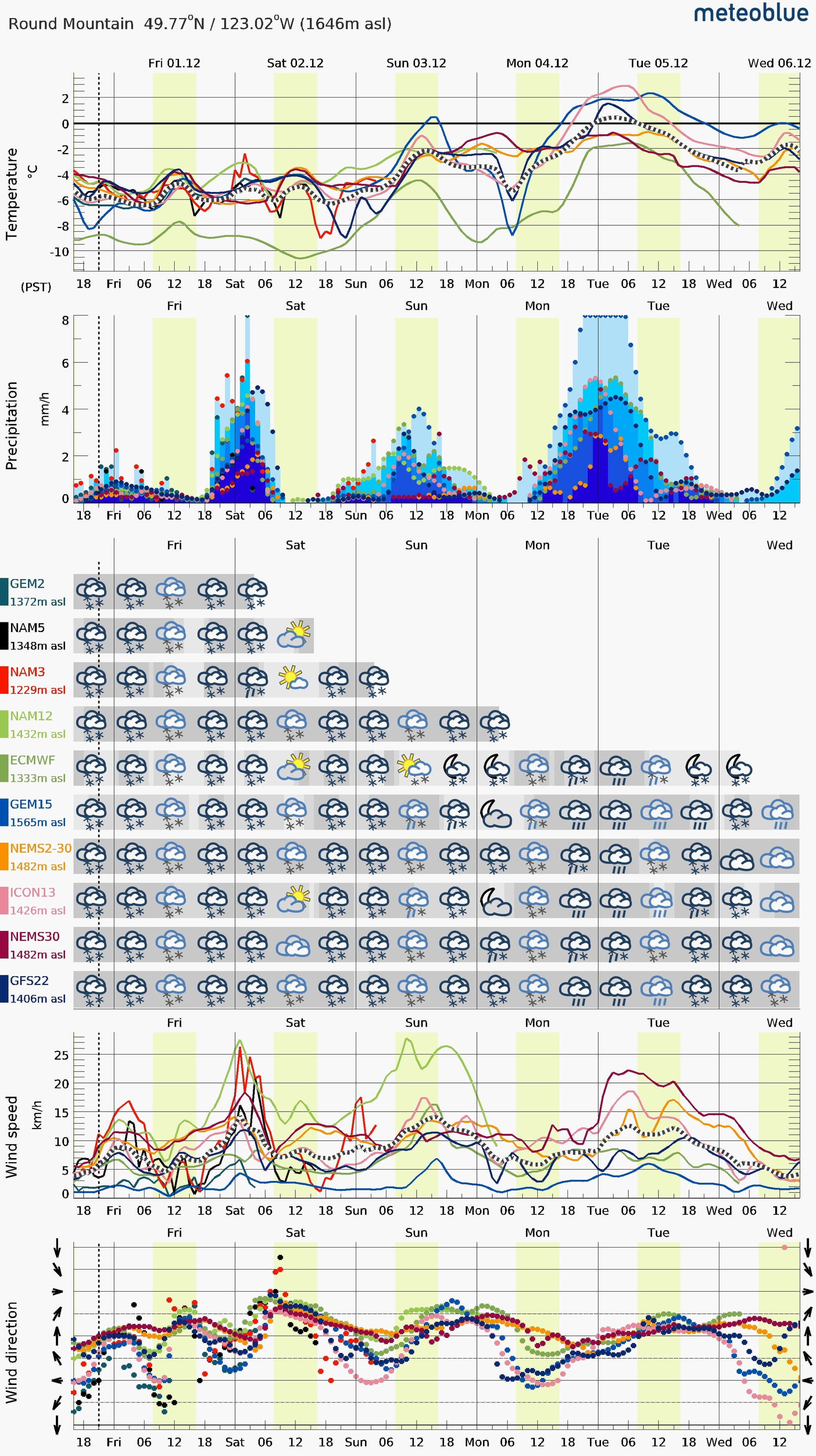
We are certainly going to have storm slab and wind slab problems for the next two days before the temps spike and the intense precip really starts. The new snow is falling on some suspect surfaces as noted above - facets, surface hoar and sun crusts. The region could see close to a meter before the temp really spikes, and right now we are seeing a spike in winds on Friday night/Saturday morning from the south/south west as usual. Just enough to really load and stiffen the slabs on the shady aspects holding good snow cover that we want to ride. For the next two days we will definitely be treating any piece of avalanche terrain that had enough snow on it before this storm to ride with suspicion. Tread cautiously! Visibility will be limited, and some intense storm periods for sure.
What are my questions for the weekend?
- Intensity of storm?
- Where does surface hoar remain?
- Where were the previous facets?
- Was there snow on the ground where I am before this storm?
What will I watch out for or avoid completely?
- We will be treading lightly as the snow starts piling up. The faceted and surface hoar upper layers will initially (through the weekend) be very touchy to new snow loads. Anywhere that had a decent amount of coverage and was riding well before this storm will be suspect in our minds.
- Steep convexities at TL!!
- ALP until things settle. There might not be SH but there’s still a decent crust that’s been faceting away in places.
- Thin rocky spots anywhere.
- Rocks in general - Even with some new snow it’s still early season hazard!
- Glaciers - we’d like to see at least another two meters fall with some good wind before we feel a little better about glacier travel.
Closing Thoughts:
Winter is coming, be conservative. No one is more keen to shred than Eric and I, but I will be going to the boring classics until this storm settles. Even with another meter of snow, we’re still dealing with early season conditions. A storm now does not mean full go-time!
Eric Carter and Evan Stevens contributed to this report. For more information, check out Zenith Mountain Guides and our local avalanche forecast. This update is supported by SkiUphill Squamish - the best stop for ski touring equipment in the Coast Mountains!
Use this information at your own risk! We are not responsible for your actions in the backcountry and conditions change rapidly from when this report was written!
Member discussion