
Feb 1 - Sea to Sky Snow Conditions
Overall theme:
What just happened…? Whatever THAT was, it does appear we’re switching back to winter! We’ll be thinking primarily about surface instabilities the next couple days with access as the main issue.
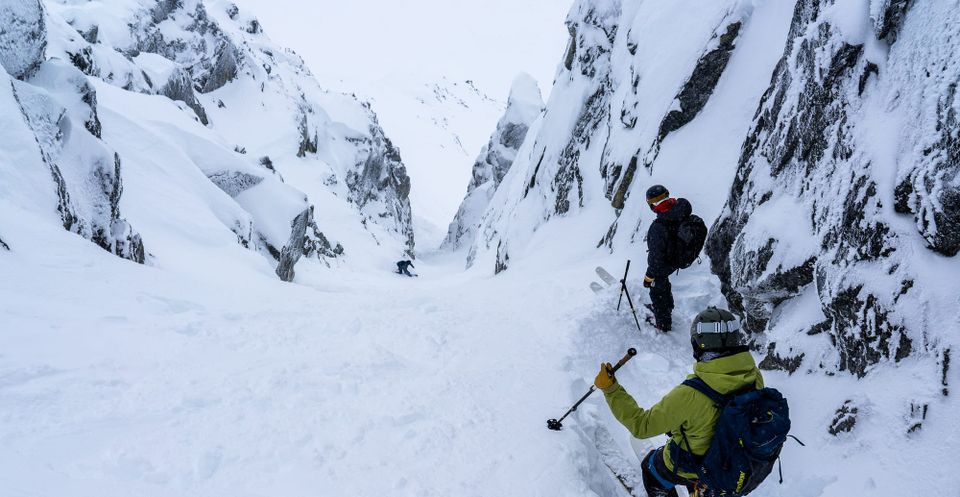
Where we’ve been skiing:
We took our own advice from last week’s newsletter and made the most we could out of Friday at Blackcomb backcountry and then after that… nothing! A bit of XC skiing, a lot of time at the swimming pool, and doing our best to not go crazy waxing skis, organizing gear, and so on.
What’s happened since the last update (weather & general snowpack structure):
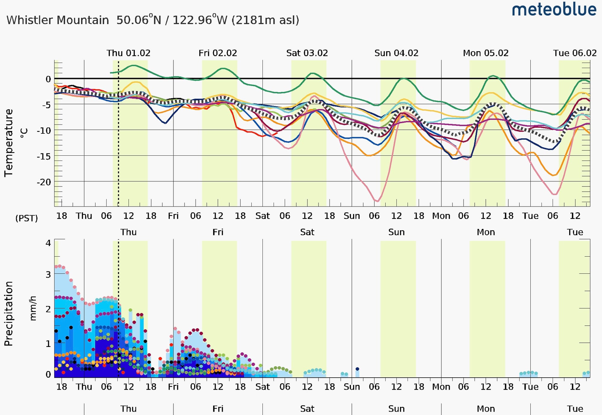
Hopefully we don’t need to recap this too much but.. it rained. It rained a lot. And it rained a lot, up high.
We could get into the weeds with rainfall totals and freezing levels but I’ll keep it limited. Thanks to the excellent weather station at the Sea to Sky Gondola, we can see that at 1000m in Squamish the temperature from Friday to Thursday was consistently above +6 and reached +12 deg C on Monday! During the storm, we had several days of >50mm rainfall with total rainfall over the last 10 days at 301mm (!)
As you can imagine, this followed somewhat normal patterns up the corridor with slightly “colder” temps and lower rainfall totals as we move north and east. Whistler Peak stayed generally at or just below zero with the remainder of the mountain getting rain and well above zero temperatures.
Several major avalanche cycles occurred in the last week, in line with the periods of highest precip and freezing levels. By Wednesday night, temperatures were decreasing and Thursday morning brought new snow falling down as low as pig alley on Whistler.
What does this mean for the snowpack? The snowpack at treeline (~1700m) is totally saturated with rain. Higher elevations that saw mix of rain and snowfall now have 15-30cm of new snow distributed by strong to extreme wind into a slab covering a very thick rain crust and well settled mid and lower snowpack.
Access roads to Red Heather & Sea to Sky Gondola are very patchy. Not looking like good options at the moment. Hanging lake trail is thin with many creeks. Low elevation in Whistler has lost snow as well with Singing Pass unskiable below 1400m. We haven’t heard much from the Duffey but with a thin snowpack to start at road elevation and with 10+ days above 0 deg, we suspect it’s not great.
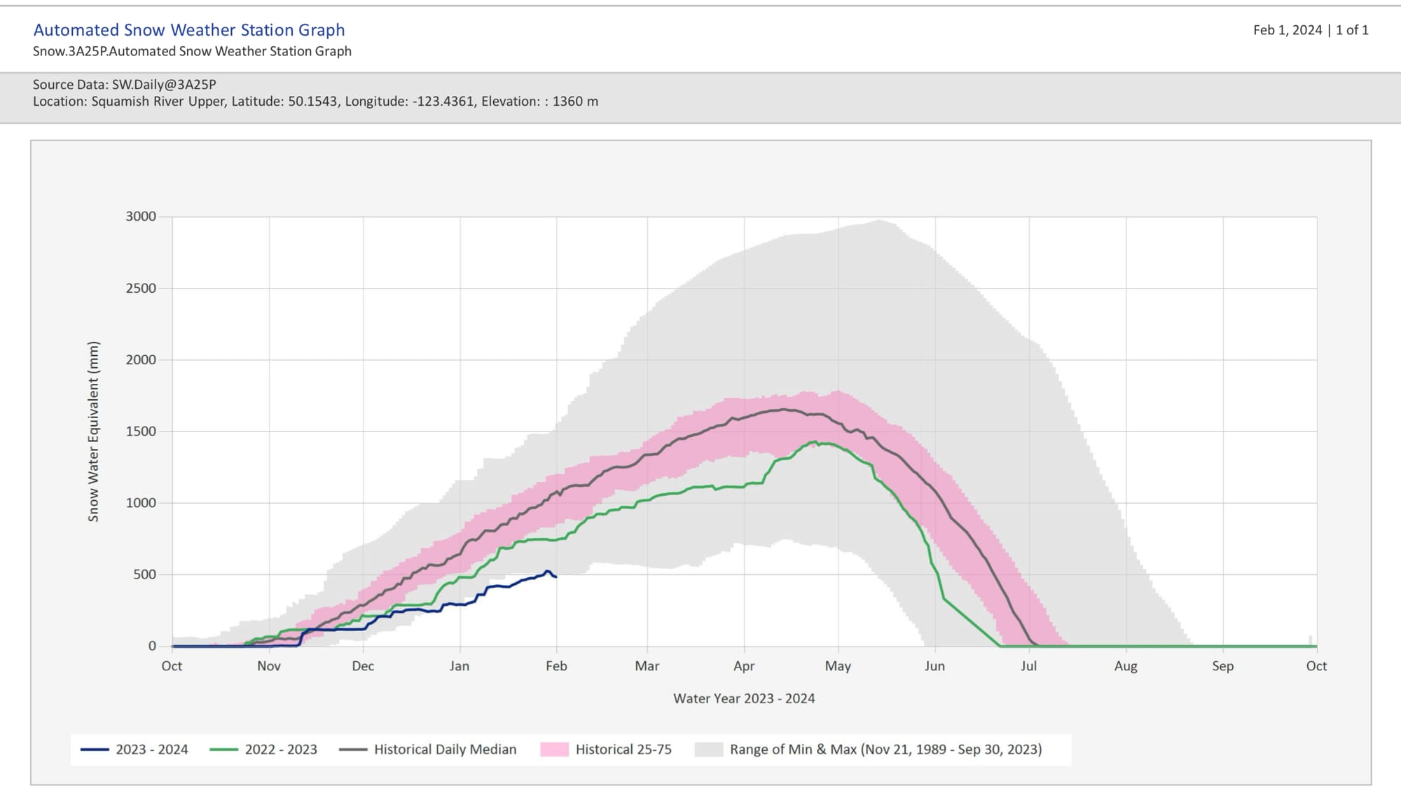
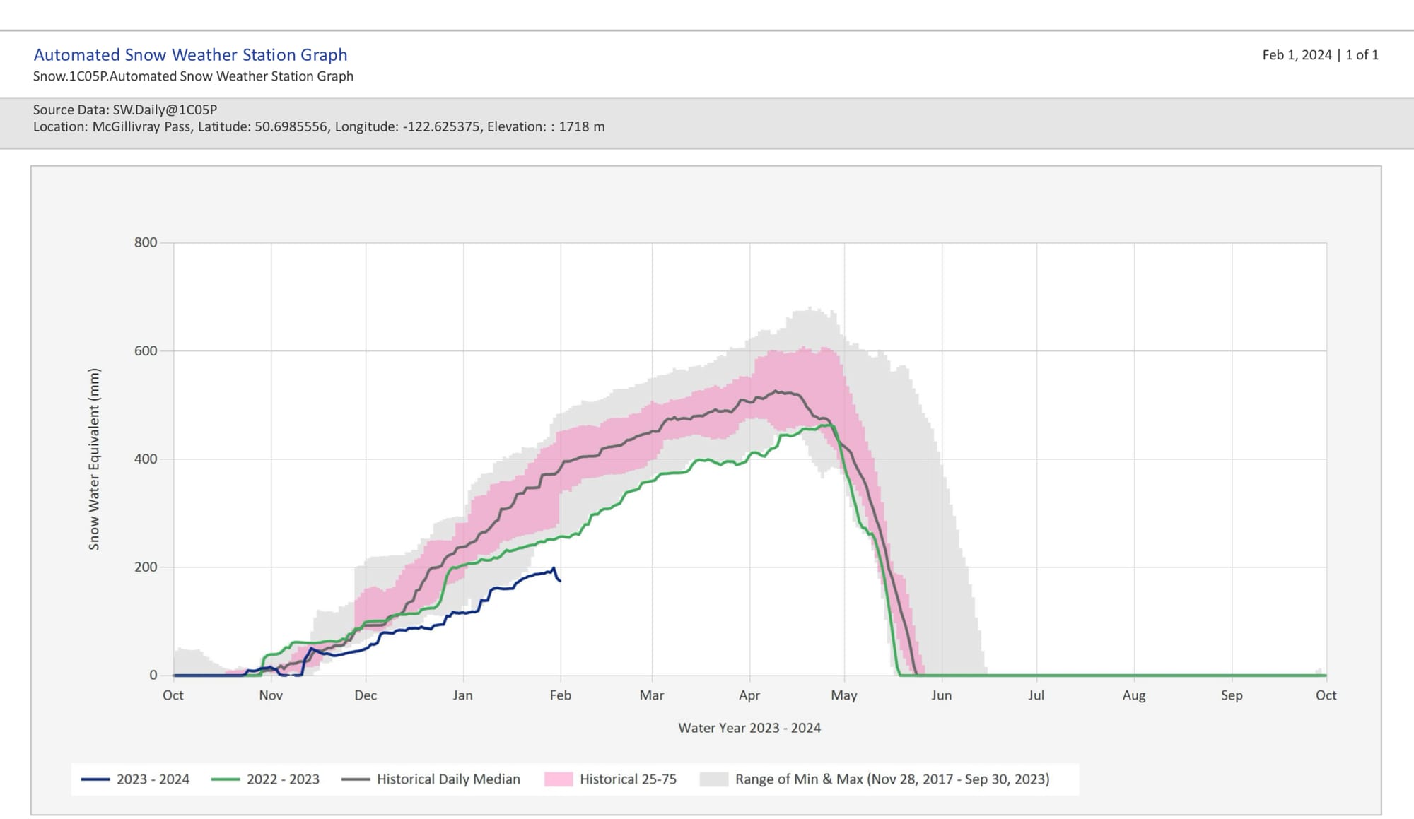
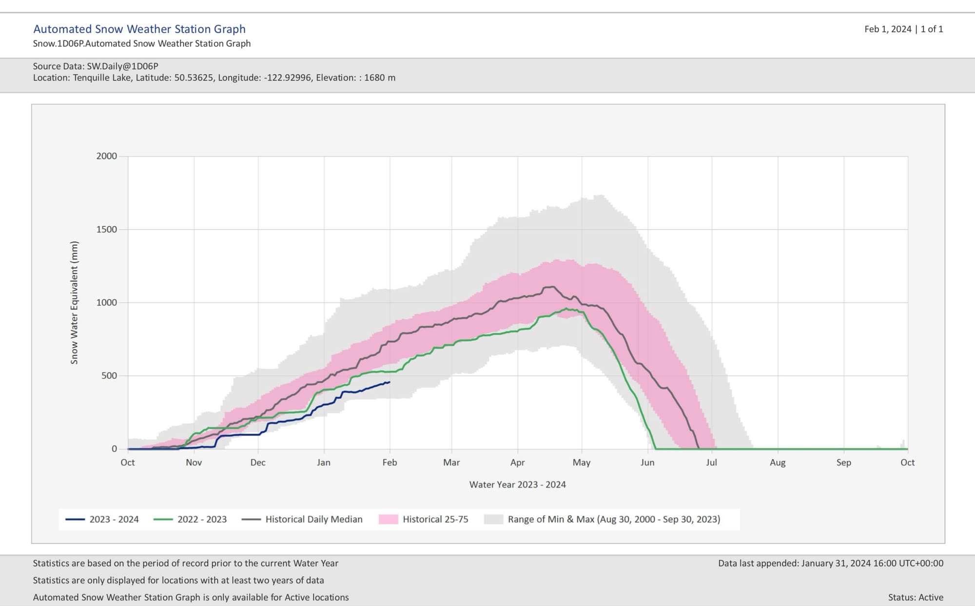
Squamish Valley and McGillivray Pass snow pillows appear to have taken a bigger hit than Tenquille Lake.
What’s the weather and avalanche forecast?
Precip is tapering off throughout the day on Thursday but there will be one more pulse Thursday night and Friday morning. On the bright side, temperatures are dropping *closer* to seasonal but we’ll still be a touch on the warm side. I’m expecting good travel conditions with sun and slightly colder temperatures, so if alpine access is possible, it might be time to act on adventure skiing!
Avalanche danger remains high while precip continues (4-3-2) on Thursday but drops through the weekend as sun and colder temps arrive and the new snow and rain stops. The new snow transported by strong winds means surface instabilities are our main issue - wind slab!
What are my questions for the weekend?
- How quickly will this all “tighten up”? I want to see that the saturated parts of the snowpack are freezing up. Isothermal mush isn’t super stable (even if much of what could slide, did). I also want to see the new fresh snow that has formed wind slabs settle out and bond to the snow underneath. Luckily it didn’t snap super cold quickly so the new snow will bond better to slushy wet snow than it would to a firm frozen crust.
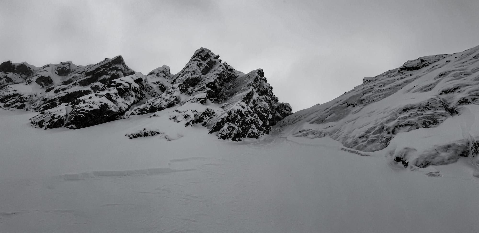
- How much damage did treeline terrain see? Massive creeks raged throughout the corridor and certainly caused some issue. Spanky’s Ladder was closed due to creeks opening on the ski out. Brandywine meadows opened into a raging torrent. We’ll see other zones that were damaged. There may be some pretty large washouts on logging roads!
What will I watch out for or avoid completely?
- I’m going to be avoiding below treeline terrain completely. Not because of an avalanche problem but because it’s just too thin and unpleasant skiing.
- I’ll certainly have my antenna up where storm/wind slab has been developing, especially if snow totals go up overnight Thursday into Friday. Ridge crests and classic wind slab slopes!
- Glaciers are still heavily on the caution radar. We don’t know yet if we lost or added to the total snowpack on the glaciers this week but I’m guessing it’s a bit of a wash. The higher and more interior you get the better off the glaciers would have faired. There was a lot of the storm that fluctuated around the 2500m FL, so let that play into your equations. Crevasse bridges will have gained strength for the most part but there are still holes, bergshrunds, and moats in places we aren’t used to. Especially expect this on the toes, low margins below 2300m.
Closing Thoughts:
That was a rugged week. We pretty much just closed our eyes and pretended we weren’t seeing what was happening. It’s still February though and cold temps are returning. With an extended sunny period, I’m expecting the chance to have easier travel conditions in the alpine. I think of conditions like this as good for moving but not good for skiing. Look to traverses and fitness skiing, not shredding faces, until we get some more snow to soften things up! I’ll definitely be tossing the ski crampons in my pack for the first few days until I know how easy travel is on the crust!
Eric Carter and Evan Stevens contributed to this report. For more information, check out Zenith Mountain Guides and our local avalanche forecast. These updates are supported by SkiUphill Squamish - the best stop for ski touring equipment in the Coast Mountains and made possible by the Sea to Sky Gondola! Use this information at your own risk! We are not responsible for your actions in the backcountry and conditions change rapidly from when this report was written!
Member discussion