
Feb 8th - Sea to Sky Snow Conditions
Overall theme:
It feels like spring… After last week’s mega rain event, we’re in an interesting place. Skiing is good in the alpine but getting there is the tricky part. Good is also relative. It’s good for this year.. Treeline is travelable but mostly a gnarly crust, while below treeline is unskiable in most areas.
Where we’ve been skiing:
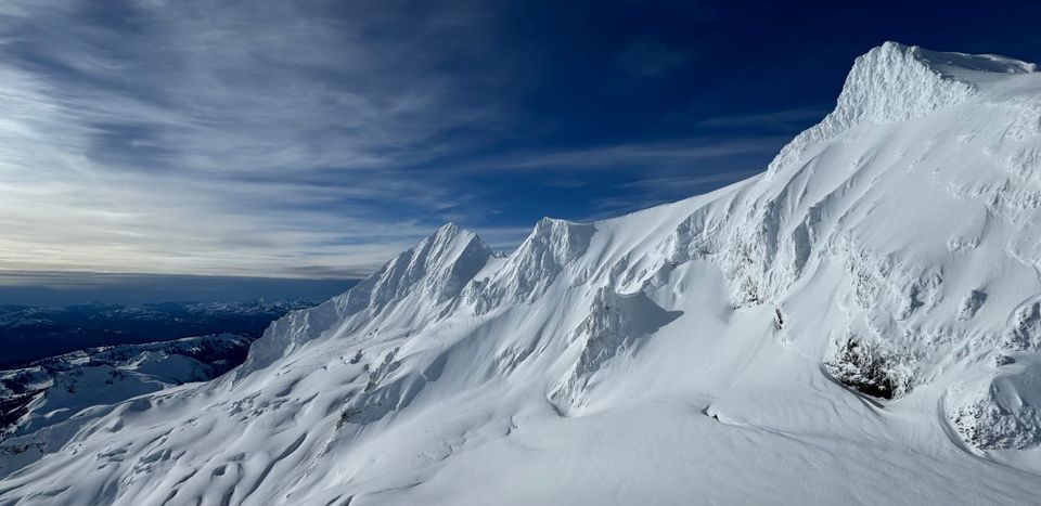
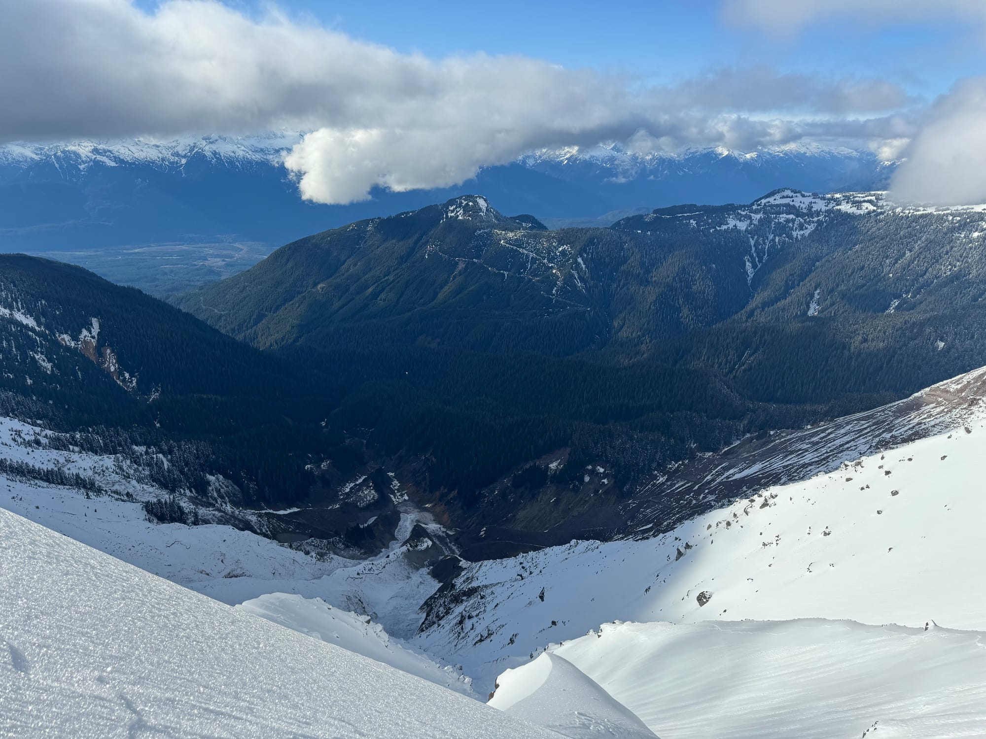
Wherever we can get as high as possible! Whistler backcountry and Garibaldi Park alpine terrain.
Using the lifts to access higher terrain is the trick at the moment even if the inbounds skiing is pretty icy and bumped out. Sheltered terrain is holding good powder while solar terrain and ridge crests have been swept and are very icy. Approaches on the Duffey are walking/delicate skinning below treeline. Red Heather is skinnable above the viewpoint at 1200m. Above that, it’s still thin and requires very careful skiing back down to avoid rocks/the forest. S2SG is snow free on the road with challenging access through the tree triangle.
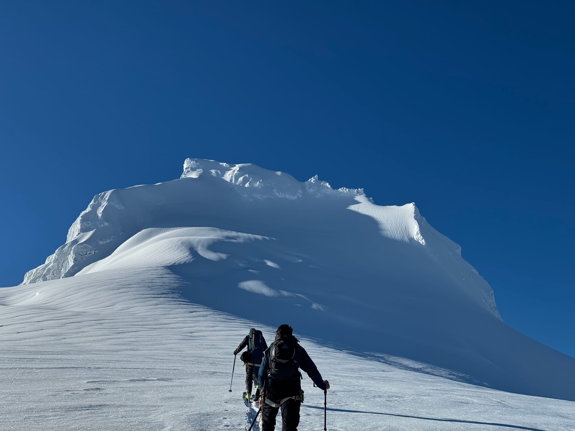
Also of note, a guided party completed a crossing of the Garibaldi Neve from Brohm to Elfin and found the Ring Creek Bridge intact! Crevasse navigation on that side of the Neve looks reasonable however it’s unclear how big the crevasses are descending from the high point down towards the Sharkfin/Sentinel Glacier. The high point is currently a large windlip with an open bergshrund.
What’s happened since the last update (weather & general snowpack structure):
As we guessed, the precip tapered off on Friday with colder temperatures that left us with some merciful pow to play with and otherwise fast travel conditions on our new baseline crust. The tail end of the storm was accompanied by a spectacular avalanche cycle throughout the corridor. Most steeper alpine slopes that can slide, did slide. Of note, we saw what appeared to be a 5 meter crown near the summit of Dalton Dome that stripped the West Face to rock/bed surface. A similar Sz 3+ avalanche appears to have stripped the Siberian Express on Atwell.
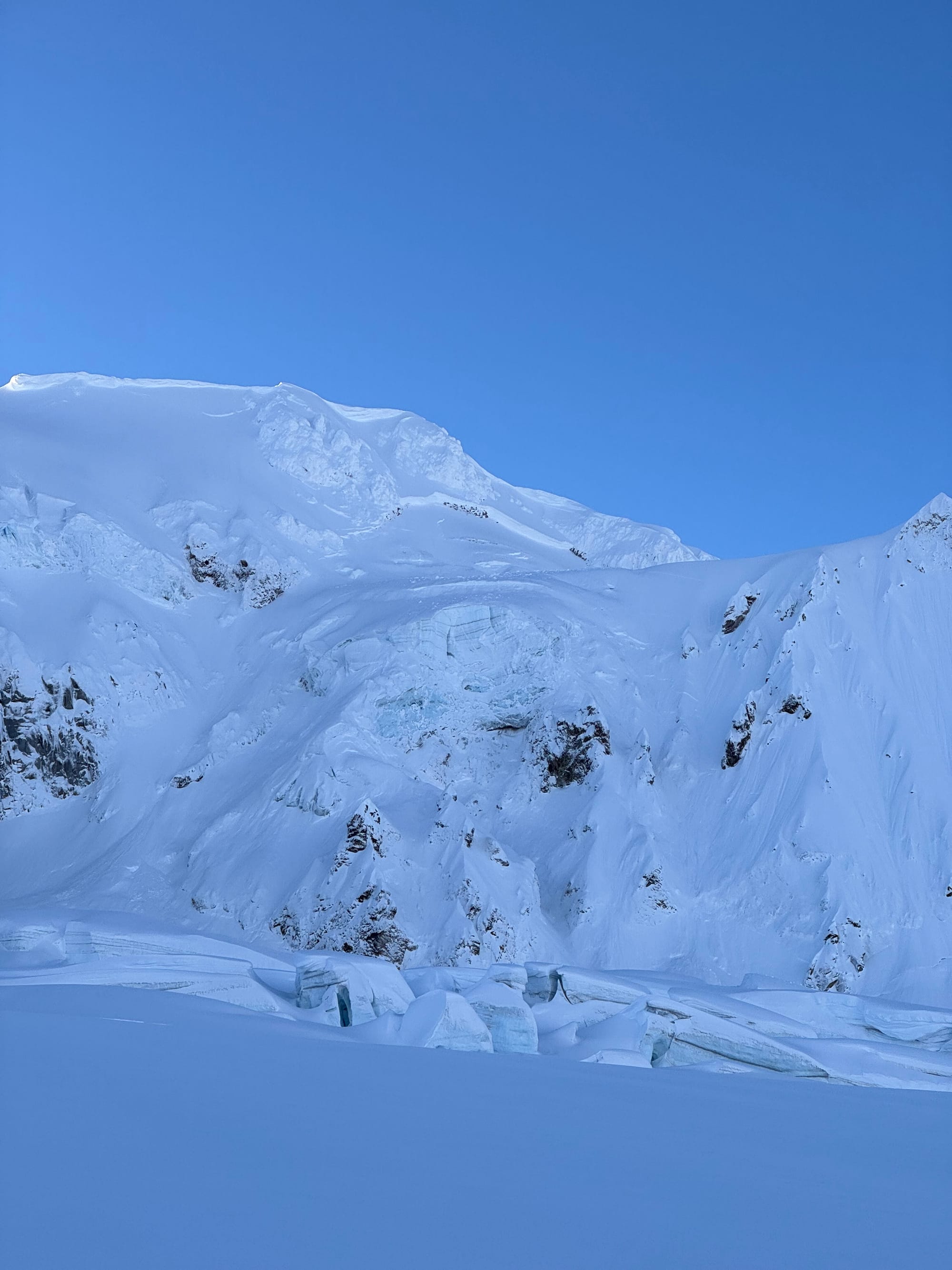
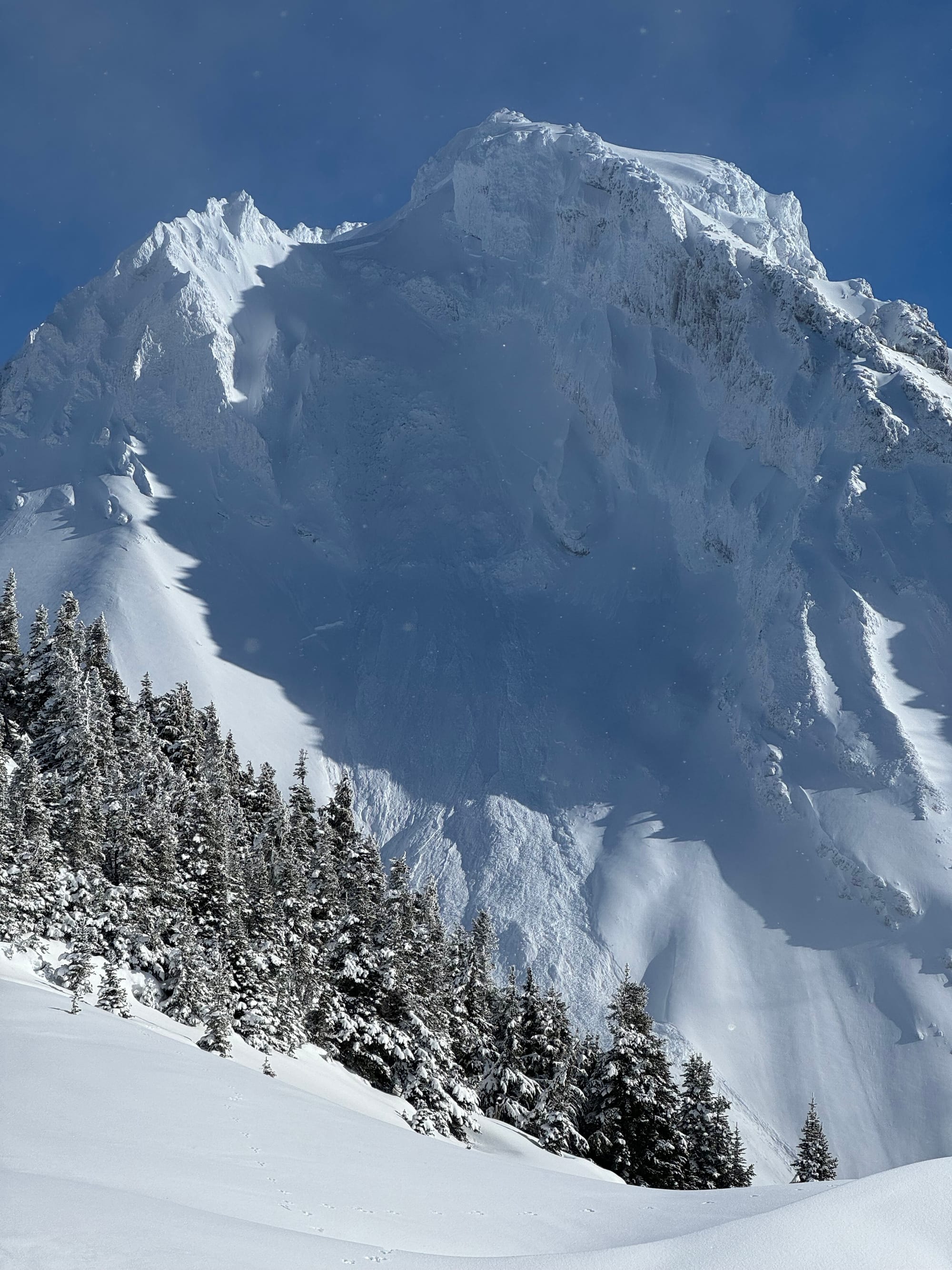
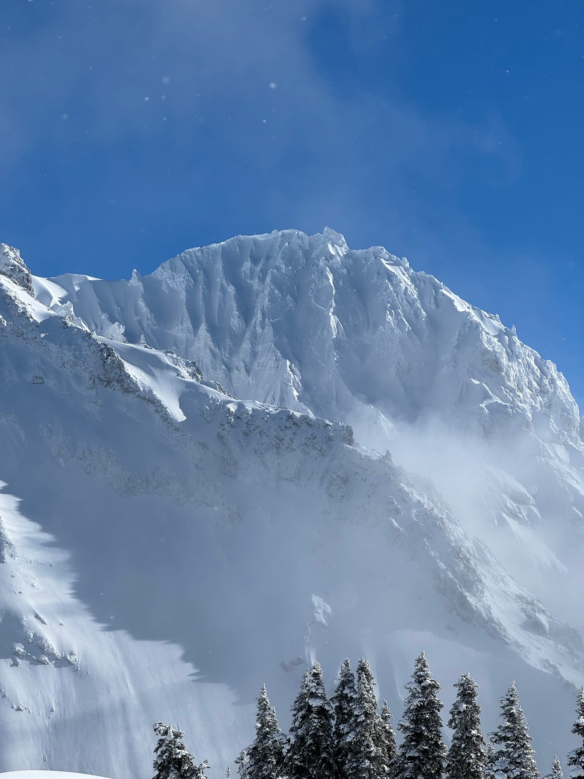
North Face of Dalton Dome with large crown near the top (Left). West Face of Dalton Dome with avalanche visible (centre). Siberian Express on Atwell with visible crown (right).
Since the end of the storm, we’ve had some very small pulses of precip but nothing substantial to change up the surface. Most of the snow was accompanied by a south wind however there were briefly some outflow winds from the north that reverse loaded areas and stripped some of the higher north faces (Garibaldi for example).
Overall we’ve had mostly sunny days with alpine temps around -10 and highs of +8 in town in Squamish. This helped with rapid settlement of the snowpack and, other than small pockets of windslab, there’s very little concern with the snowpack structure. Sheltered polar slopes hold 20-30cm of wind pressed powder while solar slopes and exposed areas are very firm crust.
What’s the weather and avalanche forecast?
We expect the weather pattern to continue in a similar fashion through the weekend before a bit of precip arrives on Sunday. At the moment, this doesn’t appear to be significant but could ramp up over the next few days and perhaps be accompanied by stronger winds than we’ve had this week.
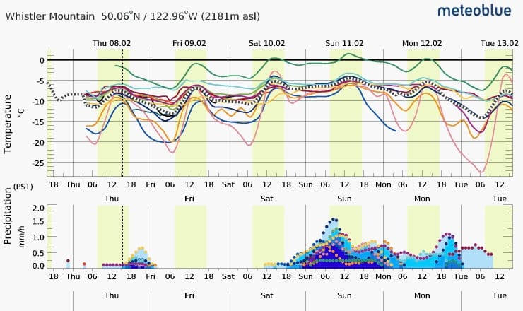
Avalanche hazard is currently a green brick! Wind slabs are still out there but they are in very isolated areas - a concern especially in areas of high exposure. Eric turned around near the summit of Atwell on Wednesday due to unmanageable wind slab in steep terrain. It’s possible that a cornice could still trigger a deeper slab but very unlikely. If/when new snow arrives, we’ll see avalanche hazard rise depending on snow totals.
The big non-avalanche hazard is the slide-for-life conditions on icy solar aspects! Bring crampons and an ice axe in the alpine until we get more snow!
What are my questions for the weekend?
- Will we get more than 20cm on Sunday? While the current easy travel and low avalanche hazard is great, a surface refresh would be amazing!
- How well will new snow bond to our ice crust? I hate to say it but I find myself hoping we get a storm that starts wet and finishes cold to help facilitate new snow sticking to the current surface.
What will I watch out for or avoid completely?
From an avalanche perspective, other than very high pockets of windslab I’m not too concerned. From a travel perspective, I’ll be avoiding:
- South facing terrain that’s steep enough to slip and fall down. Low angle is fine.
- Below treeline, and even treeline terrain until we get a refresh. We need to get access somehow but getting up high is key. This comes with the complication that alpine travel is hard with low vis so storm day skiing might be limited to the ski resort. I probably won’t plan for a big mission on Sunday if it ends up snowing because vis will be limited in the alpine and everything else is unskiable.
Closing Thoughts:
It looked pretty grim for us there during the storm but good things did come of it! Alpine terrain above 2000m gained snowpack overall. We will get a refresh eventually. Until then, we can take advantage of good travel conditions and nice views! Avalanche Canada re-published a great article about going big when stability improves and it’s very appropriate for right now!
Eric Carter and Evan Stevens contributed to this report. For more information, check out Zenith Mountain Guides and our local avalanche forecast. These updates are supported by SkiUphill Squamish - the best stop for ski touring equipment in the Coast Mountains and made possible by the Sea to Sky Gondola! Use this information at your own risk! We are not responsible for your actions in the backcountry and conditions change rapidly from when this report was written!
Member discussion