
Feb 15 - Sea to Sky Snow Conditions
Overall theme:
Cold and windy! Conditions have improved since last week but north winds are wreaking havoc.
Where we’ve been skiing:
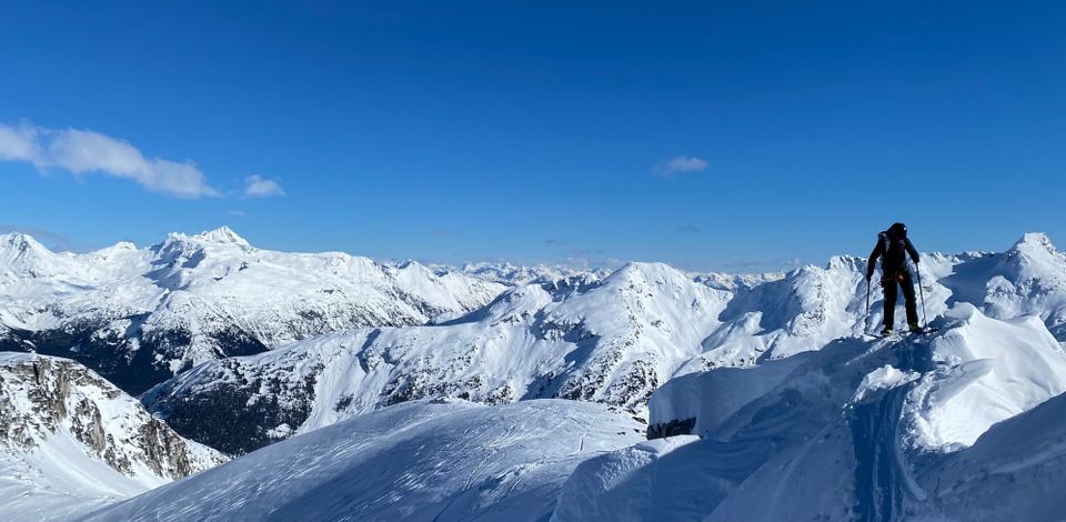
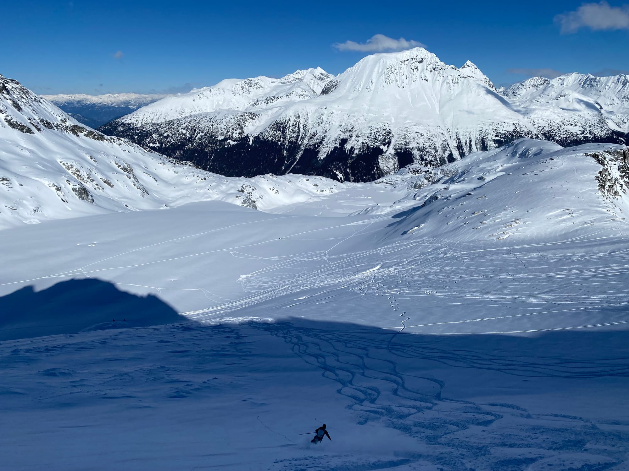
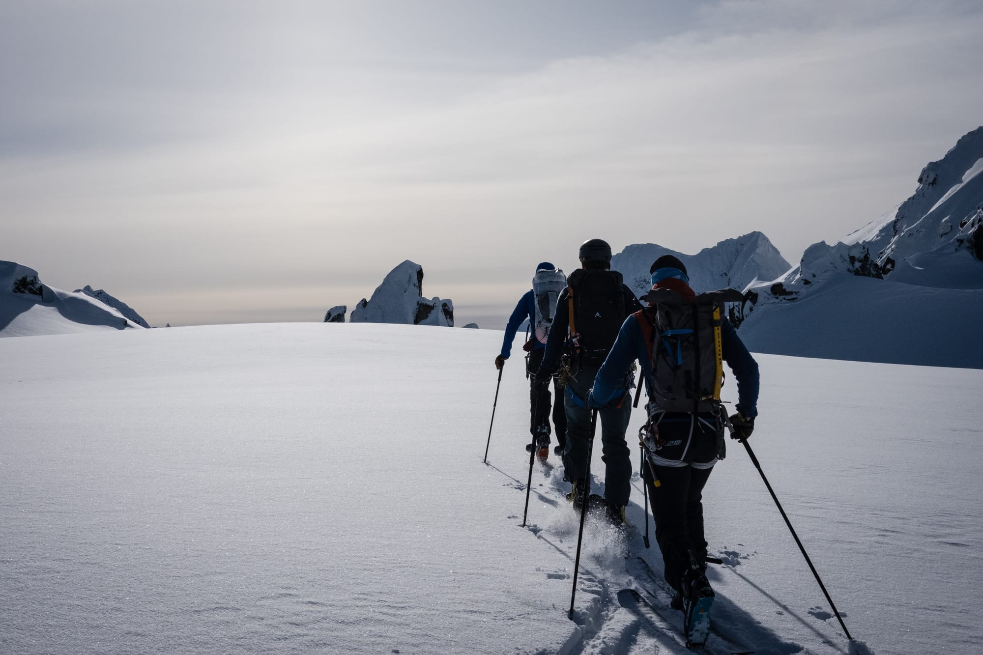
We’ve had limited observations since last week. If you remember, our main goal from last week was to use infrastructure to get above tree line and take advantage of good visibility and travel in the alpine. On Friday, we took advantage of the fast travel conditions for a lap of the Spearhead Traverse. After the weekend’s storm, we looked for powder skiing off Whistler Blackcomb and in the Squamish area with moderate luck! Best conditions remain in sheltered areas.
What’s happened since the last update (weather & general snowpack structure):
Last week finished off with high pressure giving way to a small storm system on Sunday. This storm had seasonal temps and dropped 15-30cm of new snow throughout the corridor with strong southerly winds. Very quickly however, high pressure rebuilt in the region and gave way to clear and cold nights and increasing north wind through the week all the way up to today. Winds were strongest Wednesday into Thursday leaving a variety of wind swept and pressed surfaces. Some areas are scoured down to the thick Feb 1 ice crust while other areas hold increasingly thick wind slabs.
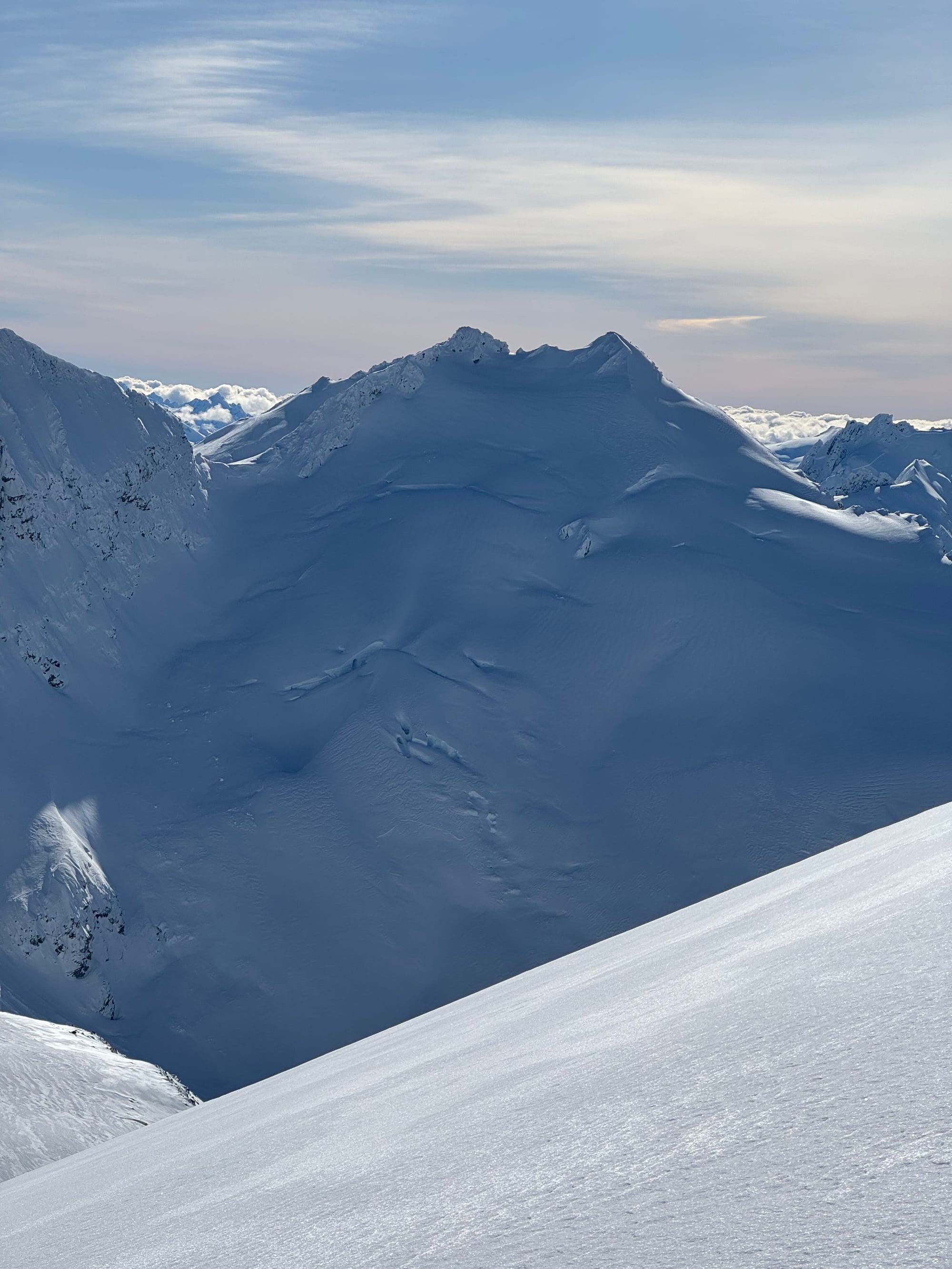
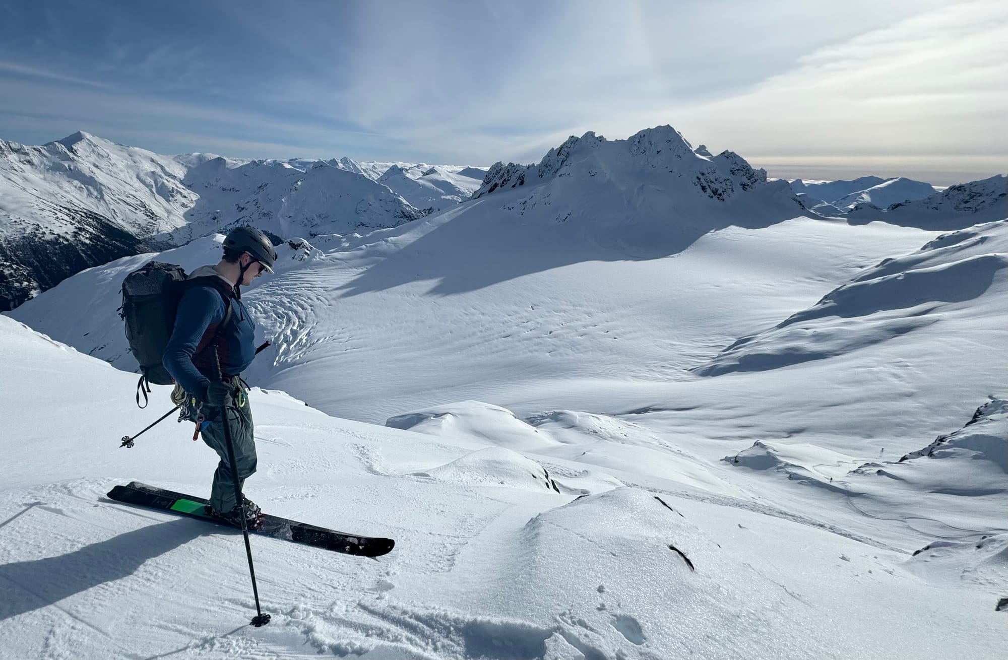
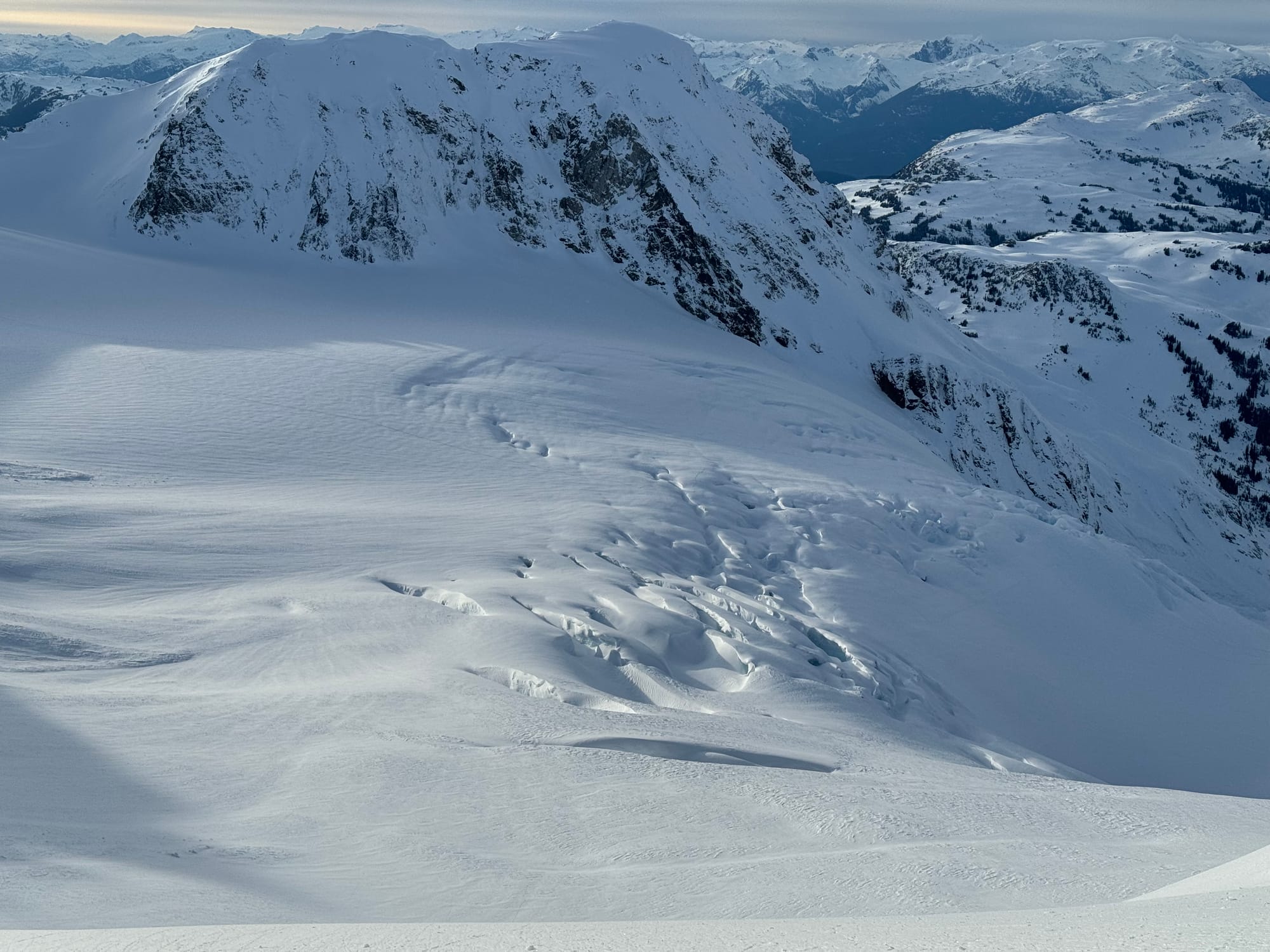
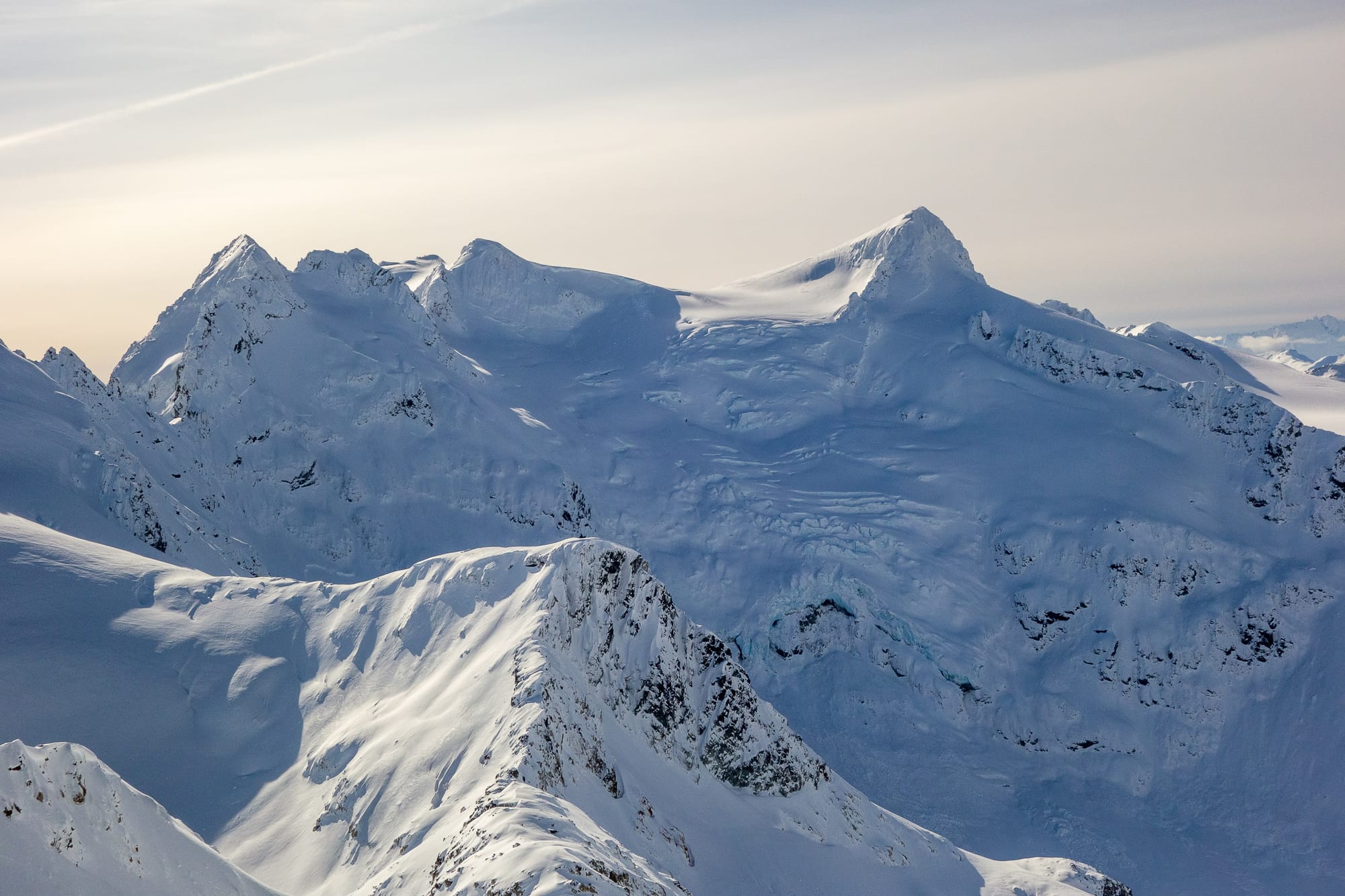
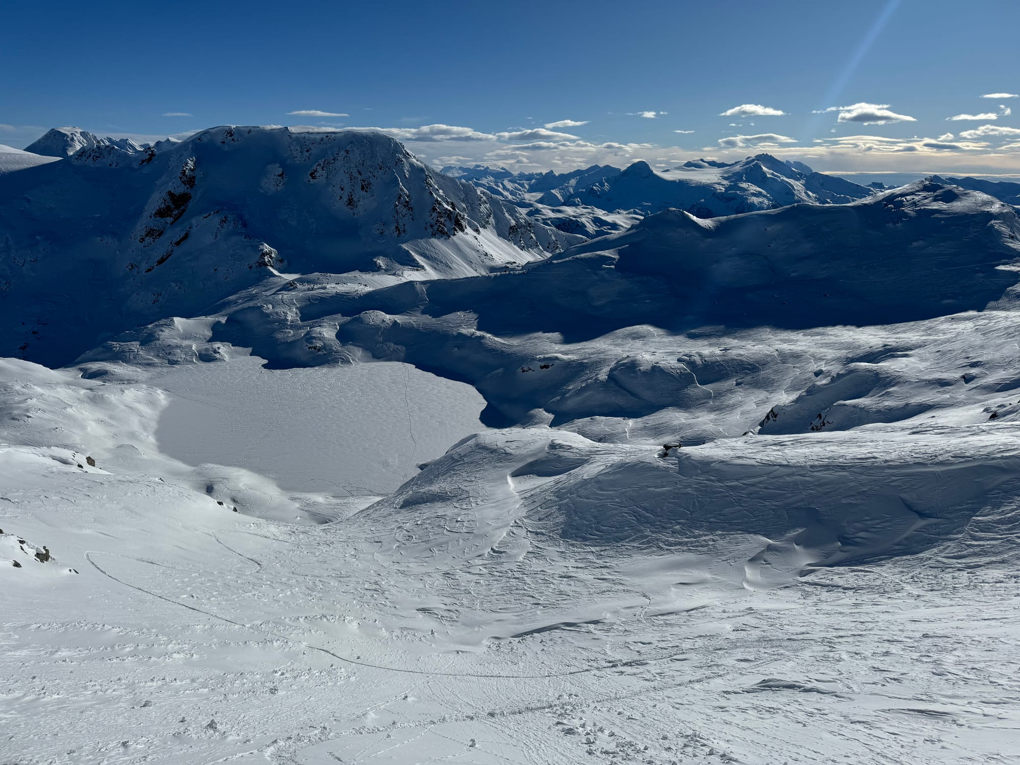
Spearhead Traverse photos! Top Left: MacBeth Curtain glacier. Top Right: Diavolo Glacier and Chekamus Peak. Bottom Left: Overlord Glacier flats with Fissile behind from Overlord Rappel. Bottom Right: Fitz and Overlord North Faces. (Pat Valade)
A fairly widespread avalanche cycle, both skier triggered and natural, has occurred over the last few days where these slabs have built up. While generally, fairly thin, they still have the ability to knock over or carry a skier. In areas, that didn’t see as much wind (protected, near TL), there is buried surface hoar that may be contributing to the weakness of the developing windslab. This surface hoar formed in the clear/cold weather before Sunday’s snowfall and then was buried. In many places, the surface hoar AND the snowfall was blown away but again, protected treeline areas still hold the hazard.
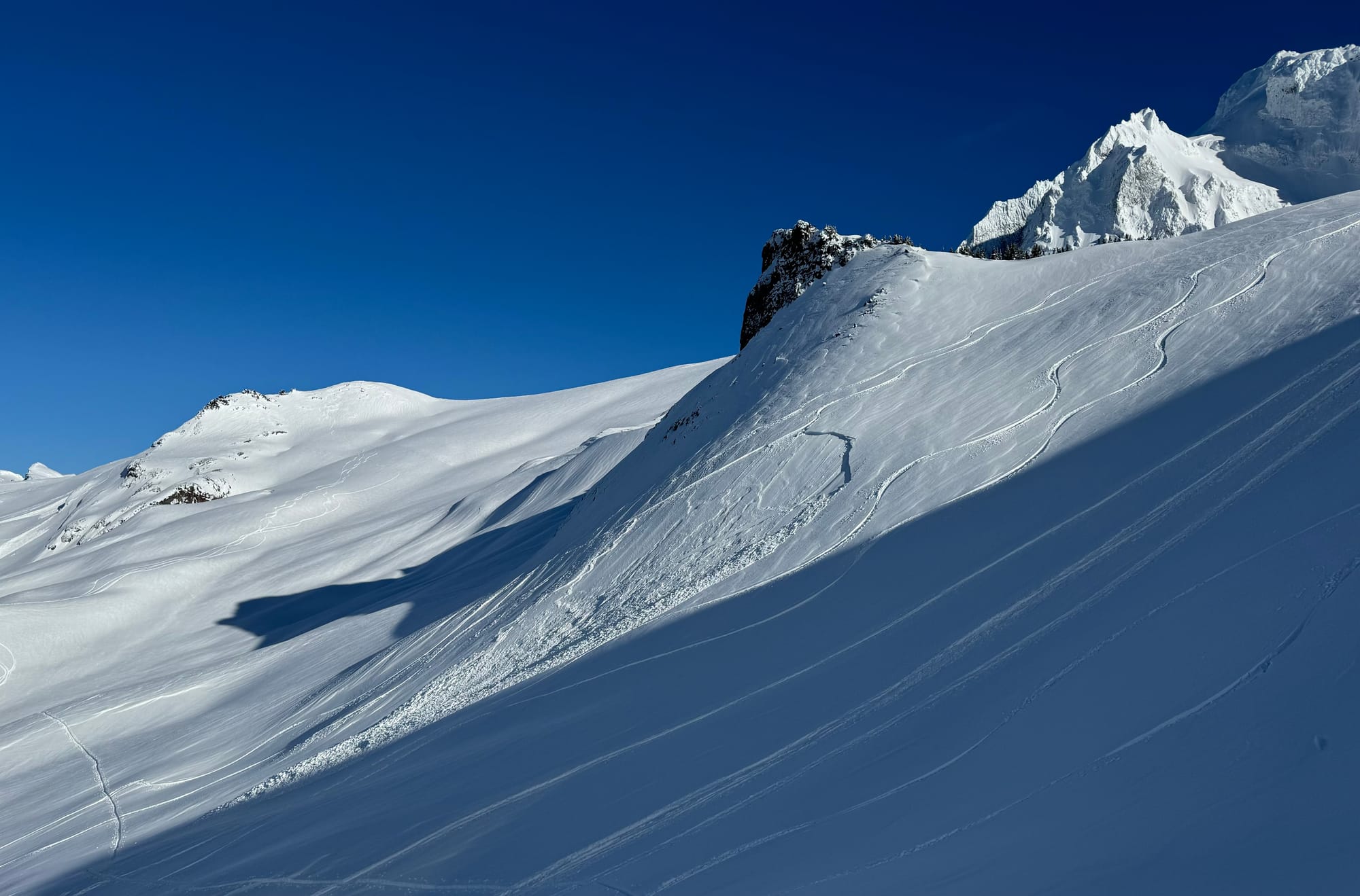
Left: Skier accidental windslab on Brohm Ridge failed on Feb 7 surface hoar (shot Monday). Right: Chaotic wind loading above circle lake with numerous Sz1 avalanches visible (shot Thursday).
What’s the weather and avalanche forecast?
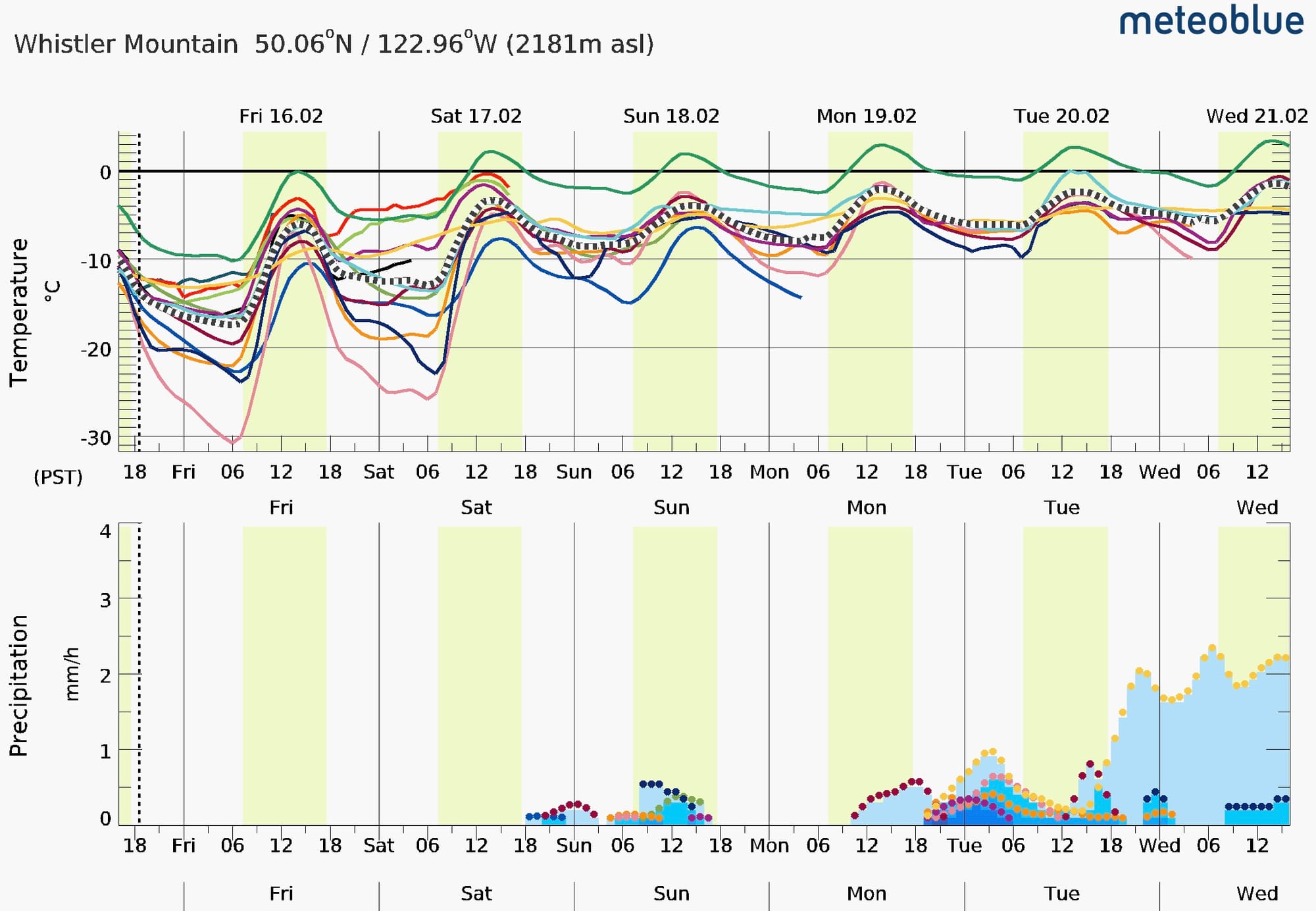
As the week wraps up, we see the winds dropping and freezing levels increasing but not much for new snow. Even the most optimistic models currently only have a few cm in the next 10days. Sunday and Tuesday look like the best chances for a sprinkle at the moment. Clouds build over the weekend but look like they’ll be clearing out again next week and we’ll be back to good travel and questionable ski quality.
According to Avalanche Canada, our current primary avalanche problem continues to be windslab. While the predicted avalanche size is smaller (less than Sz 2), they are on all aspects and likely to be triggered by humans. This hazard will continue to build as long as winds continue.
We may see the slabs start to heal as the wind abates and temperatures rise, settling out the slabs however we are in a somewhat unique mid-winter situation with a widespread and very thick crust layer, covered in weak faceting snow, capped with wind slab. Any new load will complicate this snowpack! Facet covered crusts are certainly something to give us pause that we don’t normally deal with!
What are my questions for the weekend?
- How widespread in the corridor is the wind slab problem and will it hang around? I’ll be looking for areas that reported less wind and looking for sheltered terrain. With slabs forming on all aspects, I’ll certainly be skeptical of most terrain going into the weekend!
- How high will we see FLs rise? How much melt will we see at TL vs. how much settlement will the warm weather contribute to? I’m hoping that by early next week, we’ll have seen the wind come down and the slabs start to settle out but there’s no guarantee.
What will I watch out for or avoid completely?
- As with last week, I’m doing everything possible to get to treeline and above. It’s a broken record at this point, but logging roads, and solid summer trails to TL are still your best bet. Places like the sea to sky gondola are still not back into shape! Below TL is pretty much out for now. If visibility isn’t great, that really reduces the skiable terrain available.
- With chaotic wind loading, wind slabs on all aspects are possible however north and west facing alpine terrain seem to especially be holding bigger slabs. While the avalanche size isn’t huge, any lines of consequence or with terrain traps are quite scary in these conditions. We often talk about low-probability, high consequence problems. Well right now, if we’re on big gentle slopes with nice run-outs, we have a high-probability, low-consequence problem. If we wanted into steeper terrain or around terrain traps however, we can VERY quickly find ourselves in high-probability, high-consequence terrain and that’s scary!
- Let’s flag tree-line south facing terrain for possible wet slide risk when the sun comes out strong or the temps rise significantly!
Closing Thoughts:
Right now chasing ski quality probably isn’t going to yield amazing results without putting some serious effort into finding that protected alpine terrain. Fitness/adventure skiing with good travel and beautiful views might be the play depending where you are in the corridor!
Eric Carter and Evan Stevens contributed to this report. For more information, check out Zenith Mountain Guides and our local avalanche forecast. These updates are supported by SkiUphill Squamish - the best stop for ski touring equipment in the Coast Mountains and made possible by the Sea to Sky Gondola! Use this information at your own risk! We are not responsible for your actions in the backcountry and conditions change rapidly from when this report was written!
Member discussion