March 28 - Sea to Sky Snow Conditions
Overall theme:
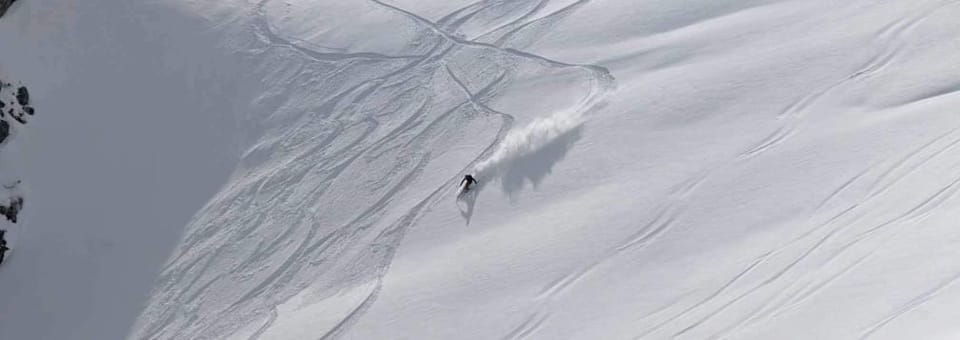
We are finally getting the spring we’ve been craving - almost. It’s a little low tide, there’s this pesky, isolated weak layer that’s giving us some lingering concerns, and surfaces on the steep high north alpine faces are firm. None of this is going anywhere we still have a concern that reloading and repeat avalanches will be an issue.
Where we’ve been skiing:
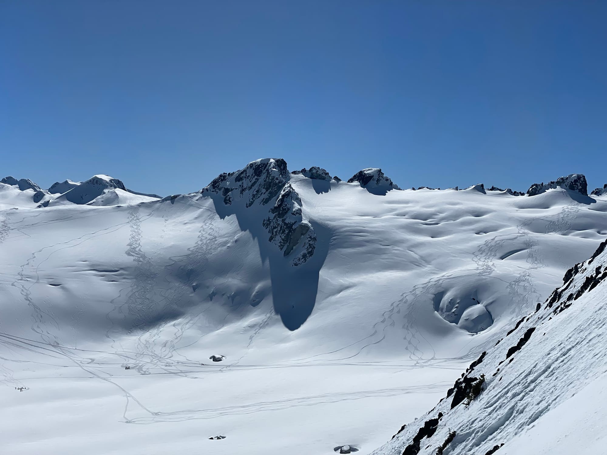
Duffey and Blackcomb Backcountry mostly. We’ve been using the easy access points to the alpine (do we sound like a broken record this season?) to skip less than ideal travel at low elevations. 1800m and below is suffering from melt freeze cycles and isothermal snow making travel difficult - ski crampons and running shoes unless you take roads or lifts to the highcountry - hence lots of time for us in the Blackcomb backcountry.
On the Duffey we’ve been using the Cayoosh road, Steep Creek roads, Cerise Creek trail and Joffre Lakes trails to get high. The trails are way tougher going than the logging roads! It’s the season for sharps on the feet in the morning for sure. And oh ya, south aspects are not great unless the sun comes out and warms them up. Warmaggedon certainly opened the potential for creamy corn skiing when the weather allows - but with these small amounts of new snow, it’s dust on crust or avy debris - which there is tons of out there.
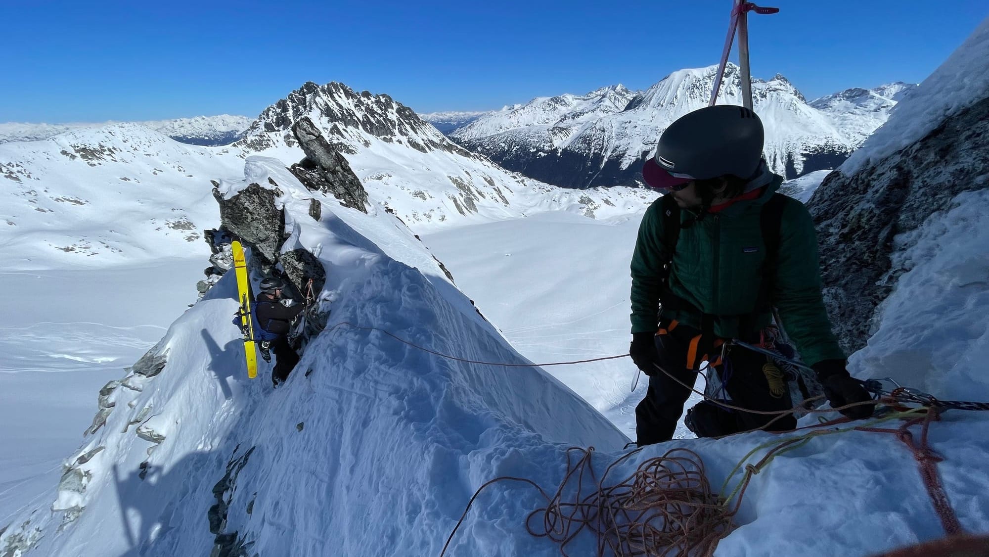
Notes from the Spearhead are that conditions are excellent. Low snowpack means there’s more crevasses but bridges are doing well. Several options exist for moving through the Naden Col and people were having success with both the Overlord Notch rappel as well as the Overlord Glacier ski around. Singing Pass is still mostly passable but requires many skis on/off transition and some walking at the end. MUCH more pleasant to suck it up and continue back to Whistler and enjoy the corduroy ski to the village.
What’s happened since the last update (weather & general snowpack structure):
Well a little bit of new snow but not tons. High alpine north faces are slowly refilling with lots of convective spring shower cycles. 20-30cms are now sitting on soft surfaces in the shady high (above 2000m) north faces closer to the ocean and maybe 10-20+ in the Duffey region. The more interior you go - like the Duffey - typically fairs better in these spring convective cycles. Moderate temps mean rapid settlement of the new snow, and the winds have been behaving, only leaving isolated wind slabs close to ridgelines that feel manageable, but you don’t want to be in the wrong spot!
We hear lots of talk of things feeling good, or tightening up, and it’s mostly true, our problem has certainly settled. But that facet/crust combo is not gone, it’s just sitting under a stiff slab, 90 to 200cms thick, that’s really really hard to trigger. Think large groups, cornice failures or thin rocky spots. There was a ton of avalanche activity in the last storm cycle, and honestly it feels like most slopes have run - but the melt freeze crust is still there, creating icy surfaces in steep slopes that are running regularly. With the thin snowpack in exposed alpine locations and the widespread nature of the crust, it doesn’t feel like the season to tag the wild alpine face you’ve been dreaming of - but classic fat slopes may be in shape.
What’s the weather and avalanche forecast?
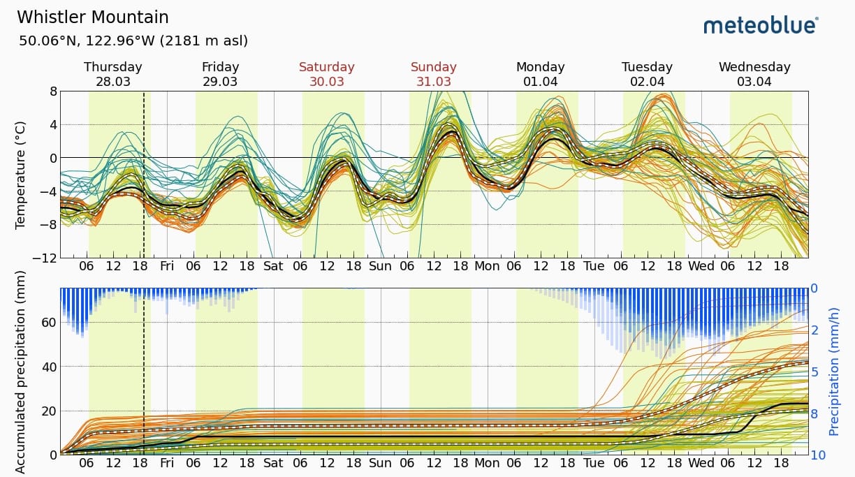
Weather improves through the weekend with clearing skies through Friday and Saturday with temps becoming progressively warmer until peaking on Sunday/Monday. Saturday looks like the most promising for the weekend. I don’t want to be in big terrain by Sunday mid-day when temps are spiking. By Tuesday, it looks like we’ll see things cool back off and perhaps a new pulse of precip Tues/Wed!
The PWL will still linger but like we mentioned large loads, shallow spots or a rain event are your main concerns for triggering it. We’ve been trying to ski slopes that have obviously avalanched and keeping clear of funky thick-to-thin places or hanging out under cornices on the hot spring days. The forecast keeps pushing the pulses back and not a ton is accumulating fast, so the daily 5-10cm is making for better skiing and riding and allowing any new instabilities to settle out quickly.
Wet loose avalanches will be a concern on solar aspects as it warms up. This looks like mostly a Sunday/Monday problem but if it heats up more than expected on Saturday, it’s a possibility! We also mentioned wind slab earlier. It’s not widespread or huge but there could certainly be pillows at ridge crest or the entrances of lines. I’ll be using a rope to scope entrances and make sure we’re well situated before committing.
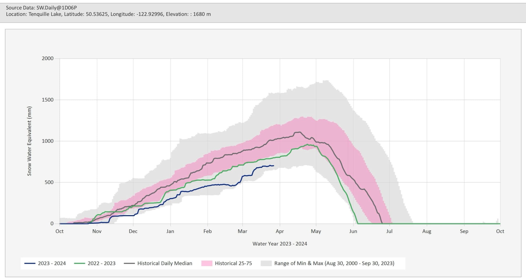
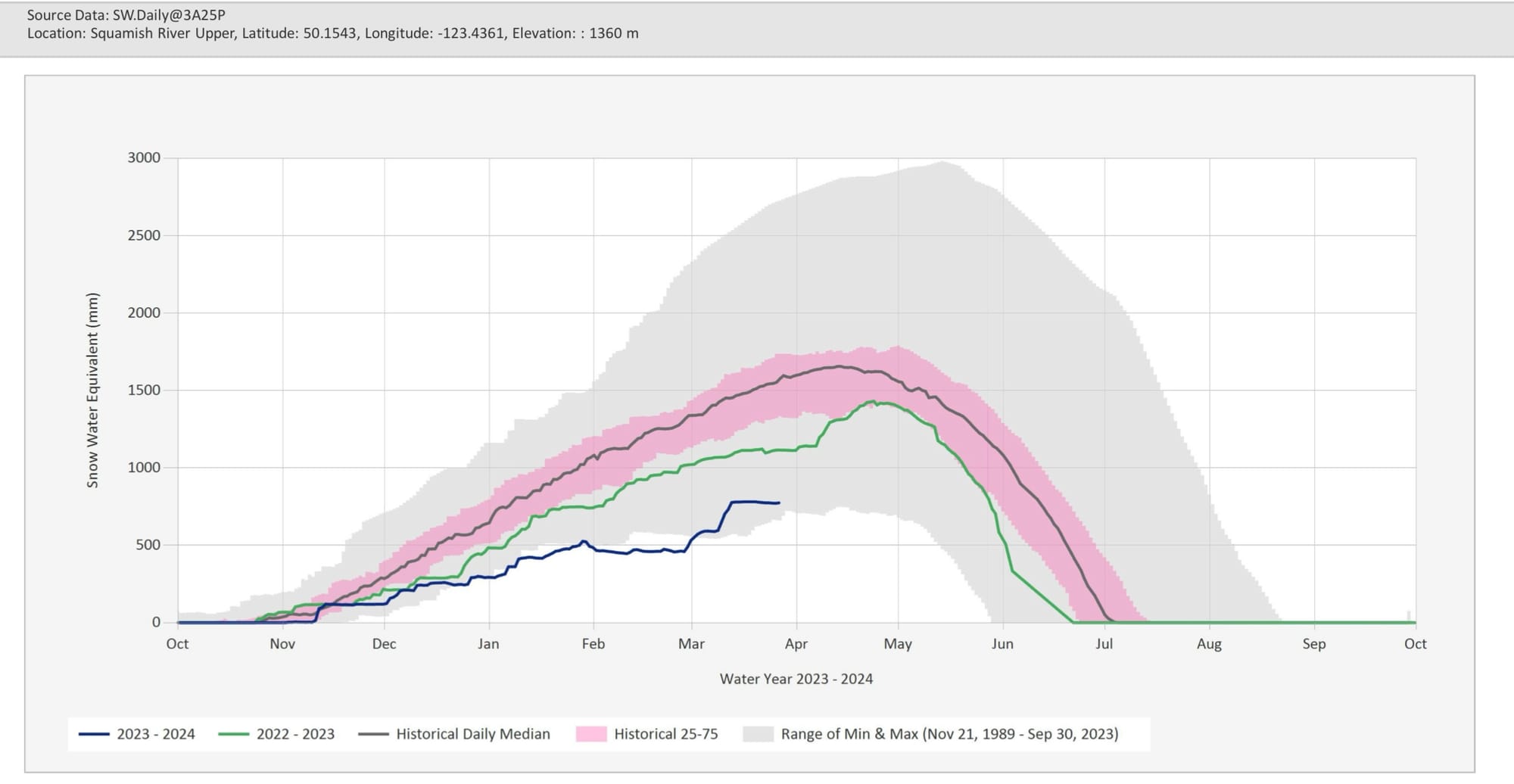
Snow pillow data. We’re that sad blue line. The spikes at the beginning of March were sweet but it’s looking pretty level for the second half of the month. Luckily we are still in the grey meaning we’re no longer “worst season ever”!
What are my questions for the weekend?
- How much snow actually fell in the corridor, especially Wednesday night and Thursday. It doesn’t look like winds were too crazy but did wind slabs form in exposed areas at ridge crest?
- Will visibility improve enough on Fri/Sat to do some bigger alpine objectives? So far it looks promising!
- When does the warmup happen? At the moment it looks like Sunday mid-day is kind of the end of fun time. I will definitely be aware of warming on Saturday. I’ll also just be watching for solar affect as the sun is strong these days!
What will I watch out for or avoid completely?
- If the sun is out strong, I’m staying away from south aspects this weekend. We’ve got a bit too much fresh snow for corn and more than enough to get raked by a wet slide.
- Cornices aren’t crazy this year but as with any warming trend, I’ll be keeping my eyes open!
Closing Thoughts:
A lot of people have given up their skis and switched to the mountain bike but game time has arrived. Ski quality is good when you get up high and access is still *reasonable* from most trailheads. When we see stability coming together, we’re taking every chance we can to get out because we have no idea how long this spring is going to last!
Eric Carter and Evan Stevens contributed to this report. For more information, check out Zenith Mountain Guides and our local avalanche forecast. These updates are supported by SkiUphill Squamish - the best stop for ski touring equipment in the Coast Mountains and made possible by the Sea to Sky Gondola! Use this information at your own risk! We are not responsible for your actions in the backcountry and conditions change rapidly from when this report was written!

Member discussion