
March 7th - Sea to Sky Snow Conditions
Overall theme:
Winter has arrived! If only it wasn’t almost springtime… But really, we’ve done enough complaining about the snowpack! First let’s look at our questions from last week:
- What didn’t slide during the storm?
- What got reloaded and how?
These turned out to be pretty important and spot on questions for our week (we’ll be careful here not to throw a shoulder patting ourselves on the back). As you’ll read below, some areas saw a very widespread avalanche cycle during the storm while others had a more specific natural cycle. These areas that saw more limited natural avalanche activity during the storm stayed more primed for skier triggered avalanches when things cleared!
Reloading was less of an issue as further snowfall seemed to glue itself on and fall fairly right side up in the places that received the most moisture!
Overall, we’ve got a highly variable snowpack through the corridor and this is reflected in how travel has been going throughout. We’ve got areas that skiing is game-on and other areas where folks are hiding scared.
Where we’ve been skiing:
We’ve been throughout the corridor. Eric has primarily been in Squamish (hard to leave good home snow!) at the Sea to Sky Gondola.
Evan has skied in Squamish, Blackcomb BC, Rutherford area, Squamish Valley, Meager, Hurley, North Creek - luckily got to explore tons of locations before this next storm.
We’ve also checked in with a few friends who have been exploring around north of Pemberton.
Access is much improved over the last few weeks. Generally above 600 or 700 meters, the forest is skiable (though still fairly thin below treeline. Our snow study plot at 1050m at the S2SG is currently at 145cm. Most trailheads in the corridor are finally accessible. Duffey access is much improved but lower elevation ski runs are still very thin for this time of year. The alder is standing tall (and now well frozen in place) so runs like Rohr slide paths are likely nearly unskiable.
What’s happened since the last update (weather & general snowpack structure):
We had a storm pattern we could all enjoy! The first big pulse came through on Wednesday and then it just kept snowing in Squamish through to Monday. We had a few moments with snow to valley bottom but our key trail heads got plenty of snow down to 800m. Temps stayed cold and it just got deeper and deeper with very little settlement during the storm. Squamish saw the biggest snow totals and also the warmest/wettest during the peak of the storm (back on Wednesday). As the storm cleared, we had cold nights and anytime the sun came out, intense warming and greenhouse effect. Tuesday had enough direct sun to melt the snow surface on solar slopes and create a thin breakable sun crust.
Our early February, very thick crust remains widespread throughout the season and provided an excellent weak layer for avalanches during the storm. Many of these occurred on the facet/surface hoar layer above it and ran on the crust bed surface. In Squamish, we now have >200cm of storm snow that is rapidly settling, sittting on the crust. This snow fell with very little wind. By today, our primary avalanche problem was a very specific and unlikely to be triggered wind slab.
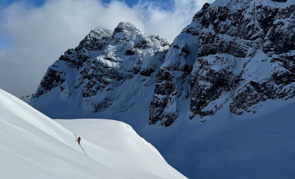
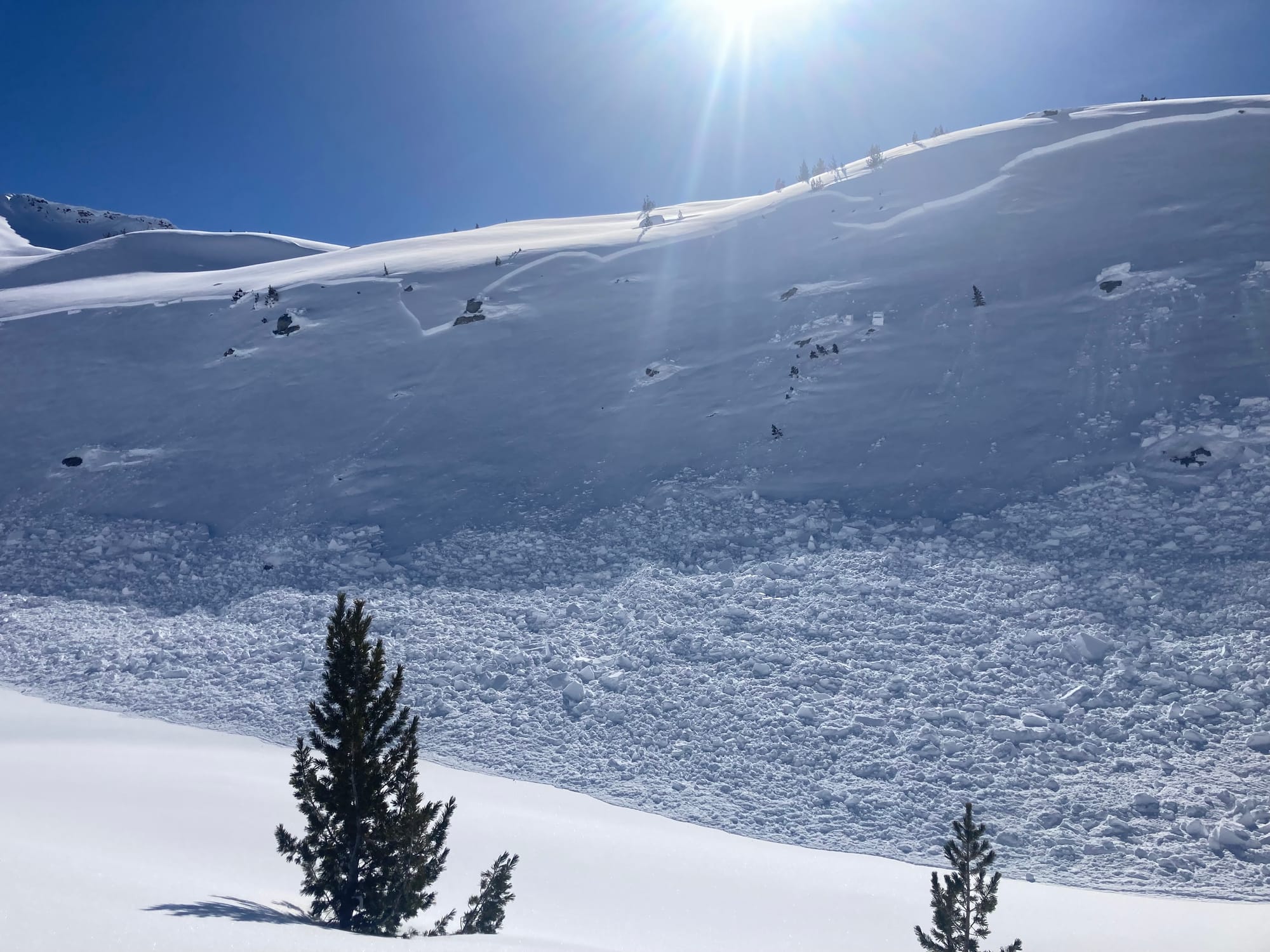
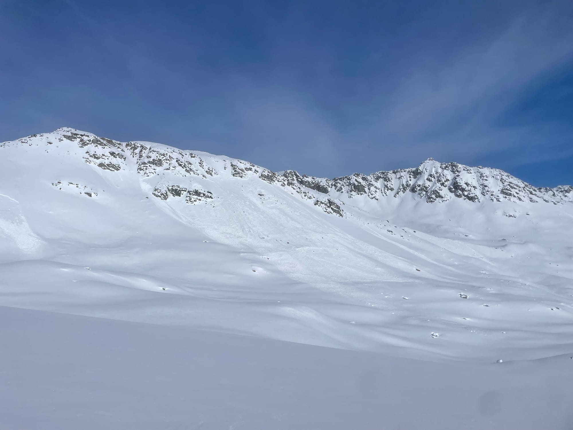
Conditions in the Gondola area. Left - Thursday remnants of a large Sz 3 that cleared the area around the Stadium Glacier. Centre - wind slab near Cleavage Col not observed until Tuesday. Right - good stability in steep terrain that slid big during the storm and continued to sluff throughout.
As we get further north, storm snow totals decreased. The crushing/settling effect of 2+ meters of snow just wasn’t there. Further, the natural avalanche cycle was not as widespread so didn’t do as much cleaning of the persistent weak layer. Surface hoar was well preserved. Whistler and north continues to struggle with this issue and MANY examples exist over the past few days of the touchy snowpack, especially around treeline where surface hoar formed. Lots of whoomphing, shooting cracks, and other signs of instability. As well, many remotely triggered avalanches by skiers. Surprisingly few actual skier involvement avalanches, perhaps because they’ve been triggered remotely before skiers could actually trigger them directly!
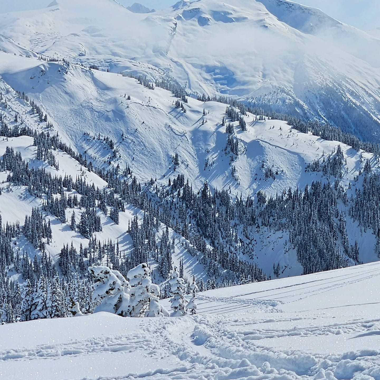
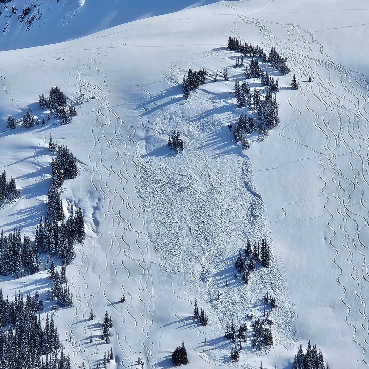
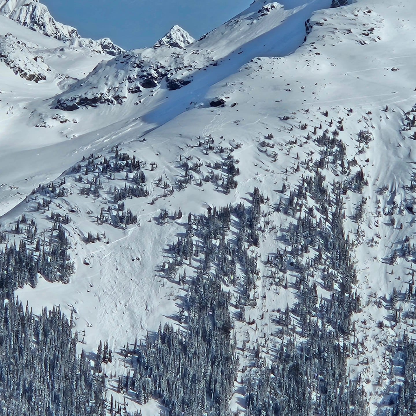
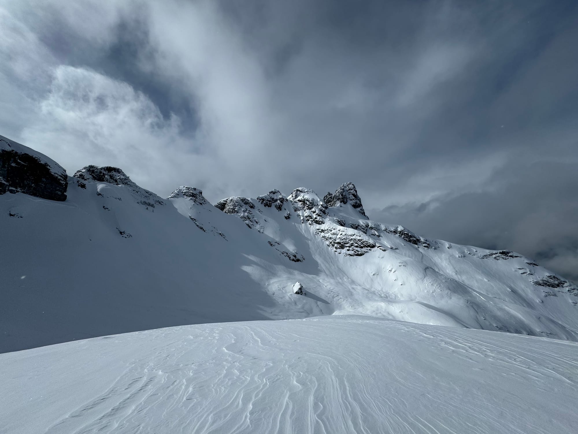
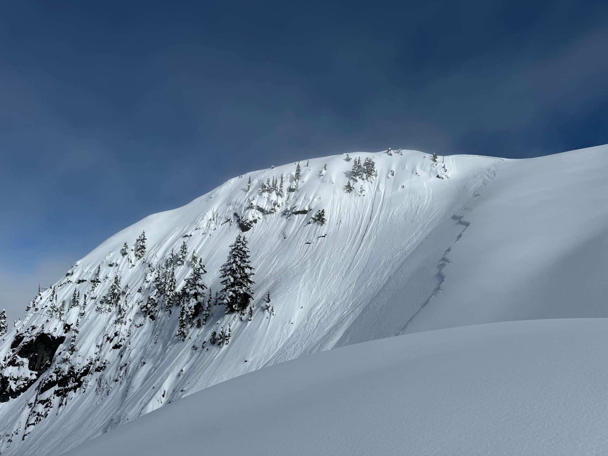
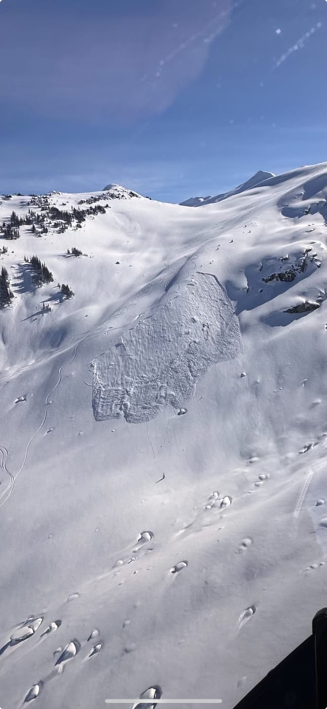
A series of photos shot by Mitch Sulkers, an ACMG guide in the Spearhead Range this week. These well illustrate the TL SH problem that was easily triggered by skiers directly and remotely. More photos and info on his Facebook post here.
If you followed Evan’s instagram story, or came to our snowpack talk at SkiUphill, we included some good charts illustrating this dramatic difference of snowpacks through the corridor by looking at the snow water equivalents (SWE). The numbers really give us good insight:
- 260mm of water fell around Squamish
- 160 in the Squamish Valley
- 110 in the Callaghan/Spearhead
- 80 on the Duffey or less!
What this tells me is anywhere with 200mm + like Squamish got crushed/flushed, but anything less is likely still suspect. The tricky part is, the deeper the snow amounts where a clean out didn’t occur = the harder to trigger a massive destructive avalanche. A good example of this is the snowmobile triggered avalanche near Brandwine this week. Not enough load to avalanche naturally but enough to go big with the load of sleds. The good/bad part about lower snow totals somewhere like the Hurley/Duffey is that slopes will trigger easily and remotely, so you won’t be lured into a false sense of security. This might make the Rutherford/Spearhead areas some of the trickiest spots for a bit…except here comes another 100mm!
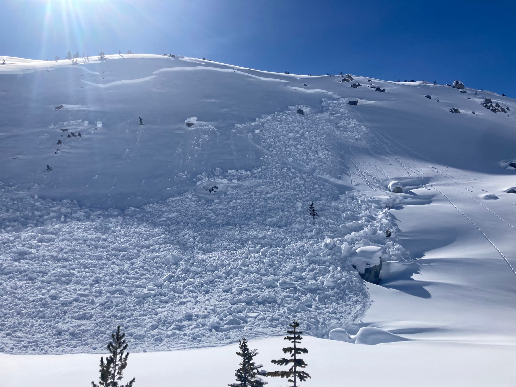
Top photos: Sled Remote triggered north of Pemberton (Peter Wojnar Photos). Lower Left: Remote trigger in upper Ryan. Lower Right: Natural avalanche in Hurley area.
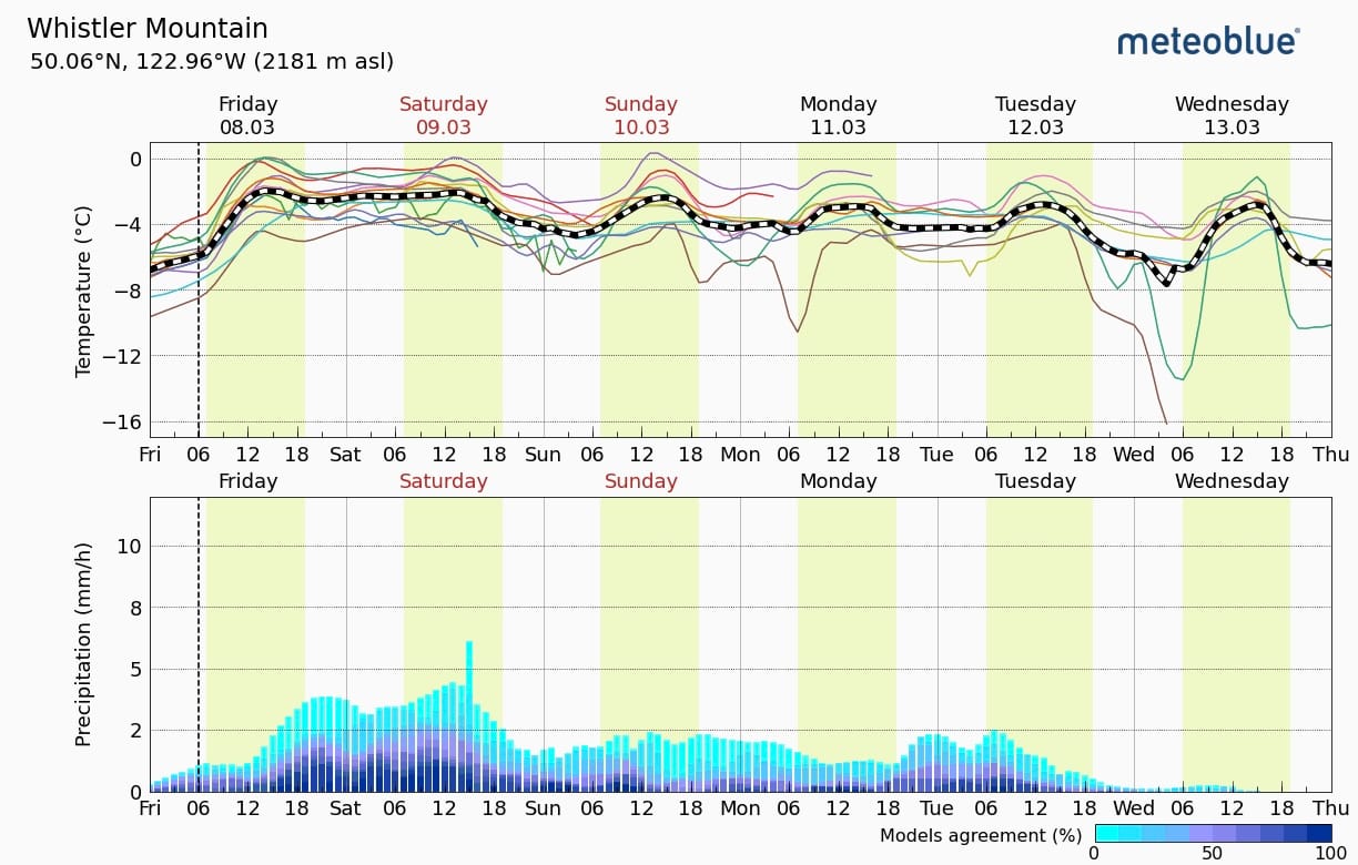
What’s the weather and avalanche forecast?
The next wave of storms arrives today. Snow totals have been decreasing with each model run BUT last week’s storm far outperformed what was predicted. Maybe I’ll keep an eye on the GFS this week… Temperatures are a bit higher this weekend with FLs looking to peak around 1300m on Sat/Sun.
This storm will bring high avalanche problem with the potential for wind/storm slab as well as avalanches that could step down to our February crust persistent weak layer.
Further out in the forecast, we’ve got a big warmup on the horizon. I’m not going to think about that too much just yet and hope that it disappears as the forecast gets closer…Overall the warm start/cold finish is exactly what we like on the coast. There is a touch of fresh surface hoar and facets on top of the snowpack now and this will be our first touchy layer as the new snow starts to fall - with plenty of potential to step down to our lingering deeper layers.
What are my questions for the weekend?
- Will the areas N of Whistler get enough snow to crush the current instability? The last storm just didn’t quite do it. We need a warm and wet one to smoosh everything out.
- Surface hoar has been forming on the current surface. Will that be buried and present a new issue? It was widespread and large around treeline pre-storm.
What will I watch out for or avoid completely?
For now we’ve been avoiding being on the Duffey, or really anywhere north of Whistler, until it can be proven innocent. Observations have been limited and what has been reported around treeline is very scary with lots of easily triggered avalanches. If this storm cycle cleans out our surface hoar issue, that will be more on the radar.
During the storm cycle, I’ll be looking for protected tree skiing that’s above the freezing level. At the moment Sat/Sun look like the wettest days so those will be good to be inbounds or looking to tour in the highest elevation trees. The Brohm Ridge webcam and weather station will be the one I’m clicking into to see what snow is doing at or just below treeline in Squamish.
Spring is coming 😢 This means that when the sun does pop out, it’s much higher, further east and west, and stronger than it would be in say January. Any sunny days, we should expect a wet loose problem on solar slopes.
Closing Thoughts:
- The crust is a big issue. The crust isn’t going anywhere. This is our mantra for the next little bit.
- Around Squamish it’s easy to forget about but further north, surface hoar is the current problem. This is all likely to change over the next 24hrs but I don’t want it out of the back of my mind!
With the above in mind, we’re ready to ride out the next storm and see what we find next week!
Eric Carter and Evan Stevens contributed to this report. For more information, check out Zenith Mountain Guides and our local avalanche forecast. These updates are supported by SkiUphill Squamish - the best stop for ski touring equipment in the Coast Mountains and made possible by the Sea to Sky Gondola! Use this information at your own risk! We are not responsible for your actions in the backcountry and conditions change rapidly from when this report was written!
Member discussion