
Jan 11 Sea to Sky Snow Conditions
Overall theme:
Winter appears to have arrived! But now we’re staring down the barrel of a deep freeze!
Where we’ve been skiing:
Whistler and Squamish with reports from the Duffey.
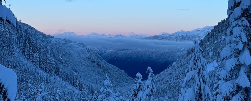
Huge change to the landscape since last week’s newsletter (more details below)! With several dumps of snow down to valley bottom, approaches have gotten much more reasonable! As usual, we’ll go from south to north.
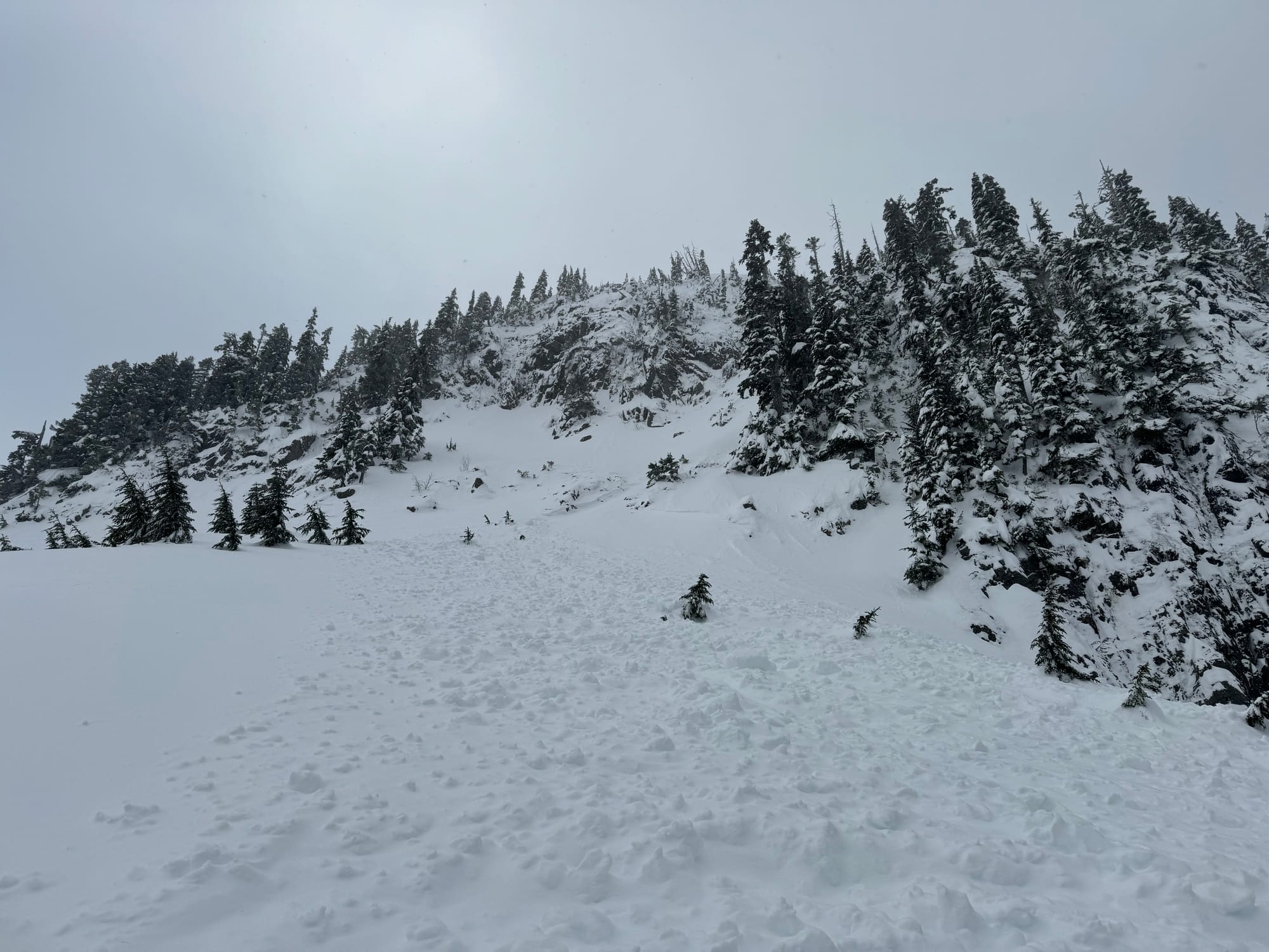
The North Shore mountains are looking more promising with the ski hills reopening. Skiing in the trees is probably still pretty grim. The Sea to Sky Gondola has resumed grooming with consistent snow cover from the station to the alpine! Check winds as outflow often closes the lift. I would expect possible closures Fri/Sat. Travel in the tree-triangle at the end of the road remains extremely challenging. Red Heather is skiable to the parking lot (and definitely requires chains). Callaghan has snow from the XC area but many creek crossings and low tide in the forest. Reports from the Singing Pass trail are that it is quite good! Further north, Duffey approaches are stacking up snow but still require some ginger skiing below tree line.
Throughout the corridor, the best skiing remains at tree line with snow stacking up in the alpine!
What’s happened since the last update (weather & general snowpack structure):
New snow! A storm rolled through between Jan 4th and the early hours of Jan 6th before the skies cleared and we got to see the damage. Down at the S2SG, we had 65cm on the storm board (at our new snow study plot located at 1050m). In whistler, there was 43cm, and Blowdown on the Duffey got ~30cm. In most areas throughout the corridor, a widespread avalanche cycle took place midway through the storm when temperatures warmed slightly. Storm slabs continued to form as the storm tapered off and led to touchy avalanche conditions on Saturday, which settled into Sunday.
The weekend was generally clear and cold with surface hoar development throughout the corridor. Another big dump of snow on Monday dropped ~35cm along the Sea to Sky and ~15cm on the Duffey.
Monday’s storm was accompanied by further storm/wind slab development and several fairly large avalanches, both natural and skier triggered. Wednesday brought a pattern shift in the weather with clearing skies and temperatures dropping, foreshadowing the oncoming high pressure and arctic outflow.
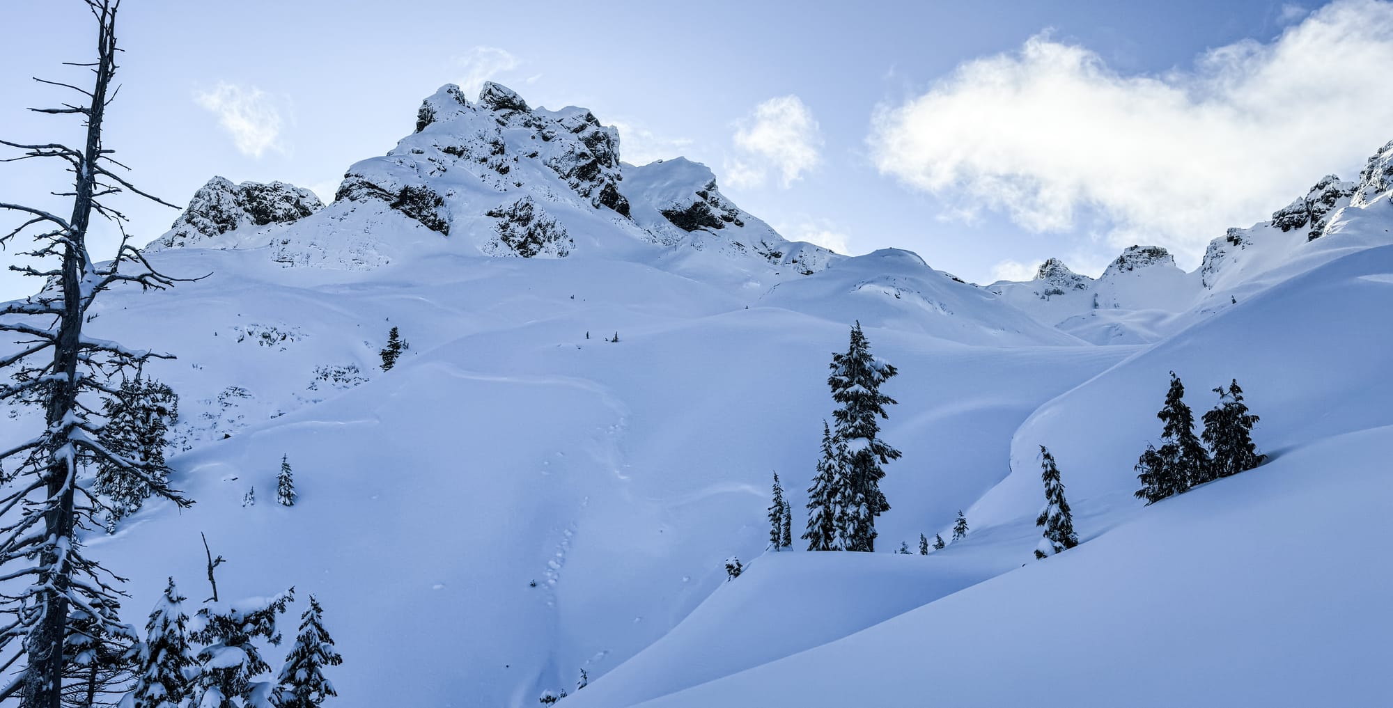
In the Sea to Sky, the snowpack is defined by 40-50cm of new snow affected by southerly wind sitting on a variety of surfaces, including a surface hoar/crust combo. Below this is 40-60cm of older storm snow that was redistributed by northerly winds. This sits on a saturated, well settled lower snowpack in the south and in the north, over a series of snow and melt freeze crusts that are well settled and capped by our very thick (30cm) Dec 20th crust that may still be acting as a persistent weak layer.
The (Jan 8) surface hoar located in the upper snowpack is thought to be responsible for several larger avalanches in the previous two days and is not something to be ignored. The biggest avalanches appear to be occurring around the Whistler area (although this area also has the most commercial operators reporting).
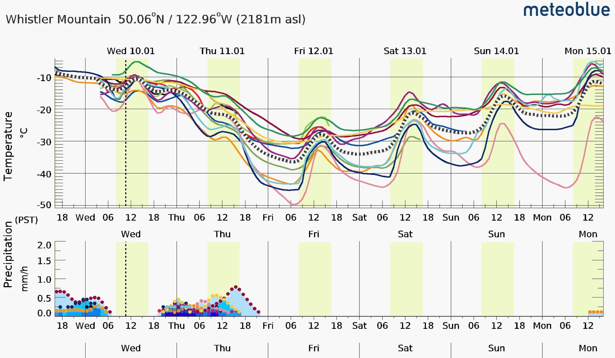
What’s the weather and avalanche forecast?
Clear and COLD!
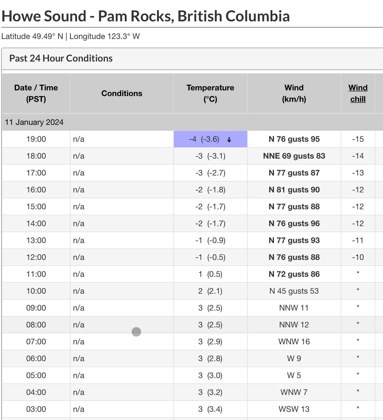
Avalanche Canada has the hazard dependent on wind. Public is advised that strong winds will result in greater wind slab development and if wind is recognized, hazards should be considered elevated - this appeared to be the case on Thursday. Remember arctic outflow events are characterized by reverse wind loading. You are going to want to be on the sunny slopes the next while…and that is where the snow will be getting transported. Watch out for strange loading patterns, and with strong winds, things load way further downslope than you would expect.
As we drop down to moderate hazard, remember that getting unlucky and triggering one of these specific features can still have very serious consequences!
What are my questions for the weekend?
- What are the implications of the cold weather? New surface Hoar? North winds building reverse loaded wind slab?
- What kind of outflow winds will we see and where will it most affect us? Brohm is classically stripped by outflow. Hopefully wind is limited to valley bottoms and the alpine is unaffected but that may be wishful thinking.
What will I watch out for or avoid completely?
At the moment, I don’t have anything completely off the table. I definitely have a few major cautions though:
- High faces and ridges will become wind swept (and were already thin).
- Traditionally thin areas (thinking Body Bag Bowl as an example) that were just rocky before are now thinly covered rocks.
- Cold risk is much much more worrisome. A pulled binding, tweaked knee, or broken down sled has bigger consequences at -25C.
- The Jan 8 surface hoar layer, although specific in location, will still be on our minds in sheltered areas. It will become more difficult to trigger over time and with the intense wind loading, but it’s not written off yet.
- The Dec 20th melt freeze crust/facet combo is still producing some random results in our region. Don’t count it out. Often our biggest problem is keeping track of slopes that slid, and then feeling better about them. We have a good handle on what slid in the Sea to Sky Gondola zone, but many other places were hard to keep track of. The cold and wind will certainly plaster things into place some more, and hopefully this layer continues to settle out.
Closing Thoughts:
Be careful in the cold! Look for sunny slopes to find better stability and warmer toes. Our snowpack is more complex than we’ve seen all winter so choose terrain wisely!
Eric Carter and Evan Stevens contributed to this report. For more information, check out Zenith Mountain Guides and our local avalanche forecast. These updates are supported by SkiUphill Squamish - the best stop for ski touring equipment in the Coast Mountains and made possible by the Sea to Sky Gondola! Use this information at your own risk! We are not responsible for your actions in the backcountry and conditions change rapidly from when this report was written!
Member discussion